

×

Papua New Guinea🇵🇬 | hikesBlack Cat TrackBlack Cat Gap, wartime pits, log-bridge gorges, Wau to Salamaua | things to do and best time to go

Explore Goroka Bilum FestivalExplore Kokoda Track

Backpacking in Black Cat Track
🌟 Highlighthike ranked #2
By Johan Kruseman 🇳🇱 | Updated October 15, 2026

Your boots slip on wet clay, the canopy drips onto your hat, and somewhere below a river you can hear but not see keeps roaring. That is a normal hour on the Black Cat Track, a rugged trail in Morobe Province in the north of Papua New Guinea, running from the Wau side over the Bulolo-Markham highlands toward Salamaua on the coast. It climbs through mossy cloud forest, crosses ridges with sweeping views and drops through village gardens where kids shout hello. Expect steep, muddy, relentless going and basic village stays, so this is no stroll. The start is reachable by public motor vehicle (PMV) minibus from Lae, though road conditions vary and you should plan around that. Unlike the Kokoda Track, which is a famous, heavily organized multi-day trek, the Black Cat is quieter, cheaper and far less crowded.

Discover everything you want to know in the 📖 Papua New Guinea Travel Guide.
Best time to go: May - October
Duration: 4 to 6 days
Distance: 62 kilometers
Total ascent: 2500 meters


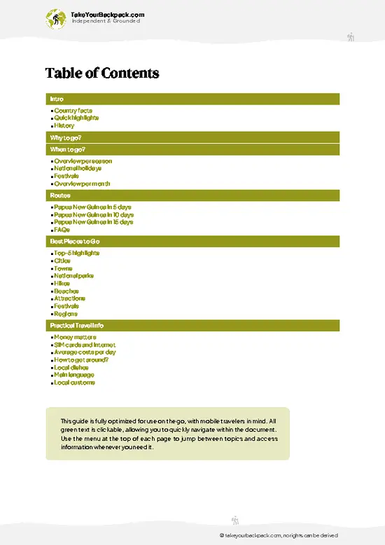
example page 0 from our offline Travel Guide for Papua New Guinea
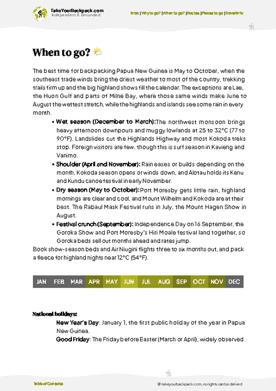
example page 1 from our offline Travel Guide for Papua New Guinea
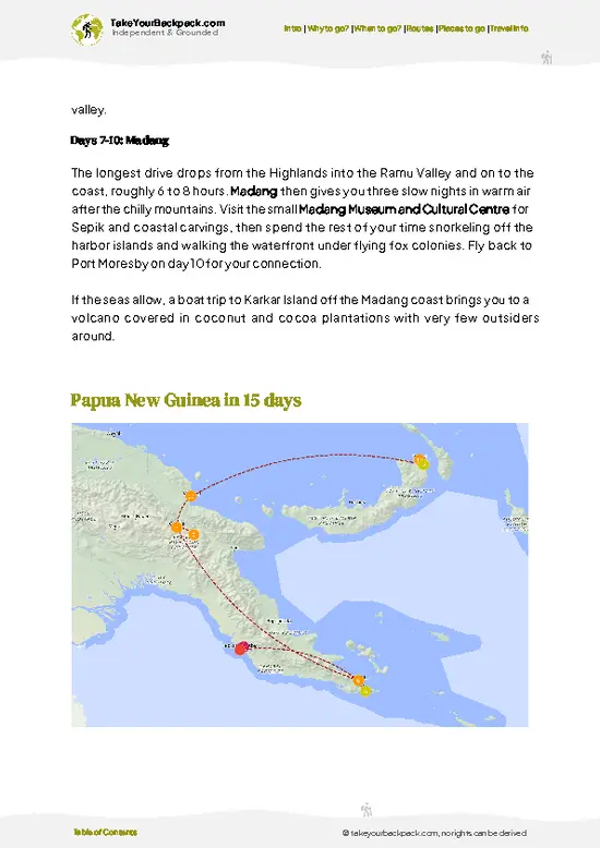
example page 2 from our offline Travel Guide for Papua New Guinea
example page 3 from our offline Travel Guide for Papua New Guinea
example page 4 from our offline Travel Guide for Papua New Guinea
example page 5 from our offline Travel Guide for Papua New Guinea
example page 6 from our offline Travel Guide for Papua New Guinea
example page 7 from our offline Travel Guide for Papua New Guinea
Loading the map 🌍
CLICK TO FILTER
cities
towns
national parks
hikes
beaches
attractions
festivals
regions
SHOW COUNTRY’S BESTSHOW ALL

✨ Why go?
Ranked #2 hike in Papua New Guinea
What sets this place apart

Backpackers come for the Salamaua to Wau route, the old World War II supply line that links the Huon Gulf coast with the Bulolo highlands on foot. You are not walking a groomed national park trail. You are following the path of Australian and American soldiers through the same ridges and river valleys where they fought the Japanese in 1942 and 1943, and the war history is right there on the ground, from rusted wreckage to village stories passed down from grandparents.

The second pull is the people. Nights are spent in village guesthouses or with host families in small settlements along the ridges, so you eat sweet potato, taro and greens cooked by whoever hosts you, and you swap stories by firelight. Porters and local guides are part of the trip, which spreads your money straight into communities … read more 👉
Backpackers come for the Salamaua to Wau route, the old World War II supply line that links the Huon Gulf coast with the Bulolo highlands on foot. You are not walking a groomed national park trail. You are following the path of Australian and American soldiers through the same ridges and river valleys where they fought the Japanese in 1942 and 1943, and the war history is right there on the ground, from rusted wreckage to village stories passed down from grandparents.

The second pull is the people. Nights are spent in village guesthouses or with host families in small settlements along the ridges, so you eat sweet potato, taro and greens cooked by whoever hosts you, and you swap stories by firelight. Porters and local guides are part of the trip, which spreads your money straight into communities that see few visitors.

The third reason is how it fits a longer trip. The track runs roughly 3 to 5 days, a manageable chunk between the coast around Lae and the highlands road toward Mt Hagen and Goroka. Expect steep, muddy climbs through montane forest and cloud, and arrive fit enough to enjoy it.

💡 HighlightsDon't-miss highlights and experiences

  1. Black Cat Gap: The high saddle that gives the trail its name, with cool, mossy forest, wartime history and long views over ridgelines folding toward the coast.
  2. Cloud forest ridges: Stretches above 2,000 meters where tree ferns, orchids and dripping moss close in around you, and the air turns noticeably cold at dusk.
  3. Wartime relics and routes: Paths used by Australian and American troops in the Salamaua campaign, with occasional traces of old pits and debris that make the history tangible.
  4. Highland village stays: Overnights in community guesthouses where you share meals of sweet potato and greens, hear local string-band singing and trade stories by firelight.
  5. River crossings and gorges: Fast, cold streams crossed on logs or by wading, with deep green valleys that open out below the steepest climbs.
… read more 👉
  1. Black Cat Gap: The high saddle that gives the trail its name, with cool, mossy forest, wartime history and long views over ridgelines folding toward the coast.
  2. Cloud forest ridges: Stretches above 2,000 meters where tree ferns, orchids and dripping moss close in around you, and the air turns noticeably cold at dusk.
  3. Wartime relics and routes: Paths used by Australian and American troops in the Salamaua campaign, with occasional traces of old pits and debris that make the history tangible.
  4. Highland village stays: Overnights in community guesthouses where you share meals of sweet potato and greens, hear local string-band singing and trade stories by firelight.
  5. River crossings and gorges: Fast, cold streams crossed on logs or by wading, with deep green valleys that open out below the steepest climbs.
Most visitors rush past the small garden clearings between villages, yet they are where you hear birds of paradise calling from the edges, and where locals will point out the best viewpoints if you stop and ask.
Spotted a mistake or missing something? Contact us.

🌤️ When to go?Choosing the right time of year

  • Dry Season (May to October): Trail conditions are best from June to September, when mud is manageable and mornings are often clear above Wau. Valley days reach 24 to 28°C (75 to 82°F), while the high ridge near 2,300 m drops to 6 to 10°C (43 to 50°F) at night.
  • Wet Season (November to April): Afternoon downpours turn clay sections into slides and rivers swell, so crossings can stall you for a day. Lowland heat sits around 28 to 31°C (82 to 88°F), and ridge cloud is near constant.
  • Daylight: Sunrise comes near 6 am and sunset near 6 pm all year, so plan to reach camp or a village by about 4 pm.
  • Crowds and Prices: Only a handful of trekkers walk it each month, with a small bump in July and August. Porter and guide rates, plus the PMV fares to Wau and Salamaua, stay steady through the year.
Book your … read more 👉
  • Dry Season (May to October): Trail conditions are best from June to September, when mud is manageable and mornings are often clear above Wau. Valley days reach 24 to 28°C (75 to 82°F), while the high ridge near 2,300 m drops to 6 to 10°C (43 to 50°F) at night.
  • Wet Season (November to April): Afternoon downpours turn clay sections into slides and rivers swell, so crossings can stall you for a day. Lowland heat sits around 28 to 31°C (82 to 88°F), and ridge cloud is near constant.
  • Daylight: Sunrise comes near 6 am and sunset near 6 pm all year, so plan to reach camp or a village by about 4 pm.
  • Crowds and Prices: Only a handful of trekkers walk it each month, with a small bump in July and August. Porter and guide rates, plus the PMV fares to Wau and Salamaua, stay steady through the year.
Book your guide and porters a few weeks ahead for a July or August start, and add a spare day for weather.


source: climatestotravel.comJANJanuary: below average for travelingFEBFebruary: below average for travelingMARMarch: below average for travelingAPRApril: fair for travelingMAYMay: excellent for travelingJUNJune: excellent for travelingJULJuly: excellent for travelingAUGAugust: excellent for travelingSEPSeptember: excellent for travelingOCTOctober: highly recommended for travelingNOVNovember: fair for travelingDECDecember: below average for traveling
when-to-go

✈️ The backpacker research shortcutPapua New Guinea Travel Guide

An offline-friendly backpacking guide with optimized travel routes, ranked highlights, transport advice, and the best areas to stay.
example page 0 from our offline Travel Guide for Papua New Guinea
example page 1 from our offline Travel Guide for Papua New Guinea
example page 2 from our offline Travel Guide for Papua New Guinea
example page 3 from our offline Travel Guide for Papua New Guinea
example page 4 from our offline Travel Guide for Papua New Guinea
example page 5 from our offline Travel Guide for Papua New Guinea
example page 6 from our offline Travel Guide for Papua New Guinea
example page 7 from our offline Travel Guide for Papua New Guinea
The digital guide (251 pages) contains:
✅ 81 highlights, ranked by travel appeal
✅ Optimized 5, 10 & 15-day travel routes
✅ Cities, national parks, landmarks, beaches
✅ How to get around
✅ Offline-friendly for travel without Wi-Fi
👉 Click to see all 30+ guide features

📅 Plan smarter in minutes, not weeks
✅ Month by month travel advice
✅ Festivals & national holidays
✅ Budget expectations

🗺️ Go to the right places, skip the overrated ones
✅ Honest pros & cons of destinations
✅ Top hikes, parks & viewpoints
✅ Lesser-known places most travelers miss
✅ Clear “worth it vs skip it” guidance

🛏️ Travel smoothly without rookie mistakes
✅ Best areas to stay
✅ Transport systems explained simply
✅ Common scams & safety advice
✅ SIM cards, money & practical tips

🌍 Understand the country, not just visit it
✅ Culture & traditions
✅ 52 Essential phrases & customs
✅ Festivals worth planning around
✅ Traveler-friendly historical context
✅ Insights that make places more meaningful

📱 Built for real travel conditions
✅ Fully downloadable PDF
✅ Works completely offline
✅ Optimized for phone use
✅ Useful in remote areas & buses
✅ Everything in one place
Stop searching, start planning
Get instant access to your full guide. 30‑day money-back guarantee.
+ Add another guide for just

By proceeding you agree to our terms.
Sent to your inbox immediately after payment • 100% Secure Checkout
Best Backpacking Travel Advisor 2025 tourism awardBest Backpacking
Travel Advisor
2025
What others say about Take Your Backpack Guides:
⭐⭐⭐⭐⭐
Fantastic, amazing amount of information!
⭐⭐⭐⭐⭐
My goodness this is amazing, it's what I've been looking for hats off too you!
⭐⭐⭐⭐⭐
I think this is absolutely BRILLIANT
⭐⭐⭐⭐
Very complete and informative. It's still missing places, but I gotta to commend you
⭐⭐⭐⭐⭐
This is truly amazing, thank you, can't wait to explore it with my kids!
⭐⭐⭐⭐⭐
Awesome resource, thank you!
⭐⭐⭐⭐⭐
This is amazing! Can't wait to explore the ones I haven't seen
⭐⭐⭐⭐
I love this! Well done, great idea.
⭐⭐⭐⭐⭐
Thanks for taking the time to make this gem!
⭐⭐⭐⭐⭐
This might be the best website I've ever seen.
⭐⭐⭐⭐⭐
Congratulations, and thank you so much for your work; it's incredibly valuable.
⭐⭐⭐⭐
In all seriousness I think you did a great job pointing out the important spots
⭐⭐⭐⭐⭐
10/10 very good
⭐⭐⭐⭐⭐
As someone who's only just starting to visit regularly this is awesome, thank you.
⭐⭐⭐⭐
Thank you very much! I'm going to visit my dad, it's going to be very useful!
⭐⭐⭐⭐⭐
This is really cool! We'll be travelling for the first time and this definitely come in handy.
⭐⭐⭐⭐⭐
You are now our minister of culture, congratulations 👨‍💼
⭐⭐⭐⭐⭐
Just wanted to tell you that this is a pearl! Going to follow your recommendations.
⭐⭐⭐⭐⭐
This is so cool. I'll definitely be using the resource for my travels soon.
⭐⭐⭐⭐⭐
This is very impressive! Good work.
⭐⭐⭐⭐⭐
This is an amazing and informative site. Very well done!

🛏️ Where to stay?Best areas to stay in Papua New Guinea

If you enjoy meeting fellow travelers, consider choosing hostels with high ratings for atmosphere. On the other hand, if you prefer having your own space, a hotel might be a better option.

🥾 Hike detailsTrail overview: what to expect on the hike

Total Distance: About 60 to 65 kilometers depending on the route variant and where you start.
Estimated Duration: 4 to 6 days at a steady pace.
Difficulty: Demanding. Steep ascents and descents, slippery clay and frequent rain make it strenuous, and you should be fit and carry sound boots.
Starting Point: The Wau side in Morobe Province, reached by PMV minibus via Lae. The trail finishes toward the coast near Salamaua.
Major Landmarks:
  • Black Cat Gap: High saddle and namesake of the trail.
  • Mountain villages: Simple settlements with guesthouses and food for walkers.
  • Salamaua: Coastal end point with wartime
… read more 👉
Total Distance: About 60 to 65 kilometers depending on the route variant and where you start.
Estimated Duration: 4 to 6 days at a steady pace.
Difficulty: Demanding. Steep ascents and descents, slippery clay and frequent rain make it strenuous, and you should be fit and carry sound boots.
Starting Point: The Wau side in Morobe Province, reached by PMV minibus via Lae. The trail finishes toward the coast near Salamaua.
Major Landmarks:
  • Black Cat Gap: High saddle and namesake of the trail.
  • Mountain villages: Simple settlements with guesthouses and food for walkers.
  • Salamaua: Coastal end point with wartime history and sea views.
Terrain and Scenery: Narrow muddy ridge paths, log bridges, stream crossings and deep valleys, with sweeping views when the cloud lifts.
Vegetation: Lowland rainforest at the base, moss-draped cloud forest higher up, tree ferns, orchids and village gardens of sweet potato and taro.
Wildlife: Birds are the main draw, including birds of paradise and many colorful forest species, plus frogs, insects and the occasional cuscus. Leeches are common in wet weather.
Practical Notes: Hire local guides and porters through the villages, carry water treatment, a warm layer and a rain jacket, and bring small notes of kina for guesthouses and food.
⚠️ Hiking info can sometimes be outdated or inaccurate. Before you hit the trail, check the latest conditions with locals. If you do spot anything that's off, I'd love to hear from you, so I can update it for fellow travelers.

🛡️ SafetyStaying Safe: What Travelers Should Know

The Black Cat Track is a demanding village-to-village trek where the main hazards are mud, steep footing and the cold ridge nights, rather than wildlife. Wet clay on the climbs and descents is slippery, so bring boots with real tread and trekking poles, and keep a slow, steady pace on the downhills. Streams rise fast after rain; cross only where your guide says it is safe and wait if the water is brown and loud. Nights above 2,000 m are cold and damp, so pack a warm layer and a waterproof shell. Carry water purification, since village sources vary. Leeches and mosquitoes are common, so use repellent and check your skin each evening. Walk with a local guide who knows the route and the landowners. They arrange village stays and keep relations smooth. Keep valuables low-profile, ask before photographing … read more 👉
The Black Cat Track is a demanding village-to-village trek where the main hazards are mud, steep footing and the cold ridge nights, rather than wildlife. Wet clay on the climbs and descents is slippery, so bring boots with real tread and trekking poles, and keep a slow, steady pace on the downhills. Streams rise fast after rain; cross only where your guide says it is safe and wait if the water is brown and loud. Nights above 2,000 m are cold and damp, so pack a warm layer and a waterproof shell. Carry water purification, since village sources vary. Leeches and mosquitoes are common, so use repellent and check your skin each evening. Walk with a local guide who knows the route and the landowners. They arrange village stays and keep relations smooth. Keep valuables low-profile, ask before photographing people, and let your guide manage the daily itinerary.

FAQFrequently asked questions about Black Cat Track

Most trekkers complete the Black Cat Track in 4 to 6 days, covering roughly 60 to 65 km between Wau and Salamaua. Fit groups sometimes push through in 3 days, but heavy rain easily adds a day. You usually start from Wau and finish on the coast near Salamaua, with a boat or road transfer to Lae afterward.
Moderate to hard, mainly because of long muddy climbs and descents rather than technical terrain. Expect daily walks of 5 to 9 hours, a high point near 2,300 m, and several stream crossings that become tricky after rain. Good fitness and sturdy boots matter more than any climbing skill.
A local guide is strongly advised, and most trekkers also hire porters, since trails are unmarked and cross village land. Guides and porters typically cost around K100 to 200 (about US$25 to 50) per person per day, and village stays or camping fees are usually paid separately. There is no formal national park permit, but you need to arrange access with village leaders, which a guide or a Wau or Lae operator can organize.
⚠️ Things can change over time, so always validate details locally before you go.

Other Papua New Guinean hikes near Black Cat Track

Explore more nearby:

  • Saruwaged Range Trek—Huon Peninsula crest, bird-of-paradise trees, moss forest, guide-led footpaths| 122 km away
  • Finisterre Range Trek—Ramu Valley ridges, garden-terrace villages, cane bridges, Madang Province| 186 km away
  • Crater Mountain Trek—volcanic plateaus, mossy rainforest, birdlife hotspots| 198 km away

💡 Not sure where to go next?
Create a personalized itinerary for Papua New Guinea including Black Cat Track and the places that fit your trip.

Generate my itinerary

👉 Discover all hikes

Or checkout all Papua New Guinea has to offer (think cities, towns, villages, national parks, hikes, beaches, festivals)
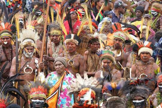
Country photo of Papua New Guinea

We 💚 feedbackIs it worth it?

Pack a proper warm layer. Most first-timers focus on heat and leeches, then shiver through nights at the higher gaps when the cloud settles in. I would also carry small kina notes and a spare pair of dry socks for the evenings, because village hospitality is a big part of why this trail is memorable.

✍️ Help improve this page!
The information on this page is based on in-depth research, insights shared by experienced travelers, and feedback from the local travel community in Papua New Guinea. While every effort is made to keep the information accurate and current, conditions can change — so if you spot anything incorrect or outdated, please get in touch.


🙋‍♂️ Give feedback

👋 Meet the founderWho’s Behind Take Your Backpack?

Johan, backpacker and founder of TakeYourBackpackHi, I’m Johan (Netherlands 🇳🇱), the creator of TakeYourBackpack. Over the past 3 decades, I’ve backpacked through 90+ countries across six continents, gaining extensive experience with independent travel, long-term trips, and overland routes.

This site is built on a combination of firsthand travel experience and carefully curated insights from other backpackers. Many guides are based on places I’ve personally visited, while others bring together tips, observations, and practical advice shared by trusted travelers I’ve met along the way.

The goal is to provide realistic, experience-driven guidance — not generic itineraries — so you can explore destinations with better context, clearer expectations, and more confidence.