
×

Puerto Rico🇵🇷 | national parksBosque Estatal de GuajatacaKarst mogotes, sinkholes, dry limestone forest | things to do and best time to go

Explore Bosque Estatal de CambalacheExplore Culebra Island

Backpacking in Bosque Estatal de Guajataca
👍 Recommendednational park ranked #9
By Johan Kruseman 🇳🇱 | Updated October 22, 2026

Cool, damp air hits you the moment the trail dips under the limestone canopy, and somewhere below you a coquí starts up even at midday. Bosque Estatal de Guajataca sits in the northwest of Puerto Rico, on karst hills above the Atlantic coast. The forest is quiet, green and wonderfully uncrowded, with caves, sinkholes and a tower for views. Cell signal is patchy, the roads wind, and trails turn slick after rain, so wear shoes with grip and download your map before leaving the main road. Fill your tank and buy water in Isabela or Quebradillas, because nothing is sold inside. Arrive by 9 a.m., walk a loop before the afternoon showers, then rest at a coastal beach.

Discover everything you want to know in the 📖 Puerto Rico Travel Guide.


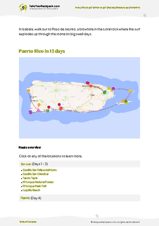
example page 0 from our offline Travel Guide for Puerto Rico
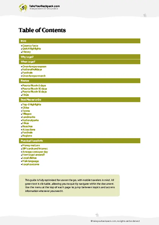
example page 1 from our offline Travel Guide for Puerto Rico
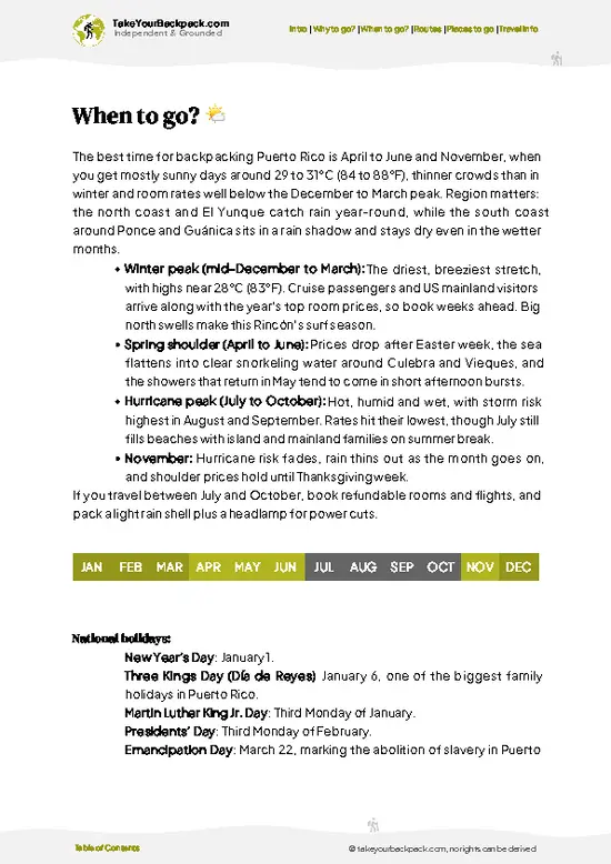
example page 2 from our offline Travel Guide for Puerto Rico
example page 3 from our offline Travel Guide for Puerto Rico
example page 4 from our offline Travel Guide for Puerto Rico
example page 5 from our offline Travel Guide for Puerto Rico
example page 6 from our offline Travel Guide for Puerto Rico
example page 7 from our offline Travel Guide for Puerto Rico
Loading the map 🌍
CLICK TO FILTER
cities
towns
villages
landmarks
national parks
hikes
beaches
attractions
festivals
regions
SHOW COUNTRY’S BESTSHOW ALL

✨ Why go?
Ranked #9 national park in Puerto Rico
The unique appeal for travelers

Bosque Estatal de Guajataca suits backpackers who like to wander on their own schedule. The forest holds more than 44 kilometers of trails and roads through limestone haystack hills (mogotes), so you can string together a half-day loop or stay out longer without a guide. Nobody needs to book you onto a tour. The Cueva del Viento and the Torre de Observación reward self-guided curiosity, and the park is rarely busy even on weekends, which makes the quiet itself a draw. Its position between Isabela and Arecibo also lets you link it with beaches and the old Guajataca Tunnel on the same trip. Pack a headlamp, insect repellent and a rain shell, and you have everything you need.

💡 HighlightsKey sights and experiences for travelers

  1. Cueva del Viento: A limestone cave reached by a short, steep descent, with stalactites and bats resting in the dim passages. A flashlight helps.
  2. Torre de Observación: A lookout tower that lifts you above the canopy for views of forested mogotes rolling toward the Atlantic.
  3. Vereda Interpretativa: The main 1.5-mile (2.4 km) trail through tall trees and ferns, ending at the observation tower, good for spotting birds like the Puerto Rican tody.
  4. Sumidero (sinkhole) formations: Deep, rounded depressions typical of the karst, visible from several trail edges and thick with moss.
  5. Coquí chorus at dusk: The park’s many tree frogs create a loud, layered nighttime sound that you hear best near the quieter forest edges.
  6. Lago Guajataca viewpoints: Nearby lake overlooks give a different perspective, with water
… read more 👉
  1. Cueva del Viento: A limestone cave reached by a short, steep descent, with stalactites and bats resting in the dim passages. A flashlight helps.
  2. Torre de Observación: A lookout tower that lifts you above the canopy for views of forested mogotes rolling toward the Atlantic.
  3. Vereda Interpretativa: The main 1.5-mile (2.4 km) trail through tall trees and ferns, ending at the observation tower, good for spotting birds like the Puerto Rican tody.
  4. Sumidero (sinkhole) formations: Deep, rounded depressions typical of the karst, visible from several trail edges and thick with moss.
  5. Coquí chorus at dusk: The park’s many tree frogs create a loud, layered nighttime sound that you hear best near the quieter forest edges.
  6. Lago Guajataca viewpoints: Nearby lake overlooks give a different perspective, with water glinting between steep green hills.
Start with the Torre de Observación in the morning, when the air is clear and the views over the canopy are sharpest.
Spotted a mistake or missing something? Contact us.

Things to do near Bosque Estatal de Guajataca

Ratings based on Tripadvisor reviews. When you book through this link, you support our work at no extra cost to you.

🌤️ When to go?Seasonal considerations and timing

The drier stretch from December through April is the easiest window for hiking Bosque Estatal de Guajataca, with fewer afternoon downpours on the karst trails.
  • Dry Season (December to April): Highs run 27 to 29°C (81 to 84°F), nights 19 to 21°C (66 to 70°F). Trails stay firmer and the caves are more reachable. Weekends fill with local families, so go midweek.
  • Shoulder (May to June): Warmer at 29 to 31°C (84 to 88°F), with showers building in the afternoon. Crowds thin out and lodging near Quebradillas and Isabela is easy to book.
  • Wet and Hurricane Season (July to November): Humid, 29 to 32°C (84 to 90°F), with heavy rain and storm risk, peaking August to October. Trails turn muddy and some close after storms.
Daylight stays between roughly 11 and 13 hours all year, so start hiking by 8 a.m. to finish before the rain.

source: climatestotravel.comJANJanuary: excellent for travelingFEBFebruary: excellent for travelingMARMarch: excellent for travelingAPRApril: highly recommended for travelingMAYMay: fair for travelingJUNJune: fair for travelingJULJuly: fair for travelingAUGAugust: fair for travelingSEPSeptember: fair for travelingOCTOctober: fair for travelingNOVNovember: highly recommended for travelingDECDecember: excellent for traveling
when-to-go

✈️ The backpacker research shortcutPuerto Rico Travel Guide

An offline-friendly backpacking guide with optimized travel routes, ranked highlights, transport advice, and the best areas to stay.
example page 0 from our offline Travel Guide for Puerto Rico
example page 1 from our offline Travel Guide for Puerto Rico
example page 2 from our offline Travel Guide for Puerto Rico
example page 3 from our offline Travel Guide for Puerto Rico
example page 4 from our offline Travel Guide for Puerto Rico
example page 5 from our offline Travel Guide for Puerto Rico
example page 6 from our offline Travel Guide for Puerto Rico
example page 7 from our offline Travel Guide for Puerto Rico
The digital guide (310 pages) contains:
✅ 81 highlights, ranked by travel appeal
✅ Optimized 5, 10 & 15-day travel routes
✅ Cities, national parks, landmarks, beaches
✅ How to get around
✅ Offline-friendly for travel without Wi-Fi
👉 Click to see all 30+ guide features

📅 Plan smarter in minutes, not weeks
✅ Month by month travel advice
✅ Festivals & national holidays
✅ Budget expectations

🗺️ Go to the right places, skip the overrated ones
✅ Honest pros & cons of destinations
✅ Top hikes, parks & viewpoints
✅ Lesser-known places most travelers miss
✅ Clear “worth it vs skip it” guidance

🛏️ Travel smoothly without rookie mistakes
✅ Best areas to stay
✅ Transport systems explained simply
✅ Common scams & safety advice
✅ SIM cards, money & practical tips

🌍 Understand the country, not just visit it
✅ Culture & traditions
✅ 52 Essential phrases & customs
✅ Festivals worth planning around
✅ Traveler-friendly historical context
✅ Insights that make places more meaningful

📱 Built for real travel conditions
✅ Fully downloadable PDF
✅ Works completely offline
✅ Optimized for phone use
✅ Useful in remote areas & buses
✅ Everything in one place
Stop searching, start planning
Get instant access to your full guide. 30‑day money-back guarantee.
+ Add another guide for just

By proceeding you agree to our terms.
Sent to your inbox immediately after payment • 100% Secure Checkout
Best Backpacking Travel Advisor 2025 tourism awardBest Backpacking
Travel Advisor
2025
What others say about Take Your Backpack Guides:
⭐⭐⭐⭐⭐
Fantastic, amazing amount of information!
⭐⭐⭐⭐⭐
My goodness this is amazing, it's what I've been looking for hats off too you!
⭐⭐⭐⭐⭐
I think this is absolutely BRILLIANT
⭐⭐⭐⭐
Very complete and informative. It's still missing places, but I gotta to commend you
⭐⭐⭐⭐⭐
This is truly amazing, thank you, can't wait to explore it with my kids!
⭐⭐⭐⭐⭐
Awesome resource, thank you!
⭐⭐⭐⭐⭐
This is amazing! Can't wait to explore the ones I haven't seen
⭐⭐⭐⭐
I love this! Well done, great idea.
⭐⭐⭐⭐⭐
Thanks for taking the time to make this gem!
⭐⭐⭐⭐⭐
This might be the best website I've ever seen.
⭐⭐⭐⭐⭐
Congratulations, and thank you so much for your work; it's incredibly valuable.
⭐⭐⭐⭐
In all seriousness I think you did a great job pointing out the important spots
⭐⭐⭐⭐⭐
10/10 very good
⭐⭐⭐⭐⭐
As someone who's only just starting to visit regularly this is awesome, thank you.
⭐⭐⭐⭐
Thank you very much! I'm going to visit my dad, it's going to be very useful!
⭐⭐⭐⭐⭐
This is really cool! We'll be travelling for the first time and this definitely come in handy.
⭐⭐⭐⭐⭐
You are now our minister of culture, congratulations 👨‍💼
⭐⭐⭐⭐⭐
Just wanted to tell you that this is a pearl! Going to follow your recommendations.
⭐⭐⭐⭐⭐
This is so cool. I'll definitely be using the resource for my travels soon.
⭐⭐⭐⭐⭐
This is very impressive! Good work.
⭐⭐⭐⭐⭐
This is an amazing and informative site. Very well done!

🛏️ Where to stay?Best areas and accommodation options

No beds exist inside Bosque Estatal de Guajataca, so your base is the nearby north coast towns, with Isabela and Quebradillas the most practical.
Isabela, about 20 minutes away by car, has the widest choice: surf hostels and budget guesthouses near Jobos Beach, plus small inns and vacation rentals. It suits backpackers who want beaches, cheap tacos and a social scene after a day on the trails.
Quebradillas sits even closer, with a quieter feel, a few simple guesthouses and rentals, and the cliffside Guajataca shoreline beach nearby. Expect fewer hostels, so book ahead on weekends.
Aguadilla is another … read more 👉
No beds exist inside Bosque Estatal de Guajataca, so your base is the nearby north coast towns, with Isabela and Quebradillas the most practical.
Isabela, about 20 minutes away by car, has the widest choice: surf hostels and budget guesthouses near Jobos Beach, plus small inns and vacation rentals. It suits backpackers who want beaches, cheap tacos and a social scene after a day on the trails.
Quebradillas sits even closer, with a quieter feel, a few simple guesthouses and rentals, and the cliffside Guajataca shoreline beach nearby. Expect fewer hostels, so book ahead on weekends.
Aguadilla is another option farther west, with more hotels and easier bus connections. Arecibo to the east works for a single night.
The forest does offer designated camping with a permit from the Department of Natural and Environmental Resources, but facilities are basic and not always open, so confirm before relying on it.

👛 Costs (as of 22 October 2026)What things cost and how to budget

Bosque Estatal de Guajataca costs a backpacker roughly US$55 to 95 a day, with entry itself usually free.
CategoryBudget RangeLocal Reality
EntranceUS$0Day access is generally free; camping needs a permit that may carry a small fee.
Accommodation (high season)US$30 to 60Hostel beds or simple guesthouse rooms in Isabela or Quebradillas; rentals cost more.
Local TransportUS$0 to 25A rental car runs US$40 to 70 a day, so splitting it helps; rideshares and taxis from the coast add up quickly.
Food and SuppliesUS$15 to 25Bakery breakfasts, plate lunches at roadside kioscos and groceries for trail snacks.
Guided ExtrasUS$0 to 10Most hiking is self-guided; small tips or parking snacks are the main spend.
Total Daily BudgetUS$55 to 95Per person, per day, in high season.


source: parquesnacionalespr.com
⚠️ Prices can change and everyone travels differently, so take this as a rough guide. Hope it helps you plan your adventure!

🥾 TrailsHiking Bosque Estatal de Guajataca national park: highlights and difficulty

Bosque Estatal de Guajataca offers gentle to moderate hiking over karst terrain, with rooty, muddy paths and limestone steps that get slick in wet weather. Forest cover keeps temperatures a few degrees cooler than the coast, but humidity is high.
  • Vereda Interpretativa: About 2.4 km (1.5 miles), 45 to 60 minutes, easy to moderate, ending at the observation tower; passes tall hardwoods and ferns, with decent birding.
  • Cueva del Viento: A short side route of 20 to 30 minutes, moderate because of the steep, uneven descent; bring a headlamp.
  • Torre de Observación: A brief walk and a climb up the tower,
… read more 👉
Bosque Estatal de Guajataca offers gentle to moderate hiking over karst terrain, with rooty, muddy paths and limestone steps that get slick in wet weather. Forest cover keeps temperatures a few degrees cooler than the coast, but humidity is high.
  • Vereda Interpretativa: About 2.4 km (1.5 miles), 45 to 60 minutes, easy to moderate, ending at the observation tower; passes tall hardwoods and ferns, with decent birding.
  • Cueva del Viento: A short side route of 20 to 30 minutes, moderate because of the steep, uneven descent; bring a headlamp.
  • Torre de Observación: A brief walk and a climb up the tower, easy, about 30 minutes in total.
  • Wildlife: Expect coquíes, lizards, bats in caves and forest birds such as the Puerto Rican tody and the Puerto Rican woodpecker.
The park is reached most easily by car from Quebradillas or Isabela, since buses rarely serve the entrance and rides are hard to find. It is usually quiet, even on weekends. Entry has traditionally been free, though facilities can be basic and trail signs worn, so carry water, repellent and a downloaded map.
⚠️ Hiking info can sometimes be outdated or inaccurate. Before you hit the trail, check the latest conditions with locals. If you do spot anything that's off, I'd love to hear from you, so I can update it for fellow travelers.

🛡️ SafetyScams, Hazards, and Annoyances

Bosque Estatal de Guajataca is a manageable forest, and most problems come from mud, heat and thin preparation rather than danger.
Slow down on steep, rooty sections. Rain arrives fast in the afternoon, which makes early starts wise. Cave passages are dark and uneven, so carry a headlamp and a backup light. Cell signal drops in the hollows, so download maps beforehand.
Bring more water than you expect, because humidity drains you quickly, plus insect repellent. Wildlife is mild: expect coquí frogs, lizards and birds, and keep your distance from feral dogs. Leave nothing visible in parked cars at trailheads and roadside pullouts.

FAQCommon questions from travelers

One full day covers the main trails and caves in Bosque Estatal de Guajataca, while two days let you add the Guajataca coast and Lake Guajataca. Most hikes run 1 to 3 hours each. Plan a half day for Cueva del Viento if it is open, then use the afternoon for the beaches near Quebradillas.
Reaching Bosque Estatal de Guajataca without a car is hard, because no regular public bus serves the forest entrance. You can take a público or bus to Quebradillas or Isabela, then a taxi or rideshare for roughly US$20 to 40 each way. A rental car from San Juan, about 1.5 to 2 hours away, is the simplest option.
Entry to Bosque Estatal de Guajataca is generally free for day visitors, with no ticket booth at most trailheads. Overnight camping requires a permit from Puerto Rico’s Department of Natural and Environmental Resources, which can carry a small fee of a few dollars. Check current access before you go, as sections sometimes close after storms.
⚠️ Things can change over time, so always validate details locally before you go.

Other Puerto Rican national parks near Bosque Estatal de Guajataca

Explore more nearby:


💡 Not sure where to go next?
Create a personalized itinerary for Puerto Rico including Bosque Estatal de Guajataca and the places that fit your trip.

Generate my itinerary

👉 Discover all national parks

Or checkout all Puerto Rico has to offer (think cities, towns, villages, national parks, hikes, beaches, festivals)
Country photo of Puerto Rico

We 💚 feedbackWhat to keep in mind

Bosque Estatal de Guajataca rewards anyone who looks down at the ground. The limestone karst here is riddled with sinkholes and caves, and the forest floor drops away in places you’d never guess from the road. I’d bring shoes with real grip, because the clay turns slick after a rain, and I’d leave the sandals in the car. Start early, before the afternoon showers roll in.

✍️ Help improve this page!
The information on this page is based on in-depth research, insights shared by experienced travelers, and feedback from the local travel community in Puerto Rico. While every effort is made to keep the information accurate and current, conditions can change — so if you spot anything incorrect or outdated, please get in touch.


🙋‍♂️ Give feedback

👋 Meet the founderWho’s Behind Take Your Backpack?

Johan, backpacker and founder of TakeYourBackpackHi, I’m Johan (Netherlands 🇳🇱), the creator of TakeYourBackpack. Over the past 3 decades, I’ve backpacked through 90+ countries across six continents, gaining extensive experience with independent travel, long-term trips, and overland routes.

This site is built on a combination of firsthand travel experience and carefully curated insights from other backpackers. Many guides are based on places I’ve personally visited, while others bring together tips, observations, and practical advice shared by trusted travelers I’ve met along the way.

The goal is to provide realistic, experience-driven guidance — not generic itineraries — so you can explore destinations with better context, clearer expectations, and more confidence.