×

Somalia🇸🇴 | regionsKarkaar MountainsLimestone ridge, Cape Guardafui, Qandala coast, Bosaso harbor | things to do and best time to go

Explore Lag Badana National ParkExplore Awdal Region

Backpacking in Karkaar Mountains
🏆 Top pickregion ranked #1
By Johan Kruseman 🇳🇱 | Updated November 1, 2026

Your 4x4 grinds up a stony track, the air turns cool and resinous, and the first twisted juniper appears out of the haze. Karkaar Mountains runs as a limestone and granite ridge across the north of Somalia, through Puntland and into Sanaag. It is raw, empty and real, with Mount Shimbiris, Somalia’s highest peak, and the Daallo juniper forest as the big draws. There are no hostels, no trail signs and no tour desks, because the roads are rough and the state is thin here. Hire a local driver and armed escort through contacts in Bosaso or Erigavo, since clan areas change every few valleys and a local name opens doors. Skip the dusty town centers except for supplies. Nights are cold, so carry a real jacket. Karkaar Mountains has almost no visitor infrastructure, so you plan everything yourself.

Part of Backpacking in Somalia: all 68 places on one map, with routes and the best time to go.
Discover everything you want to know in the 📖 Somalia Travel Guide.
Safety warning

The current risk level for Somalia is high. Check the advice before going.


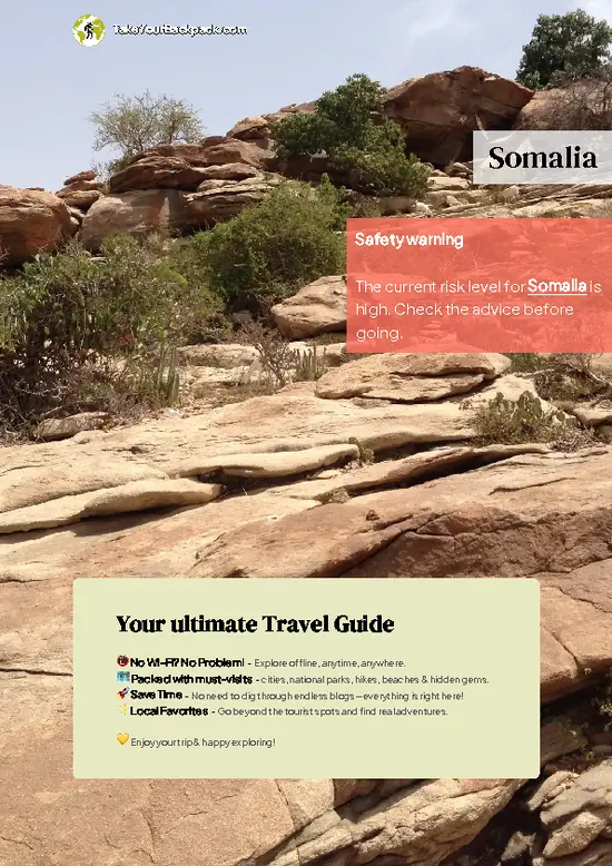
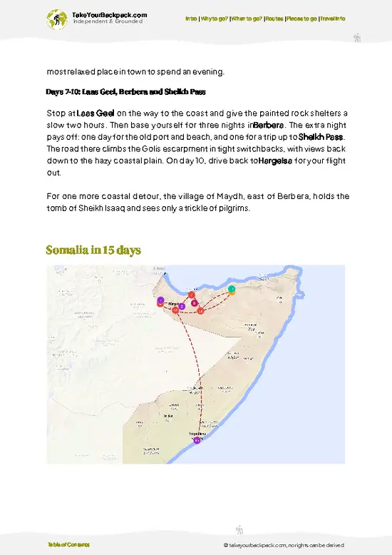
example page 0 from our offline Travel Guide for Somalia
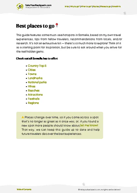
example page 1 from our offline Travel Guide for Somalia
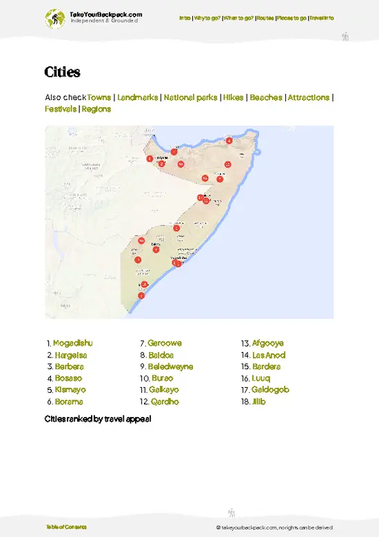
example page 2 from our offline Travel Guide for Somalia
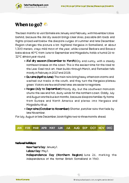
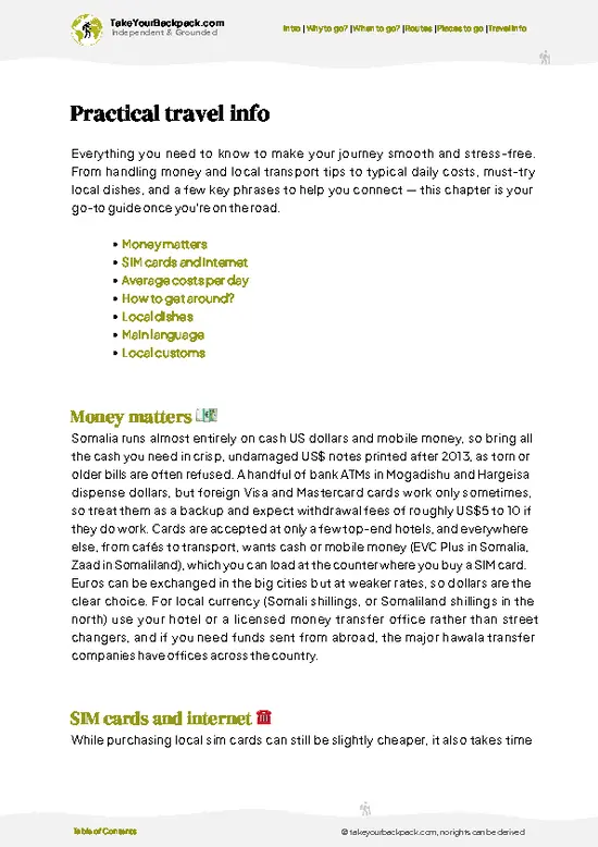
example page 3 from our offline Travel Guide for Somalia
example page 4 from our offline Travel Guide for Somalia
example page 5 from our offline Travel Guide for Somalia
example page 6 from our offline Travel Guide for Somalia
example page 7 from our offline Travel Guide for Somalia
Loading the map 🌍
CLICK TO FILTER
cities
towns
landmarks
national parks
hikes
beaches
attractions
festivals
regions
SHOW COUNTRY’S BESTSHOW ALL

✨ Why go?
Ranked #1 region in Somalia
What makes it a must-see region

Karkaar Mountains gives you a climate shift that nowhere else in Somalia offers: you leave a hot coastal plain and within a morning stand in cool juniper forest. That Daallo Forest canopy, fed by sea mist, is why people come and why the slower travelers stay. A single loop covers highland trekking, frankincense country and fishing coast without a flight in between, because the ridge runs almost to Cape Guardafui.

The second reason is people. Pastoralist families still move herds along these slopes, and a night in a camp or town guesthouse leads to tea, camel milk and long conversations in Somali. Your presence is rare and welcomed, which is a big difference from regions where hosts have seen thousands of backpackers. Plan on a flexible schedule with local transport, a guide and a fixed contact … read more 👉
Karkaar Mountains gives you a climate shift that nowhere else in Somalia offers: you leave a hot coastal plain and within a morning stand in cool juniper forest. That Daallo Forest canopy, fed by sea mist, is why people come and why the slower travelers stay. A single loop covers highland trekking, frankincense country and fishing coast without a flight in between, because the ridge runs almost to Cape Guardafui.

The second reason is people. Pastoralist families still move herds along these slopes, and a night in a camp or town guesthouse leads to tea, camel milk and long conversations in Somali. Your presence is rare and welcomed, which is a big difference from regions where hosts have seen thousands of backpackers. Plan on a flexible schedule with local transport, a guide and a fixed contact in each town. Roads are few, so you cannot rush. The reward for patience is Mount Shimbiris at around 2,400 meters and the view across a coast where almost nobody else is hiking.

💡 HighlightsKey sights and experiences for travelers

  1. Mount Shimbiris: Somalia’s highest peak, a rocky summit near Erigavo with views over the ridge and, on clear days, toward the Gulf of Aden.
  2. Daallo Forest: a remnant juniper woodland on the escarpment, cool and damp with mist, with birdlife found almost nowhere else in the Horn.
  3. Erigavo: the highland town below the peaks, useful for supplies, with a lively livestock and khat market and a cooler climate than the coast.
  4. Qandala: a coastal town under the northern slopes where the mountains meet the sea, with a fishing harbor and wild beaches nearby.
  5. Frankincense groves of the Cal Madow slopes: scrubby hillsides where families still cut resin from boswellia trees, a trade that has run here for millennia.
  6. Iskushuban: a small market town in the hills, good for tea stops and for hiring local guides who
… read more 👉
  1. Mount Shimbiris: Somalia’s highest peak, a rocky summit near Erigavo with views over the ridge and, on clear days, toward the Gulf of Aden.
  2. Daallo Forest: a remnant juniper woodland on the escarpment, cool and damp with mist, with birdlife found almost nowhere else in the Horn.
  3. Erigavo: the highland town below the peaks, useful for supplies, with a lively livestock and khat market and a cooler climate than the coast.
  4. Qandala: a coastal town under the northern slopes where the mountains meet the sea, with a fishing harbor and wild beaches nearby.
  5. Frankincense groves of the Cal Madow slopes: scrubby hillsides where families still cut resin from boswellia trees, a trade that has run here for millennia.
  6. Iskushuban: a small market town in the hills, good for tea stops and for hiring local guides who know the trails.
  7. Dhahar: a quiet upland town with caves and cool nights, little visited and welcoming.
  8. Alula (Caluula): a fishing village near the end of the range, where dhow builders and fishermen work the shore.
  9. Cape Guardafui: the rocky tip of the Horn of Africa, with an old lighthouse and strong winds off the Indian Ocean.
  10. Bosaso port: the busy gateway to Puntland, with a fish market and harbor scenes that show how the region trades.
Nothing in Karkaar Mountains uses tickets, but a local escort and vehicle should be arranged well before you head into the highlands.
Spotted a mistake or missing something? Contact us.

⌛️ 5 daysSeeing the highlights in 5 days

Day 1: Daallo Forest: Start here and do not trade it away for anything else. The juniper forest is the reason the ridge matters, and the cool, misty mornings are best for walking and birding. Reaching it means a long drive on the one main highland track, so you spend the day getting there and sleeping in or near Erigavo to avoid night driving. Day 2: Mount Shimbiris: Climb Shimbiris from the Erigavo side with a local guide. Start early because the slope is rocky and the weather turns quickly, and give the summit a full day. Roads here are slow and limited, so you plan one major site per day and let the trail set the pace. Make this your best day: the high point of Somalia, with views that justify the whole trip. Day 3: Iskushuban: Move east along the ridge to the market town, where you rest, … read more 👉
Day 1: Daallo Forest: Start here and do not trade it away for anything else. The juniper forest is the reason the ridge matters, and the cool, misty mornings are best for walking and birding. Reaching it means a long drive on the one main highland track, so you spend the day getting there and sleeping in or near Erigavo to avoid night driving. Day 2: Mount Shimbiris: Climb Shimbiris from the Erigavo side with a local guide. Start early because the slope is rocky and the weather turns quickly, and give the summit a full day. Roads here are slow and limited, so you plan one major site per day and let the trail set the pace. Make this your best day: the high point of Somalia, with views that justify the whole trip. Day 3: Iskushuban: Move east along the ridge to the market town, where you rest, restock and talk to people about the next stretch of track. Overnight stays are short because few vehicles run, and you rely on your own driver. A detour to Alula and Cape Guardafui adds a coastal finale to the highland days and stays on the same eastern track, so it costs only a day of the schedule if you start early. Day 4: Qandala: Drop toward the sea to Qandala. The slopes fall steeply to the coast, and the change in air and light after the dry plateau is quick. Spend the afternoon on the shore and with fishermen, which gives your legs a rest. Day 5: Bosaso: Finish in Bosaso, the transport hub, where flights and onward vehicles connect. Use the morning for the port and fish market, then leave with buffer time, since schedules shift.

🌤️ When to go?When to go for the best experience

The cool, dry months of December to February are the most comfortable window for the Karkaar Mountains, when the highlands stay clear and walkable.
  • Cool Dry Season (Dec to Feb): Highland days run 18 to 26°C (64 to 79°F), nights can drop to 6 to 12°C (43 to 54°F), and the coast around Bosaso is a bearable 25 to 30°C (77 to 86°F). Daylight lasts about 11.5 hours.
  • Spring Rains (Apr to Jun): Showers green the slopes and turn dirt tracks to mud, which slows 4x4 travel. Highlands sit at 20 to 27°C (68 to 81°F).
  • Hot Season (Jul to Sep): Bosaso and the lowlands hit 38 to 43°C (100 to 109°F) with wind and dust. Higher villages stay at 22 to 30°C (72 to 86°F), and light mist and drizzle sometimes drift over the ridges.
  • Autumn Rains (Oct to Nov): Short rains bring clear air and good views. Vehicle hire costs
… read more 👉
The cool, dry months of December to February are the most comfortable window for the Karkaar Mountains, when the highlands stay clear and walkable.
  • Cool Dry Season (Dec to Feb): Highland days run 18 to 26°C (64 to 79°F), nights can drop to 6 to 12°C (43 to 54°F), and the coast around Bosaso is a bearable 25 to 30°C (77 to 86°F). Daylight lasts about 11.5 hours.
  • Spring Rains (Apr to Jun): Showers green the slopes and turn dirt tracks to mud, which slows 4x4 travel. Highlands sit at 20 to 27°C (68 to 81°F).
  • Hot Season (Jul to Sep): Bosaso and the lowlands hit 38 to 43°C (100 to 109°F) with wind and dust. Higher villages stay at 22 to 30°C (72 to 86°F), and light mist and drizzle sometimes drift over the ridges.
  • Autumn Rains (Oct to Nov): Short rains bring clear air and good views. Vehicle hire costs the same all year, but a vehicle is harder to find around Ramadan and Eid.
Book your driver at least a week ahead for the cool months, since drivers with 4x4s are limited.


source: climatestotravel.comJANJanuary: excellent for travelingFEBFebruary: excellent for travelingMARMarch: highly recommended for travelingAPRApril: below average for travelingMAYMay: below average for travelingJUNJune: below average for travelingJULJuly: fair for travelingAUGAugust: fair for travelingSEPSeptember: good for travelingOCTOctober: highly recommended for travelingNOVNovember: excellent for travelingDECDecember: excellent for traveling
when-to-go

✈️ The backpacker research shortcutSomalia Travel Guide

What the free pages can't give you: ready-made routes, every place ranked, and it works offline. All in 1 guide.
example page 0 from our offline Travel Guide for Somalia
example page 1 from our offline Travel Guide for Somalia
example page 2 from our offline Travel Guide for Somalia
example page 3 from our offline Travel Guide for Somalia
example page 4 from our offline Travel Guide for Somalia
example page 5 from our offline Travel Guide for Somalia
example page 6 from our offline Travel Guide for Somalia
example page 7 from our offline Travel Guide for Somalia
The digital guide (237 pages) contains:-page digital guide:
✅ Ready-made 5, 10 & 15-day routes
✅ All 68 places ranked, so you skip the overrated ones
✅ Works offline, all in 1 guide
✅ Cities, national parks, landmarks, beaches
✅ How to get around
👉 Click to see all 30+ guide features

📅 Plan smarter in minutes, not weeks
✅ Month by month travel advice
✅ Festivals & national holidays
✅ Budget expectations

🗺️ Go to the right places, skip the overrated ones
✅ Honest pros & cons of destinations
✅ Top hikes, parks & viewpoints
✅ Lesser-known places most travelers miss
✅ Clear “worth it vs skip it” guidance

🛏️ Travel smoothly without rookie mistakes
✅ Best areas to stay
✅ Transport systems explained simply
✅ Common scams & safety advice
✅ SIM cards, money & practical tips

🌍 Understand the country, not just visit it
✅ Culture & traditions
✅ 52 Essential phrases & customs
✅ Festivals worth planning around
✅ Traveler-friendly historical context
✅ Insights that make places more meaningful

📱 Built for real travel conditions
✅ Fully downloadable PDF
✅ Works completely offline
✅ Optimized for phone use
✅ Useful in remote areas & buses
✅ All in 1 guide
Stop searching, start planning
Get instant access to your full guide. 30‑day money-back guarantee.


By proceeding you agree to our terms.
Sent to your inbox immediately after payment • 100% Secure Checkout
Best Backpacking Travel Advisor 2025 tourism awardBest Backpacking
Travel Advisor
2025
What others say about Take Your Backpack Guides:
⭐⭐⭐⭐⭐
Fantastic, amazing amount of information!
⭐⭐⭐⭐⭐
My goodness this is amazing, it's what I've been looking for hats off too you!
⭐⭐⭐⭐⭐
I think this is absolutely BRILLIANT
⭐⭐⭐⭐
Very complete and informative. It's still missing places, but I gotta to commend you
⭐⭐⭐⭐⭐
This is truly amazing, thank you, can't wait to explore it with my kids!
⭐⭐⭐⭐⭐
Awesome resource, thank you!
⭐⭐⭐⭐⭐
This is amazing! Can't wait to explore the ones I haven't seen
⭐⭐⭐⭐
I love this! Well done, great idea.
⭐⭐⭐⭐⭐
Thanks for taking the time to make this gem!
⭐⭐⭐⭐⭐
This might be the best website I've ever seen.
⭐⭐⭐⭐⭐
Congratulations, and thank you so much for your work; it's incredibly valuable.
⭐⭐⭐⭐
In all seriousness I think you did a great job pointing out the important spots
⭐⭐⭐⭐⭐
10/10 very good
⭐⭐⭐⭐⭐
As someone who's only just starting to visit regularly this is awesome, thank you.
⭐⭐⭐⭐
Thank you very much! I'm going to visit my dad, it's going to be very useful!
⭐⭐⭐⭐⭐
This is really cool! We'll be travelling for the first time and this definitely come in handy.
⭐⭐⭐⭐⭐
You are now our minister of culture, congratulations 👨‍💼
⭐⭐⭐⭐⭐
Just wanted to tell you that this is a pearl! Going to follow your recommendations.
⭐⭐⭐⭐⭐
This is so cool. I'll definitely be using the resource for my travels soon.
⭐⭐⭐⭐⭐
This is very impressive! Good work.
⭐⭐⭐⭐⭐
This is an amazing and informative site. Very well done!

🛏️ Where to stay?Choosing the right base

Bosaso is the practical place to sleep before and after trips into the Karkaar Mountains, with the widest choice of rooms, a working airport and the most reliable transport. It is a hot port town, so pick a room with a fan or air conditioning and reliable power. Guesthouses and small hotels cluster near the main roads and the waterfront, and the area around the port is lively in the evenings, with tea shops and fish restaurants. It is where you will meet aid workers, traders and the few other travelers, and where you can arrange drivers and guides.
Erigavo is the best highland base on the southern … read more 👉
Bosaso is the practical place to sleep before and after trips into the Karkaar Mountains, with the widest choice of rooms, a working airport and the most reliable transport. It is a hot port town, so pick a room with a fan or air conditioning and reliable power. Guesthouses and small hotels cluster near the main roads and the waterfront, and the area around the port is lively in the evenings, with tea shops and fish restaurants. It is where you will meet aid workers, traders and the few other travelers, and where you can arrange drivers and guides.
Erigavo is the best highland base on the southern side of the range. It sits around 1,800 meters up, so the nights are cool and the air is dry, and it is the starting point for the Daallo forest and the Shimbiris peak area. Rooms are plain and the town is small, so expect to be known by the second day. That works in your favor, since people here will point you to the right driver and warn you about weather.
Garowe is the larger alternative if you are coming through Puntland’s capital, with more services and a calmer street feel. In the mountains themselves, some villages host visitors with a local contact, so ask your guide ahead of time. Social hostel scenes do not exist here. Meet people over tea, and let local contacts and your guide decide where you sleep.

🚌 Getting aroundHow to get around Karkaar Mountains

Karkaar Mountains punish anyone who shows up in Bosaso or Erigavo hoping to sort out a vehicle, escort and permission on the spot. There is no public transport into the range itself, so the sensible way is to book a local driver and a contact in advance, and arrive with your plan settled. Between the main towns, shared vehicles run reliably enough, but they stop where the asphalt does.
  • Flights to Bosaso: Daily-to-weekly services connect Mogadishu and Bosaso, usually US$200 to 350 one way. Flying skips two or more days of overland driving, which is why it beats a bus from the south for anyone short on time.
  • Shared Land Cruiser or minibus between towns: Bosaso to Garowe takes about 7 to 9 hours and costs roughly US$20 to 40. Vehicles leave when full, usually early, so go to the departure yard
… read more 👉
Karkaar Mountains punish anyone who shows up in Bosaso or Erigavo hoping to sort out a vehicle, escort and permission on the spot. There is no public transport into the range itself, so the sensible way is to book a local driver and a contact in advance, and arrive with your plan settled. Between the main towns, shared vehicles run reliably enough, but they stop where the asphalt does.
  • Flights to Bosaso: Daily-to-weekly services connect Mogadishu and Bosaso, usually US$200 to 350 one way. Flying skips two or more days of overland driving, which is why it beats a bus from the south for anyone short on time.
  • Shared Land Cruiser or minibus between towns: Bosaso to Garowe takes about 7 to 9 hours and costs roughly US$20 to 40. Vehicles leave when full, usually early, so go to the departure yard the evening before and book a seat. Comfort is basic and stops are frequent.
  • Hired 4x4 with driver: Expect US$100 to 200 a day including fuel. This is the only practical way into the highland valleys and villages, because tracks are rough, steep and unsigned, and a local driver knows which ones are passable after rain. Bosaso to Erigavo is a long day or two, depending on conditions.
  • Local pickups and village lifts: Short hops between villages cost US$3 to 10 and run on no timetable. Do not plan around them. They are worth using only when your driver is not available for a stretch.
  • Walking: Once you are in the highlands, short hikes between hamlets and viewpoints are the best use of your legs. Hire a local guide for US$15 to 30 a day, because paths are faint and herders move their camps.
Do not try to cover the range on your own in rented cars. The range is large, the tracks are poorly mapped, and local knowledge decides what is passable. Spend the money on a driver who is from the area and has a contact at each stop. Carry small US dollar bills, fuel and water in jerrycans, and allow a spare day for delays. A driver who tells you the road is closed is usually right, so listen.

🍲 FoodWhat to Eat & Drink

Karkaar Mountains cooking runs on goat, camel, rice and tea, and the highlands add fresh milk and sun-dried meat. Look for hilib ari, goat roasted or boiled until it falls off the bone, and bariis, rice cooked with cardamom, cloves and cumin, usually with a squeeze of lime and a banana on the side. Suqaar, small cubes of meat fried with onion and pepper, comes with canjeero, a spongy fermented pancake that you tear and use to scoop. Breakfast is often canjeero dipped in sesame oil and sugar.
Drinks matter. Shaah is black tea boiled with cardamom, ginger and a lot of sugar, and it appears at every meeting. Caano geel, fresh camel milk, is slightly salty and smoky from the wooden containers, and herders offer it to guests. Along the coast, Bosaso has grilled fish, lobster and shark served with … read more 👉
Karkaar Mountains cooking runs on goat, camel, rice and tea, and the highlands add fresh milk and sun-dried meat. Look for hilib ari, goat roasted or boiled until it falls off the bone, and bariis, rice cooked with cardamom, cloves and cumin, usually with a squeeze of lime and a banana on the side. Suqaar, small cubes of meat fried with onion and pepper, comes with canjeero, a spongy fermented pancake that you tear and use to scoop. Breakfast is often canjeero dipped in sesame oil and sugar.
Drinks matter. Shaah is black tea boiled with cardamom, ginger and a lot of sugar, and it appears at every meeting. Caano geel, fresh camel milk, is slightly salty and smoky from the wooden containers, and herders offer it to guests. Along the coast, Bosaso has grilled fish, lobster and shark served with rice and a green chili sauce.
Eat at small local restaurants, tea houses and roadside stops, where a plate costs about US$2 to 6. In the highlands, meals are mostly what a host family has on hand. Use your right hand for eating and passing, wash before and after, and wait for the elder or host to start. Many places are men-only or have a separate family area. During Ramadan, eat out of sight in the day. Pay in US dollars or the local shilling, and keep small bills.

FAQTraveler FAQ

Karkaar Mountains need about 4 to 7 days if you start from Bosaso. Allow one day each way for the long drive to the highlands, one or two for the Daallo forest and the Shimbiris area, and a spare day for weather or road delays. Add 2 more days if you continue on to Erigavo or Garowe.
Karkaar Mountains have no public transport inside the range, so a hired 4x4 with a local driver is the realistic option, at roughly US$100 to 200 a day. Shared Land Cruisers connect Bosaso with Garowe in about 7 to 9 hours for US$20 to 40, and short village lifts cost US$3 to 10. Once in the highlands, you walk with a local guide, who costs about US$15 to 30 a day.
Karkaar Mountains are known for Shimbiris, at about 2,460 meters the highest peak in Somalia, and for the Daallo juniper forest on the cool upper slopes. The range stretches roughly 400 kilometers across northern Somalia, east from the Erigavo area toward the Horn, and its slopes are a source of frankincense and myrrh. Herding of goats and camels remains the local way of life.
⚠️ Things can change over time, so always validate details locally before you go.

Other Somali regions near Karkaar Mountains

Explore more nearby:

  • Sool Plateau—Taleh Dervish forts, camel markets, open grazing plains, Las Anod tea houses| 121 km away
  • Cal Madow—Shimbiris summit, Daallo juniper, Erigavo gateway, frankincense slopes| 253 km away
  • Sool Valley—broad floodplain, acacia groves, migratory birds, traditional grazing lands| 334 km away

💡 Not sure where to go next?
Create a personalized itinerary for Somalia including Karkaar Mountains and the places that fit your trip.

Generate my itinerary

👉 Discover all regions

Or checkout all Somalia has to offer (think cities, towns, villages, national parks, hikes, beaches, festivals)
Country photo of Somalia

We 💚 feedbackParting advice and final tips

Give Karkaar Mountains five days at minimum, because the roads are slow and one site a day is the honest pace. Stay a few extra days if you want the full ridge, including Shimbiris and the coast. I would bring a warm layer and cash in small notes, and I would never hike without a local guide who knows the clan areas.

✍️ Help improve this page!
The information on this page is based on in-depth research, insights shared by experienced travelers, and feedback from the local travel community in Somalia. While every effort is made to keep the information accurate and current, conditions can change — so if you spot anything incorrect or outdated, please get in touch.


🙋‍♂️ Give feedback

👋 Meet the founderWho’s Behind Take Your Backpack?

Johan, backpacker and founder of TakeYourBackpackHi, I’m Johan (Netherlands 🇳🇱), the creator of TakeYourBackpack. Over the past 30 years, I’ve backpacked through 88 countries across six continents, gaining extensive experience with independent travel, long-term trips, and overland routes.

This site is built on a combination of firsthand travel experience and carefully curated insights from other backpackers. Many guides are based on places I’ve personally visited, while others bring together tips, observations, and practical advice shared by trusted travelers I’ve met along the way.

The goal is to provide realistic, experience-driven guidance — not generic itineraries — so you can explore destinations with better context, clearer expectations, and more confidence.