


×

South Africa🇿🇦 | hikesOtter Trail12-person permits, Waterfall Bay, Bloukrans tide crossing, 42 km | things to do and best time to go

Explore DrakensbergExplore Robberg Nature Reserve

Backpacking in Otter Trail
🏆 Top pickhike ranked #1
By Johan Kruseman 🇳🇱 | Updated October 22, 2026

Otter Trail lets only 12 hikers start each day, and that cap fills the calendar many months ahead, so the permit is harder to land than the walking is. It runs along the Indian Ocean coast of South Africa, east of Plettenberg Bay, from Storms River Mouth to Nature’s Valley. The coast is excellent: quartzite cliffs, fynbos, patches of Afromontane forest, and a waterfall that drops straight onto a beach. At about 42 kilometers over five days, the daily distances are short, which leaves afternoons for swimming. The terrain is the real work. Roots, wet rock and endless short climbs punish a heavy pack, so ignore anyone calling it a casual stroll. Getting there without a car is awkward: the Baz Bus reaches Storms River village, but you still need a shuttle to the gate and another ride back from the finish. I connect this trail with the hollow boom of surf in the sea caves below Ngubu Hut and the sharp, croaking call of a Knysna turaco overhead. Book through SANParks the day your dates open, and check the tide table before day four.

Discover everything you want to know in the 📖 South Africa Travel Guide.
Best time to go: March - May, September - November
Duration: 5 days
Distance: 42 kilometers
Total ascent: 1500 meters


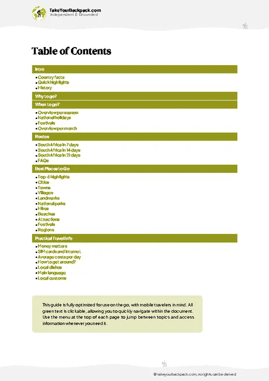
example page 0 from our offline Travel Guide for South Africa
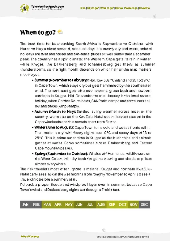
example page 1 from our offline Travel Guide for South Africa
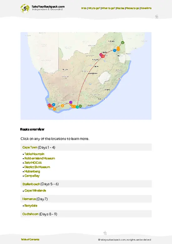
example page 2 from our offline Travel Guide for South Africa
example page 3 from our offline Travel Guide for South Africa
example page 4 from our offline Travel Guide for South Africa
example page 5 from our offline Travel Guide for South Africa
example page 6 from our offline Travel Guide for South Africa
example page 7 from our offline Travel Guide for South Africa
Loading the map 🌍
CLICK TO FILTER
cities
towns
villages
landmarks
national parks
hikes
beaches
attractions
festivals
regions
SHOW COUNTRY’S BESTSHOW ALL

✨ Why go?
Ranked #1 hike in South Africa
Reasons people choose to hike the here

Otter Trail is the rare hike where the hut is booked, the route is marked and your pack stays lighter than on most multi-day walks, because the rustic cabins have bunks and you carry no tent. That convenience is a big draw. Everything is organized around 12 hikers a day, so you spend nights with a small group instead of a crowd, and the coastline stays quiet even in busy months.
The scenery payoff is dense. Within five days you cross Bloukrans River at low tide, pass sea caves, rocky platforms and forest, and finish on a long beach at a lagoon mouth. Daily distances are modest, so you actually have time to swim, watch the waves and look for otters, dassies and whales offshore.
It also sits neatly on the Garden Route. Backpackers on the Baz Bus circuit can string it between Cape Town and Port … read more 👉
Otter Trail is the rare hike where the hut is booked, the route is marked and your pack stays lighter than on most multi-day walks, because the rustic cabins have bunks and you carry no tent. That convenience is a big draw. Everything is organized around 12 hikers a day, so you spend nights with a small group instead of a crowd, and the coastline stays quiet even in busy months.
The scenery payoff is dense. Within five days you cross Bloukrans River at low tide, pass sea caves, rocky platforms and forest, and finish on a long beach at a lagoon mouth. Daily distances are modest, so you actually have time to swim, watch the waves and look for otters, dassies and whales offshore.
It also sits neatly on the Garden Route. Backpackers on the Baz Bus circuit can string it between Cape Town and Port Elizabeth, then rest in Nature’s Valley or Plettenberg Bay. The Storms River Mouth start also makes the logistics easy once you reach the village.

💡 HighlightsMust-see experiences and standout moments

  1. Waterfall Bay: The trail’s best-known picture is a freshwater stream falling over a cliff directly into the sea, near the start of day two. You can see it from the path above and scramble down for a closer look. It is the shot everyone brings home.
  2. Storms River Mouth suspension bridge: The trail begins beside this swaying footbridge over the river mouth. Rock walls close in on both sides and the Indian Ocean surges in underneath. It takes ten minutes to walk across and is worth doing before you head off.
  3. Bloukrans River crossing: The tidal river mouth on day four is the trail’s toughest moment. You need to time the crossing for low tide, and in good conditions you wade or swim with your pack. The route forces you to plan around the sea, which makes it memorable.
  4. Ngubu Hut and its shoreline: The
… read more 👉
  1. Waterfall Bay: The trail’s best-known picture is a freshwater stream falling over a cliff directly into the sea, near the start of day two. You can see it from the path above and scramble down for a closer look. It is the shot everyone brings home.
  2. Storms River Mouth suspension bridge: The trail begins beside this swaying footbridge over the river mouth. Rock walls close in on both sides and the Indian Ocean surges in underneath. It takes ten minutes to walk across and is worth doing before you head off.
  3. Bloukrans River crossing: The tidal river mouth on day four is the trail’s toughest moment. You need to time the crossing for low tide, and in good conditions you wade or swim with your pack. The route forces you to plan around the sea, which makes it memorable.
  4. Ngubu Hut and its shoreline: The first night’s hut sits close to the sea, with a rocky shore and rock pools just below. Bed down to the sound of surf and watch for otters and dassies at dusk. It is a gentle introduction to the hut system.
  5. Nature’s Valley finish: The last stretch drops to Groot River lagoon and a long, empty beach. After four days of cliffs and roots, the flat sand is a relief. The tiny village offers a place to rest and shower.
Otter Trail gives first-timers the most in Waterfall Bay, a scenic highlight on day two that is easy to enjoy without any extra planning.
Spotted a mistake or missing something? Contact us.

Things to do near Otter Trail

Ratings based on Tripadvisor reviews. When you book through this link, you support our work at no extra cost to you.

🌤️ When to go?Best time to hike the Otter Trail

  • Autumn (March to May): Days run 20 to 25°C (68 to 77°F), nights 10 to 14°C (50 to 57°F), and the sea is still swimmable. Rain is lighter than in spring, so this is the most settled stretch.
  • Winter (June to August): Cold fronts bring rain, with days of 15 to 19°C (59 to 66°F) and nights near 6 to 9°C (43 to 48°F). Daylight is short, about 10 hours, so the long second-day stages feel tight. Crowds thin out, but wet rock and the Bloukrans River crossing demand care.
  • Spring (September to November): Highs of 19 to 23°C (66 to 73°F), fresh wildflowers and whale season. Southern right whales and humpbacks pass the cliffs. Rain can arrive quickly.
  • Summer (December to February): Warm at 22 to 27°C (72 to 81°F) with daylight of about 14 hours. School holidays fill the trail, and bookings sell out many
… read more 👉
  • Autumn (March to May): Days run 20 to 25°C (68 to 77°F), nights 10 to 14°C (50 to 57°F), and the sea is still swimmable. Rain is lighter than in spring, so this is the most settled stretch.
  • Winter (June to August): Cold fronts bring rain, with days of 15 to 19°C (59 to 66°F) and nights near 6 to 9°C (43 to 48°F). Daylight is short, about 10 hours, so the long second-day stages feel tight. Crowds thin out, but wet rock and the Bloukrans River crossing demand care.
  • Spring (September to November): Highs of 19 to 23°C (66 to 73°F), fresh wildflowers and whale season. Southern right whales and humpbacks pass the cliffs. Rain can arrive quickly.
  • Summer (December to February): Warm at 22 to 27°C (72 to 81°F) with daylight of about 14 hours. School holidays fill the trail, and bookings sell out many months ahead. Fees are fixed, but nearby lodging rises sharply.
Book your slot 9 to 12 months out, and choose a mid-week February or March start if you want warm water and fewer hikers.


source: climatestotravel.comJANJanuary: fair for travelingFEBFebruary: fair for travelingMARMarch: highly recommended for travelingAPRApril: excellent for travelingMAYMay: excellent for travelingJUNJune: fair for travelingJULJuly: below average for travelingAUGAugust: fair for travelingSEPSeptember: excellent for travelingOCTOctober: excellent for travelingNOVNovember: highly recommended for travelingDECDecember: fair for traveling
south-africa-hike-otter-trail v1
© Google |

✈️ The backpacker research shortcutSouth Africa Travel Guide

An offline-friendly backpacking guide with optimized travel routes, ranked highlights, transport advice, and the best areas to stay.
example page 0 from our offline Travel Guide for South Africa
example page 1 from our offline Travel Guide for South Africa
example page 2 from our offline Travel Guide for South Africa
example page 3 from our offline Travel Guide for South Africa
example page 4 from our offline Travel Guide for South Africa
example page 5 from our offline Travel Guide for South Africa
example page 6 from our offline Travel Guide for South Africa
example page 7 from our offline Travel Guide for South Africa
The digital guide (457 pages) contains:
✅ 125 highlights, ranked by travel appeal
✅ Optimized 7, 14 & 21-day travel routes
✅ Cities, national parks, landmarks, beaches
✅ How to get around
✅ Offline-friendly for travel without Wi-Fi
👉 Click to see all 30+ guide features

📅 Plan smarter in minutes, not weeks
✅ Month by month travel advice
✅ Festivals & national holidays
✅ Budget expectations

🗺️ Go to the right places, skip the overrated ones
✅ Honest pros & cons of destinations
✅ Top hikes, parks & viewpoints
✅ Lesser-known places most travelers miss
✅ Clear “worth it vs skip it” guidance

🛏️ Travel smoothly without rookie mistakes
✅ Best areas to stay
✅ Transport systems explained simply
✅ Common scams & safety advice
✅ SIM cards, money & practical tips

🌍 Understand the country, not just visit it
✅ Culture & traditions
✅ 52 Essential phrases & customs
✅ Festivals worth planning around
✅ Traveler-friendly historical context
✅ Insights that make places more meaningful

📱 Built for real travel conditions
✅ Fully downloadable PDF
✅ Works completely offline
✅ Optimized for phone use
✅ Useful in remote areas & buses
✅ Everything in one place
Stop searching, start planning
Get instant access to your full guide. 30‑day money-back guarantee.
+ Add another guide for just

By proceeding you agree to our terms.
Sent to your inbox immediately after payment • 100% Secure Checkout
Best Backpacking Travel Advisor 2025 tourism awardBest Backpacking
Travel Advisor
2025
What others say about Take Your Backpack Guides:
⭐⭐⭐⭐⭐
Fantastic, amazing amount of information!
⭐⭐⭐⭐⭐
My goodness this is amazing, it's what I've been looking for hats off too you!
⭐⭐⭐⭐⭐
I think this is absolutely BRILLIANT
⭐⭐⭐⭐
Very complete and informative. It's still missing places, but I gotta to commend you
⭐⭐⭐⭐⭐
This is truly amazing, thank you, can't wait to explore it with my kids!
⭐⭐⭐⭐⭐
Awesome resource, thank you!
⭐⭐⭐⭐⭐
This is amazing! Can't wait to explore the ones I haven't seen
⭐⭐⭐⭐
I love this! Well done, great idea.
⭐⭐⭐⭐⭐
Thanks for taking the time to make this gem!
⭐⭐⭐⭐⭐
This might be the best website I've ever seen.
⭐⭐⭐⭐⭐
Congratulations, and thank you so much for your work; it's incredibly valuable.
⭐⭐⭐⭐
In all seriousness I think you did a great job pointing out the important spots
⭐⭐⭐⭐⭐
10/10 very good
⭐⭐⭐⭐⭐
As someone who's only just starting to visit regularly this is awesome, thank you.
⭐⭐⭐⭐
Thank you very much! I'm going to visit my dad, it's going to be very useful!
⭐⭐⭐⭐⭐
This is really cool! We'll be travelling for the first time and this definitely come in handy.
⭐⭐⭐⭐⭐
You are now our minister of culture, congratulations 👨‍💼
⭐⭐⭐⭐⭐
Just wanted to tell you that this is a pearl! Going to follow your recommendations.
⭐⭐⭐⭐⭐
This is so cool. I'll definitely be using the resource for my travels soon.
⭐⭐⭐⭐⭐
This is very impressive! Good work.
⭐⭐⭐⭐⭐
This is an amazing and informative site. Very well done!

🛏️ Where to stay?Best areas and accommodation options

If you enjoy meeting fellow travelers, consider choosing hostels with high ratings for atmosphere. On the other hand, if you prefer having your own space, a hotel might be a better option.

🥾 Hike detailsEverything you need to know before hiking Otter Trail

Total Distance: Otter Trail covers about 42 kilometers one way from Storms River Mouth to Nature’s Valley, split into five days.
Estimated Duration: Five days and four nights. Day four is the longest, at roughly 14 kilometers, and the others are short enough for a slow pace.
Difficulty: Moderate to hard. Slippery roots, rock scrambles and repeated steep ups and downs make progress slower than the distance suggests. Good boots and trekking poles help.
Starting Point: Storms River Mouth, inside Garden Route National Park. The nearest public transport stop is Storms River village, reached by the Baz
… read more 👉
Total Distance: Otter Trail covers about 42 kilometers one way from Storms River Mouth to Nature’s Valley, split into five days.
Estimated Duration: Five days and four nights. Day four is the longest, at roughly 14 kilometers, and the others are short enough for a slow pace.
Difficulty: Moderate to hard. Slippery roots, rock scrambles and repeated steep ups and downs make progress slower than the distance suggests. Good boots and trekking poles help.
Starting Point: Storms River Mouth, inside Garden Route National Park. The nearest public transport stop is Storms River village, reached by the Baz Bus or intercity coaches along the N2. You then need a shuttle or taxi to the gate. The finish at Nature’s Valley also needs a pre-booked ride back.
Major Landmarks:
  • Storms River Mouth: The suspension bridge and rocky cove at the start.
  • Waterfall Bay: A stream falls straight onto the shore.
  • Huts: Ngubu, Oakhurst, Scott and Andre, each with bunks, a braai area and basic facilities.
  • Bloukrans River: A tidal crossing on day four that must be timed for low tide.
  • Nature’s Valley: The finish at a lagoon and beach.
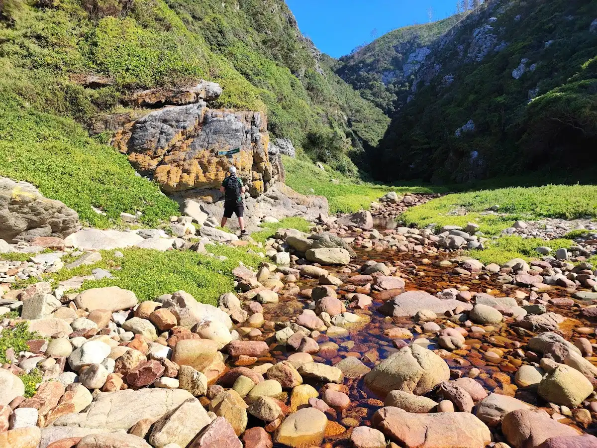
Terrain and Scenery: Quartzite cliffs, boulder-strewn beaches, rocky platforms and forest paths. The trail rises and falls between sea level and clifftops, with open ocean views on most days.
Vegetation: Coastal fynbos on the headlands, Afromontane forest in the gullies and milkwood and yellowwood trees in the sheltered valleys. Proteas and ericas bloom in places.
Wildlife: Cape clawless otters, dassies, bushbuck, blue duikers and baboons are possible. Knysna turacos call from the forest, and southern right whales and dolphins pass offshore in season.
Practical Notes: Permits are limited and must be booked well ahead through SANParks. Carry all food and a sleeping bag, and pack waterproof bags for the river crossing.
⚠️ Hiking info can sometimes be outdated or inaccurate. Before you hit the trail, check the latest conditions with locals. If you do spot anything that's off, I'd love to hear from you, so I can update it for fellow travelers.

🛡️ SafetySafety Tips and Common Scams in Otter Trail

Otter Trail is well-marked and well-managed, and the main hazards are weather and tides. Coastal fronts can roll in within an hour, so pack a proper rain shell and keep sleeping gear in dry bags. The Bloukrans River mouth on day four can only be crossed safely near low tide. Check the tide table the night before and leave the hut on time, because waiting for the water to drop can wreck the day. Footing is the other issue. Rock, roots and wet boardwalks are slippery, and the climbs out of each valley are steep, so trekking poles help tired knees. Carry all the water you need between streams, since some of it is tea-colored but drinkable. Wildlife is mild. Watch for puff adders sunning on the path, and keep food sealed away from vervet monkeys and baboons. Cell signal is patchy, so tell someone your finish date.

FAQTraveler FAQ

Otter Trail takes five days and four nights, covering about 45 kilometers (28 miles) between Storms River Mouth and Nature’s Valley. Daily stages run roughly 5 to 14 kilometers, with the longest being day two at about 13 kilometers. Most hikers walk it only in this direction and sleep in the huts at Ngubu, Scott, Oakhurst and Andre.
Otter Trail is moderately hard, mainly because of repeated steep climbs and descents along the coast with a loaded pack of roughly 12 to 15 kilograms. Day four includes the Bloukrans River crossing, which depends on the tides. Average fitness is enough if you train with a pack and take it slowly, and the stages are short enough to finish by mid-afternoon.
Otter Trail requires a booking through South African National Parks (SANParks), but no guide is needed since the path is well-marked. Group size is capped at 12 people, and the fee is roughly US$150 to 200 per person for the five days, including huts. Bookings open 12 months ahead and summer spots sell out fast, so reserve early.
⚠️ Things can change over time, so always validate details locally before you go.

Other South African hikes near Otter Trail

Explore more nearby:


💡 Not sure where to go next?
Create a personalized itinerary for South Africa including Otter Trail and the places that fit your trip.

Generate my itinerary

👉 Discover all hikes

Or checkout all South Africa has to offer (think cities, towns, villages, national parks, hikes, beaches, festivals)
Country photo of South Africa

We 💚 feedbackSumming up the experience

Otter Trail works best as the centerpiece of a Garden Route loop. I would pair it with a night in Plettenberg Bay before the start and a rest day in Nature’s Valley afterward, then continue along the coast by Baz Bus. Bring poles and dry bags, and book the permit before you book anything else, because the route plans around it.

✈️ When did I visit South Africa?
I have visited South Africa, before and after my Zimbabwe trip in 2001.

✍️ Help improve this page!
The information on this page is based on my own backpacking experience in South Africa, supplemented with up-to-date research and feedback from other travelers. Travel details can change, so if you notice anything outdated or incomplete, feel free to let me know.


🙋‍♂️ Give feedback

👋 Meet the founderWho’s Behind Take Your Backpack?

Johan, backpacker and founder of TakeYourBackpackHi, I’m Johan (Netherlands 🇳🇱), the creator of TakeYourBackpack. Over the past 3 decades, I’ve backpacked through 90+ countries across six continents, gaining extensive experience with independent travel, long-term trips, and overland routes.

This site is built on a combination of firsthand travel experience and carefully curated insights from other backpackers. Many guides are based on places I’ve personally visited, while others bring together tips, observations, and practical advice shared by trusted travelers I’ve met along the way.

The goal is to provide realistic, experience-driven guidance — not generic itineraries — so you can explore destinations with better context, clearer expectations, and more confidence.