×

Suriname🇸🇷 | regionsTumuc-Humac MountainsLawa River, Tapanahony, granite inselbergs, hammock camps | things to do and best time to go

Explore Bigi PanExplore Boven Saramacca

Backpacking in Tumuc-Humac Mountains
👍 Recommendedregion ranked #11
By Johan Kruseman 🇳🇱 | Updated October 19, 2026

Your boat idles against a granite slab in the Lawa or Tapanahony, the engine cuts, and the forest suddenly hums with cicadas and the hollow knock of a distant bird. Then comes the heat, thick and wet. The Tumuc-Humac Mountains lie along the far southern border of Suriname, shared with Brazil and French Guiana, and reaching them takes days of river travel with Maroon or Indigenous guides. There are no marked trails, no lodges and no crowds, only rapids, mosquito nets and unbroken canopy. Wildlife is rich, but you hear it far more than you see it. Logistics are hard and costly, which is the point. You end each day by lying in a hammock listening to rain on the leaves.

Discover everything you want to know in the 📖 Suriname Travel Guide.


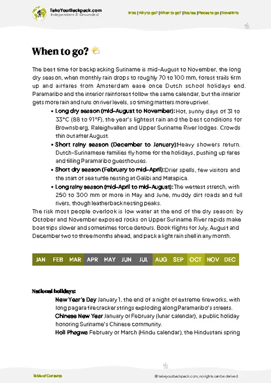
example page 0 from our offline Travel Guide for Suriname
example page 1 from our offline Travel Guide for Suriname
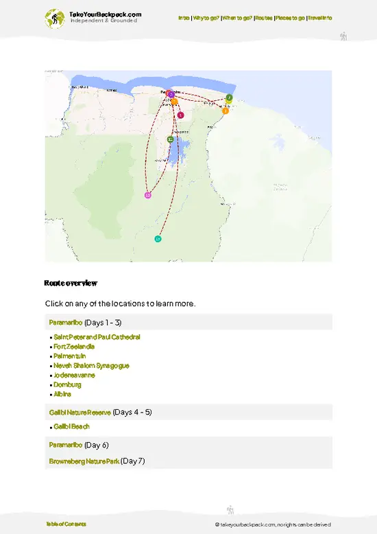
example page 2 from our offline Travel Guide for Suriname
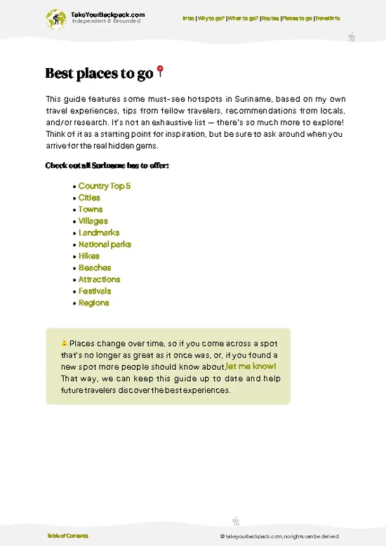
example page 3 from our offline Travel Guide for Suriname
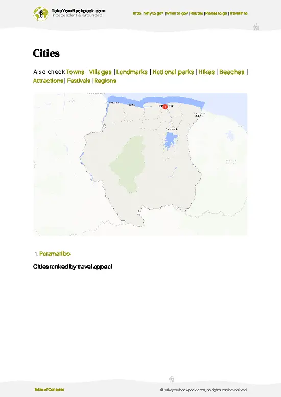
example page 4 from our offline Travel Guide for Suriname
example page 5 from our offline Travel Guide for Suriname
example page 6 from our offline Travel Guide for Suriname
example page 7 from our offline Travel Guide for Suriname
Loading the map 🌍
CLICK TO FILTER
cities
towns
villages
landmarks
national parks
hikes
beaches
attractions
festivals
regions
SHOW COUNTRY’S BESTSHOW ALL

✨ Why go?
Ranked #11 region in Suriname
What makes it a must-see region

Backpackers pick Tumuc-Humac Mountains because almost nobody else does. This is true expedition country, where you travel by dugout canoe up rapids such as those on the Lawa and Tapanahony rivers, sleep in hammocks at riverside villages, and walk with local guides who know the forest as a working landscape. Independent planning barely exists here, so you join a guided expedition, but the trade is a place with no queues, no souvenir stalls and no signposts. The granite domes and forested ridges along the Brazilian border are among the least visited in South America. If you want days of paddling and bushwalking in primary rainforest, with a night camp beside a rock outcrop, this is the address. Come fit, patient and ready for insects.

💡 HighlightsDon't-miss highlights and experiences

  1. Lawa River approach: The main waterway toward the southern interior, with long dugout canoe days past Maroon villages, sandbars and rapids that crews haul boats through.
  2. Tapanahony River: An alternate route into the deep south, lined with forest and small settlements, with granite boulders breaking the current.
  3. Granite inselbergs: Bare domes rise above the canopy, and from their tops you see an unbroken green carpet reaching toward Brazil.
  4. Primary rainforest walks: Guided bushwalks under towering trees, with buttress roots, lianas and the loud calls of howler monkeys and parrots.
  5. Riverside hammock camps: Nights on sandbanks or in village huts, with frogs, insects and starlight all around.
  6. Indigenous and Maroon villages: Brief stops where you can meet residents, see cassava processing and learn
… read more 👉
  1. Lawa River approach: The main waterway toward the southern interior, with long dugout canoe days past Maroon villages, sandbars and rapids that crews haul boats through.
  2. Tapanahony River: An alternate route into the deep south, lined with forest and small settlements, with granite boulders breaking the current.
  3. Granite inselbergs: Bare domes rise above the canopy, and from their tops you see an unbroken green carpet reaching toward Brazil.
  4. Primary rainforest walks: Guided bushwalks under towering trees, with buttress roots, lianas and the loud calls of howler monkeys and parrots.
  5. Riverside hammock camps: Nights on sandbanks or in village huts, with frogs, insects and starlight all around.
  6. Indigenous and Maroon villages: Brief stops where you can meet residents, see cassava processing and learn how people live this far from roads.
  7. Rapids and waterfalls: Whitewater sections where passengers walk the bank while boatmen pull the canoe through.
Start with the Lawa River approach, because the days on the water set the pace and give your body time to adapt to the heat before any walking begins.
Spotted a mistake or missing something? Contact us.

⌛️ 5 daysHow to make the most of Tumuc-Humac Mountains

The pace here is set by rivers, not roads: nothing moves without a dugout canoe, a chartered small plane from Paramaribo, and a Trio or Wayana guide who knows which rapids drop at which water level. Plan on days that start at first light and pause hard through the midday heat, when hammocks beat hiking.
Day 1: Kwamalasamutu:
The Trio village is the usual gateway, reached by charter flight onto a jungle airstrip. Use the afternoon to settle in, meet your guide and arrange the boat, because river levels decide everything that follows. Paying village fees and hiring local boatmen here keeps the money where it matters.
Day 2 and 3: Upriver toward the Tumuc-Humac:
Travel by motorized dugout, hauling the boat around rapids on foot where the water is low. This slow stretch is the point: forest walls … read more 👉
The pace here is set by rivers, not roads: nothing moves without a dugout canoe, a chartered small plane from Paramaribo, and a Trio or Wayana guide who knows which rapids drop at which water level. Plan on days that start at first light and pause hard through the midday heat, when hammocks beat hiking.
Day 1: Kwamalasamutu:
The Trio village is the usual gateway, reached by charter flight onto a jungle airstrip. Use the afternoon to settle in, meet your guide and arrange the boat, because river levels decide everything that follows. Paying village fees and hiring local boatmen here keeps the money where it matters.
Day 2 and 3: Upriver toward the Tumuc-Humac:
Travel by motorized dugout, hauling the boat around rapids on foot where the water is low. This slow stretch is the point: forest walls close in, giant river otters and macaws appear, and you sleep in hammocks at riverside camps. Starting early gives you the cool hours for the portages.
Day 4: Granite dome and forest trail:
From the upper camp, hike inland to the rock outcrops, where the canopy opens onto an unbroken green horizon. Climb before the heat builds and rest through the middle of the day.
Day 5: Detour to a Trio sacred rock:
One side trip adds a lot without changing the boat schedule: a short guided walk to a lookout rock used by the community, with views over the headwater forest. Then drift back downstream with the current doing the work.

If you keep only one day, make it Day 4. The summit view across the empty interior is the reason to come this far.

🌤️ When to go?Seasonal considerations and timing

  • Long Dry Season (August to mid-December): Rivers drop, rapids and granite outcrops are exposed, and trails are firm. Days run 30 to 34°C (86 to 93°F), nights 21 to 23°C (70 to 73°F). Charter flights and Trio-run expeditions sell out first, and prices peak.
  • Short Wet Season (mid-December to January): Showers are frequent but brief, and rivers stay navigable. Fewer groups go, and some operators discount.
  • Short Dry Spell (February to mid-April): A brief break, with lower rainfall and decent river levels.
  • Long Wet Season (mid-April to July): Heavy rain, high rivers, muddy trails, and insects at their worst. Quiet, and cheapest, but airstrips and boat access can be disrupted.
Daylight stays close to twelve hours all year, so plan around river levels, not light. Book your charter flight and guides at … read more 👉
  • Long Dry Season (August to mid-December): Rivers drop, rapids and granite outcrops are exposed, and trails are firm. Days run 30 to 34°C (86 to 93°F), nights 21 to 23°C (70 to 73°F). Charter flights and Trio-run expeditions sell out first, and prices peak.
  • Short Wet Season (mid-December to January): Showers are frequent but brief, and rivers stay navigable. Fewer groups go, and some operators discount.
  • Short Dry Spell (February to mid-April): A brief break, with lower rainfall and decent river levels.
  • Long Wet Season (mid-April to July): Heavy rain, high rivers, muddy trails, and insects at their worst. Quiet, and cheapest, but airstrips and boat access can be disrupted.
Daylight stays close to twelve hours all year, so plan around river levels, not light. Book your charter flight and guides at least two to three months ahead for September or October.


source: climatestotravel.comJANJanuary: fair for travelingFEBFebruary: fair for travelingMARMarch: fair for travelingAPRApril: fair for travelingMAYMay: fair for travelingJUNJune: fair for travelingJULJuly: good for travelingAUGAugust: excellent for travelingSEPSeptember: excellent for travelingOCTOctober: excellent for travelingNOVNovember: highly recommended for travelingDECDecember: fair for traveling
suriname-region-tumuc-humac-mountains
© Google | Camille Daudigny

✈️ The backpacker research shortcutSuriname Travel Guide

An offline-friendly backpacking guide with optimized travel routes, ranked highlights, transport advice, and the best areas to stay.
example page 0 from our offline Travel Guide for Suriname
example page 1 from our offline Travel Guide for Suriname
example page 2 from our offline Travel Guide for Suriname
example page 3 from our offline Travel Guide for Suriname
example page 4 from our offline Travel Guide for Suriname
example page 5 from our offline Travel Guide for Suriname
example page 6 from our offline Travel Guide for Suriname
example page 7 from our offline Travel Guide for Suriname
The digital guide (153 pages) contains:
✅ 40 highlights, ranked by travel appeal
✅ Optimized 5, 10 & 15-day travel routes
✅ Cities, national parks, landmarks, beaches
✅ How to get around
✅ Offline-friendly for travel without Wi-Fi
👉 Click to see all 30+ guide features

📅 Plan smarter in minutes, not weeks
✅ Month by month travel advice
✅ Festivals & national holidays
✅ Budget expectations

🗺️ Go to the right places, skip the overrated ones
✅ Honest pros & cons of destinations
✅ Top hikes, parks & viewpoints
✅ Lesser-known places most travelers miss
✅ Clear “worth it vs skip it” guidance

🛏️ Travel smoothly without rookie mistakes
✅ Best areas to stay
✅ Transport systems explained simply
✅ Common scams & safety advice
✅ SIM cards, money & practical tips

🌍 Understand the country, not just visit it
✅ Culture & traditions
✅ 52 Essential phrases & customs
✅ Festivals worth planning around
✅ Traveler-friendly historical context
✅ Insights that make places more meaningful

📱 Built for real travel conditions
✅ Fully downloadable PDF
✅ Works completely offline
✅ Optimized for phone use
✅ Useful in remote areas & buses
✅ Everything in one place
Stop searching, start planning
Get instant access to your full guide. 30‑day money-back guarantee.
+ Add another guide for just

By proceeding you agree to our terms.
Sent to your inbox immediately after payment • 100% Secure Checkout
Best Backpacking Travel Advisor 2025 tourism awardBest Backpacking
Travel Advisor
2025
What others say about Take Your Backpack Guides:
⭐⭐⭐⭐⭐
Fantastic, amazing amount of information!
⭐⭐⭐⭐⭐
My goodness this is amazing, it's what I've been looking for hats off too you!
⭐⭐⭐⭐⭐
I think this is absolutely BRILLIANT
⭐⭐⭐⭐
Very complete and informative. It's still missing places, but I gotta to commend you
⭐⭐⭐⭐⭐
This is truly amazing, thank you, can't wait to explore it with my kids!
⭐⭐⭐⭐⭐
Awesome resource, thank you!
⭐⭐⭐⭐⭐
This is amazing! Can't wait to explore the ones I haven't seen
⭐⭐⭐⭐
I love this! Well done, great idea.
⭐⭐⭐⭐⭐
Thanks for taking the time to make this gem!
⭐⭐⭐⭐⭐
This might be the best website I've ever seen.
⭐⭐⭐⭐⭐
Congratulations, and thank you so much for your work; it's incredibly valuable.
⭐⭐⭐⭐
In all seriousness I think you did a great job pointing out the important spots
⭐⭐⭐⭐⭐
10/10 very good
⭐⭐⭐⭐⭐
As someone who's only just starting to visit regularly this is awesome, thank you.
⭐⭐⭐⭐
Thank you very much! I'm going to visit my dad, it's going to be very useful!
⭐⭐⭐⭐⭐
This is really cool! We'll be travelling for the first time and this definitely come in handy.
⭐⭐⭐⭐⭐
You are now our minister of culture, congratulations 👨‍💼
⭐⭐⭐⭐⭐
Just wanted to tell you that this is a pearl! Going to follow your recommendations.
⭐⭐⭐⭐⭐
This is so cool. I'll definitely be using the resource for my travels soon.
⭐⭐⭐⭐⭐
This is very impressive! Good work.
⭐⭐⭐⭐⭐
This is an amazing and informative site. Very well done!

🛏️ Where to stay?Choosing the right base

No hotels exist inside the Tumuc-Humac Mountains area, so you sleep in hammocks at remote villages and river camps, arranged through a tour operator. Most trips are organized from Paramaribo, where backpackers stay in hostels and guesthouses around the historic center, from US$15 to 40 a night. Expect to spend the night before departure there, near the operators and the Zorg en Hoop airfield used for charters.

On the ground, the Trio village of Kwamalasamutu is the main gateway, with basic guesthouse lodging and hammock huts run by the community, around US$20 to 50 per person with meals when … read more 👉
No hotels exist inside the Tumuc-Humac Mountains area, so you sleep in hammocks at remote villages and river camps, arranged through a tour operator. Most trips are organized from Paramaribo, where backpackers stay in hostels and guesthouses around the historic center, from US$15 to 40 a night. Expect to spend the night before departure there, near the operators and the Zorg en Hoop airfield used for charters.

On the ground, the Trio village of Kwamalasamutu is the main gateway, with basic guesthouse lodging and hammock huts run by the community, around US$20 to 50 per person with meals when booked through a package. Alalapadu, another Trio village, also receives visitors. Along expedition routes you string a hammock with a mosquito net at jungle camps, and most operators supply the tarps. Bring your own hammock if you want to be comfortable, and pack light, because charter planes have strict weight limits.

🚌 Getting aroundHow to get around Tumuc-Humac Mountains

Tumuc-Humac Mountains has no center to walk, because the range is a roadless stretch of forest on the Brazil border in southern Suriname, and walking only makes sense once you are already deep inside it, on jungle trails where the ground is wet leaf litter, root and granite. Most backpackers never reach it independently. Nearly everyone goes with an organized expedition out of Paramaribo, and it is reliable only because operators control every link in the chain.
  • Charter flight to Kwamalasamutu or Sipaliwini airstrip: roughly US$250 to 450 one way per seat, 1 to 1.5 hours from Paramaribo’s Zorg en Hoop airport. Scheduled seats barely exist, so joining a group charter splits the cost and is what experienced travelers do.
  • Motorized dugout canoe: the only way along the Corantijn and its tributaries,
… read more 👉
Tumuc-Humac Mountains has no center to walk, because the range is a roadless stretch of forest on the Brazil border in southern Suriname, and walking only makes sense once you are already deep inside it, on jungle trails where the ground is wet leaf litter, root and granite. Most backpackers never reach it independently. Nearly everyone goes with an organized expedition out of Paramaribo, and it is reliable only because operators control every link in the chain.
  • Charter flight to Kwamalasamutu or Sipaliwini airstrip: roughly US$250 to 450 one way per seat, 1 to 1.5 hours from Paramaribo’s Zorg en Hoop airport. Scheduled seats barely exist, so joining a group charter splits the cost and is what experienced travelers do.
  • Motorized dugout canoe: the only way along the Corantijn and its tributaries, at about US$50 to 100 a day including a boatman, often 6 to 10 hours of drone, spray and diesel smell. Operators bundle it into the package because fuel is hauled in and priced accordingly.
  • Foot trek with indigenous guides: included in tours, usually 3 to 6 hours of hiking a day through humid shade. Hire Trio guides from the village rather than going solo, since trails vanish within weeks of the last clearing.
  • Multi-day expedition package: US$1,500 to 3,000 for 7 to 10 days, covering flights, boats, hammocks and food. It looks steep, but it replaces the logistics you cannot buy piecemeal.
Book through a Paramaribo operator at least two months ahead, travel in the drier months when river levels let boats pass the rapids, and pack everything in waterproof bags, because afternoon downpours drum on the canopy and soak anything left exposed.

👛 Costs (as of 19 October 2026)Typical daily expenses

Expect to spend about US$215 a day on an organized Tumuc-Humac Mountains trip in high season, since flights and guides account for most of the bill. Independent travel is not practical, so these figures assume a package or shared charter. Payment is usually made in US dollars or euros, and cash is needed in villages.
CategoryBudget RangeLocal Reality
Entrance/PermitsUS$10 to 30Community and access fees are usually bundled into the tour price by the operator.
Accommodation (high season)US$20 to 50Hammock huts or basic village guesthouses. Paramaribo hostels run higher.
Guides and Local TransportUS$100 to 250Charter flights and dugout canoes are split across the group, and a Trio guide is mandatory.
Food and SuppliesUS$15 to 35Meals are cassava, fish, and rice, often included in packages. Bring snacks
… read more 👉
Expect to spend about US$215 a day on an organized Tumuc-Humac Mountains trip in high season, since flights and guides account for most of the bill. Independent travel is not practical, so these figures assume a package or shared charter. Payment is usually made in US dollars or euros, and cash is needed in villages.
CategoryBudget RangeLocal Reality
Entrance/PermitsUS$10 to 30Community and access fees are usually bundled into the tour price by the operator.
Accommodation (high season)US$20 to 50Hammock huts or basic village guesthouses. Paramaribo hostels run higher.
Guides and Local TransportUS$100 to 250Charter flights and dugout canoes are split across the group, and a Trio guide is mandatory.
Food and SuppliesUS$15 to 35Meals are cassava, fish, and rice, often included in packages. Bring snacks and water purification.
Total Daily BudgetUS$215Per person, per day, in high season.
⚠️ Prices can change and everyone travels differently, so take this as a rough guide. Hope it helps you plan your adventure!

🍲 FoodEating & Drinking in Tumuc-Humac Mountains

Food here is Trio and Amerindian cooking, built on what the river and forest give. The staple is cassava: flat, crisp cassava bread baked on a hot griddle, and sour, slightly fermented kasiri, a mildly alcoholic drink that is polite to accept. Expect smoked or grilled river fish such as pacu and piranha, flaking in woodsmoke, and thick pepper pot broths sharpened with fiery madame jeanette peppers that sting before they sweeten.

There are no restaurants. You eat at village kitchens, around a camp fire, or from the expedition cook, who usually serves rice, beans, tinned fish and fresh catch. Pack snacks from Paramaribo’s markets, like peanuts, roti and fruit, since supplies are limited.

Customs matter. Meals are shared, so wait to be served, accept offered bowls with both hands, and never waste … read more 👉
Food here is Trio and Amerindian cooking, built on what the river and forest give. The staple is cassava: flat, crisp cassava bread baked on a hot griddle, and sour, slightly fermented kasiri, a mildly alcoholic drink that is polite to accept. Expect smoked or grilled river fish such as pacu and piranha, flaking in woodsmoke, and thick pepper pot broths sharpened with fiery madame jeanette peppers that sting before they sweeten.

There are no restaurants. You eat at village kitchens, around a camp fire, or from the expedition cook, who usually serves rice, beans, tinned fish and fresh catch. Pack snacks from Paramaribo’s markets, like peanuts, roti and fruit, since supplies are limited.

Customs matter. Meals are shared, so wait to be served, accept offered bowls with both hands, and never waste cassava. Water comes boiled or filtered, so bring purification tablets.

🛡️ SafetySafety Tips and Common Scams in Tumuc-Humac Mountains

This is genuinely remote country, so the main risks are logistical rather than dramatic. There are no marked trails, no rescue service nearby, and the nearest clinic may be a charter flight away, so go only with a Trio guide and an operator carrying a satellite phone. Heat and humidity drain you quickly, so drink often and rest at midday. Wet granite and river rocks are slick, and boat trips through rapids call for a life jacket. Snakes, ticks, and stinging insects are the usual nuisances, and jaguars and other wildlife keep away from groups, so stay with your guide and never feed anything. Start malaria prophylaxis and check your yellow fever vaccination before you leave.

FAQTraveler FAQ

Plan on 5 to 8 days for the Tumuc-Humac Mountains, since most expeditions are fixed itineraries. The charter flight to Kwamalasamutu takes roughly 1.5 hours from Paramaribo, and shorter 4 to 5 day trips cover the village and nearby river and granite domes. Longer trips add boat travel and jungle camping deeper toward the Brazilian border.
Visiting the Tumuc-Humac Mountains without a car is the only realistic way, because no roads reach the area. You fly by small charter plane from Paramaribo to airstrips such as Kwamalasamutu, then continue by dugout canoe and on foot with a Trio guide. A shared charter flight typically costs US$150 to 300 per person return, depending on group size.
Yes, visiting the Tumuc-Humac Mountains requires arrangements with the local Trio community and usually an operator based in Paramaribo. Community access fees are typically bundled into tour prices, roughly US$10 to 30 per person. Independent entry is discouraged, and your operator handles permission before you fly.
⚠️ Things can change over time, so always validate details locally before you go.

More places to explore across Suriname

Tumuc-Humac Mountains isn’t the only highlight in Suriname. Explore all what Suriname has to offer.
Country photo of Suriname

We 💚 feedbackParting advice and final tips

Plan for the drier months, roughly August to November, when rivers drop enough to expose sandbars for camping and rapids are easier to pass, though water levels still decide the schedule. Tumuc-Humac Mountains rewards early mornings, when mist lifts off the canopy and birds are loudest. Bring a good hammock net.

✍️ Help improve this page!
The information on this page is based on in-depth research, insights shared by experienced travelers, and feedback from the local travel community in Suriname. While every effort is made to keep the information accurate and current, conditions can change — so if you spot anything incorrect or outdated, please get in touch.


🙋‍♂️ Give feedback

👋 Meet the founderWho’s Behind Take Your Backpack?

Johan, backpacker and founder of TakeYourBackpackHi, I’m Johan (Netherlands 🇳🇱), the creator of TakeYourBackpack. Over the past 3 decades, I’ve backpacked through 90+ countries across six continents, gaining extensive experience with independent travel, long-term trips, and overland routes.

This site is built on a combination of firsthand travel experience and carefully curated insights from other backpackers. Many guides are based on places I’ve personally visited, while others bring together tips, observations, and practical advice shared by trusted travelers I’ve met along the way.

The goal is to provide realistic, experience-driven guidance — not generic itineraries — so you can explore destinations with better context, clearer expectations, and more confidence.