

×
Half Dome

the USA🇺🇸 | hikesHalf DomeGranite dome, steel cables, Mist Trail, Yosemite Valley | things to do and best time to go

Explore Pacific Crest TrailExplore Zion Narrows

Backpacking in Half Dome
👍 Recommendedhike ranked #7
By Johan Kruseman 🇳🇱 | Updated October 22, 2026

Half Dome is not a dome sliced in half by a glacier; glaciers only polished and steepened a granite block that was never a full sphere. It sits in Yosemite National Park in the Sierra Nevada of eastern California, United States. The round trip runs about 26 kilometers with roughly 1,460 meters of climbing, and the last 120 meters are two steel cables on bare granite that require a permit. Views are enormous, the crowds on the cables can be comic, and the Valley trailhead has a free shuttle. I bring cheap work gloves and left a pair at the cable base for the next hiker, which is a habit worth copying. Your first day could be spent collecting your permit confirmation, hiking the Mist Trail to Vernal Fall, and sleeping early.

Discover everything you want to know in the 📖 the USA Travel Guide.
Best time to go: April - October
Duration: 12 hours
Distance: 26 kilometers
Total ascent: 1460 meters


example page 0 from our offline Travel Guide for United States
example page 1 from our offline Travel Guide for United States
example page 2 from our offline Travel Guide for United States
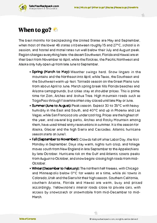
example page 3 from our offline Travel Guide for United States
example page 4 from our offline Travel Guide for United States
example page 5 from our offline Travel Guide for United States
example page 6 from our offline Travel Guide for United States
example page 7 from our offline Travel Guide for United States
Loading the map 🌍
CLICK TO FILTER
cities
towns
villages
landmarks
national parks
hikes
beaches
attractions
festivals
regions
SHOW COUNTRY’S BESTSHOW ALL

✨ Why go?
Ranked #7 hike in the USA
The unique appeal for travelers

Half Dome gives you one of the most recognizable summits in North America, and you reach it on foot from a valley floor you can access by free park shuttle. That combination is rare. The cables route up the final 120 meters is the draw: you pull yourself up a 45-degree granite slope between wooden-board rungs and steel poles, then stand on a summit with a drop of roughly 600 meters on the north face. Nothing in the lower 48 states feels quite like it. Many hikers also use the climb as the centerpiece of a longer Yosemite stay, linking it with the Mist Trail past Vernal and Nevada Falls, which makes the approach a highlight rather than a chore. Permits are won by lottery, and that scarcity is part of the appeal. You are earning something that takes planning, a very long day, and a pair of gloves, … read more 👉
Half Dome gives you one of the most recognizable summits in North America, and you reach it on foot from a valley floor you can access by free park shuttle. That combination is rare. The cables route up the final 120 meters is the draw: you pull yourself up a 45-degree granite slope between wooden-board rungs and steel poles, then stand on a summit with a drop of roughly 600 meters on the north face. Nothing in the lower 48 states feels quite like it. Many hikers also use the climb as the centerpiece of a longer Yosemite stay, linking it with the Mist Trail past Vernal and Nevada Falls, which makes the approach a highlight rather than a chore. Permits are won by lottery, and that scarcity is part of the appeal. You are earning something that takes planning, a very long day, and a pair of gloves, and the summit view across Tenaya Canyon and the high country makes that feel fair.

💡 HighlightsKey sights and experiences for travelers

  1. Half Dome Summit: A flat, granite top of around 5 hectares with views down to Yosemite Valley and across to Clouds Rest. The edge at the north face is a sheer drop of about 600 meters, so approach it with respect.
  2. The Cables: Two steel cables climb the last 120 meters at about 45 degrees, with wooden planks as rests. This is the part everyone talks about, and it takes roughly 20 to 40 minutes depending on queues.
  3. Vernal Fall via the Mist Trail: A stone staircase beside a 97-meter waterfall, where spray soaks you in early summer. Bring a rain shell for the wet steps.
  4. Nevada Fall: A 181-meter plunge viewed from the trail as it climbs above Vernal Fall. The top has a footbridge and a granite lip where you can rest before the long forest section.
  5. Little Yosemite Valley: A flat, wooded meadow stretch
… read more 👉
  1. Half Dome Summit: A flat, granite top of around 5 hectares with views down to Yosemite Valley and across to Clouds Rest. The edge at the north face is a sheer drop of about 600 meters, so approach it with respect.
  2. The Cables: Two steel cables climb the last 120 meters at about 45 degrees, with wooden planks as rests. This is the part everyone talks about, and it takes roughly 20 to 40 minutes depending on queues.
  3. Vernal Fall via the Mist Trail: A stone staircase beside a 97-meter waterfall, where spray soaks you in early summer. Bring a rain shell for the wet steps.
  4. Nevada Fall: A 181-meter plunge viewed from the trail as it climbs above Vernal Fall. The top has a footbridge and a granite lip where you can rest before the long forest section.
  5. Little Yosemite Valley: A flat, wooded meadow stretch along the Merced River with a backcountry camp area. It makes a calm midpoint, with the dome looming above the trees.
For a first visit, the Mist Trail past Vernal Fall gives the best return, since the staircase and the waterfall are spectacular even if you never reach the cables.
Spotted a mistake or missing something? Contact us.

Things to do around Half Dome

Ratings based on Tripadvisor reviews. When you book through this link, you support our work at no extra cost to you.

🌤️ When to go?Weather, crowds, and seasonal trade-offs

  • Late June to mid-September: The cables are up and the permit lottery days fill, so expect crowds. Valley highs run 27 to 35°C (80 to 95°F), with cooler summit air and long daylight of roughly 14 hours. Afternoon thunderstorms occasionally build in July and August.
  • Mid-May to early June: Cables usually go up around Memorial Day weekend, weather is mild at 15 to 25°C (59 to 77°F), and Yosemite’s waterfalls along the Mist Trail are at full force.
  • Late September to mid-October: Crisp days of 15 to 24°C (59 to 75°F), thinner crowds, and shorter daylight of about 11 to 12 hours. The cables normally come down after Columbus Day, and nights can approach freezing.
  • Winter and early spring: Ice and snow make the upper route a mountaineering objective without cables. Lodging in the valley is cheaper then,
… read more 👉
  • Late June to mid-September: The cables are up and the permit lottery days fill, so expect crowds. Valley highs run 27 to 35°C (80 to 95°F), with cooler summit air and long daylight of roughly 14 hours. Afternoon thunderstorms occasionally build in July and August.
  • Mid-May to early June: Cables usually go up around Memorial Day weekend, weather is mild at 15 to 25°C (59 to 77°F), and Yosemite’s waterfalls along the Mist Trail are at full force.
  • Late September to mid-October: Crisp days of 15 to 24°C (59 to 75°F), thinner crowds, and shorter daylight of about 11 to 12 hours. The cables normally come down after Columbus Day, and nights can approach freezing.
  • Winter and early spring: Ice and snow make the upper route a mountaineering objective without cables. Lodging in the valley is cheaper then, but the hike is not practical for most backpackers.
Weekdays in early June or September give you the cables with the shortest lines and easier lodging.


source: climatestotravel.comJANJanuary: below average for travelingFEBFebruary: below average for travelingMARMarch: fair for travelingAPRApril: good for travelingMAYMay: highly recommended for travelingJUNJune: excellent for travelingJULJuly: highly recommended for travelingAUGAugust: highly recommended for travelingSEPSeptember: highly recommended for travelingOCTOctober: good for travelingNOVNovember: fair for travelingDECDecember: below average for traveling
United States - Yosemity Half Dome

✈️ The backpacker research shortcutthe USA Travel Guide

An offline-friendly backpacking guide with optimized travel routes, ranked highlights, transport advice, and the best areas to stay.
example page 0 from our offline Travel Guide for United States
example page 1 from our offline Travel Guide for United States
example page 2 from our offline Travel Guide for United States
example page 3 from our offline Travel Guide for United States
example page 4 from our offline Travel Guide for United States
example page 5 from our offline Travel Guide for United States
example page 6 from our offline Travel Guide for United States
example page 7 from our offline Travel Guide for United States
The digital guide (451 pages) contains:
✅ 159 highlights, ranked by travel appeal
✅ Optimized 14, 21 & 30-day travel routes
✅ Cities, national parks, landmarks, beaches
✅ How to get around
✅ Offline-friendly for travel without Wi-Fi
👉 Click to see all 30+ guide features

📅 Plan smarter in minutes, not weeks
✅ Month by month travel advice
✅ Festivals & national holidays
✅ Budget expectations

🗺️ Go to the right places, skip the overrated ones
✅ Honest pros & cons of destinations
✅ Top hikes, parks & viewpoints
✅ Lesser-known places most travelers miss
✅ Clear “worth it vs skip it” guidance

🛏️ Travel smoothly without rookie mistakes
✅ Best areas to stay
✅ Transport systems explained simply
✅ Common scams & safety advice
✅ SIM cards, money & practical tips

🌍 Understand the country, not just visit it
✅ Culture & traditions
✅ Local customs
✅ Festivals worth planning around
✅ Traveler-friendly historical context
✅ Insights that make places more meaningful

📱 Built for real travel conditions
✅ Fully downloadable PDF
✅ Works completely offline
✅ Optimized for phone use
✅ Useful in remote areas & buses
✅ Everything in one place
Stop searching, start planning
Get instant access to your full guide. 30‑day money-back guarantee.
+ Add another guide for just

By proceeding you agree to our terms.
Sent to your inbox immediately after payment • 100% Secure Checkout
Best Backpacking Travel Advisor 2025 tourism awardBest Backpacking
Travel Advisor
2025
What others say about Take Your Backpack Guides:
⭐⭐⭐⭐⭐
Fantastic, amazing amount of information!
⭐⭐⭐⭐⭐
My goodness this is amazing, it's what I've been looking for hats off too you!
⭐⭐⭐⭐⭐
I think this is absolutely BRILLIANT
⭐⭐⭐⭐
Very complete and informative. It's still missing places, but I gotta to commend you
⭐⭐⭐⭐⭐
This is truly amazing, thank you, can't wait to explore it with my kids!
⭐⭐⭐⭐⭐
Awesome resource, thank you!
⭐⭐⭐⭐⭐
This is amazing! Can't wait to explore the ones I haven't seen
⭐⭐⭐⭐
I love this! Well done, great idea.
⭐⭐⭐⭐⭐
Thanks for taking the time to make this gem!
⭐⭐⭐⭐⭐
This might be the best website I've ever seen.
⭐⭐⭐⭐⭐
Congratulations, and thank you so much for your work; it's incredibly valuable.
⭐⭐⭐⭐
In all seriousness I think you did a great job pointing out the important spots
⭐⭐⭐⭐⭐
10/10 very good
⭐⭐⭐⭐⭐
As someone who's only just starting to visit regularly this is awesome, thank you.
⭐⭐⭐⭐
Thank you very much! I'm going to visit my dad, it's going to be very useful!
⭐⭐⭐⭐⭐
This is really cool! We'll be travelling for the first time and this definitely come in handy.
⭐⭐⭐⭐⭐
You are now our minister of culture, congratulations 👨‍💼
⭐⭐⭐⭐⭐
Just wanted to tell you that this is a pearl! Going to follow your recommendations.
⭐⭐⭐⭐⭐
This is so cool. I'll definitely be using the resource for my travels soon.
⭐⭐⭐⭐⭐
This is very impressive! Good work.
⭐⭐⭐⭐⭐
This is an amazing and informative site. Very well done!

🛏️ Where to stay?How to pick the right area

If you enjoy meeting fellow travelers, consider choosing hostels with high ratings for atmosphere. On the other hand, if you prefer having your own space, a hotel might be a better option.

🥾 Hike detailsTrail overview: what to expect on the hike

Total Distance: About 26 kilometers round trip from Happy Isles via the Mist Trail or John Muir Trail.
Duration: 10 to 14 hours as a day hike; many people split it with a night in Little Yosemite Valley.
Difficulty: Strenuous. About 1,460 meters of climbing, with the final stretch on exposed granite using cables.
Starting Point: Happy Isles, shuttle stop 16 in Yosemite Valley. The free park shuttle reaches it, and the Valley itself has regional bus service from nearby towns.
Major Landmarks:
  • Vernal Fall: The first big waterfall, reached by stone steps.
  • Nevada Fall: The second major drop, with a bridge
… read more 👉
Total Distance: About 26 kilometers round trip from Happy Isles via the Mist Trail or John Muir Trail.
Duration: 10 to 14 hours as a day hike; many people split it with a night in Little Yosemite Valley.
Difficulty: Strenuous. About 1,460 meters of climbing, with the final stretch on exposed granite using cables.
Starting Point: Happy Isles, shuttle stop 16 in Yosemite Valley. The free park shuttle reaches it, and the Valley itself has regional bus service from nearby towns.
Major Landmarks:
  • Vernal Fall: The first big waterfall, reached by stone steps.
  • Nevada Fall: The second major drop, with a bridge and overlook.
  • Little Yosemite Valley: A forested flat with campsites and a ranger-managed backcountry area.
  • Sub Dome: A steep granite staircase before the cables, climbing roughly 120 meters.
  • The Cables: The final ascent to the summit.
Terrain and Scenery: Granite steps, packed dirt, forest, and slabs of bare rock. Views open onto the Merced River gorge, the Valley below, and the high country.
Vegetation: Black oak and Jeffrey pine near the bottom, then white fir and lodgepole pine higher up, with only lichens and a few scrubby trees near the summit.
Wildlife: Black bears are present, so use bear lockers or canisters in camp. Mule deer, Steller’s jays, and marmots are common, and peregrine falcons nest on nearby cliffs.
Permit: A permit is required for the cables, obtained by preseason or daily lottery through the park’s reservation system. Rangers check permits at the base of Sub Dome.
⚠️ Hiking info can sometimes be outdated or inaccurate. Before you hit the trail, check the latest conditions with locals. If you do spot anything that's off, I'd love to hear from you, so I can update it for fellow travelers.

🛡️ SafetyTraveler Safety Guide

Half Dome is a strenuous but well-managed hike, and the biggest hazards are fatigue, dehydration and the final cable section. Start by 6 a.m. or earlier so you are off the cables well before afternoon, when lightning is a real threat in summer. Turn back if clouds build, and never climb on wet granite. Carry 3 to 4 liters of water (or a filter for the Merced River and Little Yosemite Valley), plus a headlamp, since many hikers return in the dark. Bring gloves with good grip for the cables and wear shoes with sticky soles. Stay on the right side of the cable lane, give way to descending hikers, and keep out of the cable area if you are tired. Black bears live here, so store all food in bear canisters or lockers and never leave packs unattended.

FAQFrequently asked questions about Half Dome

Half Dome takes most hikers 10 to 14 hours round trip for about 14 to 16 miles (22 to 26 km) from Happy Isles. The Mist Trail route gains roughly 4,800 feet (1,460 m), so start before dawn. Some backpackers split it over two days with a wilderness camp in Little Yosemite Valley.
Half Dome is strenuous, with a steep granite staircase section, long mileage and the last 400 feet (120 m) on the cables at about a 45-degree angle. Fit hikers manage it in a day, but expect tired legs on the descent. Most of the route is well maintained and clearly marked, with water available from the Merced River.
Yes, Half Dome requires a permit to climb the cables when they are up, usually from late May to mid-October. Day-hike permits come through a preseason lottery in March and a daily lottery two days ahead, with a fee of about US$10 per person to apply and US$10 more if you win. No guide is required, though overnight stays need a separate wilderness permit from Yosemite National Park.
⚠️ Things can change over time, so always validate details locally before you go.

Other American hikes near Half Dome

Explore more nearby:

  • John Muir Trail—Sierra passes, point-to-point, Mount Whitney, resupply buckets| 82 km away
  • Pacific Crest Trail—Lassen volcano, Mount Shasta, Hat Creek Rim, lava tube| 371 km away
  • Lost Coast Trail—Tide tables, black sand, seal haul-outs, beach camps| 454 km away

💡 Not sure where to go next?
Create a personalized itinerary for the USA including Half Dome and the places that fit your trip.

Generate my itinerary

👉 Discover all hikes

Or checkout all the USA has to offer (think cities, towns, villages, national parks, hikes, beaches, festivals)
Country photo of the USA

We 💚 feedbackWhat to keep in mind

Half Dome rewards early starts, and few first-timers notice how much the descent punishes tired knees; the granite steps beside Vernal Fall are slick and relentless. I would carry trekking poles, bring a headlamp even for a day trip, and treat the summit as the halfway point rather than the finish.

✈️ When did I visit the USA?
In January 2023 I visited New York. Many years before, before digital cameras existed, I discovered most of the national parks in the West.

✍️ Help improve this page!
The information on this page is based on my own backpacking experience in the USA, supplemented with up-to-date research and feedback from other travelers. Travel details can change, so if you notice anything outdated or incomplete, feel free to let me know.


🙋‍♂️ Give feedback

👋 Meet the founderWho’s Behind Take Your Backpack?

Johan, backpacker and founder of TakeYourBackpackHi, I’m Johan (Netherlands 🇳🇱), the creator of TakeYourBackpack. Over the past 3 decades, I’ve backpacked through 90+ countries across six continents, gaining extensive experience with independent travel, long-term trips, and overland routes.

This site is built on a combination of firsthand travel experience and carefully curated insights from other backpackers. Many guides are based on places I’ve personally visited, while others bring together tips, observations, and practical advice shared by trusted travelers I’ve met along the way.

The goal is to provide realistic, experience-driven guidance — not generic itineraries — so you can explore destinations with better context, clearer expectations, and more confidence.