×

the USA🇺🇸 | hikesLost Coast TrailTide tables, black sand, seal haul-outs, beach camps | things to do and best time to go

Explore Zion NarrowsExplore Enchantments Traverse

Backpacking in Lost Coast Trail
👀 For curious travelershike ranked #10
By Johan Kruseman 🇳🇱 | Updated October 22, 2026

The real decision on the Lost Coast Trail is north to south or south to north, and the wind decides it: hiking north to south puts the prevailing northwest wind at your back. The trail runs along the Pacific in the King Range, in northern California, United States, roughly 25 miles of mostly beach walking. Tides control everything, because several headlands are impassable at high tide. I once ate a squashed gas-station burrito on a driftwood log at Black Sand Beach, US$9, and it beat any restaurant meal that week. The scenery is huge, the permit is required, and the shuttle logistics are clumsy. Public transit to either trailhead is basically absent. Reserve your permit and a shuttle before anything else.

Discover everything you want to know in the 📖 the USA Travel Guide.
Best time to go: April - October
Duration: 3 days
Distance: 40 kilometers
Total ascent: 600 meters


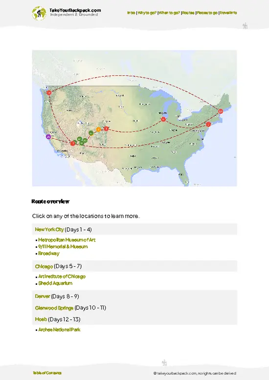
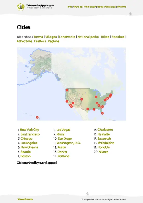
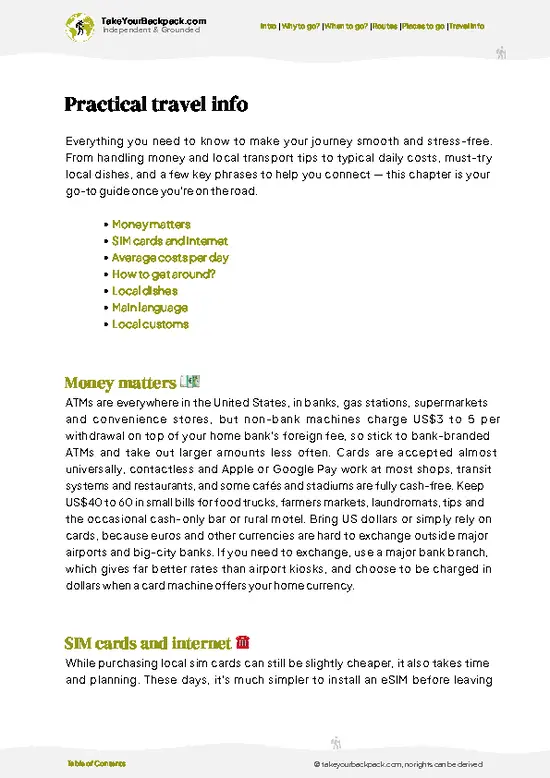
example page 0 from our offline Travel Guide for United States
example page 1 from our offline Travel Guide for United States
example page 2 from our offline Travel Guide for United States
example page 3 from our offline Travel Guide for United States
example page 4 from our offline Travel Guide for United States
example page 5 from our offline Travel Guide for United States
example page 6 from our offline Travel Guide for United States
example page 7 from our offline Travel Guide for United States
Loading the map 🌍
CLICK TO FILTER
cities
towns
villages
landmarks
national parks
hikes
beaches
attractions
festivals
regions
SHOW COUNTRY’S BESTSHOW ALL

✨ Why go?
Ranked #10 hike in the USA
What makes it a must-see hike

Lost Coast Trail gives you something almost nowhere else in the lower 48 does: about 25 miles of roadless Pacific shoreline where the King Range drops steeply into the surf. You walk on black sand and cobble, past the Punta Gorda Lighthouse and seal haul-outs, with the mountains stacked behind you. That ratio of wilderness to effort is hard to match, since the elevation gain is small and the route is simple to follow. It also fits a longer Northern California loop, tying in the Avenue of the Giants and Redwood National and State Parks to the north. Flexibility helps too. You can do the whole thing in three days, or take a short out-and-back from Mattole or Shelter Cove. The catch is that the tide tables dictate your daily schedule, so you plan around the ocean, not your own preferences.

💡 HighlightsKey sights and experiences for travelers

  1. Punta Gorda Lighthouse: The 1911 lighthouse stands near the Mattole end, with a short walk to the site. It marks the start of wild coast and sits near seal and sea lion haul-outs.
  2. Black Sand Beaches: Dark sand and rounded cobble stretch for miles, glinting after waves recede. Walking on them is slow but strikingly beautiful.
  3. Sea Lion and Seal Rookeries: Marine mammals haul out on rocks along the shore. Give them distance and listen for the barking before you see them.
  4. Miller Flat and Randall Creek Camps: Beach campsites tucked beside freshwater creeks, with driftwood for windbreaks. Watching the sunset from here is the trail's best evening.
  5. Tide Pools: Rocky shelves near the southern stretches hold anemones, sea stars, and mussels at low tide. Check the tide chart before heading out.
Lost Coast … read more 👉
  1. Punta Gorda Lighthouse: The 1911 lighthouse stands near the Mattole end, with a short walk to the site. It marks the start of wild coast and sits near seal and sea lion haul-outs.
  2. Black Sand Beaches: Dark sand and rounded cobble stretch for miles, glinting after waves recede. Walking on them is slow but strikingly beautiful.
  3. Sea Lion and Seal Rookeries: Marine mammals haul out on rocks along the shore. Give them distance and listen for the barking before you see them.
  4. Miller Flat and Randall Creek Camps: Beach campsites tucked beside freshwater creeks, with driftwood for windbreaks. Watching the sunset from here is the trail's best evening.
  5. Tide Pools: Rocky shelves near the southern stretches hold anemones, sea stars, and mussels at low tide. Check the tide chart before heading out.
Lost Coast Trail requires a backcountry permit booked in advance through Recreation.gov, and these sell out for peak summer weekends.
Spotted a mistake or missing something? Contact us.

Things to do near Lost Coast Trail

Ratings based on Tripadvisor reviews. When you book through this link, you support our work at no extra cost to you.

🌤️ When to go?Seasonal considerations and timing

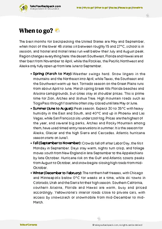
  • Summer (June to September): Dry, with coastal fog and highs of 15 to 21°C (59 to 70°F), nights near 8 to 11°C (46 to 52°F). Days run long, permits sell out first, and the tide windows are easiest.
  • Fall (October to November): Clearer, calmer skies, 12 to 20°C (54 to 68°F), thinner crowds, and permits are easier to book. Rain starts returning by November.
  • Winter (December to March): Cold, wet, 5 to 14°C (41 to 57°F). Creeks swell, daylight is short, and few people hike.
  • Spring (April to May): Wildflowers, showers, 10 to 17°C (50 to 63°F), and steady winds.
Book the permit months ahead for summer weekends, and pick a start day when low tide falls in the morning. Permits cost US$12 per person plus a US$6 reservation fee.

source: climatestotravel.comJANJanuary: below average for travelingFEBFebruary: below average for travelingMARMarch: fair for travelingAPRApril: good for travelingMAYMay: highly recommended for travelingJUNJune: highly recommended for travelingJULJuly: excellent for travelingAUGAugust: excellent for travelingSEPSeptember: highly recommended for travelingOCTOctober: good for travelingNOVNovember: fair for travelingDECDecember: below average for traveling
when-to-go

✈️ The backpacker research shortcutthe USA Travel Guide

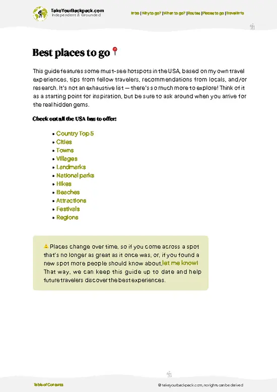
An offline-friendly backpacking guide with optimized travel routes, ranked highlights, transport advice, and the best areas to stay.
example page 0 from our offline Travel Guide for United States
example page 1 from our offline Travel Guide for United States
example page 2 from our offline Travel Guide for United States
example page 3 from our offline Travel Guide for United States
example page 4 from our offline Travel Guide for United States
example page 5 from our offline Travel Guide for United States
example page 6 from our offline Travel Guide for United States
example page 7 from our offline Travel Guide for United States
The digital guide (451 pages) contains:
✅ 159 highlights, ranked by travel appeal
✅ Optimized 14, 21 & 30-day travel routes
✅ Cities, national parks, landmarks, beaches
✅ How to get around
✅ Offline-friendly for travel without Wi-Fi
👉 Click to see all 30+ guide features

📅 Plan smarter in minutes, not weeks
✅ Month by month travel advice
✅ Festivals & national holidays
✅ Budget expectations

🗺️ Go to the right places, skip the overrated ones
✅ Honest pros & cons of destinations
✅ Top hikes, parks & viewpoints
✅ Lesser-known places most travelers miss
✅ Clear “worth it vs skip it” guidance

🛏️ Travel smoothly without rookie mistakes
✅ Best areas to stay
✅ Transport systems explained simply
✅ Common scams & safety advice
✅ SIM cards, money & practical tips

🌍 Understand the country, not just visit it
✅ Culture & traditions
✅ Local customs
✅ Festivals worth planning around
✅ Traveler-friendly historical context
✅ Insights that make places more meaningful

📱 Built for real travel conditions
✅ Fully downloadable PDF
✅ Works completely offline
✅ Optimized for phone use
✅ Useful in remote areas & buses
✅ Everything in one place
Stop searching, start planning
Get instant access to your full guide. 30‑day money-back guarantee.
+ Add another guide for just

By proceeding you agree to our terms.
Sent to your inbox immediately after payment • 100% Secure Checkout
Best Backpacking Travel Advisor 2025 tourism awardBest Backpacking
Travel Advisor
2025
What others say about Take Your Backpack Guides:
⭐⭐⭐⭐⭐
Fantastic, amazing amount of information!
⭐⭐⭐⭐⭐
My goodness this is amazing, it's what I've been looking for hats off too you!
⭐⭐⭐⭐⭐
I think this is absolutely BRILLIANT
⭐⭐⭐⭐
Very complete and informative. It's still missing places, but I gotta to commend you
⭐⭐⭐⭐⭐
This is truly amazing, thank you, can't wait to explore it with my kids!
⭐⭐⭐⭐⭐
Awesome resource, thank you!
⭐⭐⭐⭐⭐
This is amazing! Can't wait to explore the ones I haven't seen
⭐⭐⭐⭐
I love this! Well done, great idea.
⭐⭐⭐⭐⭐
Thanks for taking the time to make this gem!
⭐⭐⭐⭐⭐
This might be the best website I've ever seen.
⭐⭐⭐⭐⭐
Congratulations, and thank you so much for your work; it's incredibly valuable.
⭐⭐⭐⭐
In all seriousness I think you did a great job pointing out the important spots
⭐⭐⭐⭐⭐
10/10 very good
⭐⭐⭐⭐⭐
As someone who's only just starting to visit regularly this is awesome, thank you.
⭐⭐⭐⭐
Thank you very much! I'm going to visit my dad, it's going to be very useful!
⭐⭐⭐⭐⭐
This is really cool! We'll be travelling for the first time and this definitely come in handy.
⭐⭐⭐⭐⭐
You are now our minister of culture, congratulations 👨‍💼
⭐⭐⭐⭐⭐
Just wanted to tell you that this is a pearl! Going to follow your recommendations.
⭐⭐⭐⭐⭐
This is so cool. I'll definitely be using the resource for my travels soon.
⭐⭐⭐⭐⭐
This is very impressive! Good work.
⭐⭐⭐⭐⭐
This is an amazing and informative site. Very well done!

🛏️ Where to stay?Best areas to stay in the USA

If you enjoy meeting fellow travelers, consider choosing hostels with high ratings for atmosphere. On the other hand, if you prefer having your own space, a hotel might be a better option.

🥾 Hike detailsHike details: route, duration, and difficulty of Lost Coast Trail

Total Distance: Lost Coast Trail covers about 25 miles (40 kilometers) one way between Mattole and Black Sands Beach near Shelter Cove.
Duration: Most hikers take 3 days and 2 nights, though fast hikers manage it in 2.
Difficulty: Moderate. Elevation change is small, but soft sand and cobbles slow every step, and tides can block the route.
Starting Point: Mattole Campground in the north or Black Sands Beach in the south. Neither has real public transit, so most hikers arrange a private shuttle between them.
Major Landmarks:
  • Punta Gorda Lighthouse: A 1911 lighthouse near the north end.
  • Spanish Flat and
… read more 👉
Total Distance: Lost Coast Trail covers about 25 miles (40 kilometers) one way between Mattole and Black Sands Beach near Shelter Cove.
Duration: Most hikers take 3 days and 2 nights, though fast hikers manage it in 2.
Difficulty: Moderate. Elevation change is small, but soft sand and cobbles slow every step, and tides can block the route.
Starting Point: Mattole Campground in the north or Black Sands Beach in the south. Neither has real public transit, so most hikers arrange a private shuttle between them.
Major Landmarks:
  • Punta Gorda Lighthouse: A 1911 lighthouse near the north end.
  • Spanish Flat and Miller Flat: Camp areas with creek water.
  • Cooskie Creek and Randall Creek: Popular camps.
  • Black Sands Beach: The southern end near Shelter Cove.
Terrain and Scenery: Sand, gravel, and boulder fields with steep ridges rising almost directly from the beach. Some stretches have only a few hours of passable time at low tide.
Vegetation: Coastal scrub, grasses, Douglas fir on the ridges, and fog-fed ferns in the creek gullies.
Wildlife: Harbor seals, sea lions, and shorebirds are common. Black bears live in the area, so a bear canister is required.
⚠️ Hiking info can sometimes be outdated or inaccurate. Before you hit the trail, check the latest conditions with locals. If you do spot anything that's off, I'd love to hear from you, so I can update it for fellow travelers.

🛡️ SafetyStaying Safe: What Travelers Should Know

The biggest hazards on the Lost Coast Trail are tides and weather. Three sections are passable only near low tide (Punta Gorda, Sea Lion Gulch to Randall Creek, and Miller Flat to Gitchell Creek), so carry a tide table and time each crossing. Beach walking on loose sand and cobble is slow and tiring, so budget fewer miles per day than you would inland. Creek crossings can run high after rain. Fog and wind make nights cold, so pack a warm layer. Black bears live here, so a bear canister is required. Rattlesnakes sun on the trail, and ticks are common, so watch your step and check your clothing. Carry extra water treatment, since some stretches have no reliable creeks. Cell service is absent.

FAQCommon questions from travelers

Most backpackers take 3 to 4 days to hike the 24 to 25 miles of the Lost Coast Trail between Mattole Beach and Shelter Cove. Three days means about 8 miles daily, while 4 days gives room for tide delays and rest. Hiking north to south is common because the wind usually blows at your back. A shuttle between the trailheads takes roughly 1.5 to 2 hours by road.
Moderate to strenuous describes the Lost Coast Trail, mainly because of the footing rather than the elevation. Much of it is soft sand and cobble, which slows you to around 1 to 2 miles an hour, and you must time the tide-restricted zones around Punta Gorda and Miller Flat. Total elevation gain is modest, but there are a few steep climbs and creek crossings. Beginners with good fitness manage it over 3 to 4 days.
Yes, the Lost Coast Trail requires a permit for overnight trips, but no guide is needed. Permits come from the Bureau of Land Management through recreation.gov and cost US$12 per person plus a US$6 reservation fee. Summer weekends sell out months ahead, and a bear canister is also required. Parking at Mattole is free, and shuttle services charge roughly US$100 to 200 for the return.
⚠️ Things can change over time, so always validate details locally before you go.

Other American hikes near Lost Coast Trail

Explore more nearby:

  • Pacific Crest Trail—Lassen volcano, Mount Shasta, Hat Creek Rim, lava tube| 256 km away
  • Half Dome—Granite dome, steel cables, Mist Trail, Yosemite Valley| 503 km away
  • John Muir Trail—Sierra passes, point-to-point, Mount Whitney, resupply buckets| 584 km away

💡 Not sure where to go next?
Create a personalized itinerary for the USA including Lost Coast Trail and the places that fit your trip.

Generate my itinerary

👉 Discover all hikes

Or checkout all the USA has to offer (think cities, towns, villages, national parks, hikes, beaches, festivals)
Country photo of the USA

We 💚 feedbackParting advice and final tips

Lost Coast Trail pairs well with a few days among the redwoods to the north, or a slow drive down the Mendocino coast afterward. I would walk north to south with the wind behind me, and budget one spare day on the route for tide delays.

✈️ When did I visit the USA?
In January 2023 I visited New York. Many years before, before digital cameras existed, I discovered most of the national parks in the West.

✍️ Help improve this page!
The information on this page is based on my own backpacking experience in the USA, supplemented with up-to-date research and feedback from other travelers. Travel details can change, so if you notice anything outdated or incomplete, feel free to let me know.


🙋‍♂️ Give feedback

👋 Meet the founderWho’s Behind Take Your Backpack?

Johan, backpacker and founder of TakeYourBackpackHi, I’m Johan (Netherlands 🇳🇱), the creator of TakeYourBackpack. Over the past 3 decades, I’ve backpacked through 90+ countries across six continents, gaining extensive experience with independent travel, long-term trips, and overland routes.

This site is built on a combination of firsthand travel experience and carefully curated insights from other backpackers. Many guides are based on places I’ve personally visited, while others bring together tips, observations, and practical advice shared by trusted travelers I’ve met along the way.

The goal is to provide realistic, experience-driven guidance — not generic itineraries — so you can explore destinations with better context, clearer expectations, and more confidence.