×

Argentina🇦🇷 | national parksParque Provincial Ernesto TornquistRock window, Tres Picos, quartzite ridges, Piletones pools | things to do and best time to go

Explore Ischigualasto Provincial ParkExplore Los Alerces National Park

Backpacking in Parque Provincial Ernesto Tornquist
👀 For curious travelersnational park ranked #26
By Johan Kruseman 🇳🇱 | Updated October 19, 2026

People assume Ventana means a proper Patagonian-scale mountain range. It doesn't. This is a modest sierra system in southern Buenos Aires Province, a few hours from the provincial capital, and treating it like a big-league trek sets you up for disappointment. What you actually get is rolling grassland hills, quartzite ridgelines, a wind that never quits, and two trailheads (Cerro Ventana and Cerro Tres Picos) that deliver real payoff for modest effort. Entrance costs a small fee, crowds spike on weekends and summer holidays, and camping options in nearby Villa Ventana keep it cheap. I remember eating a sweaty medialuna at the base of Cerro Ventana, looking up at that famous hole in the rock, wind slapping my jacket like it owed me money.

Discover everything you want to know in the 📖 Argentina Travel Guide.


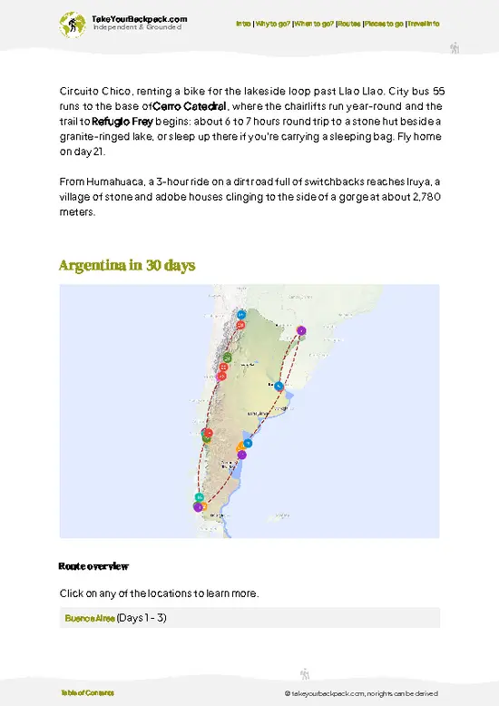
example page 0 from our offline Travel Guide for Argentina
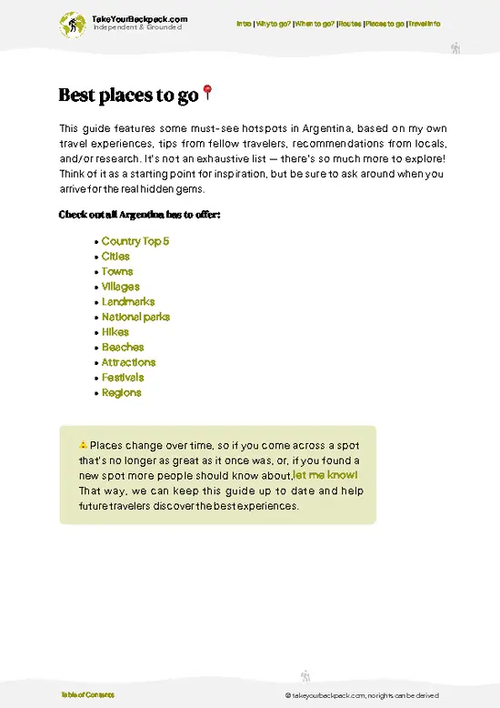
example page 1 from our offline Travel Guide for Argentina
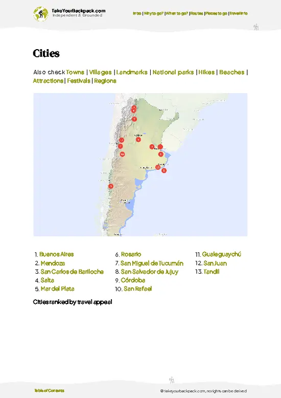
example page 2 from our offline Travel Guide for Argentina
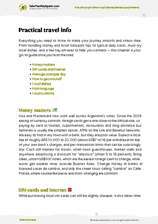
example page 3 from our offline Travel Guide for Argentina
example page 4 from our offline Travel Guide for Argentina
example page 5 from our offline Travel Guide for Argentina
example page 6 from our offline Travel Guide for Argentina
example page 7 from our offline Travel Guide for Argentina
Loading the map 🌍
CLICK TO FILTER
cities
towns
villages
landmarks
national parks
hikes
beaches
attractions
festivals
regions
SHOW COUNTRY’S BESTSHOW ALL

✨ Why go?
Ranked #26 national park in Argentina
The unique appeal for travelers

Backpackers show up here because the trails are self-guided friendly, well-marked, and short enough to knock out in a day without a guide fee eating your budget. Budget camping in Villa Ventana and nearby hostels keeps costs low, and the trail variety, from the 4-hour Cerro Ventana climb to the tougher Cerro Tres Picos route, suits both casual walkers and serious hikers. It's an easy add-on for anyone bussing between Buenos Aires and Bahía Blanca.

💡 HighlightsMust-see experiences and standout moments

  1. Cerro Ventana: The signature hike, climbing to the natural rock window (the 'ventana') at roughly 1,136 meters. The view through the hole down to the valley is the park's calling card.
  2. Cerro Tres Picos: The province's highest point at 1,239 meters, a longer, steeper slog with scree sections near the top.
  3. Garganta Olvidada: A narrower canyon trail with rock scrambling and shade, a good contrast to the exposed ridge walks.
  4. Piletones Natural Pools: Rock-carved swimming holes fed by mountain streams, a genuine relief after a hot ridge climb.
  5. Villa Ventana: Not a trail but the low-key base town with pine groves, useful for resupply and camping.
  6. Grutas de Cura Malal area: Smaller rock formations and caves worth a half-day detour if you have extra time.
  7. Local grassland wildlife spotting: Foxes, armadillos,
… read more 👉
  1. Cerro Ventana: The signature hike, climbing to the natural rock window (the 'ventana') at roughly 1,136 meters. The view through the hole down to the valley is the park's calling card.
  2. Cerro Tres Picos: The province's highest point at 1,239 meters, a longer, steeper slog with scree sections near the top.
  3. Garganta Olvidada: A narrower canyon trail with rock scrambling and shade, a good contrast to the exposed ridge walks.
  4. Piletones Natural Pools: Rock-carved swimming holes fed by mountain streams, a genuine relief after a hot ridge climb.
  5. Villa Ventana: Not a trail but the low-key base town with pine groves, useful for resupply and camping.
  6. Grutas de Cura Malal area: Smaller rock formations and caves worth a half-day detour if you have extra time.
  7. Local grassland wildlife spotting: Foxes, armadillos, and birds of prey are regularly seen along the lower trail sections, especially early morning.
Spotted a mistake or missing something? Contact us.

🌤️ When to go?Choosing the right time of year

  • Spring (Sep-Nov): Mild temps, 15-22°C (59-72°F), wildflowers out, moderate crowds.
  • Summer (Dec-Feb): Hot, up to 30°C (86°F), busiest season with holiday crowds and higher accommodation prices.
  • Autumn (Mar-May): Cool, 10-20°C (50-68°F), fewer people, good visibility.
  • Winter (Jun-Aug): Cold and windy, 2-12°C (36-54°F), quiet trails, some closures after storms.
October is the sweet spot. Grass is green, wind is bearable, and you won't be sharing the summit with fifty selfie sticks.

source: climatestotravel.comJANJanuary: fair for travelingFEBFebruary: fair for travelingMARMarch: highly recommended for travelingAPRApril: excellent for travelingMAYMay: highly recommended for travelingJUNJune: fair for travelingJULJuly: below average for travelingAUGAugust: fair for travelingSEPSeptember: excellent for travelingOCTOctober: excellent for travelingNOVNovember: highly recommended for travelingDECDecember: fair for traveling
when-to-go

✈️ The backpacker research shortcutArgentina Travel Guide

An offline-friendly backpacking guide with optimized travel routes, ranked highlights, transport advice, and the best areas to stay.
example page 0 from our offline Travel Guide for Argentina
example page 1 from our offline Travel Guide for Argentina
example page 2 from our offline Travel Guide for Argentina
example page 3 from our offline Travel Guide for Argentina
example page 4 from our offline Travel Guide for Argentina
example page 5 from our offline Travel Guide for Argentina
example page 6 from our offline Travel Guide for Argentina
example page 7 from our offline Travel Guide for Argentina
The digital guide (393 pages) contains:
✅ 131 highlights, ranked by travel appeal
✅ Optimized 14, 21 & 30-day travel routes
✅ Cities, national parks, landmarks, beaches
✅ How to get around
✅ Offline-friendly for travel without Wi-Fi
👉 Click to see all 30+ guide features

📅 Plan smarter in minutes, not weeks
✅ Month by month travel advice
✅ Festivals & national holidays
✅ Budget expectations

🗺️ Go to the right places, skip the overrated ones
✅ Honest pros & cons of destinations
✅ Top hikes, parks & viewpoints
✅ Lesser-known places most travelers miss
✅ Clear “worth it vs skip it” guidance

🛏️ Travel smoothly without rookie mistakes
✅ Best areas to stay
✅ Transport systems explained simply
✅ Common scams & safety advice
✅ SIM cards, money & practical tips

🌍 Understand the country, not just visit it
✅ Culture & traditions
✅ 52 Essential phrases & customs
✅ Festivals worth planning around
✅ Traveler-friendly historical context
✅ Insights that make places more meaningful

📱 Built for real travel conditions
✅ Fully downloadable PDF
✅ Works completely offline
✅ Optimized for phone use
✅ Useful in remote areas & buses
✅ Everything in one place
Stop searching, start planning
Get instant access to your full guide. 30‑day money-back guarantee.
+ Add another guide for just

By proceeding you agree to our terms.
Sent to your inbox immediately after payment • 100% Secure Checkout
Best Backpacking Travel Advisor 2025 tourism awardBest Backpacking
Travel Advisor
2025
What others say about Take Your Backpack Guides:
⭐⭐⭐⭐⭐
Fantastic, amazing amount of information!
⭐⭐⭐⭐⭐
My goodness this is amazing, it's what I've been looking for hats off too you!
⭐⭐⭐⭐⭐
I think this is absolutely BRILLIANT
⭐⭐⭐⭐
Very complete and informative. It's still missing places, but I gotta to commend you
⭐⭐⭐⭐⭐
This is truly amazing, thank you, can't wait to explore it with my kids!
⭐⭐⭐⭐⭐
Awesome resource, thank you!
⭐⭐⭐⭐⭐
This is amazing! Can't wait to explore the ones I haven't seen
⭐⭐⭐⭐
I love this! Well done, great idea.
⭐⭐⭐⭐⭐
Thanks for taking the time to make this gem!
⭐⭐⭐⭐⭐
This might be the best website I've ever seen.
⭐⭐⭐⭐⭐
Congratulations, and thank you so much for your work; it's incredibly valuable.
⭐⭐⭐⭐
In all seriousness I think you did a great job pointing out the important spots
⭐⭐⭐⭐⭐
10/10 very good
⭐⭐⭐⭐⭐
As someone who's only just starting to visit regularly this is awesome, thank you.
⭐⭐⭐⭐
Thank you very much! I'm going to visit my dad, it's going to be very useful!
⭐⭐⭐⭐⭐
This is really cool! We'll be travelling for the first time and this definitely come in handy.
⭐⭐⭐⭐⭐
You are now our minister of culture, congratulations 👨‍💼
⭐⭐⭐⭐⭐
Just wanted to tell you that this is a pearl! Going to follow your recommendations.
⭐⭐⭐⭐⭐
This is so cool. I'll definitely be using the resource for my travels soon.
⭐⭐⭐⭐⭐
This is very impressive! Good work.
⭐⭐⭐⭐⭐
This is an amazing and informative site. Very well done!

🛏️ Where to stay?Best areas to stay in Argentina

There's no lodging inside the park itself, but Villa Ventana and Parque Provincial Ernesto Tornquist town sit right at its edges and cover every budget. Villa Ventana has municipal campgrounds shaded by pines, ideal for tents and cheap. Parque Provincial Ernesto Tornquist town offers hostels, cabañas, and small guesthouses, plus grocery stores for resupply. Both towns put you within a short drive or taxi of the main trailheads, so basing yourself in either works fine without a car being mandatory.

👛 Costs (as of 19 October 2026)Money, prices, and spending tips

Visiting the sierras is affordable by regional standards, with camping keeping costs especially low for backpackers.
CategoryBudget RangeLocal Reality
Entrance fee (provincial reserve)USD 3 to 6Charged at trailhead checkpoints for Cerro Ventana and Tres Picos
CampingUSD 5 to 10 per nightMunicipal sites in Villa Ventana, basic facilities
Hostel/dorm bedUSD 10 to 18 per nightAvailable in Parque Provincial Ernesto Tornquist town
Local transport (bus/remis)USD 3 to 10Remis needed for trailhead access from town
Food/suppliesUSD 8 to 15 per daySelf-catering from local grocery stores is cheapest
⚠️ Prices can change and everyone travels differently, so take this as a rough guide. Hope it helps you plan your adventure!

🥾 TrailsPlan your hike in Parque Provincial Ernesto Tornquist: routes, terrain, and sights

Trails here are short by international standards but genuinely rewarding, running through quartzite ridgelines and open grassland with near-constant wind exposure. Wildlife sightings include foxes, armadillos, and the occasional guanaco lower down, though nothing dangerous. Cerro Ventana
  • Length: About 8-9 km round trip
  • Duration: 4-5 hours
  • Difficulty: Moderate, steep final approach
  • Key features: Natural rock window, panoramic valley views
Cerro Tres Picos
  • Length: Roughly 14-16 km round trip
  • Duration: 7-9 hours
  • Difficulty: Hard, scree and exposed scrambling near summit
  • Key features: Highest point in Buenos
… read more 👉
Trails here are short by international standards but genuinely rewarding, running through quartzite ridgelines and open grassland with near-constant wind exposure. Wildlife sightings include foxes, armadillos, and the occasional guanaco lower down, though nothing dangerous. Cerro Ventana
  • Length: About 8-9 km round trip
  • Duration: 4-5 hours
  • Difficulty: Moderate, steep final approach
  • Key features: Natural rock window, panoramic valley views
Cerro Tres Picos
  • Length: Roughly 14-16 km round trip
  • Duration: 7-9 hours
  • Difficulty: Hard, scree and exposed scrambling near summit
  • Key features: Highest point in Buenos Aires Province, sweeping ridge views
Public transport reaches Parque Provincial Ernesto Tornquist town via bus from Buenos Aires or Bahía Blanca, but trailheads themselves usually require a short taxi or remis ride. Entrance fees apply at provincial reserve checkpoints and are modest. Weekends and January get crowded; weekdays outside summer are quiet.
⚠️ Hiking info can sometimes be outdated or inaccurate. Before you hit the trail, check the latest conditions with locals. If you do spot anything that's off, I'd love to hear from you, so I can update it for fellow travelers.

🛡️ SafetyStaying Safe: What Travelers Should Know

This is a manageable, well-trodden park, not a wilderness gauntlet. Wind is the main hazard, gusts on exposed ridges can knock you off balance, so pack a windproof layer even in summer. Weather shifts fast; clouds roll in and visibility drops on Tres Picos. Footing gets loose on scree near summits, so proper boots matter. No dangerous wildlife. Start early to avoid afternoon wind peaks and finish before dark.

FAQFrequently asked questions about Parque Provincial Ernesto Tornquist

Two to three days covers the main hikes comfortably, one day for Cerro Ventana and another for the longer Cerro Tres Picos, with a spare day for the natural pools or a rest.
Yes, buses run from Buenos Aires and Bahía Blanca to Parque Provincial Ernesto Tornquist town, and from there short remis rides or occasional local shuttles reach the trailheads. A car makes logistics easier but isn't essential.
Yes, a modest entrance fee (roughly USD 3 to 6) is charged at reserve checkpoints for trails like Cerro Ventana and Cerro Tres Picos, payable on arrival, no advance permit required.
⚠️ Things can change over time, so always validate details locally before you go.

Other Argentine national parks near Parque Provincial Ernesto Tornquist

Explore more nearby:


💡 Not sure where to go next?
Create a personalized itinerary for Argentina including Parque Provincial Ernesto Tornquist and the places that fit your trip.

Generate my itinerary

👉 Discover all national parks

Or checkout all Argentina has to offer (think cities, towns, villages, national parks, hikes, beaches, festivals)
Country photo of Argentina

We 💚 feedbackParting advice and final tips

Worth it for how much scenery you get from such short, accessible hikes, real ridge views without a multi-day commitment. The drawback: summer crowds and relentless wind can wear you down if you're not prepared for either.

✈️ When did I visit Argentina?
I have visited Argentina, together with Chile, in September 2012.

✍️ Help improve this page!
The information on this page is based on my own backpacking experience in Argentina, supplemented with up-to-date research and feedback from other travelers. Travel details can change, so if you notice anything outdated or incomplete, feel free to let me know.


🙋‍♂️ Give feedback

👋 Meet the founderWho’s Behind Take Your Backpack?

Johan, backpacker and founder of TakeYourBackpackHi, I’m Johan (Netherlands 🇳🇱), the creator of TakeYourBackpack. Over the past 3 decades, I’ve backpacked through 90+ countries across six continents, gaining extensive experience with independent travel, long-term trips, and overland routes.

This site is built on a combination of firsthand travel experience and carefully curated insights from other backpackers. Many guides are based on places I’ve personally visited, while others bring together tips, observations, and practical advice shared by trusted travelers I’ve met along the way.

The goal is to provide realistic, experience-driven guidance — not generic itineraries — so you can explore destinations with better context, clearer expectations, and more confidence.