
×

Australia🇦🇺 | hikesBibbulmun Track1,000 km, Kalamunda to Albany, jarrah and karri forest, trail-shelter logbooks | things to do and best time to go

Explore Three Capes TrackExplore Cape to Cape Track

Backpacking in Bibbulmun Track
🌟 Highlighthike ranked #5
By Johan Kruseman 🇳🇱 | Updated October 15, 2026

Every few dozen kilometers along the Bibbulmun Track, a sleeping shelter has a logbook, and the entries are a running comedy of snake sightings, blisters and possum-related grievances. The track runs about 1,000 kilometers through the southwest of Australia, from Kalamunda in the Perth hills to Albany on the south coast, through jarrah and karri forest, granite country and coastal heath. Walking it is gentle on the knees but hard on logistics. Water tanks run low in late summer, so check the current status before you commit to a long dry stretch. Food drops and resupply towns are spaced unevenly, so pack extra rather than trusting a shop to be open. Buses run from Perth to Kalamunda, so plan the first leg around them. At a Dwellingup café a woman behind the counter looked at my pack and said, “Take the ranger’s advice, not mine, but mine is more fun.” Best for planners who enjoy forest solitude, and not for anyone who needs a hot shower nightly.

Discover everything you want to know in the 📖 Australia Travel Guide.
Best time to go: March - May, August - November
Duration: 6 to 8 weeks
Distance: 1000 kilometers
Total ascent: approximately 10800 meters


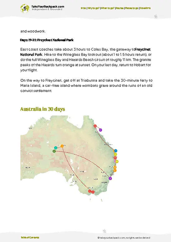
example page 0 from our offline Travel Guide for Australia
example page 1 from our offline Travel Guide for Australia
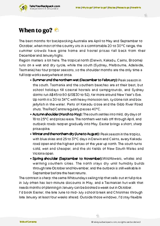
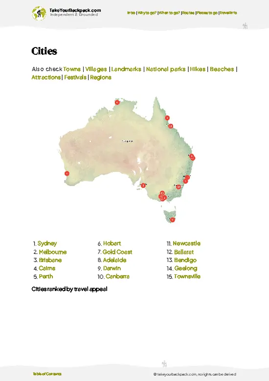
example page 2 from our offline Travel Guide for Australia
example page 3 from our offline Travel Guide for Australia
example page 4 from our offline Travel Guide for Australia
example page 5 from our offline Travel Guide for Australia
example page 6 from our offline Travel Guide for Australia
example page 7 from our offline Travel Guide for Australia
Loading the map 🌍
CLICK TO FILTER
cities
towns
villages
landmarks
national parks
hikes
beaches
attractions
festivals
regions
SHOW COUNTRY’S BESTSHOW ALL

✨ Why go?
Ranked #5 hike in Australia
What makes it a must-see hike

Backpackers come for the chance to walk an entire state with a well-kept system of huts roughly a day apart and almost no fuss. You can do it end to end in about 6 to 8 weeks, or take a weekend slice, since towns such as Dwellingup, Balingup, Pemberton and Denmark sit on the route and let you resupply and bail out. The scenery changes enormously: red jarrah forest, the giant karri trees near Pemberton and the surf-battered south coast near Walpole. Costs stay low because the shelters are free to use and you only need to pay for food and the odd town night. It is also one of the easiest long trails for a first-timer, with clear waymarking and a community of walkers who swap tips at every hut.

💡 HighlightsPlaces and moments you shouldn't skip

  1. Kalamunda Northern Terminus: The start of the trail, marked by a big signboard in the Perth Hills town. Pose for the traditional photo before heading south through the jarrah forest.
  2. Dwellingup Jarrah Forest: Rolling forest with red earth, wildflowers in spring and the Murray River crossings. It is the most walked section for good reason.
  3. Beedelup Falls near Pemberton: A modest waterfall with a suspension bridge across the creek, best after winter rain.
  4. Gloucester Tree: A giant karri with a spiral of metal rungs hammered into its trunk, climbing to a 37-meter platform in the canopy. It sits close to Pemberton.
  5. William Bay and Denmark Coast: Granite boulders and clear water at Greens Pool, with the trail threading along a sheltered southern coast near Denmark.
The Gloucester Tree and Beedelup Falls … read more 👉
  1. Kalamunda Northern Terminus: The start of the trail, marked by a big signboard in the Perth Hills town. Pose for the traditional photo before heading south through the jarrah forest.
  2. Dwellingup Jarrah Forest: Rolling forest with red earth, wildflowers in spring and the Murray River crossings. It is the most walked section for good reason.
  3. Beedelup Falls near Pemberton: A modest waterfall with a suspension bridge across the creek, best after winter rain.
  4. Gloucester Tree: A giant karri with a spiral of metal rungs hammered into its trunk, climbing to a 37-meter platform in the canopy. It sits close to Pemberton.
  5. William Bay and Denmark Coast: Granite boulders and clear water at Greens Pool, with the trail threading along a sheltered southern coast near Denmark.
The Gloucester Tree and Beedelup Falls sit close together near Pemberton, so you can see both in one day.
Spotted a mistake or missing something? Contact us.

Things to do near Bibbulmun Track

Ratings based on Tripadvisor reviews. When you book through this link, you support our work at no extra cost to you.

🌤️ When to go?Choosing the right time of year

  • Spring (September to November): Wildflower season is the prize, with orchids and kangaroo paws out across the jarrah forest and the south coast. Days run 18 to 25°C (64 to 77°F), nights 7 to 12°C (45 to 54°F), and daylight stretches past 12 hours. Schools break in late September, so shelters fill.
  • Summer (December to February): Hot and dry, 28 to 40°C (82 to 104°F) inland, with total fire bans and occasional track closures. Daylight lasts about 14 hours, but I would skip it for long sections.
  • Autumn (March to May): Stable, mild weather of 17 to 26°C (63 to 79°F), cool nights and fewer people. Water tanks refill as rain returns in May.
  • Winter (June to August): Wet and cold, 8 to 17°C (46 to 63°F), nights near 3°C (37°F), with about 10 hours of daylight. Creeks run high and the track is quiet,
… read more 👉
  • Spring (September to November): Wildflower season is the prize, with orchids and kangaroo paws out across the jarrah forest and the south coast. Days run 18 to 25°C (64 to 77°F), nights 7 to 12°C (45 to 54°F), and daylight stretches past 12 hours. Schools break in late September, so shelters fill.
  • Summer (December to February): Hot and dry, 28 to 40°C (82 to 104°F) inland, with total fire bans and occasional track closures. Daylight lasts about 14 hours, but I would skip it for long sections.
  • Autumn (March to May): Stable, mild weather of 17 to 26°C (63 to 79°F), cool nights and fewer people. Water tanks refill as rain returns in May.
  • Winter (June to August): Wet and cold, 8 to 17°C (46 to 63°F), nights near 3°C (37°F), with about 10 hours of daylight. Creeks run high and the track is quiet, though the south coast gets wild storms.
Start in late September to catch flowers before the school holiday rush, and check closures before booking.


source: climatestotravel.comJANJanuary: fair for travelingFEBFebruary: fair for travelingMARMarch: highly recommended for travelingAPRApril: excellent for travelingMAYMay: excellent for travelingJUNJune: fair for travelingJULJuly: fair for travelingAUGAugust: good for travelingSEPSeptember: excellent for travelingOCTOctober: excellent for travelingNOVNovember: highly recommended for travelingDECDecember: fair for traveling
australia-hike-bibbulmun-track
© Google |

✈️ The backpacker research shortcutAustralia Travel Guide

An offline-friendly backpacking guide with optimized travel routes, ranked highlights, transport advice, and the best areas to stay.
example page 0 from our offline Travel Guide for Australia
example page 1 from our offline Travel Guide for Australia
example page 2 from our offline Travel Guide for Australia
example page 3 from our offline Travel Guide for Australia
example page 4 from our offline Travel Guide for Australia
example page 5 from our offline Travel Guide for Australia
example page 6 from our offline Travel Guide for Australia
example page 7 from our offline Travel Guide for Australia
The digital guide (414 pages) contains:
✅ 143 highlights, ranked by travel appeal
✅ Optimized 14, 21 & 30-day travel routes
✅ Cities, national parks, landmarks, beaches
✅ How to get around
✅ Offline-friendly for travel without Wi-Fi
👉 Click to see all 30+ guide features

📅 Plan smarter in minutes, not weeks
✅ Month by month travel advice
✅ Festivals & national holidays
✅ Budget expectations

🗺️ Go to the right places, skip the overrated ones
✅ Honest pros & cons of destinations
✅ Top hikes, parks & viewpoints
✅ Lesser-known places most travelers miss
✅ Clear “worth it vs skip it” guidance

🛏️ Travel smoothly without rookie mistakes
✅ Best areas to stay
✅ Transport systems explained simply
✅ Common scams & safety advice
✅ SIM cards, money & practical tips

🌍 Understand the country, not just visit it
✅ Culture & traditions
✅ Local customs
✅ Festivals worth planning around
✅ Traveler-friendly historical context
✅ Insights that make places more meaningful

📱 Built for real travel conditions
✅ Fully downloadable PDF
✅ Works completely offline
✅ Optimized for phone use
✅ Useful in remote areas & buses
✅ Everything in one place
Stop searching, start planning
Get instant access to your full guide. 30‑day money-back guarantee.
+ Add another guide for just

By proceeding you agree to our terms.
Sent to your inbox immediately after payment • 100% Secure Checkout
Best Backpacking Travel Advisor 2025 tourism awardBest Backpacking
Travel Advisor
2025
What others say about Take Your Backpack Guides:
⭐⭐⭐⭐⭐
Fantastic, amazing amount of information!
⭐⭐⭐⭐⭐
My goodness this is amazing, it's what I've been looking for hats off too you!
⭐⭐⭐⭐⭐
I think this is absolutely BRILLIANT
⭐⭐⭐⭐
Very complete and informative. It's still missing places, but I gotta to commend you
⭐⭐⭐⭐⭐
This is truly amazing, thank you, can't wait to explore it with my kids!
⭐⭐⭐⭐⭐
Awesome resource, thank you!
⭐⭐⭐⭐⭐
This is amazing! Can't wait to explore the ones I haven't seen
⭐⭐⭐⭐
I love this! Well done, great idea.
⭐⭐⭐⭐⭐
Thanks for taking the time to make this gem!
⭐⭐⭐⭐⭐
This might be the best website I've ever seen.
⭐⭐⭐⭐⭐
Congratulations, and thank you so much for your work; it's incredibly valuable.
⭐⭐⭐⭐
In all seriousness I think you did a great job pointing out the important spots
⭐⭐⭐⭐⭐
10/10 very good
⭐⭐⭐⭐⭐
As someone who's only just starting to visit regularly this is awesome, thank you.
⭐⭐⭐⭐
Thank you very much! I'm going to visit my dad, it's going to be very useful!
⭐⭐⭐⭐⭐
This is really cool! We'll be travelling for the first time and this definitely come in handy.
⭐⭐⭐⭐⭐
You are now our minister of culture, congratulations 👨‍💼
⭐⭐⭐⭐⭐
Just wanted to tell you that this is a pearl! Going to follow your recommendations.
⭐⭐⭐⭐⭐
This is so cool. I'll definitely be using the resource for my travels soon.
⭐⭐⭐⭐⭐
This is very impressive! Good work.
⭐⭐⭐⭐⭐
This is an amazing and informative site. Very well done!

🛏️ Where to stay?Where staying makes the most sense

If you enjoy meeting fellow travelers, consider choosing hostels with high ratings for atmosphere. On the other hand, if you prefer having your own space, a hotel might be a better option.

🥾 Hike detailsHike details: route, duration, and difficulty of Bibbulmun Track

Total Distance: About 1,000 kilometers from Kalamunda to Albany.
Duration: 6 to 8 weeks end to end, or shorter sections of a few days.
Difficulty: Moderate. The path is well graded, but length, heat and remoteness make it demanding.
Starting Point: Kalamunda, in the Perth Hills. Buses run there from Perth, and the finish at Albany has coach links back to the city.
Major Landmarks:
  • Dwellingup: A forest town with a trail visitor center and food stops.
  • Balingup and Donnelly River: Small settlements with resupply options.
  • Pemberton: The karri forest heartland.
  • Walpole and Denmark: Coastal sections and inlets.
… read more 👉
Total Distance: About 1,000 kilometers from Kalamunda to Albany.
Duration: 6 to 8 weeks end to end, or shorter sections of a few days.
Difficulty: Moderate. The path is well graded, but length, heat and remoteness make it demanding.
Starting Point: Kalamunda, in the Perth Hills. Buses run there from Perth, and the finish at Albany has coach links back to the city.
Major Landmarks:
  • Dwellingup: A forest town with a trail visitor center and food stops.
  • Balingup and Donnelly River: Small settlements with resupply options.
  • Pemberton: The karri forest heartland.
  • Walpole and Denmark: Coastal sections and inlets.
Terrain and Scenery: Mostly forested hills, sandy coastal tracks, granite outcrops and some farmland. Some sections have steep climbs and loose sand.
Vegetation: Jarrah and marri forest, towering karri, banksia heath and spring wildflowers.
Wildlife: Western gray kangaroos, emus, quokkas in a few places, tiger snakes and dugites in warm months, plus many birds such as red-tailed black cockatoos.
Shelters: Three-sided huts with water tanks and tent platforms about a day’s walk apart. Check tank levels before long dry stretches.
⚠️ Hiking info can sometimes be outdated or inaccurate. Before you hit the trail, check the latest conditions with locals. If you do spot anything that's off, I'd love to hear from you, so I can update it for fellow travelers.

🛡️ SafetyStaying Safe: What Travelers Should Know

The Bibbulmun Track is well marked and well managed, and most problems come from heat, water and underpreparation. Follow the yellow Waugal markers and carry the track map, since phone reception drops out for long stretches. Summer heat can top 40°C (104°F), so walk early, rest through midday and never rely on one water source. Shelter tanks can run dry in late summer, so confirm levels with the Bibbulmun Track Foundation. Snakes, mainly dugites and tiger snakes, are common in warm months. Wear closed shoes and gaiters, step firmly and give them room, and they nearly always slide away. Ticks and leeches are minor, but check your skin each evening. In winter, wet boots and cold nights cause real trouble, so pack a warm layer and a waterproof liner. Sign the shelter logbooks, because rangers … read more 👉
The Bibbulmun Track is well marked and well managed, and most problems come from heat, water and underpreparation. Follow the yellow Waugal markers and carry the track map, since phone reception drops out for long stretches. Summer heat can top 40°C (104°F), so walk early, rest through midday and never rely on one water source. Shelter tanks can run dry in late summer, so confirm levels with the Bibbulmun Track Foundation. Snakes, mainly dugites and tiger snakes, are common in warm months. Wear closed shoes and gaiters, step firmly and give them room, and they nearly always slide away. Ticks and leeches are minor, but check your skin each evening. In winter, wet boots and cold nights cause real trouble, so pack a warm layer and a waterproof liner. Sign the shelter logbooks, because rangers use them to find overdue walkers. Treat all tank and creek water before drinking.

FAQTraveler FAQ

The full Bibbulmun Track from Kalamunda to Albany takes most walkers 6 to 8 weeks, covering about 1,000 km (620 miles). Many people walk sections instead, with a weekend on the Kalamunda to Mundaring stretch or 7 to 10 days through the southern forests. Fit end-to-enders average 20 to 25 km (12 to 15 miles) a day between huts spaced roughly a day apart.
Difficulty is moderate overall, with well-graded paths and no technical climbing, but the distance and weight of your pack make the full walk demanding. Daily sections run 10 to 25 km (6 to 15 miles) with rolling hills such as the Darling Range and the Walpole coastal dunes. Summer heat and winter rain raise the challenge more than the terrain does.
No guide is needed because the track is clearly waymarked and has shelters about a day’s walk apart. No permit or track fee applies for walking it, and the shelters are free to use on a first-come basis. Larger groups of 8 or more are asked to register with the Bibbulmun Track Foundation, and a membership of about A$50 a year includes maps and updates.
⚠️ Things can change over time, so always validate details locally before you go.

Other Australian hikes near Bibbulmun Track

Explore more nearby:

  • Cape to Cape Track—123 km, two lighthouses, sea stacks, Boranup karri shade| 251 km away
  • Kings Canyon Rim Walk—6 km rim loop, 500-step climb, sandstone domes, dawn start| 1745 km away
  • Larapinta Trail—223 km, West MacDonnells, 12 sections, rock-wallaby gaps| 1977 km away

💡 Not sure where to go next?
Create a personalized itinerary for Australia including Bibbulmun Track and the places that fit your trip.

Generate my itinerary

👉 Discover all hikes

Or checkout all Australia has to offer (think cities, towns, villages, national parks, hikes, beaches, festivals)
Country photo of Australia

We 💚 feedbackSumming up the experience

The Bibbulmun suits walkers who enjoy simple routines: wake, walk, cook, sleep, repeat, with a few kangaroos for company. If you crave nightlife or big summits, skip it. I would do a section from Dwellingup or Pemberton first, carrying an extra liter of water and a spare day of food.

✈️ When did I visit Australia?
On my trip to New Zealand in 1993, I had a short stop in Australia as well.

✍️ Help improve this page!
The information on this page is based on my own backpacking experience in Australia, supplemented with up-to-date research and feedback from other travelers. Travel details can change, so if you notice anything outdated or incomplete, feel free to let me know.


🙋‍♂️ Give feedback

👋 Meet the founderWho’s Behind Take Your Backpack?

Johan, backpacker and founder of TakeYourBackpackHi, I’m Johan (Netherlands 🇳🇱), the creator of TakeYourBackpack. Over the past 3 decades, I’ve backpacked through 90+ countries across six continents, gaining extensive experience with independent travel, long-term trips, and overland routes.

This site is built on a combination of firsthand travel experience and carefully curated insights from other backpackers. Many guides are based on places I’ve personally visited, while others bring together tips, observations, and practical advice shared by trusted travelers I’ve met along the way.

The goal is to provide realistic, experience-driven guidance — not generic itineraries — so you can explore destinations with better context, clearer expectations, and more confidence.