×

Canada🇨🇦 | hikesChilkoot TrailHistoric gold rush pass, alpine tundra, border crossing | things to do and best time to go

Explore East Coast TrailExplore Auyuittuq

Backpacking in Chilkoot Trail
👍 Recommendedhike ranked #7
By Johan Kruseman 🇳🇱 | Updated September 4, 2026

Your boots sink into cold mud as you haul on the chain, lungs burning, pack biting into your shoulders, the wooden “Golden Stairs” half-rotten under slick snow patches. Someone ahead curses, someone behind laughs, and when you finally crest the pass, the wind slaps your sweat-caked shirt dry while green lakes and busted old boiler relics scatter below like a museum someone forgot to lock. This is the Chilkoot Trail, running from tidewater near Skagway, Alaska into British Columbia, Canada, ending near Bennett in the Yukon rail corridor. On the Canadian side it’s a 53 km, 3–5 day haul: steep, rocky, and absolutely not a casual stroll, but logistically easier than it looks thanks to train and shuttle links. Compared to nearby Canadian classics like the West Coast Trail, Chilkoot is shorter, rougher underfoot, less coastal drama, more gold‑rush ghosts—and I’d say more soul per kilometer.

Discover everything you want to know in the 📖 Canada Travel Guide.
Best time to go: May - September
Duration: 3 to 5 days
Distance: 53 kilometers
Total ascent: 1,200 meters


Get your Canada guide
127 ranked highlights, routes & tips, works offline (492 pages)
Loading the map 🌍
CLICK TO FILTER
cities
towns
villages
landmarks
national parks
hikes
beaches
attractions
festivals
regions
SHOW COUNTRY’S BESTSHOW ALL

✨ Why go?
Ranked #7 hike in Canada
Reasons people choose to hike the here

The Chilkoot Trail is a rite of passage for backpackers, blending grit and glory in a way that few hikes can match. You’ll feel the burn in your legs as you tackle the steep ascents, but each step brings you closer to jaw-dropping scenery. Towering peaks, glacial lakes, and the haunting remnants of the Gold Rush whisper stories of adventure.

Access is a breeze; hop on a public transport shuttle from Skagway, and you’re on your way. The trail’s flexible distances let you customize your experience, whether you want a quick two-day jaunt or a more leisurely four-day trek. This adaptability makes it easy to weave into a longer backpacking route through the Yukon, connecting you to other epic trails.

And let’s talk about the cost—it’s wallet-friendly, especially considering the rich historyread more 👉
The Chilkoot Trail is a rite of passage for backpackers, blending grit and glory in a way that few hikes can match. You’ll feel the burn in your legs as you tackle the steep ascents, but each step brings you closer to jaw-dropping scenery. Towering peaks, glacial lakes, and the haunting remnants of the Gold Rush whisper stories of adventure.

Access is a breeze; hop on a public transport shuttle from Skagway, and you’re on your way. The trail’s flexible distances let you customize your experience, whether you want a quick two-day jaunt or a more leisurely four-day trek. This adaptability makes it easy to weave into a longer backpacking route through the Yukon, connecting you to other epic trails.

And let’s talk about the cost—it’s wallet-friendly, especially considering the rich history and stunning vistas you’ll encounter. After a day of pushing through the elements, there’s nothing quite like that first cold beer at the end of the trail, savoring the satisfaction of conquering the wild. The Chilkoot isn’t just a hike; it’s a journey that rewards every ounce of effort with breathtaking views and unforgettable moments.
Want to include Chilkoot Trail in your Canada route?
Create a personalized Canada itinerary that includes Chilkoot Trail and the places that fit your trip — based on your travel style, budget, and available time. Get your route in seconds.

Generate my trip

💡 HighlightsEssential experiences to have while hiking the Chilkoot Trail

  • Chilkoot Pass & the Golden Stairs — The moment everyone pictures: a steep, historic ramp where stampeders hauled goods up carved wooden steps to Canada. It’s unique because it’s both a legit physical challenge and a living piece of Gold Rush history, with the border cairn at the top and jaw-dropping panoramas of glaciers and valleys. (Personal favorite — nothing beats watching clouds roll through the pass after slogging up the Stairs.)
  • Summit Lake — A high alpine tarn just below the pass with glassy reflections, often ringed by wildflowers and marmots. The shift from bleak snowfields to a serene mountain basin is sudden and cinematic, which makes it feel more like a discovery than “just another view.”
  • Bennett Lake and the ghost towns — The trail dumps you out at Bennett, where decaying
read more 👉
  • Chilkoot Pass & the Golden Stairs — The moment everyone pictures: a steep, historic ramp where stampeders hauled goods up carved wooden steps to Canada. It’s unique because it’s both a legit physical challenge and a living piece of Gold Rush history, with the border cairn at the top and jaw-dropping panoramas of glaciers and valleys. (Personal favorite — nothing beats watching clouds roll through the pass after slogging up the Stairs.)
  • Summit Lake — A high alpine tarn just below the pass with glassy reflections, often ringed by wildflowers and marmots. The shift from bleak snowfields to a serene mountain basin is sudden and cinematic, which makes it feel more like a discovery than “just another view.”
  • Bennett Lake and the ghost towns — The trail dumps you out at Bennett, where decaying boardwalks, rusting steamboat relics and old hotel sites tell the story of the frantic end-point of the stampede. It’s where the hiking stops and the Gold Rush museum vibe starts — rare to end a trail surrounded by literal artifacts of the route’s human history.
  • Lindeman Lake & village site — Early on the Canadian side you hit Lindeman, a peaceful lake fronted by interpretive remains of a once-bustling stampeder settlement. The mix of calm water, beach camping and interpretive signs makes the past very tangible without feeling like a staged museum.
  • Coastal rainforest to alpine transition — One of the coolest things: in a few dozen kilometres you go from moss-draped Sitka spruce and salmon streams to windswept alpine tundra. That huge ecological shift means you can see eagles and black bears in deep forest sections and marmots and ptarmigan higher up — a condensed wildlife and habitat sampler you don’t get on most hikes.
Spotted a mistake or missing something? Contact us.

Things to do around Chilkoot Trail

Ratings based on Tripadvisor reviews. When you book through this link, you support our work at no extra cost to you.

🌤️ When to go?Choosing the right time of year


  • Weather: The trail opens mid-May and closes early September. Early season means snow patches and muddy stretches; late season risks early frost. July and August offer the most stable weather, but expect sudden rain and chilly winds.

  • Temperature: Daytime highs hover around 15-20°C (59-68°F) in summer, dropping to near freezing at night. Early or late season hikes face colder nights, sometimes below 0°C (32°F), demanding serious layering.

  • Daylight Hours: Peak summer grants up to 18 hours of daylight, pushing your hiking window well into the evening. May and September see shorter days, limiting your pace and camp setup time.

  • Crowds: July and August pack the trail with hikers, turning solitude into a shuffle. May and early June or late August to early September offer fewer people but
read more 👉

  • Weather: The trail opens mid-May and closes early September. Early season means snow patches and muddy stretches; late season risks early frost. July and August offer the most stable weather, but expect sudden rain and chilly winds.

  • Temperature: Daytime highs hover around 15-20°C (59-68°F) in summer, dropping to near freezing at night. Early or late season hikes face colder nights, sometimes below 0°C (32°F), demanding serious layering.

  • Daylight Hours: Peak summer grants up to 18 hours of daylight, pushing your hiking window well into the evening. May and September see shorter days, limiting your pace and camp setup time.

  • Crowds: July and August pack the trail with hikers, turning solitude into a shuffle. May and early June or late August to early September offer fewer people but more unpredictable trail conditions.

  • Seasonal Activities: Summer brings guided tours, ferry services, and ranger stations fully operational. Outside this window, services dwindle, and you’re on your own for navigation and resupply.

  • Price Fluctuations: Peak season rates for permits and ferries spike in July and August. Shoulder seasons offer cheaper permits but come with trade-offs in weather and trail conditions.


Pro-tip: Start your hike in late June for a sweet spot—long days, manageable crowds, and trail conditions that reward your effort with crisp mountain air and expansive views.


source: climatestotravel.comJANJanuary: below average for travelingFEBFebruary: below average for travelingMARMarch: below average for travelingAPRApril: below average for travelingMAYMay: good for travelingJUNJune: highly recommended for travelingJULJuly: excellent for travelingAUGAugust: excellent for travelingSEPSeptember: good for travelingOCTOctober: below average for travelingNOVNovember: below average for travelingDECDecember: below average for traveling
canada-hike-chilkoot-trail
© Google |

✈️ The backpacker research shortcutCanada Travel Guide

An offline-friendly backpacking guide with optimized travel routes, ranked highlights, transport advice, and the best areas to stay.
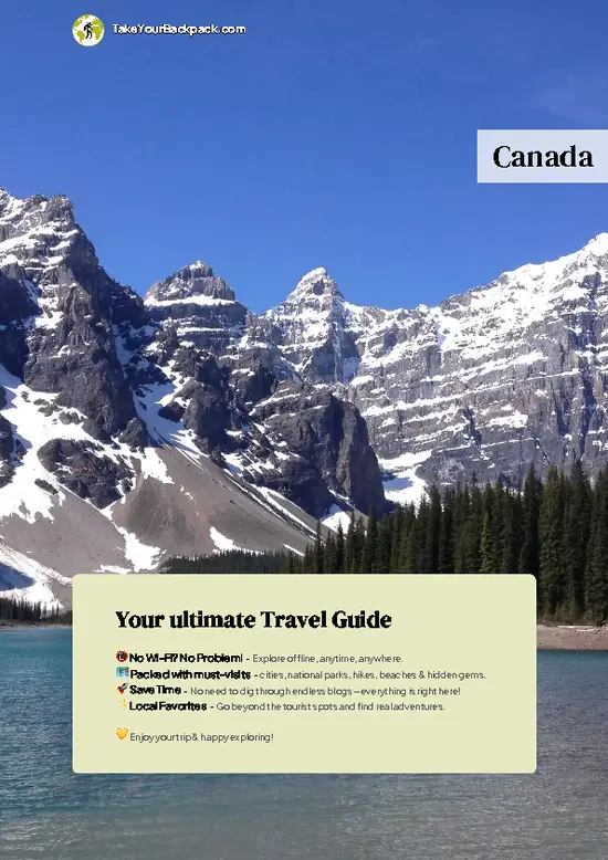
example page 0 from our offline Travel Guide for Canada
example page 1 from our offline Travel Guide for Canada
example page 2 from our offline Travel Guide for Canada
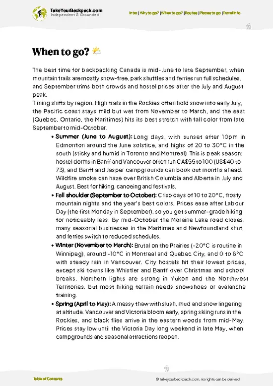
example page 3 from our offline Travel Guide for Canada
example page 4 from our offline Travel Guide for Canada
example page 5 from our offline Travel Guide for Canada
example page 6 from our offline Travel Guide for Canada
example page 7 from our offline Travel Guide for Canada
The digital guide (492 pages) contains:
127 highlights, ranked by travel appeal
Optimized 14, 21 & 30-day travel routes
Cities, national parks, landmarks, beaches
How to get around
Offline-friendly for travel without Wi-Fi
👉 Click to see all 30+ guide features

📅 Plan smarter in minutes, not weeks
Month by month travel advice
Festivals & national holidays
Budget expectations

🗺️ Go to the right places, skip the overrated ones
Honest pros & cons of destinations
Top hikes, parks & viewpoints
Lesser-known places most travelers miss
Clear “worth it vs skip it” guidance

🛏️ Travel smoothly without rookie mistakes
Best areas to stay
Transport systems explained simply
Common scams & safety advice
SIM cards, money & practical tips

🌍 Understand the country, not just visit it
Culture & traditions
Local customs
Festivals worth planning around
Traveler-friendly historical context
Insights that make places more meaningful

📱 Built for real travel conditions
Fully downloadable PDF
Works completely offline
Optimized for phone use
Useful in remote areas & buses
Everything in one place
Save weeks of stressful planning
Get instant access to your full guide. 30‑day money-back guarantee.
+ Add another guide for just US$7.80

By proceeding you agree to our terms.
Sent to your inbox immediately after payment • 100% Secure Checkout
Best Backpacking Travel Advisor 2025 tourism awardBest Backpacking
Travel Advisor
2025
What others say about Take Your Backpack Guides:
⭐⭐⭐⭐⭐
Fantastic, amazing amount of information!
⭐⭐⭐⭐⭐
My goodness this is amazing, it's what I've been looking for hats off too you!
⭐⭐⭐⭐⭐
I think this is absolutely BRILLIANT
⭐⭐⭐⭐
Very complete and informative. It's still missing places, but I gotta to commend you
⭐⭐⭐⭐⭐
This is truly amazing, thank you, can't wait to explore it with my kids!
⭐⭐⭐⭐⭐
Awesome resource, thank you!
⭐⭐⭐⭐⭐
This is amazing! Can't wait to explore the ones I haven't seen
⭐⭐⭐⭐
I love this! Well done, great idea.
⭐⭐⭐⭐⭐
Thanks for taking the time to make this gem!
⭐⭐⭐⭐⭐
This might be the best website I've ever seen.
⭐⭐⭐⭐⭐
Congratulations, and thank you so much for your work; it's incredibly valuable.
⭐⭐⭐⭐
In all seriousness I think you did a great job pointing out the important spots
⭐⭐⭐⭐⭐
10/10 very good
⭐⭐⭐⭐⭐
As someone who's only just starting to visit regularly this is awesome, thank you.
⭐⭐⭐⭐
Thank you very much! I'm going to visit my dad, it's going to be very useful!
⭐⭐⭐⭐⭐
This is really cool! We'll be travelling for the first time and this definitely come in handy.
⭐⭐⭐⭐⭐
You are now our minister of culture, congratulations 👨‍💼
⭐⭐⭐⭐⭐
Just wanted to tell you that this is a pearl! Going to follow your recommendations.
⭐⭐⭐⭐⭐
This is so cool. I'll definitely be using the resource for my travels soon.
⭐⭐⭐⭐⭐
This is very impressive! Good work.
⭐⭐⭐⭐⭐
This is an amazing and informative site. Very well done!

🛏️ Where to stay?Where staying makes the most sense

If you enjoy meeting fellow travelers, consider choosing hostels with high ratings for atmosphere. On the other hand, if you prefer having your own space, a hotel might be a better option.

🥾 Hike detailsRoute, distance, and difficulty explained

Total Distance: The Chilkoot Trail stretches about 53 kilometers (33 miles) from Dyea, Alaska, to Bennett Lake, Canada.

Estimated Duration: Most hikers take around 4 to 5 days to complete the trail, but it really depends on your pace and how long you want to spend soaking in the views.

Difficulty Level: This trail is considered moderate to challenging. Expect steep climbs, rugged terrain, and some sections that can be quite demanding, especially with a backpack.

Starting Point: You’ll kick off in Dyea, Alaska. To get there via public transport, you can take a bus from Skagway. It’s about a … read more 👉
Total Distance: The Chilkoot Trail stretches about 53 kilometers (33 miles) from Dyea, Alaska, to Bennett Lake, Canada.

Estimated Duration: Most hikers take around 4 to 5 days to complete the trail, but it really depends on your pace and how long you want to spend soaking in the views.

Difficulty Level: This trail is considered moderate to challenging. Expect steep climbs, rugged terrain, and some sections that can be quite demanding, especially with a backpack.

Starting Point: You’ll kick off in Dyea, Alaska. To get there via public transport, you can take a bus from Skagway. It’s about a 10-minute ride, and buses run regularly during the tourist season.

Major Landmarks Along the Route:
  • Dyea: The historical starting point, where you can see remnants of the Gold Rush era.
  • Chilkoot Pass: The highest point on the trail, offering stunning views and a sense of history.
  • Lake Bennett: A beautiful spot to relax and reflect on your journey before heading out.

Type of Terrain and Scenery: The trail features a mix of terrain, including rocky paths, muddy sections, and alpine meadows. You’ll be treated to breathtaking mountain views, glaciers, and lush forests. The scenery varies dramatically, so keep your camera ready!

Typical Vegetation and Wildlife: Expect to see a mix of coniferous trees, wildflowers, and shrubs. As for wildlife, you might catch a glimpse of black bears, moose, and various birds. Keep your eyes peeled and remember to store food properly to avoid attracting any curious critters!
⚠️ Hiking info can sometimes be outdated or inaccurate. Before you hit the trail, check the latest conditions with locals. If you do spot anything that's off, I'd love to hear from you, so I can update it for fellow travelers.

🛡️ SafetyStaying Safe: What Travelers Should Know

The Chilkoot Trail is a wild ride, and while it’s manageable for most, a few realities can catch you off guard. Weather can shift in an instant; sunny skies can morph into rain or snow. Dress in layers and be ready to adapt.

The terrain? Expect steep sections and rocky paths that demand your attention. Navigation is straightforward, but don’t underestimate the power of a good map and compass. River crossings can be tricky, especially in spring when meltwater swells. Timing your hike to avoid the peak melt can save you from a cold surprise.

Wildlife encounters are part of the experience. Keep your distance from bears and moose; they’re more interested in foraging than you. Make noise while hiking to avoid startling them.

Preparation is key. Many first-timers underestimate the physical … read more 👉
The Chilkoot Trail is a wild ride, and while it’s manageable for most, a few realities can catch you off guard. Weather can shift in an instant; sunny skies can morph into rain or snow. Dress in layers and be ready to adapt.

The terrain? Expect steep sections and rocky paths that demand your attention. Navigation is straightforward, but don’t underestimate the power of a good map and compass. River crossings can be tricky, especially in spring when meltwater swells. Timing your hike to avoid the peak melt can save you from a cold surprise.

Wildlife encounters are part of the experience. Keep your distance from bears and moose; they’re more interested in foraging than you. Make noise while hiking to avoid startling them.

Preparation is key. Many first-timers underestimate the physical demands. Train your legs and lungs before you hit the trail. With the right mindset and gear, the reward—a breathtaking view from the summit or a cold beer at the end—makes every step worthwhile.

FAQCommon questions from travelers

The Chilkoot Trail hike typically takes 4 to 6 days to complete, covering about 33 miles (53 kilometers) from Dyea, Alaska to Bennett, British Columbia. Most hikers plan for 5 days to allow for a moderate pace and acclimatization.
The Chilkoot Trail is considered moderately difficult due to steep ascents, rugged terrain, and variable weather conditions. Hikers should be prepared for elevation gains of up to 2,800 feet and potentially cold, wet weather even in summer months.
Yes, a permit is required to hike the Chilkoot Trail, and it must be obtained in advance from Parks Canada or the U.S. Forest Service. A guide is not mandatory, but many hikers choose to hire one for safety and historical context, especially if unfamiliar with backcountry hiking.
⚠️ Things can change over time, so always validate details locally before you go.

Other Canadian hikes near Chilkoot Trail

Explore more nearby:

  • Berg Lake Trail—Glacial lakes, waterfalls, Mount Robson views| 1224 km away
  • Skyline Trail—Open ridges, panoramic vistas, moose sightings| 1319 km away
  • West Coast Trail—Rainforest, ladders, tidal shelves, shipwreck history| 1422 km away

💡 Not sure where to go next?
Create a personalized itinerary for Canada including Chilkoot Trail and the places that fit your trip.

Generate my itinerary

👉 Discover all hikes

Or checkout all Canada has to offer (think cities, towns, villages, national parks, hikes, beaches, festivals)
Country photo of Canada

We 💚 feedbackIs it worth it?

The Chilkoot Trail is a raw, gritty adventure that slams you into the heart of history and nature. Picture this: the burn in your legs as you conquer the Golden Stairs, only to be rewarded with jaw-dropping views of emerald lakes and jagged peaks. But be warned—weather can turn on a dime. Pack for everything, or you might find yourself soaked and shivering. It’s a challenge, but that’s what makes the triumph taste so sweet.

✈️ When did I visit Canada?
As part of my 1.5 year travel around the world trip, I visited Canada in 2016.

✍️ Help improve this page!
The information on this page is based on my own backpacking experience in Canada, supplemented with up-to-date research and feedback from other travelers. Travel details can change, so if you notice anything outdated or incomplete, feel free to let me know.


🙋‍♂️ Give feedback

👋 Meet the founderWho’s Behind Take Your Backpack?

Johan, backpacker and founder of TakeYourBackpackHi, I’m Johan (Netherlands 🇳🇱), the creator of TakeYourBackpack. Over the past decade, I’ve backpacked through 80+ countries across six continents, gaining extensive experience with independent travel, long-term trips, and overland routes.

This site is built on a combination of firsthand travel experience and carefully curated insights from other backpackers. Many guides are based on places I’ve personally visited, while others bring together tips, observations, and practical advice shared by trusted travelers I’ve met along the way.

The goal is to provide realistic, experience-driven guidance — not generic itineraries — so you can explore destinations with better context, clearer expectations, and more confidence.

Get full Canada guide •
Instant download • 127 highlights • Full Offline guide