×

Canada🇨🇦 | national parksAuyuittuq National ParkAkshayuk Pass traverse, Mount Thor wall, Arctic tundra, river fords | things to do and best time to go

Explore Chilkoot TrailExplore Banff National Park

Backpacking in Auyuittuq
👌 Worth visitingnational park ranked #20
By Johan Kruseman 🇳🇱 | Updated October 22, 2026

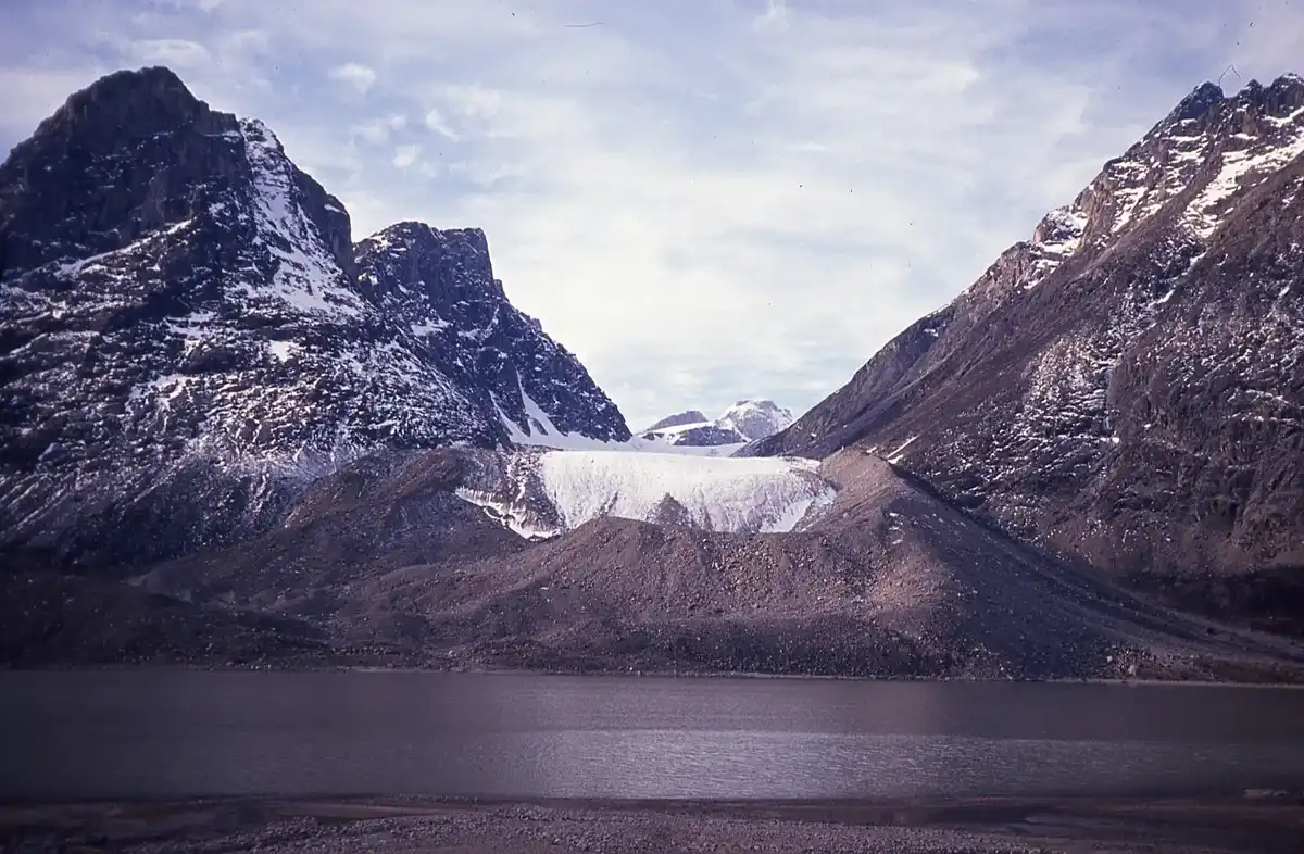
Auyuittuq means “the land that never melts,” and the park has no roads, no bridges and no maintained trail markers. It sits on Baffin Island's Cumberland Peninsula in the north of Canada, reached from Pangnirtung or Qikiqtarjuaq. The walk is long, glacial and wild, with rivers to ford and granite walls rising straight from the valley. I expected silence, but the Weasel River gravel hissed and clicked all night. Crowds are tiny, and the reward is Thor Peak's wall glowing above the pass.

Discover everything you want to know in the 📖 Canada Travel Guide.


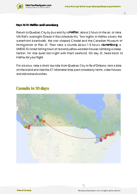
example page 0 from our offline Travel Guide for Canada
example page 1 from our offline Travel Guide for Canada
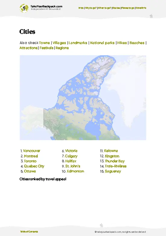
example page 2 from our offline Travel Guide for Canada
example page 3 from our offline Travel Guide for Canada
example page 4 from our offline Travel Guide for Canada
example page 5 from our offline Travel Guide for Canada
example page 6 from our offline Travel Guide for Canada
example page 7 from our offline Travel Guide for Canada
Loading the map 🌍
CLICK TO FILTER
cities
towns
villages
landmarks
national parks
hikes
beaches
attractions
festivals
regions
SHOW COUNTRY’S BESTSHOW ALL

✨ Why go?
Ranked #20 national park in Canada
Reasons people choose to explore here

Auyuittuq National Park suits self-sufficient hikers who want a route without tour groups. The classic Akshayuk Pass traverse runs about 97 kilometers between two Inuit communities, so you can plan your own pace, camp where the terrain allows and carry only what you need. Parks Canada requires registration and orientation, which gives structure without a guide. Expect Mount Asgard and Summit Lake as your anchors, with river crossings and polar bear awareness as the real skills test.

💡 HighlightsWhat this place is best known for

  1. Akshayuk Pass: The park's signature route, a glacier-carved valley with braided rivers and wide tundra flats.
  2. Mount Asgard: A twin-towered, flat-topped granite peak with a cylindrical profile, visible from the Pass north of Summit Lake.
  3. Summit Lake: The high point of the traverse, with big open views.
  4. Mount Thor: Among the steepest vertical drops on Earth, a sheer granite face of about 1,250 meters.
  5. Weasel Valley: A long river corridor with gravel bars, wildflower patches in summer and chances of seeing caribou or Arctic hare.
  6. Overlord Peak: A striking, pyramid-shaped summit that dominates the skyline near Summit Lake.
  7. Pangnirtung Fiord entrance: The southern gateway, where the trail begins beside steep fiord walls and tidal flats.
Mount Asgard and Summit Lake combine well in one day, since they … read more 👉
  1. Akshayuk Pass: The park's signature route, a glacier-carved valley with braided rivers and wide tundra flats.
  2. Mount Asgard: A twin-towered, flat-topped granite peak with a cylindrical profile, visible from the Pass north of Summit Lake.
  3. Summit Lake: The high point of the traverse, with big open views.
  4. Mount Thor: Among the steepest vertical drops on Earth, a sheer granite face of about 1,250 meters.
  5. Weasel Valley: A long river corridor with gravel bars, wildflower patches in summer and chances of seeing caribou or Arctic hare.
  6. Overlord Peak: A striking, pyramid-shaped summit that dominates the skyline near Summit Lake.
  7. Pangnirtung Fiord entrance: The southern gateway, where the trail begins beside steep fiord walls and tidal flats.
Mount Asgard and Summit Lake combine well in one day, since they sit within a manageable distance of each other along the Pass.
Spotted a mistake or missing something? Contact us.
🌤️ When to go?Choosing the right time of year

  • Hiking Season (July to early September): Highs run 5 to 12°C (41 to 54°F), nights hover near freezing, and the sun barely sets. Rivers are lowest by August, and mosquitoes peak in July.
  • Ski and Sled Season (late March to May): Temperatures sit between -20 and -5°C (-4 to 23°F). Daylight is long, snow is stable, and Pangnirtung sees most guided ski traffic.
  • Deep Winter (November to February): Bitter cold and very short days. Nobody goes.
Book Parks Canada registration and flights by spring for July and August trips.

source: climatestotravel.comJANJanuary: below average for travelingFEBFebruary: below average for travelingMARMarch: below average for travelingAPRApril: below average for travelingMAYMay: fair for travelingJUNJune: highly recommended for travelingJULJuly: good for travelingAUGAugust: highly recommended for travelingSEPSeptember: fair for travelingOCTOctober: below average for travelingNOVNovember: below average for travelingDECDecember: below average for traveling
canada-national-park-auyuittuq-national-park
© Google | Scott Elliott

✈️ The backpacker research shortcutCanada Travel Guide

An offline-friendly backpacking guide with optimized travel routes, ranked highlights, transport advice, and the best areas to stay.
example page 0 from our offline Travel Guide for Canada
example page 1 from our offline Travel Guide for Canada
example page 2 from our offline Travel Guide for Canada
example page 3 from our offline Travel Guide for Canada
example page 4 from our offline Travel Guide for Canada
example page 5 from our offline Travel Guide for Canada
example page 6 from our offline Travel Guide for Canada
example page 7 from our offline Travel Guide for Canada
The digital guide (385 pages) contains:
✅ 128 highlights, ranked by travel appeal
✅ Optimized 14, 21 & 30-day travel routes
✅ Cities, national parks, landmarks, beaches
✅ How to get around
✅ Offline-friendly for travel without Wi-Fi
👉 Click to see all 30+ guide features

📅 Plan smarter in minutes, not weeks
✅ Month by month travel advice
✅ Festivals & national holidays
✅ Budget expectations

🗺️ Go to the right places, skip the overrated ones
✅ Honest pros & cons of destinations
✅ Top hikes, parks & viewpoints
✅ Lesser-known places most travelers miss
✅ Clear “worth it vs skip it” guidance

🛏️ Travel smoothly without rookie mistakes
✅ Best areas to stay
✅ Transport systems explained simply
✅ Common scams & safety advice
✅ SIM cards, money & practical tips

🌍 Understand the country, not just visit it
✅ Culture & traditions
✅ Local customs
✅ Festivals worth planning around
✅ Traveler-friendly historical context
✅ Insights that make places more meaningful

📱 Built for real travel conditions
✅ Fully downloadable PDF
✅ Works completely offline
✅ Optimized for phone use
✅ Useful in remote areas & buses
✅ Everything in one place
Stop searching, start planning
Get instant access to your full guide. 30‑day money-back guarantee.
+ Add another guide for just

By proceeding you agree to our terms.
Sent to your inbox immediately after payment • 100% Secure Checkout
Best Backpacking Travel Advisor 2025 tourism awardBest Backpacking
Travel Advisor
2025
What others say about Take Your Backpack Guides:
⭐⭐⭐⭐⭐
Fantastic, amazing amount of information!
⭐⭐⭐⭐⭐
My goodness this is amazing, it's what I've been looking for hats off too you!
⭐⭐⭐⭐⭐
I think this is absolutely BRILLIANT
⭐⭐⭐⭐
Very complete and informative. It's still missing places, but I gotta to commend you
⭐⭐⭐⭐⭐
This is truly amazing, thank you, can't wait to explore it with my kids!
⭐⭐⭐⭐⭐
Awesome resource, thank you!
⭐⭐⭐⭐⭐
This is amazing! Can't wait to explore the ones I haven't seen
⭐⭐⭐⭐
I love this! Well done, great idea.
⭐⭐⭐⭐⭐
Thanks for taking the time to make this gem!
⭐⭐⭐⭐⭐
This might be the best website I've ever seen.
⭐⭐⭐⭐⭐
Congratulations, and thank you so much for your work; it's incredibly valuable.
⭐⭐⭐⭐
In all seriousness I think you did a great job pointing out the important spots
⭐⭐⭐⭐⭐
10/10 very good
⭐⭐⭐⭐⭐
As someone who's only just starting to visit regularly this is awesome, thank you.
⭐⭐⭐⭐
Thank you very much! I'm going to visit my dad, it's going to be very useful!
⭐⭐⭐⭐⭐
This is really cool! We'll be travelling for the first time and this definitely come in handy.
⭐⭐⭐⭐⭐
You are now our minister of culture, congratulations 👨‍💼
⭐⭐⭐⭐⭐
Just wanted to tell you that this is a pearl! Going to follow your recommendations.
⭐⭐⭐⭐⭐
This is so cool. I'll definitely be using the resource for my travels soon.
⭐⭐⭐⭐⭐
This is very impressive! Good work.
⭐⭐⭐⭐⭐
This is an amazing and informative site. Very well done!

🛏️ Where to stay?Best areas and accommodation options

No lodging exists inside Auyuittuq National Park, so you either camp or sleep in a gateway hamlet. Pangnirtung, on the southern side, is the main base. It has the Parks Canada office, a small hotel, and a few B&Bs, typically US$180 to 300 a night. Qikiqtarjuaq, on the northern side, has a similar small hotel and a few B&Bs. Inside the park, you pitch a tent at designated camping areas, and basic emergency shelters called Arctic Refuges sit along the Akshayuk Pass route. Book rooms well ahead for July and August, since Pangnirtung has very few beds.

👛 Costs (as of 22 October 2026)How expensive it really is

A self-supported trip to Auyuittuq National Park runs roughly US$407 to 605 per day once you count flights and the boat shuttle. Parks Canada fees are modest, but Arctic logistics drive the total. Everything is paid in Canadian dollars.
CategoryBudget RangeLocal Reality
Park feeUS$17 to 25 per dayDaily fee per adult, plus a registration session
AccommodationUS$0 to 250Camping is covered by the fee; B&Bs in Pangnirtung cost more
Local transportUS$150 to 250Boat or snowmobile drop to the trailhead, per direction
Food and suppliesUS$40 to 80Groceries cost far more than in southern Canada
Total Daily BudgetUS$407 to 605Using high-season accommodation, excluding flights


source: parks.canada.ca
⚠️ Prices can change and everyone travels differently, so take this as a rough guide. Hope it helps you plan your adventure!

🥾 TrailsHiking Auyuittuq national park: highlights and difficulty

Auyuittuq National Park has one famous route and several shorter walks from its trailheads. The terrain is rocky, wet and exposed, and there are no bridges.
  • Akshayuk Pass: about 97 kilometers, usually 7 to 10 days. Difficult. Glacial moraine, boulder fields, braided river crossings and Arctic tundra.
  • Overlord and Summit Lake section: the high central stretch, with open views and cold winds. Allow 1 to 2 days between camps.
  • Weasel Valley day walks: out-and-back hikes from Overlord at the Pangnirtung end, mostly gentle, with river gravel and wildlife chances.
  • Pangnirtung Fiord start: easy to moderate
… read more 👉
Auyuittuq National Park has one famous route and several shorter walks from its trailheads. The terrain is rocky, wet and exposed, and there are no bridges.
  • Akshayuk Pass: about 97 kilometers, usually 7 to 10 days. Difficult. Glacial moraine, boulder fields, braided river crossings and Arctic tundra.
  • Overlord and Summit Lake section: the high central stretch, with open views and cold winds. Allow 1 to 2 days between camps.
  • Weasel Valley day walks: out-and-back hikes from Overlord at the Pangnirtung end, mostly gentle, with river gravel and wildlife chances.
  • Pangnirtung Fiord start: easy to moderate approach hiking beside the fiord before climbing to the pass.
Access is by boat from Pangnirtung or Qikiqtarjuaq, which depends on tides and weather, and flights reach both communities. Visitor numbers are very low. A park fee applies, and registration and a safety orientation are mandatory. Polar bears are a real concern, so carry deterrents and store food securely.
⚠️ Hiking info can sometimes be outdated or inaccurate. Before you hit the trail, check the latest conditions with locals. If you do spot anything that's off, I'd love to hear from you, so I can update it for fellow travelers.

🛡️ SafetySafety Tips and Common Scams in Auyuittuq

Auyuittuq National Park is remote, and self-reliance matters more than any single hazard. Weather turns fast, so carry a proper tent and cold-rated layers even in July. Glacial rivers such as the Weasel and Owl run high on warm afternoons, so cross early in the day, in groups, with trail shoes. Polar bears are possible, and Parks Canada requires an orientation session, plus deterrents and a bear-aware camp routine. Navigation is straightforward but trails are faint, so carry a satellite communicator and allow spare days.

FAQCommon questions from travelers

Plan on 7 to 10 days for the full Akshayuk Pass traverse of about 97 km (60 miles) between Pangnirtung and Qikiqtarjuaq. Shorter trips of 3 to 4 days reach Overlord or Summit Lake from the Pangnirtung side. Add a buffer day or two for weather and river levels at Auyuittuq National Park.
Yes, but you need boats rather than a car, because no roads reach Auyuittuq National Park. You fly from Iqaluit to Pangnirtung or Qikiqtarjuaq, then hire a local outfitter for a boat shuttle in summer or a snowmobile in spring. Shuttles cost roughly US$150 to 250 per direction.
Yes, Auyuittuq National Park charges a daily fee of roughly US$17 to 25 per adult, and overnight visitors must register and attend a Parks Canada orientation in Pangnirtung or Qikiqtarjuaq. Reserve ahead for July and August. Backcountry camping is covered by the fee, and you may be asked to rent or carry bear deterrents.
⚠️ Things can change over time, so always validate details locally before you go.

Other Canadian national parks near Auyuittuq

Explore more nearby:


💡 Not sure where to go next?
Create a personalized itinerary for Canada including Auyuittuq and the places that fit your trip.

Generate my itinerary

👉 Discover all national parks

Or checkout all Canada has to offer (think cities, towns, villages, national parks, hikes, beaches, festivals)
Country photo of Canada

We 💚 feedbackFinal thoughts on exploring Auyuittuq

Auyuittuq National Park is best in July and August, when river levels allow the safest crossings and the sun barely sets. Go early in the day for lower, calmer rivers, and bring sturdy sandals for the water.

✈️ When did I visit Canada?
As part of my 1.5 year travel around the world trip, I visited Canada in 2016.

✍️ Help improve this page!
The information on this page is based on my own backpacking experience in Canada, supplemented with up-to-date research and feedback from other travelers. Travel details can change, so if you notice anything outdated or incomplete, feel free to let me know.


🙋‍♂️ Give feedback

👋 Meet the founderWho’s Behind Take Your Backpack?

Johan, backpacker and founder of TakeYourBackpackHi, I’m Johan (Netherlands 🇳🇱), the creator of TakeYourBackpack. Over the past 3 decades, I’ve backpacked through 90+ countries across six continents, gaining extensive experience with independent travel, long-term trips, and overland routes.

This site is built on a combination of firsthand travel experience and carefully curated insights from other backpackers. Many guides are based on places I’ve personally visited, while others bring together tips, observations, and practical advice shared by trusted travelers I’ve met along the way.

The goal is to provide realistic, experience-driven guidance — not generic itineraries — so you can explore destinations with better context, clearer expectations, and more confidence.