×

Chile🇨🇱 | national parksAltos de Lircay National ReserveBasalt plateau, Descabezado views, Claro River, condor ridges | things to do and best time to go

Explore Corcovado National ParkExplore Atacama Desert

Backpacking in Altos de Lircay National Reserve
🌟 Highlightnational park ranked #7
By Johan Kruseman 🇳🇱 | Updated October 19, 2026

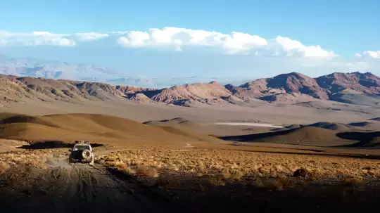
The reserve has a trail network that starts right at the ranger post, so you can be walking within minutes of getting off the bus. Altos de Lircay National Reserve sits in the Andean foothills of the Maule Region in central Chile, east of Talca. The access road is gravel, which is why most people bus to San Clemente and share a taxi rather than rely on a rental sedan. On my way in, the driver stopped to let a flock of goats finish crossing a one-lane bridge, and he simply turned the engine off and waited. That tells you how the place runs: slowly. Trails are well marked, volcano views are broad, and crowds stay thin outside January and February. Wildlife is modest, mostly birds and the odd fox, and weekend campers can fill the sites. A first day works best as an early start on the climb to Laguna del Alto, then a long lunch back in the forest.

Discover everything you want to know in the 📖 Chile Travel Guide.
Best time to go: October - April
Daily cost: US$57 to 117
Duration: 2 days
Distance: 20 kilometers
Total ascent: 1,200 meters


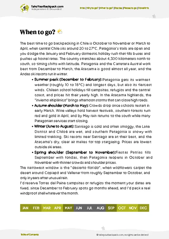
example page 0 from our offline Travel Guide for Chile
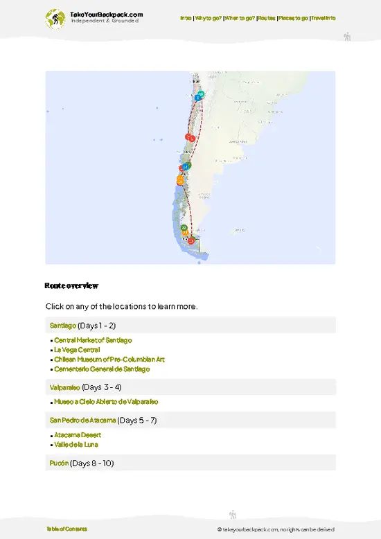
example page 1 from our offline Travel Guide for Chile
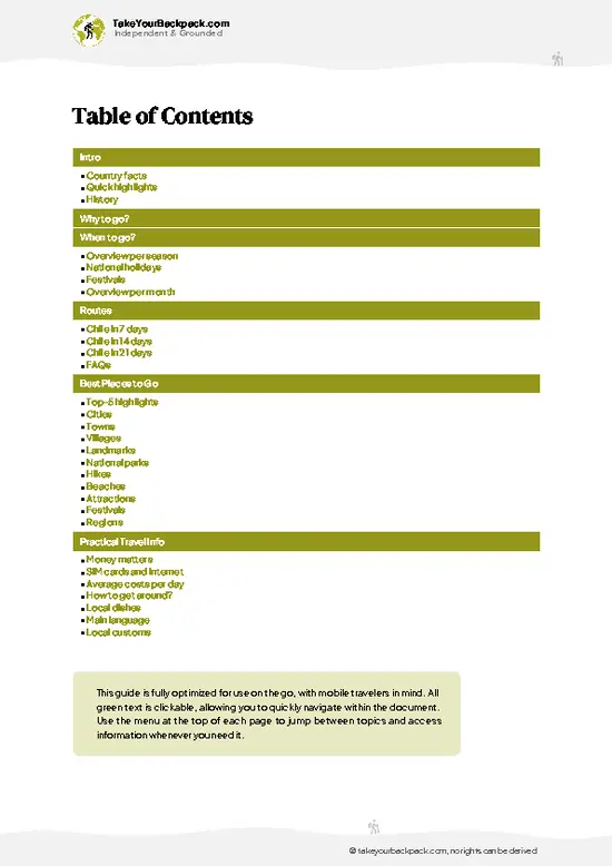
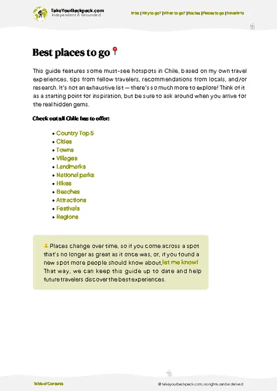
example page 2 from our offline Travel Guide for Chile
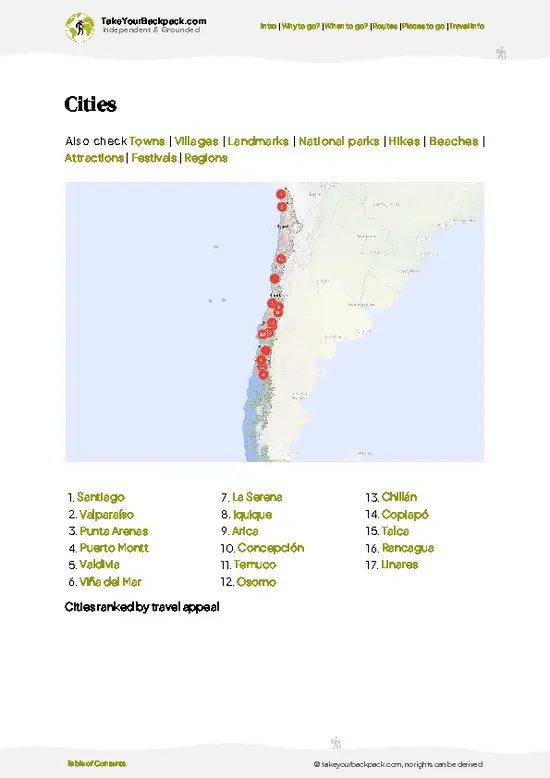
example page 3 from our offline Travel Guide for Chile
example page 4 from our offline Travel Guide for Chile
example page 5 from our offline Travel Guide for Chile
example page 6 from our offline Travel Guide for Chile
example page 7 from our offline Travel Guide for Chile
Loading the map 🌍
CLICK TO FILTER
cities
towns
villages
landmarks
national parks
hikes
beaches
attractions
festivals
regions
SHOW COUNTRY’S BESTSHOW ALL

✨ Why go?
Ranked #7 national park in Chile
What sets this place apart

Altos de Lircay National Reserve suits backpackers who want real multi-day walking without permits, guides or a fixed itinerary. The main draw is the Enladrillado plateau, a basalt-tiled high plain at about 2,200 meters that you can reach under your own power, camping along the way. The route to Valle del Venado adds a second reason: it threads forest, river crossings and open ridgeline, so you can build a two- or three-day loop at your own pace. Because trails are signed and the ranger post keeps a register, solo walkers can go self-guided with confidence. Guided groups exist, but they add little on these paths. Camping is simple and close to the trailheads, which keeps logistics light. Bring a map and enough food, since there is no resupply once you leave the entrance. The volcano views reward the effort.

💡 HighlightsKey sights and experiences for travelers

  1. Enladrillado: a wide plateau of basalt slabs that look laid by hand, with Descabezado Grande and other peaks on the horizon. It is the reserve’s signature destination.
  2. Mirador del Venado: a viewpoint over the Valle del Venado, reached by a long forest trail of about 10 kilometers one way.
  3. Valle del Venado: a quiet valley with meadows and basic campsites, good for slowing down and spotting birds.
  4. Descabezado Grande views: the flat-topped volcano is visible from the higher stretches and dominates the skyline on clear days.
  5. Laguna del Alto: a crater lake below Cerro Peine, reached by a signed branch that climbs about 600 meters in 3 kilometers out of the forest.
  6. Andean condor sightings: large birds that glide over the upper ridges, easiest to see from the plateau.
Spotted a mistake or missing something? Contact us.

Things to do near Altos de Lircay National Reserve

Ratings based on Tripadvisor reviews. When you book through this link, you support our work at no extra cost to you.

🌤️ When to go?Best time to explore Altos de Lircay National Reserve

  • Summer (December to March): Dry and warm, with valley highs of 26 to 32°C (79 to 90°F) and cool nights near 8 to 12°C (46 to 54°F). Days are long, rivers run low and the Enladrillado plateau is open. Expect the biggest crowds and fullest campsites, especially January weekends.
  • Autumn (April to May): Highs of 15 to 22°C (59 to 72°F), with lenga and ñirre forests turning red and gold. Daylight shortens, nights approach freezing, and the park is quiet.
  • Winter (June to August): Highs of 5 to 12°C (41 to 54°F), with snow and ice on the upper plateau. Higher trails can be impassable and services thin out. Skip it unless you have snow experience.
  • Spring (September to November): Highs of 14 to 24°C (57 to 75°F), with wildflowers and meltwater swelling the creeks. Upper sections may hold snow until November.
… read more 👉
  • Summer (December to March): Dry and warm, with valley highs of 26 to 32°C (79 to 90°F) and cool nights near 8 to 12°C (46 to 54°F). Days are long, rivers run low and the Enladrillado plateau is open. Expect the biggest crowds and fullest campsites, especially January weekends.
  • Autumn (April to May): Highs of 15 to 22°C (59 to 72°F), with lenga and ñirre forests turning red and gold. Daylight shortens, nights approach freezing, and the park is quiet.
  • Winter (June to August): Highs of 5 to 12°C (41 to 54°F), with snow and ice on the upper plateau. Higher trails can be impassable and services thin out. Skip it unless you have snow experience.
  • Spring (September to November): Highs of 14 to 24°C (57 to 75°F), with wildflowers and meltwater swelling the creeks. Upper sections may hold snow until November.
Weekdays in February or March give you summer conditions with far fewer people on the trail.


source: climatestotravel.comJANJanuary: highly recommended for travelingFEBFebruary: highly recommended for travelingMARMarch: highly recommended for travelingAPRApril: good for travelingMAYMay: fair for travelingJUNJune: below average for travelingJULJuly: below average for travelingAUGAugust: below average for travelingSEPSeptember: fair for travelingOCTOctober: good for travelingNOVNovember: excellent for travelingDECDecember: highly recommended for traveling
when-to-go

✈️ The backpacker research shortcutChile Travel Guide

An offline-friendly backpacking guide with optimized travel routes, ranked highlights, transport advice, and the best areas to stay.
example page 0 from our offline Travel Guide for Chile
example page 1 from our offline Travel Guide for Chile
example page 2 from our offline Travel Guide for Chile
example page 3 from our offline Travel Guide for Chile
example page 4 from our offline Travel Guide for Chile
example page 5 from our offline Travel Guide for Chile
example page 6 from our offline Travel Guide for Chile
example page 7 from our offline Travel Guide for Chile
The digital guide (333 pages) contains:
✅ 107 highlights, ranked by travel appeal
✅ Optimized 7, 14 & 21-day travel routes
✅ Cities, national parks, landmarks, beaches
✅ How to get around
✅ Offline-friendly for travel without Wi-Fi
👉 Click to see all 30+ guide features

📅 Plan smarter in minutes, not weeks
✅ Month by month travel advice
✅ Festivals & national holidays
✅ Budget expectations

🗺️ Go to the right places, skip the overrated ones
✅ Honest pros & cons of destinations
✅ Top hikes, parks & viewpoints
✅ Lesser-known places most travelers miss
✅ Clear “worth it vs skip it” guidance

🛏️ Travel smoothly without rookie mistakes
✅ Best areas to stay
✅ Transport systems explained simply
✅ Common scams & safety advice
✅ SIM cards, money & practical tips

🌍 Understand the country, not just visit it
✅ Culture & traditions
✅ 52 Essential phrases & customs
✅ Festivals worth planning around
✅ Traveler-friendly historical context
✅ Insights that make places more meaningful

📱 Built for real travel conditions
✅ Fully downloadable PDF
✅ Works completely offline
✅ Optimized for phone use
✅ Useful in remote areas & buses
✅ Everything in one place
Stop searching, start planning
Get instant access to your full guide. 30‑day money-back guarantee.
+ Add another guide for just

By proceeding you agree to our terms.
Sent to your inbox immediately after payment • 100% Secure Checkout
Best Backpacking Travel Advisor 2025 tourism awardBest Backpacking
Travel Advisor
2025
What others say about Take Your Backpack Guides:
⭐⭐⭐⭐⭐
Fantastic, amazing amount of information!
⭐⭐⭐⭐⭐
My goodness this is amazing, it's what I've been looking for hats off too you!
⭐⭐⭐⭐⭐
I think this is absolutely BRILLIANT
⭐⭐⭐⭐
Very complete and informative. It's still missing places, but I gotta to commend you
⭐⭐⭐⭐⭐
This is truly amazing, thank you, can't wait to explore it with my kids!
⭐⭐⭐⭐⭐
Awesome resource, thank you!
⭐⭐⭐⭐⭐
This is amazing! Can't wait to explore the ones I haven't seen
⭐⭐⭐⭐
I love this! Well done, great idea.
⭐⭐⭐⭐⭐
Thanks for taking the time to make this gem!
⭐⭐⭐⭐⭐
This might be the best website I've ever seen.
⭐⭐⭐⭐⭐
Congratulations, and thank you so much for your work; it's incredibly valuable.
⭐⭐⭐⭐
In all seriousness I think you did a great job pointing out the important spots
⭐⭐⭐⭐⭐
10/10 very good
⭐⭐⭐⭐⭐
As someone who's only just starting to visit regularly this is awesome, thank you.
⭐⭐⭐⭐
Thank you very much! I'm going to visit my dad, it's going to be very useful!
⭐⭐⭐⭐⭐
This is really cool! We'll be travelling for the first time and this definitely come in handy.
⭐⭐⭐⭐⭐
You are now our minister of culture, congratulations 👨‍💼
⭐⭐⭐⭐⭐
Just wanted to tell you that this is a pearl! Going to follow your recommendations.
⭐⭐⭐⭐⭐
This is so cool. I'll definitely be using the resource for my travels soon.
⭐⭐⭐⭐⭐
This is very impressive! Good work.
⭐⭐⭐⭐⭐
This is an amazing and informative site. Very well done!

🛏️ Where to stay?Where staying makes the most sense

Your best base is inside the reserve itself, at CONAF’s Antahuara campground near the administration or the Valle del Venado camping area, where you pay a small nightly fee per person for tent sites with basic toilets and cold showers. Backcountry camping is also allowed at designated spots such as the campsite on the Enladrillado route and Valle del Venado, which saves you a long hike back down. Just outside the gate, small private cabins and campsites along the road from San Clemente offer hot showers and simple meals for roughly US$10 to 20 per person (camping) or US$45 to 90 per cabin. Talca, … read more 👉
Your best base is inside the reserve itself, at CONAF’s Antahuara campground near the administration or the Valle del Venado camping area, where you pay a small nightly fee per person for tent sites with basic toilets and cold showers. Backcountry camping is also allowed at designated spots such as the campsite on the Enladrillado route and Valle del Venado, which saves you a long hike back down. Just outside the gate, small private cabins and campsites along the road from San Clemente offer hot showers and simple meals for roughly US$10 to 20 per person (camping) or US$45 to 90 per cabin. Talca, about 50 km west, is the nearest real city, with hostels and budget hotels from US$20 to 50 a night, plus supermarkets for stocking up. San Clemente is the closer town, with a few guesthouses, small shops and the transport links to the reserve. If you plan to hike early, sleep at the campground or in a cabin near the entrance, since reaching the trailhead from Talca depends on limited morning transport.

👛 Costs (as of 19 October 2026)Money, prices, and spending tips

Plan on roughly US$57 to 117 a day for Altos de Lircay National Reserve if you camp and cook most meals.
CategoryBudget RangeLocal Reality
Entrance feeUS$8 to 12Charged per person at the CONAF entrance, with a lower rate for Chilean residents. Payment is typically accepted in pesos.
CampingUS$8 to 20CONAF sites and private campgrounds near the gate charge per person per night. Backcountry sites cost the same or slightly less.
Cabins or hostels (high season)US$25 to 50Dorm beds in Talca or a share of a cabin near the entrance. Prices rise in January and February.
Local transportUS$6 to 15Bus from Talca to San Clemente, then a shuttle or taxi toward the gate. Round trips add up when services are limited.
Food and suppliesUS$10 to 20Stock up on pasta, bread, fruit and fuel in Talca or San Clemente.
… read more 👉
Plan on roughly US$57 to 117 a day for Altos de Lircay National Reserve if you camp and cook most meals.
CategoryBudget RangeLocal Reality
Entrance feeUS$8 to 12Charged per person at the CONAF entrance, with a lower rate for Chilean residents. Payment is typically accepted in pesos.
CampingUS$8 to 20CONAF sites and private campgrounds near the gate charge per person per night. Backcountry sites cost the same or slightly less.
Cabins or hostels (high season)US$25 to 50Dorm beds in Talca or a share of a cabin near the entrance. Prices rise in January and February.
Local transportUS$6 to 15Bus from Talca to San Clemente, then a shuttle or taxi toward the gate. Round trips add up when services are limited.
Food and suppliesUS$10 to 20Stock up on pasta, bread, fruit and fuel in Talca or San Clemente. Meals at roadside cabins cost more.
Total Daily BudgetUS$57 to 117Based on one day of entrance, one night in high-season cabins or hostels, local transport and food.
⚠️ Prices can change and everyone travels differently, so take this as a rough guide. Hope it helps you plan your adventure!

🥾 TrailsPlan your hike in Altos de Lircay National Reserve: routes, terrain, and sights

Altos de Lircay National Reserve is a hiker’s reserve, with terrain that moves from river forest to rocky plateau.
  • Sendero Enladrillado: about 10 to 12 kilometers one way, 5 to 7 hours up, moderate to hard. A steady climb through forest, then open volcanic ground with big views.
  • Sendero Laguna del Alto: a signed branch that climbs about 600 meters in 3 kilometers from the forest to a crater lake on the plateau, moderate to hard.
  • Sendero Valle del Venado: a longer day or overnight, moderate to hard. Meadows, stream crossings and camping spots.
Expect birds such as Magellanic woodpeckers and the occasional … read more 👉
Altos de Lircay National Reserve is a hiker’s reserve, with terrain that moves from river forest to rocky plateau.
  • Sendero Enladrillado: about 10 to 12 kilometers one way, 5 to 7 hours up, moderate to hard. A steady climb through forest, then open volcanic ground with big views.
  • Sendero Laguna del Alto: a signed branch that climbs about 600 meters in 3 kilometers from the forest to a crater lake on the plateau, moderate to hard.
  • Sendero Valle del Venado: a longer day or overnight, moderate to hard. Meadows, stream crossings and camping spots.
Expect birds such as Magellanic woodpeckers and the occasional condor, with foxes and small mammals seen less often. Trails can be rocky and slippery after rain, and the upper plateau is exposed to wind, so carry layers and water. The reserve is open mainly in the warmer months, and access can be limited in winter by snow. Reaching it takes a bus to San Clemente, then a taxi or a prearranged ride along gravel road. An entrance fee is charged at the ranger post, payable in Chilean pesos. Crowds peak on summer weekends, and weekdays are noticeably quieter.
⚠️ Hiking info can sometimes be outdated or inaccurate. Before you hit the trail, check the latest conditions with locals. If you do spot anything that's off, I'd love to hear from you, so I can update it for fellow travelers.

🛡️ SafetyTraveler Safety Guide

Altos de Lircay is a well-run, straightforward reserve where most problems come from underpreparation rather than danger. Weather turns fast on the Enladrillado plateau, where there is little shade, strong sun and sudden wind. Carry a rain layer even in summer and start early so you finish the climb before afternoon heat. Trails are clear and signed, but the steep stretches and loose volcanic rock reward trekking poles and sturdy boots. Creek crossings swell during spring melt, so check levels before committing. Wildlife is mild: you may see foxes, birds of prey and the odd cow or horse, and pumas are shy and rarely seen. Store food away from camp. Fires are strictly banned, so bring a stove. Register with CONAF at the entrance, and fill water bottles before heading up, since sources on the plateau are limited.

FAQCommon questions from travelers

Plan on two to three days for Altos de Lircay National Reserve. A day trip covers Laguna del Alto or Mirador del Condor, but the Enladrillado plateau and Valle del Venado circuit need an overnight at a campsite. Most hikers spend two nights to complete the full loop at an easy pace.
Yes, Altos de Lircay National Reserve can be reached without a car, though it takes planning. Buses run from Talca to San Clemente in about 45 minutes to an hour, and from there you need a taxi or pre-arranged transfer for the roughly 20 km to the gate. Hitching is possible in summer, and some cabin owners offer pickups for US$15 to 30.
Yes, Altos de Lircay National Reserve charges an entrance fee of roughly US$8 to 12 per foreign visitor, paid at the CONAF gate. You sign in at the entrance so rangers know who is on the trails. Camping costs an extra US$8 to 20 per night, and no separate permit is normally needed for the main trails. Fires are not permitted anywhere in the reserve.
⚠️ Things can change over time, so always validate details locally before you go.

Other Chilean national parks near Altos de Lircay National Reserve

Explore more nearby:


💡 Not sure where to go next?
Create a personalized itinerary for Chile including Altos de Lircay National Reserve and the places that fit your trip.

Generate my itinerary

👉 Discover all national parks

Or checkout all Chile has to offer (think cities, towns, villages, national parks, hikes, beaches, festivals)
Country photo of Chile

We 💚 feedbackWhat to keep in mind

Altos de Lircay National Reserve pairs well with a few days around Talca and the Maule wine valleys, or as a stop on a longer run south toward Curicó and the lake district. I would do the plateau overnight, then recover with a vineyard afternoon. Skip the trip in deep winter.

✈️ When did I visit Chile?
I have visited Chile, together with Argentina, in September 2012.

✍️ Help improve this page!
The information on this page is based on my own backpacking experience in Chile, supplemented with up-to-date research and feedback from other travelers. Travel details can change, so if you notice anything outdated or incomplete, feel free to let me know.


🙋‍♂️ Give feedback

👋 Meet the founderWho’s Behind Take Your Backpack?

Johan, backpacker and founder of TakeYourBackpackHi, I’m Johan (Netherlands 🇳🇱), the creator of TakeYourBackpack. Over the past 3 decades, I’ve backpacked through 90+ countries across six continents, gaining extensive experience with independent travel, long-term trips, and overland routes.

This site is built on a combination of firsthand travel experience and carefully curated insights from other backpackers. Many guides are based on places I’ve personally visited, while others bring together tips, observations, and practical advice shared by trusted travelers I’ve met along the way.

The goal is to provide realistic, experience-driven guidance — not generic itineraries — so you can explore destinations with better context, clearer expectations, and more confidence.