×

Colombia🇨🇴 | national parksSierra Nevada de Santa Marta National ParkCiudad Perdida, Buritaca swims, Kogui villages, Arhuaco town | things to do and best time to go

Explore Los Nevados National ParkExplore Tayrona National Park

Backpacking in Sierra Nevada de Santa Marta
By Johan Kruseman 🇳🇱 | Updated October 19, 2026

Sierra Nevada de Santa Marta National Park has no independent route to its main attraction. Ciudad Perdida can only be reached on a licensed guided trek, and the glaciated summits above are closed to ordinary hikers. The park rises in the north of Colombia, inland from the Caribbean coast near Santa Marta, and climbs from jungle to 5,700 meters in about 40 kilometers. The trek is a sweaty, muddy slog of steep climbs and river crossings, but it ends at a 1,200-step stone staircase through cloud forest, and that view is worth every blister. Skip the idea of peak-bagging. Wildlife is mostly birds and frogs you hear more than see. Crowds stay small and spread across camps. At the first camp, the cook ladled soup and said, “Despacio, mijo, the mountain doesn’t leave,” and I slowed down. Book your operator at least a few days ahead in Santa Marta.

Discover everything you want to know in the 📖 Colombia Travel Guide.


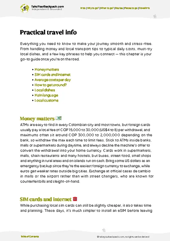
example page 0 from our offline Travel Guide for Colombia
example page 1 from our offline Travel Guide for Colombia
example page 2 from our offline Travel Guide for Colombia
example page 3 from our offline Travel Guide for Colombia
example page 4 from our offline Travel Guide for Colombia
example page 5 from our offline Travel Guide for Colombia
example page 6 from our offline Travel Guide for Colombia
example page 7 from our offline Travel Guide for Colombia
Loading the map 🌍
CLICK TO FILTER
cities
towns
villages
landmarks
national parks
hikes
beaches
attractions
festivals
regions
SHOW COUNTRY’S BESTSHOW ALL

✨ Why go?
Ranked #99 national park in Colombia
The unique appeal for travelers

Sierra Nevada de Santa Marta National Park suits backpackers who want a real multi-day walk rather than a day hike from a parking lot. The main route is the Ciudad Perdida trek, a roughly 45 to 50 kilometer loop that most groups walk in four to six days. You sleep in basic bunk or hammock camps, eat meals the guides and cooks prepare, and cross the Buritaca River on foot several times. Independent travelers lose a little freedom, since you cannot go alone, but you gain small groups of about 6 to 12 people and a shared rhythm that tends to turn strangers into friends by day two.

The second draw is the people. The park sits inside the ancestral territory of the Kogui, Wiwa, Arhuaco and Kankuamo, and the trail passes Kogui villages where guides explain how the mountain is still treated as the … read more 👉
Sierra Nevada de Santa Marta National Park suits backpackers who want a real multi-day walk rather than a day hike from a parking lot. The main route is the Ciudad Perdida trek, a roughly 45 to 50 kilometer loop that most groups walk in four to six days. You sleep in basic bunk or hammock camps, eat meals the guides and cooks prepare, and cross the Buritaca River on foot several times. Independent travelers lose a little freedom, since you cannot go alone, but you gain small groups of about 6 to 12 people and a shared rhythm that tends to turn strangers into friends by day two.

The second draw is the people. The park sits inside the ancestral territory of the Kogui, Wiwa, Arhuaco and Kankuamo, and the trail passes Kogui villages where guides explain how the mountain is still treated as the heart of the world. Add the archaeological site of Teyuna, older than Machu Picchu by several centuries, and you have a trek with real history at the end instead of just a summit.

💡 HighlightsDon't-miss highlights and experiences

  1. Ciudad Perdida (Teyuna): The reason almost everyone comes. This Tairona-built city of circular stone terraces, built around the 8th century, sits on a ridge above the jungle at about 1,200 meters. Guides lead you through the terraces and explain what each level was for.
  2. The 1,200-step stone staircase: The final climb to the city is a steep, moss-slick stairway through thick forest. Arrive early before other groups and you often have the upper terraces to yourself.
  3. Buritaca River swims: The trail follows and crosses this river several times, and guides stop at natural pools. After a humid, muddy climb, a plunge into the cold water is the best part of the day.
  4. Kogui villages: Round thatched homes appear along the route, including near Mutanzi. Guides arrange respectful visits with permission and
… read more 👉
  1. Ciudad Perdida (Teyuna): The reason almost everyone comes. This Tairona-built city of circular stone terraces, built around the 8th century, sits on a ridge above the jungle at about 1,200 meters. Guides lead you through the terraces and explain what each level was for.
  2. The 1,200-step stone staircase: The final climb to the city is a steep, moss-slick stairway through thick forest. Arrive early before other groups and you often have the upper terraces to yourself.
  3. Buritaca River swims: The trail follows and crosses this river several times, and guides stop at natural pools. After a humid, muddy climb, a plunge into the cold water is the best part of the day.
  4. Kogui villages: Round thatched homes appear along the route, including near Mutanzi. Guides arrange respectful visits with permission and explain Kogui customs, such as the white clothing and the spiritual role of the mamos, or elders. Photography rules apply.
  5. Alto de Mira ridge views: The camp on the ridge looks across forested valleys toward the coast on clear mornings. It is a quiet place to eat dinner while the clouds roll in below you.
  6. Nabusimake: The Arhuaco community’s main town lies on the southeastern flank near Pueblo Bello, with high-altitude cool air, handwoven mochila bags, and a ceremonial center. Visits need an Arhuaco guide and prior arrangement, but it offers a very different experience from the Ciudad Perdida route.
The river swims and the Kogui village stops fit naturally into the same day of trekking, since the pools and the settlements sit along the same stretch of trail.
Spotted a mistake or missing something? Contact us.

Things to do near Sierra Nevada de Santa Marta National Park

Ratings based on Tripadvisor reviews. When you book through this link, you support our work at no extra cost to you.

🌤️ When to go?Best time to explore Sierra Nevada de Santa Marta

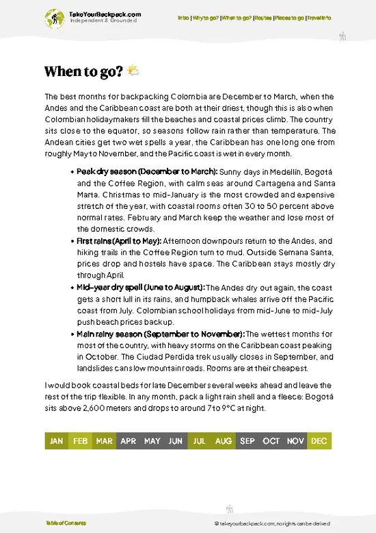
  • Dry Season (December to March): Lowest rain and clearest skies on the Caribbean slopes. Coastal lowlands run 28 to 33°C (82 to 91°F), while the high camps near Pueblito and the Ciudad Perdida trail drop to 18 to 24°C (64 to 75°F) at night. Trails are firmest and river crossings lowest, but this is the busiest stretch, so book treks ahead.
  • Short Dry Spell (June to August): A lull between rains that gives decent trekking weather, with warm humid days of 27 to 32°C (81 to 90°F). Domestic holidays in late June and July push up prices on the coast.
  • Wet Season (April to May, September to November): Afternoon downpours turn clay paths to mud and swell the Buritaca River. Expect 24 to 30°C (75 to 86°F) in the lowlands and fewer hikers. Some operators trim departures, though tours are cheaper and trails
… read more 👉
  • Dry Season (December to March): Lowest rain and clearest skies on the Caribbean slopes. Coastal lowlands run 28 to 33°C (82 to 91°F), while the high camps near Pueblito and the Ciudad Perdida trail drop to 18 to 24°C (64 to 75°F) at night. Trails are firmest and river crossings lowest, but this is the busiest stretch, so book treks ahead.
  • Short Dry Spell (June to August): A lull between rains that gives decent trekking weather, with warm humid days of 27 to 32°C (81 to 90°F). Domestic holidays in late June and July push up prices on the coast.
  • Wet Season (April to May, September to November): Afternoon downpours turn clay paths to mud and swell the Buritaca River. Expect 24 to 30°C (75 to 86°F) in the lowlands and fewer hikers. Some operators trim departures, though tours are cheaper and trails quieter.
  • High Peaks: Above 4,500 m (14,800 ft) it freezes any month, and access is restricted.
Daylight stays close to 11 to 13 hours all year, so plan to reach camp by mid-afternoon, and book Ciudad Perdida departures a week or two ahead from December to February.


source: climatestotravel.comJANJanuary: excellent for travelingFEBFebruary: excellent for travelingMARMarch: excellent for travelingAPRApril: highly recommended for travelingMAYMay: fair for travelingJUNJune: fair for travelingJULJuly: fair for travelingAUGAugust: fair for travelingSEPSeptember: fair for travelingOCTOctober: fair for travelingNOVNovember: fair for travelingDECDecember: highly recommended for traveling
when-to-go

✈️ The backpacker research shortcutColombia Travel Guide

An offline-friendly backpacking guide with optimized travel routes, ranked highlights, transport advice, and the best areas to stay.
example page 0 from our offline Travel Guide for Colombia
example page 1 from our offline Travel Guide for Colombia
example page 2 from our offline Travel Guide for Colombia
example page 3 from our offline Travel Guide for Colombia
example page 4 from our offline Travel Guide for Colombia
example page 5 from our offline Travel Guide for Colombia
example page 6 from our offline Travel Guide for Colombia
example page 7 from our offline Travel Guide for Colombia
The digital guide (349 pages) contains:
✅ 115 highlights, ranked by travel appeal
✅ Optimized 7, 14 & 21-day travel routes
✅ Cities, national parks, landmarks, beaches
✅ How to get around
✅ Offline-friendly for travel without Wi-Fi
👉 Click to see all 30+ guide features

📅 Plan smarter in minutes, not weeks
✅ Month by month travel advice
✅ Festivals & national holidays
✅ Budget expectations

🗺️ Go to the right places, skip the overrated ones
✅ Honest pros & cons of destinations
✅ Top hikes, parks & viewpoints
✅ Lesser-known places most travelers miss
✅ Clear “worth it vs skip it” guidance

🛏️ Travel smoothly without rookie mistakes
✅ Best areas to stay
✅ Transport systems explained simply
✅ Common scams & safety advice
✅ SIM cards, money & practical tips

🌍 Understand the country, not just visit it
✅ Culture & traditions
✅ 52 Essential phrases & customs
✅ Festivals worth planning around
✅ Traveler-friendly historical context
✅ Insights that make places more meaningful

📱 Built for real travel conditions
✅ Fully downloadable PDF
✅ Works completely offline
✅ Optimized for phone use
✅ Useful in remote areas & buses
✅ Everything in one place
Stop searching, start planning
Get instant access to your full guide. 30‑day money-back guarantee.
+ Add another guide for just

By proceeding you agree to our terms.
Sent to your inbox immediately after payment • 100% Secure Checkout
Best Backpacking Travel Advisor 2025 tourism awardBest Backpacking
Travel Advisor
2025
What others say about Take Your Backpack Guides:
⭐⭐⭐⭐⭐
Fantastic, amazing amount of information!
⭐⭐⭐⭐⭐
My goodness this is amazing, it's what I've been looking for hats off too you!
⭐⭐⭐⭐⭐
I think this is absolutely BRILLIANT
⭐⭐⭐⭐
Very complete and informative. It's still missing places, but I gotta to commend you
⭐⭐⭐⭐⭐
This is truly amazing, thank you, can't wait to explore it with my kids!
⭐⭐⭐⭐⭐
Awesome resource, thank you!
⭐⭐⭐⭐⭐
This is amazing! Can't wait to explore the ones I haven't seen
⭐⭐⭐⭐
I love this! Well done, great idea.
⭐⭐⭐⭐⭐
Thanks for taking the time to make this gem!
⭐⭐⭐⭐⭐
This might be the best website I've ever seen.
⭐⭐⭐⭐⭐
Congratulations, and thank you so much for your work; it's incredibly valuable.
⭐⭐⭐⭐
In all seriousness I think you did a great job pointing out the important spots
⭐⭐⭐⭐⭐
10/10 very good
⭐⭐⭐⭐⭐
As someone who's only just starting to visit regularly this is awesome, thank you.
⭐⭐⭐⭐
Thank you very much! I'm going to visit my dad, it's going to be very useful!
⭐⭐⭐⭐⭐
This is really cool! We'll be travelling for the first time and this definitely come in handy.
⭐⭐⭐⭐⭐
You are now our minister of culture, congratulations 👨‍💼
⭐⭐⭐⭐⭐
Just wanted to tell you that this is a pearl! Going to follow your recommendations.
⭐⭐⭐⭐⭐
This is so cool. I'll definitely be using the resource for my travels soon.
⭐⭐⭐⭐⭐
This is very impressive! Good work.
⭐⭐⭐⭐⭐
This is an amazing and informative site. Very well done!

🛏️ Where to stay?How to pick the right area

Santa Marta is the best base for most backpackers, with hostels clustered in the Centro Histórico and in Rodadero, and the park’s main trailheads are one to two hours away by road. Dorm beds in Santa Marta run about US$8 to 14, and private rooms US$25 to 50. Minca, a hill village about 45 minutes uphill from Santa Marta, suits anyone who wants cooler air, birdsong and river swimming. Its hostels and jungle lodges charge US$8 to 20 for a dorm bed, and some have hammock dorms with valley views. Inside the park itself, options are basic. Along the Lost City trek, the tour operators run simple camps … read more 👉
Santa Marta is the best base for most backpackers, with hostels clustered in the Centro Histórico and in Rodadero, and the park’s main trailheads are one to two hours away by road. Dorm beds in Santa Marta run about US$8 to 14, and private rooms US$25 to 50. Minca, a hill village about 45 minutes uphill from Santa Marta, suits anyone who wants cooler air, birdsong and river swimming. Its hostels and jungle lodges charge US$8 to 20 for a dorm bed, and some have hammock dorms with valley views. Inside the park itself, options are basic. Along the Lost City trek, the tour operators run simple camps with bunks or hammocks and mosquito nets, and the price is bundled into the tour. Kogui and Arhuaco villages are not open for casual overnight stays. For the northern side near Palomino and the coast, Palomino has beach hostels at US$10 to 25, and it is a good option for reaching the northern slopes. Taganga, a fishing village 10 minutes from Santa Marta, has cheap dorms from US$7 and is popular with divers. Book Minca and Santa Marta ahead from December to January and during Easter week.

👛 Costs (as of 19 October 2026)What things cost and how to budget

Plan on about US$54 to 102 per day for a backpacker who stays in hostels, eats locally and does shorter hikes, though the multi-day Lost City trek costs far more as a single package. The table breaks down a typical day in high season.
CategoryBudget RangeLocal Reality
Entrance feeUS$6 to 12Charged at park entry points such as Tayrona-side and Minca-area sectors, with higher rates for foreigners. The Lost City permit is bundled into the tour price.
AccommodationUS$10 to 25Dorm beds in Santa Marta or Minca; private rooms start near US$30. Prices rise in December and January and at Easter.
Local transportUS$3 to 10Shared minivans and colectivos run from Santa Marta to Minca and Palomino. Motorcycle taxis cost a little more on the steep Minca roads.
Food and suppliesUS$10 to 20Set lunches (menú del
… read more 👉
Plan on about US$54 to 102 per day for a backpacker who stays in hostels, eats locally and does shorter hikes, though the multi-day Lost City trek costs far more as a single package. The table breaks down a typical day in high season.
CategoryBudget RangeLocal Reality
Entrance feeUS$6 to 12Charged at park entry points such as Tayrona-side and Minca-area sectors, with higher rates for foreigners. The Lost City permit is bundled into the tour price.
AccommodationUS$10 to 25Dorm beds in Santa Marta or Minca; private rooms start near US$30. Prices rise in December and January and at Easter.
Local transportUS$3 to 10Shared minivans and colectivos run from Santa Marta to Minca and Palomino. Motorcycle taxis cost a little more on the steep Minca roads.
Food and suppliesUS$10 to 20Set lunches (menú del día) cost US$3 to 5, and a hostel dinner or restaurant meal runs US$6 to 12.
Guided activitiesUS$25 to 35Day hikes, coffee farm visits and bird walks near Minca cost US$15 to 40. The four to six day Lost City trek costs US$400 to 550 with food, guide and camp lodging.
Total Daily BudgetUS$54 to 102Midpoint is roughly US$75 to 100 on days with a guided activity and no multi-day trek.


source: colombia.travel
⚠️ Prices can change and everyone travels differently, so take this as a rough guide. Hope it helps you plan your adventure!

🥾 TrailsScenic routes and wildlife spotting in Sierra Nevada de Santa Marta

Sierra Nevada de Santa Marta National Park offers one famous trek and little else for ordinary visitors, because indigenous authorities and the national park service restrict access to the high peaks. Terrain is steep jungle path, slick red mud in the wet months, and rocky river crossings. Expect heat and humidity at lower levels and cool nights higher up. Wildlife is mostly toucans, parrots, hummingbirds, butterflies, lizards and frogs, with the occasional monkey call in the canopy.

  • Ciudad Perdida trek: About 45 to 50 kilometers round trip, usually four to six days depending on the operator.
… read more 👉
Sierra Nevada de Santa Marta National Park offers one famous trek and little else for ordinary visitors, because indigenous authorities and the national park service restrict access to the high peaks. Terrain is steep jungle path, slick red mud in the wet months, and rocky river crossings. Expect heat and humidity at lower levels and cool nights higher up. Wildlife is mostly toucans, parrots, hummingbirds, butterflies, lizards and frogs, with the occasional monkey call in the canopy.

  • Ciudad Perdida trek: About 45 to 50 kilometers round trip, usually four to six days depending on the operator. Difficulty is hard because of relentless ups and downs, humidity and river crossings, though fit beginners manage it. Key features are Kogui villages, swimming holes, hammock camps and the final 1,200 steps to the ruins.
  • Four-day itinerary: The fastest version, about 12 to 15 kilometers a day on the toughest days. It suits fit hikers who want less time in camp.
  • Five and six-day itineraries: Slower days with more time for swimming, village stops and rest. These are better for first-timers or anyone who dislikes pushing through heat.
  • Nabusimake visit: A cultural visit rather than a hike, with short walks around an Arhuaco town at altitude. It needs advance arrangement with a local guide.

Public transport reaches the trailhead area only as far as the village of El Mamey, and tour operators in Santa Marta handle the 2 to 3 hour jeep ride from the city. Entry is included in the trek price, which runs about US$450 to 550 and covers guides, food, camps and permits. The route is busiest from December to March and July to August, but groups are small and spaced out, so it rarely feels crowded. Trekking independently is not allowed.
⚠️ Hiking info can sometimes be outdated or inaccurate. Before you hit the trail, check the latest conditions with locals. If you do spot anything that's off, I'd love to hear from you, so I can update it for fellow travelers.

🛡️ SafetySafety Tips and Common Scams in Sierra Nevada de Santa Marta

Most trekkers finish the Lost City route without trouble, and the main hazards are heat, humidity and slippery footing rather than crime. The trail climbs and drops steeply through jungle, with muddy stretches and several river crossings that can be knee to thigh deep after rain, so wear quick-drying shoes and pack a dry bag for electronics. Daytime temperatures are hot and sticky at lower elevations, so drink often, start walking early and rest in the afternoon. Higher routes toward the snow peaks are cold, exposed and need permits and a local guide. Only licensed operators can run the Lost City trek, and going independently is not permitted. Insects, mainly mosquitoes and sandflies, are the daily nuisance, so bring repellent and cover up at dusk. Snakes exist but are rarely seen on the trail, … read more 👉
Most trekkers finish the Lost City route without trouble, and the main hazards are heat, humidity and slippery footing rather than crime. The trail climbs and drops steeply through jungle, with muddy stretches and several river crossings that can be knee to thigh deep after rain, so wear quick-drying shoes and pack a dry bag for electronics. Daytime temperatures are hot and sticky at lower elevations, so drink often, start walking early and rest in the afternoon. Higher routes toward the snow peaks are cold, exposed and need permits and a local guide. Only licensed operators can run the Lost City trek, and going independently is not permitted. Insects, mainly mosquitoes and sandflies, are the daily nuisance, so bring repellent and cover up at dusk. Snakes exist but are rarely seen on the trail, and watching where you place hands and feet is enough. Respect Indigenous communities by asking before taking photos and staying on marked paths. Carry a small first-aid kit with blister care and rehydration salts. Get routine vaccinations and consider yellow fever vaccination, which is recommended for this area.

FAQFrequently asked questions about Sierra Nevada de Santa Marta

Three to four days covers Santa Marta, Minca and a day hike, while the Lost City trek alone takes four to six days. Add one or two days if you also want the coast near Palomino, which is about 1.5 to 2 hours from Santa Marta. Sierra Nevada de Santa Marta National Park is large, so most backpackers pick one or two sectors rather than trying to see everything.
Yes, Sierra Nevada de Santa Marta National Park is easy to reach without a car using shared minivans and buses from Santa Marta. Colectivos to Minca take about 45 minutes and cost roughly US$2 to 4, and buses to Palomino take around 1.5 to 2 hours for US$4 to 8. The Lost City trek starts from Machete Pelao or El Mamey with transfers arranged by your tour operator, so no vehicle is needed.
Yes, Sierra Nevada de Santa Marta National Park charges entry fees at some access points, usually about US$6 to 12 for foreigners. The Lost City requires a licensed operator and a guide, with the permit built into a package of roughly US$400 to 550 for four to six days. Independent trekking there is not allowed, so book ahead in high season from December to March and in July and August.
⚠️ Things can change over time, so always validate details locally before you go.

Other Colombian national parks near Sierra Nevada de Santa Marta

Explore more nearby:


💡 Not sure where to go next?
Create a personalized itinerary for Colombia including Sierra Nevada de Santa Marta and the places that fit your trip.

Generate my itinerary

👉 Discover all national parks

Or checkout all Colombia has to offer (think cities, towns, villages, national parks, hikes, beaches, festivals)
Country photo of Colombia

We 💚 feedbackParting advice and final tips

Sierra Nevada de Santa Marta National Park is for people who like sweat, river water and slow history more than viewpoints and ticking boxes. It suits fit first-timers with a sense of humor and curious travelers who want to hear indigenous perspectives from the people who live here. If you hate mud or crave solitude, skip it. I would bring quick-dry socks and book the five-day version.

✈️ When did I visit Colombia?
Did a good 3-week trip around Colombia in August 2014.

✍️ Help improve this page!
The information on this page is based on my own backpacking experience in Colombia, supplemented with up-to-date research and feedback from other travelers. Travel details can change, so if you notice anything outdated or incomplete, feel free to let me know.


🙋‍♂️ Give feedback

👋 Meet the founderWho’s Behind Take Your Backpack?

Johan, backpacker and founder of TakeYourBackpackHi, I’m Johan (Netherlands 🇳🇱), the creator of TakeYourBackpack. Over the past 3 decades, I’ve backpacked through 90+ countries across six continents, gaining extensive experience with independent travel, long-term trips, and overland routes.

This site is built on a combination of firsthand travel experience and carefully curated insights from other backpackers. Many guides are based on places I’ve personally visited, while others bring together tips, observations, and practical advice shared by trusted travelers I’ve met along the way.

The goal is to provide realistic, experience-driven guidance — not generic itineraries — so you can explore destinations with better context, clearer expectations, and more confidence.