×

Colombia🇨🇴 | national parksVía Parque Isla de SalamancaMangrove boardwalks, Ciénaga Grande, stilt villages, waterbirds | things to do and best time to go

Explore Serranía de la Macarena National ParkExplore Pisba National Park

Backpacking in Vía Parque Isla de Salamanca
👍 Recommendednational park ranked #15
By Johan Kruseman 🇳🇱 | Updated October 19, 2026

Isla de Salamanca is not an island you reach by boat from Cartagena; it is a mangrove-and-sandbar strip in the north of Colombia, between Barranquilla and Santa Marta along the highway. The boardwalks are short and the wildlife is mostly birds, so skip it if you want big hikes. Go for the Ciénaga Grande lagoon, flamingos, and quiet. I bought a plastic bottle of water at the Los Cocos gate before walking the Caño Clarín boardwalk, and finished it before the first heron. Bring your own water and cash, go early, and book a boat in advance. Birders and mangrove fans will love it; thrill seekers will not.

Discover everything you want to know in the 📖 Colombia Travel Guide.


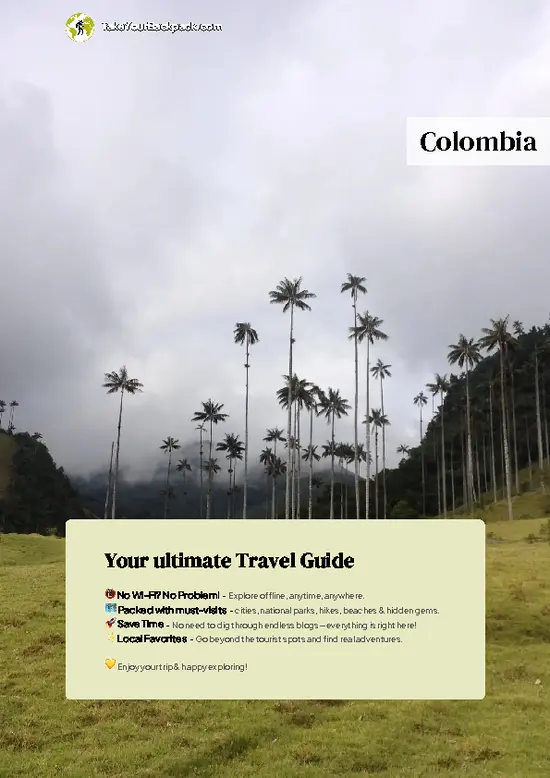
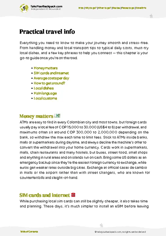
example page 0 from our offline Travel Guide for Colombia
example page 1 from our offline Travel Guide for Colombia
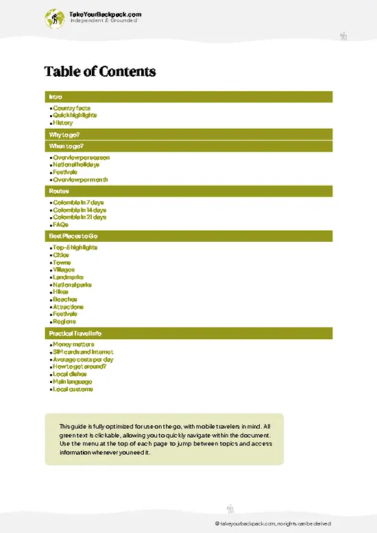
example page 2 from our offline Travel Guide for Colombia
example page 3 from our offline Travel Guide for Colombia
example page 4 from our offline Travel Guide for Colombia
example page 5 from our offline Travel Guide for Colombia
example page 6 from our offline Travel Guide for Colombia
example page 7 from our offline Travel Guide for Colombia
Loading the map 🌍
CLICK TO FILTER
cities
towns
villages
landmarks
national parks
hikes
beaches
attractions
festivals
regions
SHOW COUNTRY’S BESTSHOW ALL

✨ Why go?
Ranked #15 national park in Colombia
What makes it a must-see national park

Vía Parque Isla de Salamanca suits backpackers who like to piece a trip together on their own. The main draw is the Ciénaga Grande de Santa Marta lagoon system, one of the largest coastal lagoons in the Caribbean and a Ramsar wetland, which you can reach with a local bus along the coastal highway and a short walk or boat hop. Independent travelers also get to set their own pace on the Los Cocos boardwalk, stopping for birds without a guide's schedule. Tours exist, but they mostly add a boat. You can do the park yourself, then continue to Santa Marta or Barranquilla by the same road, with no need for a rental car or a fixed itinerary.

💡 HighlightsKey sights and experiences for travelers

  1. Ciénaga Grande de Santa Marta: the huge brackish lagoon that defines the park, with fishing villages on stilts and thousands of waterbirds.
  2. Mangrove boardwalks: raised wooden walkways through red and black mangroves, where fiddler crabs scuttle below you and herons stand still.
  3. Los Cocos sector: the main visitor access from the highway, with an information point and the easiest walking.
  4. Caño Clarín: a water channel linking lagoon and sea, good for slow paddling or a boat ride through narrow mangrove tunnels.
  5. Birdwatching: herons, egrets, ibises, kingfishers and pelicans appear in large numbers, and flamingos are sometimes seen.
  6. Palafitic villages: Nueva Venecia and Buenavista, wooden settlements on stilts in the lagoon, reached only by boat.
  7. Caribbean sandbar beaches: empty, wild shoreline on the
… read more 👉
  1. Ciénaga Grande de Santa Marta: the huge brackish lagoon that defines the park, with fishing villages on stilts and thousands of waterbirds.
  2. Mangrove boardwalks: raised wooden walkways through red and black mangroves, where fiddler crabs scuttle below you and herons stand still.
  3. Los Cocos sector: the main visitor access from the highway, with an information point and the easiest walking.
  4. Caño Clarín: a water channel linking lagoon and sea, good for slow paddling or a boat ride through narrow mangrove tunnels.
  5. Birdwatching: herons, egrets, ibises, kingfishers and pelicans appear in large numbers, and flamingos are sometimes seen.
  6. Palafitic villages: Nueva Venecia and Buenavista, wooden settlements on stilts in the lagoon, reached only by boat.
  7. Caribbean sandbar beaches: empty, wild shoreline on the seaward side, better for a quiet walk than for swimming.
Start with the Los Cocos boardwalk early in the morning, because the birds are most active then and it gives you a feel for the mangroves before you commit to a boat trip.
Spotted a mistake or missing something? Contact us.

🌤️ When to go?When to go for the best experience

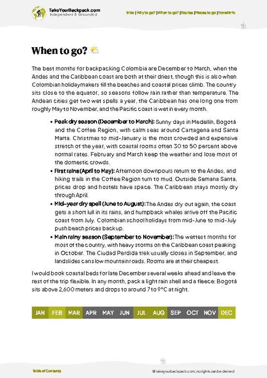
December to March is the easiest window for walking the boardwalks and boating the mangrove channels near Barranquilla.
  • Dry Season (December to April): Mostly sunny, 24 to 32°C (75 to 90°F), breezy, and the lagoon waters are calm. Bird counts are good and crowds peak around Christmas, New Year and Carnival (February), when lodging prices climb.
  • Early Rains (May to July): Short afternoon downpours, 26 to 34°C (79 to 93°F), and mosquitoes multiply. Fewer visitors and lower prices.
  • Wettest Months (September to November): Heavy rain, road flooding and muddy tracks, with highs of 30 to 33°C (86 to 91°F). Some boat trips get canceled.
Daylight stays close to 12 hours all year. Book boat trips for early morning, when the air is cooler and birds are most active.

source: climatestotravel.comJANJanuary: excellent for travelingFEBFebruary: excellent for travelingMARMarch: highly recommended for travelingAPRApril: fair for travelingMAYMay: fair for travelingJUNJune: fair for travelingJULJuly: fair for travelingAUGAugust: fair for travelingSEPSeptember: fair for travelingOCTOctober: fair for travelingNOVNovember: fair for travelingDECDecember: excellent for traveling
when-to-go

✈️ The backpacker research shortcutColombia Travel Guide

An offline-friendly backpacking guide with optimized travel routes, ranked highlights, transport advice, and the best areas to stay.
example page 0 from our offline Travel Guide for Colombia
example page 1 from our offline Travel Guide for Colombia
example page 2 from our offline Travel Guide for Colombia
example page 3 from our offline Travel Guide for Colombia
example page 4 from our offline Travel Guide for Colombia
example page 5 from our offline Travel Guide for Colombia
example page 6 from our offline Travel Guide for Colombia
example page 7 from our offline Travel Guide for Colombia
The digital guide (349 pages) contains:
✅ 115 highlights, ranked by travel appeal
✅ Optimized 7, 14 & 21-day travel routes
✅ Cities, national parks, landmarks, beaches
✅ How to get around
✅ Offline-friendly for travel without Wi-Fi
👉 Click to see all 30+ guide features

📅 Plan smarter in minutes, not weeks
✅ Month by month travel advice
✅ Festivals & national holidays
✅ Budget expectations

🗺️ Go to the right places, skip the overrated ones
✅ Honest pros & cons of destinations
✅ Top hikes, parks & viewpoints
✅ Lesser-known places most travelers miss
✅ Clear “worth it vs skip it” guidance

🛏️ Travel smoothly without rookie mistakes
✅ Best areas to stay
✅ Transport systems explained simply
✅ Common scams & safety advice
✅ SIM cards, money & practical tips

🌍 Understand the country, not just visit it
✅ Culture & traditions
✅ 52 Essential phrases & customs
✅ Festivals worth planning around
✅ Traveler-friendly historical context
✅ Insights that make places more meaningful

📱 Built for real travel conditions
✅ Fully downloadable PDF
✅ Works completely offline
✅ Optimized for phone use
✅ Useful in remote areas & buses
✅ Everything in one place
Stop searching, start planning
Get instant access to your full guide. 30‑day money-back guarantee.
+ Add another guide for just

By proceeding you agree to our terms.
Sent to your inbox immediately after payment • 100% Secure Checkout
Best Backpacking Travel Advisor 2025 tourism awardBest Backpacking
Travel Advisor
2025
What others say about Take Your Backpack Guides:
⭐⭐⭐⭐⭐
Fantastic, amazing amount of information!
⭐⭐⭐⭐⭐
My goodness this is amazing, it's what I've been looking for hats off too you!
⭐⭐⭐⭐⭐
I think this is absolutely BRILLIANT
⭐⭐⭐⭐
Very complete and informative. It's still missing places, but I gotta to commend you
⭐⭐⭐⭐⭐
This is truly amazing, thank you, can't wait to explore it with my kids!
⭐⭐⭐⭐⭐
Awesome resource, thank you!
⭐⭐⭐⭐⭐
This is amazing! Can't wait to explore the ones I haven't seen
⭐⭐⭐⭐
I love this! Well done, great idea.
⭐⭐⭐⭐⭐
Thanks for taking the time to make this gem!
⭐⭐⭐⭐⭐
This might be the best website I've ever seen.
⭐⭐⭐⭐⭐
Congratulations, and thank you so much for your work; it's incredibly valuable.
⭐⭐⭐⭐
In all seriousness I think you did a great job pointing out the important spots
⭐⭐⭐⭐⭐
10/10 very good
⭐⭐⭐⭐⭐
As someone who's only just starting to visit regularly this is awesome, thank you.
⭐⭐⭐⭐
Thank you very much! I'm going to visit my dad, it's going to be very useful!
⭐⭐⭐⭐⭐
This is really cool! We'll be travelling for the first time and this definitely come in handy.
⭐⭐⭐⭐⭐
You are now our minister of culture, congratulations 👨‍💼
⭐⭐⭐⭐⭐
Just wanted to tell you that this is a pearl! Going to follow your recommendations.
⭐⭐⭐⭐⭐
This is so cool. I'll definitely be using the resource for my travels soon.
⭐⭐⭐⭐⭐
This is very impressive! Good work.
⭐⭐⭐⭐⭐
This is an amazing and informative site. Very well done!

🛏️ Where to stay?Where staying makes the most sense

Barranquilla is the practical base, since no lodging for backpackers exists inside Vía Parque Isla de Salamanca. The city sits roughly 20 to 30 minutes from the park's Los Cocos visitor area by road. The El Prado and Alto Prado neighborhoods have the best selection of hostels and budget hotels, with dorms around US$10 to 18 and private rooms from US$25 to 45. They are leafy and walkable, with restaurants nearby. Santa Marta, about 1.5 hours east along the coast road, suits you better if you want beaches, nightlife and a livelier traveler scene, and the park is reachable from there on a day trip. … read more 👉
Barranquilla is the practical base, since no lodging for backpackers exists inside Vía Parque Isla de Salamanca. The city sits roughly 20 to 30 minutes from the park's Los Cocos visitor area by road. The El Prado and Alto Prado neighborhoods have the best selection of hostels and budget hotels, with dorms around US$10 to 18 and private rooms from US$25 to 45. They are leafy and walkable, with restaurants nearby. Santa Marta, about 1.5 hours east along the coast road, suits you better if you want beaches, nightlife and a livelier traveler scene, and the park is reachable from there on a day trip. Near the park's eastern edge, the small fishing village of Puebloviejo has basic guesthouses and some simple homestays for those wanting a quiet, local stay.

👛 Costs (as of 19 October 2026)How expensive it really is

Expect to spend about US$58 per day around Vía Parque Isla de Salamanca if you sleep in Barranquilla and visit the park on guided outings.
CategoryBudget RangeLocal Reality
Entrance FeeUS$3 to 8Charged to foreigners at the visitor center; rates vary by area and season.
Accommodation (High Season)US$12 to 25Hostel dorms or simple private rooms in Barranquilla. Prices rise during Carnival.
Local TransportUS$5 to 12Buses or shared taxis toward the park, plus a ride back. Taxis cost more.
Boat and GuideUS$10 to 20Shared mangrove or lagoon boat tours. Private boats cost more.
Food and SuppliesUS$8 to 15Set lunches (corrientazo) and fried fish at roadside stalls are cheap. Bring water.
Total Daily BudgetUS$38 to 80About US$58 at midrange within this spread.
⚠️ Prices can change and everyone travels differently, so take this as a rough guide. Hope it helps you plan your adventure!

🥾 TrailsBest hikes in Vía Parque Isla de Salamanca national park

Vía Parque Isla de Salamanca is a flat, wet landscape, so the walking is easy and short; the real exploring happens on the water.
  • Los Cocos Boardwalk: roughly 1 to 2 kilometers of wooden walkway, about 1 hour, easy. Passes mangroves, with frequent bird and crab sightings.
  • Caño Clarín Route: usually done by boat or kayak, 1 to 3 hours, easy. Narrow channels, mangrove tunnels and heron colonies.
  • Lagoon Boat Trip to Nueva Venecia: a half-day outing, easy, with open water, stilt houses and large flocks of birds.
  • Beach Walk: sandy, exposed and flat, as long as you like. Look for shorebirds and driftwood.
… read more 👉
Vía Parque Isla de Salamanca is a flat, wet landscape, so the walking is easy and short; the real exploring happens on the water.
  • Los Cocos Boardwalk: roughly 1 to 2 kilometers of wooden walkway, about 1 hour, easy. Passes mangroves, with frequent bird and crab sightings.
  • Caño Clarín Route: usually done by boat or kayak, 1 to 3 hours, easy. Narrow channels, mangrove tunnels and heron colonies.
  • Lagoon Boat Trip to Nueva Venecia: a half-day outing, easy, with open water, stilt houses and large flocks of birds.
  • Beach Walk: sandy, exposed and flat, as long as you like. Look for shorebirds and driftwood.
Wildlife includes caimans, manatees (rarely seen), iguanas and over 200 bird species. Expect heat, humidity and mosquitoes, so bring repellent and a hat.
The park lies along the highway between Barranquilla and Santa Marta, and buses on that route can drop you near the entrance. Crowds are small, and weekends are the busiest. There is a modest entrance fee for the park, paid in Colombian pesos and generally cheap; boat trips cost more.
⚠️ Hiking info can sometimes be outdated or inaccurate. Before you hit the trail, check the latest conditions with locals. If you do spot anything that's off, I'd love to hear from you, so I can update it for fellow travelers.

🛡️ SafetyTraveler Safety Guide

Vía Parque Isla de Salamanca is straightforward on boardwalks and with licensed boat operators, and the main nuisances are heat, sun and insects. Wear long, light sleeves, apply repellent, and carry at least 2 liters of water, since shade is limited. Stay on marked walkways, because mangrove mud is deep and hides roots. Caimans and snakes exist but rarely bother people who keep their distance, so don't feed or approach wildlife. Use registered guides and boats with life jackets, and avoid water travel during storms or strong winds. Arrange transport back in advance, as the highway area has little traffic after dark.

FAQTraveler FAQ

One day is enough for Vía Parque Isla de Salamanca, since the main boardwalks and boat routes take about 3 to 5 hours. Most people go in the morning from Barranquilla and return by afternoon. Add a second day if you want to combine it with the fishing villages of Puebloviejo or a longer lagoon trip.
Yes, Vía Parque Isla de Salamanca can be reached without a car, though it takes a little planning. Buses on the Barranquilla to Santa Marta highway pass the park area in about 30 to 45 minutes, and a taxi from Barranquilla runs roughly US$10 to 20 each way. Boat tours from nearby villages like Puebloviejo cover the water side.
Yes, Vía Parque Isla de Salamanca charges an entrance fee, typically around US$3 to 8 for foreign visitors depending on the sector and season. No special trekking permit is required for the standard boardwalk and boat routes. Boats and guides are paid separately, usually US$10 to 20 per person on shared tours.
⚠️ Things can change over time, so always validate details locally before you go.

Other Colombian national parks near Vía Parque Isla de Salamanca

Explore more nearby:


💡 Not sure where to go next?
Create a personalized itinerary for Colombia including Vía Parque Isla de Salamanca and the places that fit your trip.

Generate my itinerary

👉 Discover all national parks

Or checkout all Colombia has to offer (think cities, towns, villages, national parks, hikes, beaches, festivals)
Country photo of Colombia

We 💚 feedbackWhat to keep in mind

Vía Parque Isla de Salamanca deserves half a day, or one night if you want a lagoon sunrise with the birds. Longer than that and the repeating mangroves start to blur. I would pair it with Santa Marta or Barranquilla, and bring binoculars and repellent.

✈️ When did I visit Colombia?
Did a good 3-week trip around Colombia in August 2014.

✍️ Help improve this page!
The information on this page is based on my own backpacking experience in Colombia, supplemented with up-to-date research and feedback from other travelers. Travel details can change, so if you notice anything outdated or incomplete, feel free to let me know.


🙋‍♂️ Give feedback

👋 Meet the founderWho’s Behind Take Your Backpack?

Johan, backpacker and founder of TakeYourBackpackHi, I’m Johan (Netherlands 🇳🇱), the creator of TakeYourBackpack. Over the past 3 decades, I’ve backpacked through 90+ countries across six continents, gaining extensive experience with independent travel, long-term trips, and overland routes.

This site is built on a combination of firsthand travel experience and carefully curated insights from other backpackers. Many guides are based on places I’ve personally visited, while others bring together tips, observations, and practical advice shared by trusted travelers I’ve met along the way.

The goal is to provide realistic, experience-driven guidance — not generic itineraries — so you can explore destinations with better context, clearer expectations, and more confidence.