×

Colombia🇨🇴 | national parksMacuira National Natural ParkDesert cloud forest, Wayuu villages, Cerro Palúa, Nazareth | things to do and best time to go

Explore Cueva de los Guácharos National ParkExplore La Paya National Park

Backpacking in Macuira National Natural Park
👍 Recommendednational park ranked #14
By Johan Kruseman 🇳🇱 | Updated October 19, 2026

Macuira is a mountain oasis of cloud forest rising from desert, and it is not a beach stop on the Guajira coast. It sits in the far north of Colombia, in the Alta Guajira, roughly northeast of Uribia. Roads here are sand tracks with no signs, so a local Wayuu driver who knows the ranchería routes beats any map. Skip the rush to Cabo de la Vela only; give Macuira its own night. I expected dust and thorn scrub, then climbed into Nazareth’s hills and found mossy ferns dripping above Wayuu goat pens.

Discover everything you want to know in the 📖 Colombia Travel Guide.


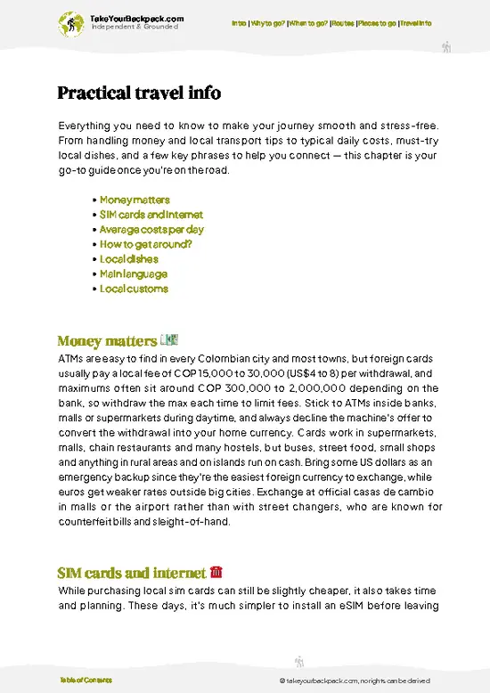
example page 0 from our offline Travel Guide for Colombia
example page 1 from our offline Travel Guide for Colombia
example page 2 from our offline Travel Guide for Colombia
example page 3 from our offline Travel Guide for Colombia
example page 4 from our offline Travel Guide for Colombia
example page 5 from our offline Travel Guide for Colombia
example page 6 from our offline Travel Guide for Colombia
example page 7 from our offline Travel Guide for Colombia
Loading the map 🌍
CLICK TO FILTER
cities
towns
villages
landmarks
national parks
hikes
beaches
attractions
festivals
regions
SHOW COUNTRY’S BESTSHOW ALL

✨ Why go?
Ranked #14 national park in Colombia
The unique appeal for travelers

Macuira National Natural Park suits travelers who want a place with no ticket-office polish. The reason to come is the sudden change: a range of about 865 meters (2,840 feet) catching trade-wind clouds, so ferns, orchids and mist sit above a plain of cactus. Self-guided hiking is limited, since trails are faint and Wayuu communities manage access, so you go with a local guide from the village of Nazareth. That is a plus for budget travelers, because your money goes straight to families. Expect hammock sleeping, goat stew and the slow, windy rhythm of the peninsula, plus the chance to see birds such as the troupial and the Guajira’s endemic species.

💡 HighlightsMust-see experiences and standout moments

  1. Cerro Palúa: The park’s best-known viewpoint, a Wayuu sacred hill with sweeping views over the desert and out to the Caribbean on clear days.
  2. Nazareth village: The main gateway community, where Wayuu families host visitors and where hikes are arranged.
  3. Cloud forest on the upper slopes: Damp, shaded woodland with ferns, bromeliads and orchids, a sharp contrast to the dry plain below.
  4. Wayuu rancherías: Family homesteads with goat corrals, woven mochilas and hammocks, where you can see daily desert life up close.
  5. Streams and pools: Seasonal water in the hills, best after the rains, with cool dips and birdsong.
  6. Birdlife: Parrots, hawks, hummingbirds and other birds use the green hills as a refuge in a dry region.
  7. Rock outcrops and desert views: Boulder-strewn ridges give long views across thorn scrub
… read more 👉
  1. Cerro Palúa: The park’s best-known viewpoint, a Wayuu sacred hill with sweeping views over the desert and out to the Caribbean on clear days.
  2. Nazareth village: The main gateway community, where Wayuu families host visitors and where hikes are arranged.
  3. Cloud forest on the upper slopes: Damp, shaded woodland with ferns, bromeliads and orchids, a sharp contrast to the dry plain below.
  4. Wayuu rancherías: Family homesteads with goat corrals, woven mochilas and hammocks, where you can see daily desert life up close.
  5. Streams and pools: Seasonal water in the hills, best after the rains, with cool dips and birdsong.
  6. Birdlife: Parrots, hawks, hummingbirds and other birds use the green hills as a refuge in a dry region.
  7. Rock outcrops and desert views: Boulder-strewn ridges give long views across thorn scrub to the sea.
Cerro Palúa pairs well with a night in Nazareth, since the village is the starting point for the climb.
Spotted a mistake or missing something? Contact us.

🌤️ When to go?Weather, crowds, and seasonal trade-offs

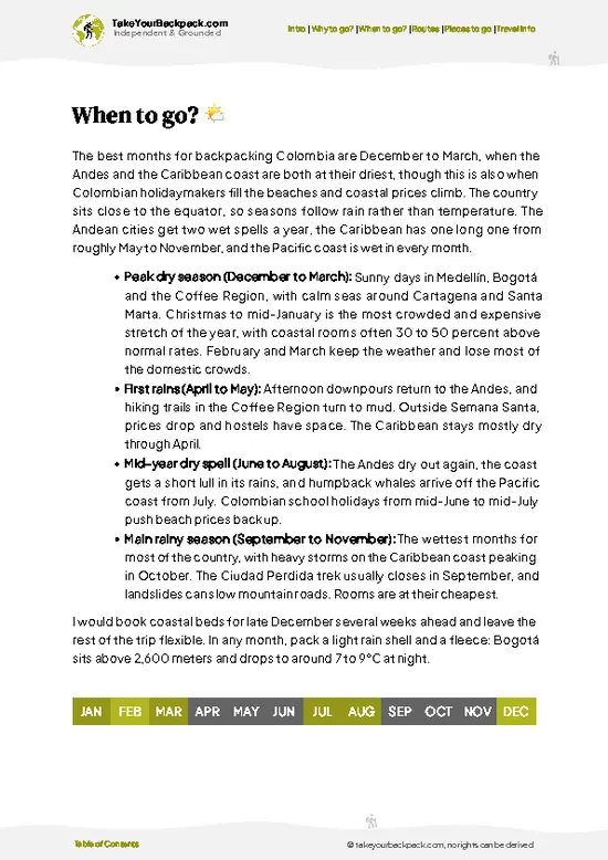
  • December to April: Driest stretch, with daytime highs of 30 to 35°C (86 to 95°F) on the Guajira lowlands and 22 to 27°C (72 to 81°F) up in the cloud-forest hills. Trails stay firm, and the Caribbean trade winds are strongest.
  • May to June and September to November: Two rainy pulses, October usually the wettest. Dirt tracks from Uribia and Cabo de la Vela turn to slick mud, and arroyos can block vehicles for hours.
  • July to August: Short dry spell with fewer showers. Colombian holiday weeks bring more visitors and higher jeep and bed prices around Nazareth.
  • Daylight: Roughly 11.5 to 12.5 hours all year, so plan summit walks for early morning.
Aim for January or February, when the tracks are passable and the hills still hold some green.

source: climatestotravel.comJANJanuary: excellent for travelingFEBFebruary: excellent for travelingMARMarch: excellent for travelingAPRApril: good for travelingMAYMay: good for travelingJUNJune: good for travelingJULJuly: good for travelingAUGAugust: good for travelingSEPSeptember: good for travelingOCTOctober: good for travelingNOVNovember: good for travelingDECDecember: excellent for traveling
when-to-go

✈️ The backpacker research shortcutColombia Travel Guide

An offline-friendly backpacking guide with optimized travel routes, ranked highlights, transport advice, and the best areas to stay.
example page 0 from our offline Travel Guide for Colombia
example page 1 from our offline Travel Guide for Colombia
example page 2 from our offline Travel Guide for Colombia
example page 3 from our offline Travel Guide for Colombia
example page 4 from our offline Travel Guide for Colombia
example page 5 from our offline Travel Guide for Colombia
example page 6 from our offline Travel Guide for Colombia
example page 7 from our offline Travel Guide for Colombia
The digital guide (349 pages) contains:
✅ 115 highlights, ranked by travel appeal
✅ Optimized 7, 14 & 21-day travel routes
✅ Cities, national parks, landmarks, beaches
✅ How to get around
✅ Offline-friendly for travel without Wi-Fi
👉 Click to see all 30+ guide features

📅 Plan smarter in minutes, not weeks
✅ Month by month travel advice
✅ Festivals & national holidays
✅ Budget expectations

🗺️ Go to the right places, skip the overrated ones
✅ Honest pros & cons of destinations
✅ Top hikes, parks & viewpoints
✅ Lesser-known places most travelers miss
✅ Clear “worth it vs skip it” guidance

🛏️ Travel smoothly without rookie mistakes
✅ Best areas to stay
✅ Transport systems explained simply
✅ Common scams & safety advice
✅ SIM cards, money & practical tips

🌍 Understand the country, not just visit it
✅ Culture & traditions
✅ 52 Essential phrases & customs
✅ Festivals worth planning around
✅ Traveler-friendly historical context
✅ Insights that make places more meaningful

📱 Built for real travel conditions
✅ Fully downloadable PDF
✅ Works completely offline
✅ Optimized for phone use
✅ Useful in remote areas & buses
✅ Everything in one place
Stop searching, start planning
Get instant access to your full guide. 30‑day money-back guarantee.
+ Add another guide for just

By proceeding you agree to our terms.
Sent to your inbox immediately after payment • 100% Secure Checkout
Best Backpacking Travel Advisor 2025 tourism awardBest Backpacking
Travel Advisor
2025
What others say about Take Your Backpack Guides:
⭐⭐⭐⭐⭐
Fantastic, amazing amount of information!
⭐⭐⭐⭐⭐
My goodness this is amazing, it's what I've been looking for hats off too you!
⭐⭐⭐⭐⭐
I think this is absolutely BRILLIANT
⭐⭐⭐⭐
Very complete and informative. It's still missing places, but I gotta to commend you
⭐⭐⭐⭐⭐
This is truly amazing, thank you, can't wait to explore it with my kids!
⭐⭐⭐⭐⭐
Awesome resource, thank you!
⭐⭐⭐⭐⭐
This is amazing! Can't wait to explore the ones I haven't seen
⭐⭐⭐⭐
I love this! Well done, great idea.
⭐⭐⭐⭐⭐
Thanks for taking the time to make this gem!
⭐⭐⭐⭐⭐
This might be the best website I've ever seen.
⭐⭐⭐⭐⭐
Congratulations, and thank you so much for your work; it's incredibly valuable.
⭐⭐⭐⭐
In all seriousness I think you did a great job pointing out the important spots
⭐⭐⭐⭐⭐
10/10 very good
⭐⭐⭐⭐⭐
As someone who's only just starting to visit regularly this is awesome, thank you.
⭐⭐⭐⭐
Thank you very much! I'm going to visit my dad, it's going to be very useful!
⭐⭐⭐⭐⭐
This is really cool! We'll be travelling for the first time and this definitely come in handy.
⭐⭐⭐⭐⭐
You are now our minister of culture, congratulations 👨‍💼
⭐⭐⭐⭐⭐
Just wanted to tell you that this is a pearl! Going to follow your recommendations.
⭐⭐⭐⭐⭐
This is so cool. I'll definitely be using the resource for my travels soon.
⭐⭐⭐⭐⭐
This is very impressive! Good work.
⭐⭐⭐⭐⭐
This is an amazing and informative site. Very well done!

🛏️ Where to stay?How to pick the right area

The best base is Nazareth, the Wayuu village at the park’s edge, where families rent hammocks and simple rooms for roughly US$8 to 15 a night, often with dinner (fish or goat) for a few dollars more. Nothing else sits inside the park, and there are no official campgrounds, so most travelers sleep in Nazareth or in ranchería homes near Taroa and Alta Gracia. Bring your own padlock and a light sheet, since hammocks are the norm and nights can be breezy. Outside the park, Cabo de la Vela has more choice, from US$10 hammocks to US$30 to 50 private rooms, and it is the usual stopover on the way in. … read more 👉
The best base is Nazareth, the Wayuu village at the park’s edge, where families rent hammocks and simple rooms for roughly US$8 to 15 a night, often with dinner (fish or goat) for a few dollars more. Nothing else sits inside the park, and there are no official campgrounds, so most travelers sleep in Nazareth or in ranchería homes near Taroa and Alta Gracia. Bring your own padlock and a light sheet, since hammocks are the norm and nights can be breezy. Outside the park, Cabo de la Vela has more choice, from US$10 hammocks to US$30 to 50 private rooms, and it is the usual stopover on the way in. Uribia is the practical gateway town for supplies and transport, though lodging there is basic. Riohacha, the departmental capital, has the widest selection of hostels and hotels, from US$12 dorms upward.

👛 Costs (as of 19 October 2026)How expensive it really is

Expect to spend about US$46 to 90 per day at Macuira National Natural Park, with most of that going to the 4x4 transport needed to reach it.
CategoryBudget RangeLocal Reality
Entrance and guideUS$8 to 20A modest park or community fee, plus a Wayuu guide usually in the US$10 to 20 range, often shared between a group.
Accommodation (high season)US$8 to 20Hammock or basic room in Nazareth, often including a simple breakfast.
Local transportUS$20 to 35Shared 4x4 or pickup from Uribia or Cabo de la Vela, with the cost split between passengers. Private jeeps cost much more.
Food and waterUS$10 to 15Fish, goat, rice and arepas at family kitchens, plus bottled water that costs more the farther in you go.
Total Daily BudgetUS$46 to 90Costs fall when you fill vehicle seats and travel in a group. Pay in Colombian
… read more 👉
Expect to spend about US$46 to 90 per day at Macuira National Natural Park, with most of that going to the 4x4 transport needed to reach it.
CategoryBudget RangeLocal Reality
Entrance and guideUS$8 to 20A modest park or community fee, plus a Wayuu guide usually in the US$10 to 20 range, often shared between a group.
Accommodation (high season)US$8 to 20Hammock or basic room in Nazareth, often including a simple breakfast.
Local transportUS$20 to 35Shared 4x4 or pickup from Uribia or Cabo de la Vela, with the cost split between passengers. Private jeeps cost much more.
Food and waterUS$10 to 15Fish, goat, rice and arepas at family kitchens, plus bottled water that costs more the farther in you go.
Total Daily BudgetUS$46 to 90Costs fall when you fill vehicle seats and travel in a group. Pay in Colombian pesos and bring cash, as there are no ATMs nearby.
⚠️ Prices can change and everyone travels differently, so take this as a rough guide. Hope it helps you plan your adventure!

🥾 TrailsBest hikes in Macuira National Natural Park national park

Macuira National Natural Park is walked on informal routes led by Wayuu guides rather than signed, measured trails, so you decide the length with your guide.
  • Nazareth to Cerro Palúa: A climb of a few hours round trip on rocky, partly shaded paths, moderate effort, with the main viewpoint at the top.
  • Cloud forest loop: Gentler walking through ferns and damp soil on the upper slopes, around half a day, with the best chances to spot birds.
  • Stream walks: Short, easy strolls to seasonal pools, best after rain and often dry in the hottest months.
  • Ranchería visits: Flat, sandy walking between homesteads,
… read more 👉
Macuira National Natural Park is walked on informal routes led by Wayuu guides rather than signed, measured trails, so you decide the length with your guide.
  • Nazareth to Cerro Palúa: A climb of a few hours round trip on rocky, partly shaded paths, moderate effort, with the main viewpoint at the top.
  • Cloud forest loop: Gentler walking through ferns and damp soil on the upper slopes, around half a day, with the best chances to spot birds.
  • Stream walks: Short, easy strolls to seasonal pools, best after rain and often dry in the hottest months.
  • Ranchería visits: Flat, sandy walking between homesteads, easy but hot and exposed.
Getting here is the hard part. There is no public bus into the park, so most travelers hire a 4x4 or a local driver from Uribia or Cabo de la Vela, and tracks can be slow when sand is soft. Visitors are few, so crowds are almost absent. Entry is arranged through the Wayuu community and park authorities, and you pay in Colombian pesos. Carry plenty of water, a hat and sun protection, and start early before the heat builds.
⚠️ Hiking info can sometimes be outdated or inaccurate. Before you hit the trail, check the latest conditions with locals. If you do spot anything that's off, I'd love to hear from you, so I can update it for fellow travelers.

🛡️ SafetyStaying Safe: What Travelers Should Know

Macuira is a remote desert-and-cloud-forest massif, and the main risks are heat, dehydration and getting lost on faint paths. Carry at least 3 liters of water per person, since sources on the hills are unreliable, and start walks at dawn before the lowland heat builds. Hire a Wayuu guide in Nazareth, which is expected and keeps you on the right trails. Rain can flood the arroyos on the approach, so check track conditions before leaving Uribia. Snakes and scorpions are present, so watch your hands and shake out shoes. Cell signal is absent in most of the park. Respect community rules, ask before photographing people, and carry small cash.

FAQCommon questions from travelers

Macuira National Natural Park needs two to three days. The road in from Uribia or Cabo de la Vela takes several hours, and you want at least one full day on the cloud-forest trails around Nazareth, Alta Gracia and Taroa. A third day gives you a buffer if rain slows the tracks.
You can reach Macuira National Natural Park without your own car, but not easily. Take a bus from Riohacha to Uribia (about 1.5 to 2 hours), then arrange a shared 4x4 or pickup to Nazareth, roughly 3 to 4 hours depending on conditions. Many travelers join a Cabo de la Vela tour instead, and prices run around US$20 to 35 per person when seats are shared.
Macuira National Natural Park charges a modest entry and community fee, usually in the range of US$4 to 10, paid in cash in or near Nazareth. A Wayuu guide is expected and typically costs US$10 to 20 per day. No advance permit is generally required, but bring cash since there are no ATMs nearby, and check current rules with Parques Nacionales Naturales before going.
⚠️ Things can change over time, so always validate details locally before you go.

Other Colombian national parks near Macuira National Natural Park

Explore more nearby:


💡 Not sure where to go next?
Create a personalized itinerary for Colombia including Macuira National Natural Park and the places that fit your trip.

Generate my itinerary

👉 Discover all national parks

Or checkout all Colombia has to offer (think cities, towns, villages, national parks, hikes, beaches, festivals)
Country photo of Colombia

We 💚 feedbackFinal thoughts on exploring Macuira National Natural Park

Combine Macuira National Natural Park with Cabo de la Vela and Punta Gallinas on a loop through the Alta Guajira, giving it a full night rather than a rushed stop. I would bring a hammock, cash and extra water, and agree on your guide before leaving Uribia.

✈️ When did I visit Colombia?
Did a good 3-week trip around Colombia in August 2014.

✍️ Help improve this page!
The information on this page is based on my own backpacking experience in Colombia, supplemented with up-to-date research and feedback from other travelers. Travel details can change, so if you notice anything outdated or incomplete, feel free to let me know.


🙋‍♂️ Give feedback

👋 Meet the founderWho’s Behind Take Your Backpack?

Johan, backpacker and founder of TakeYourBackpackHi, I’m Johan (Netherlands 🇳🇱), the creator of TakeYourBackpack. Over the past 3 decades, I’ve backpacked through 90+ countries across six continents, gaining extensive experience with independent travel, long-term trips, and overland routes.

This site is built on a combination of firsthand travel experience and carefully curated insights from other backpackers. Many guides are based on places I’ve personally visited, while others bring together tips, observations, and practical advice shared by trusted travelers I’ve met along the way.

The goal is to provide realistic, experience-driven guidance — not generic itineraries — so you can explore destinations with better context, clearer expectations, and more confidence.