×

Dominican Republic🇩🇴 | national parksSierra de Bahoruco National ParkCloud forest, Hispaniolan trogon, pine ridges, Hoyo de Pelempito | things to do and best time to go

Explore Parque Nacional CotubanamáExplore Valle Nuevo National Park

Backpacking in Sierra de Bahoruco
🌟 Highlightnational park ranked #5
By Johan Kruseman 🇳🇱 | Updated October 23, 2026

Sierra de Bahoruco National Park hands you cloud forest, pine ridges and dry thorn scrub in a single day, which is more variety than most parks pack into a week. It sits in the southwest of the Dominican Republic, rising above Lake Enriquillo near the Haitian border. The scenery is the draw: orchids, bromeliads, hummingbirds and the Hispaniolan trogon, plus trails that stay quiet because almost nobody else comes. Access is the sticking point. Public transport stops well short of the trailheads, and the rough tracks punish rental sedans, so book a 4x4 or a driver in advance or you will pay for a flat tire and a long walk. Roads are slow, cell signal vanishes, and cloud turns mornings cold, so pack a layer and download offline maps. Plan a first day that starts at dawn, with a local guide, a thermos and the birding trails of the higher elevations, then a lazy descent for lunch.

Discover everything you want to know in the 📖 Dominican Republic Travel Guide.


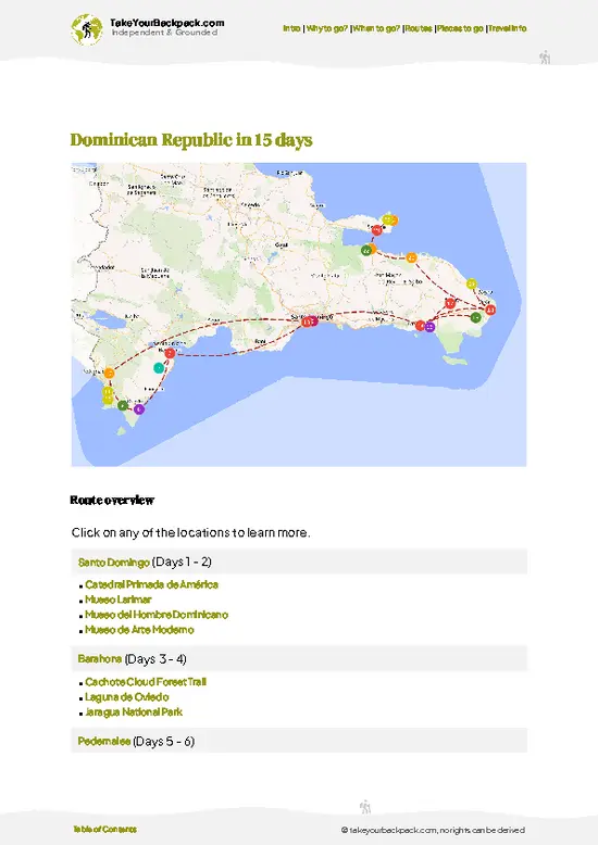
example page 0 from our offline Travel Guide for Dominican Republic
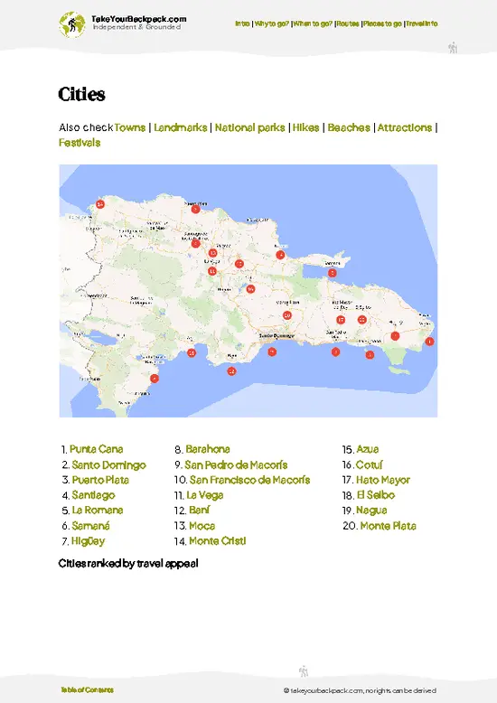
example page 1 from our offline Travel Guide for Dominican Republic
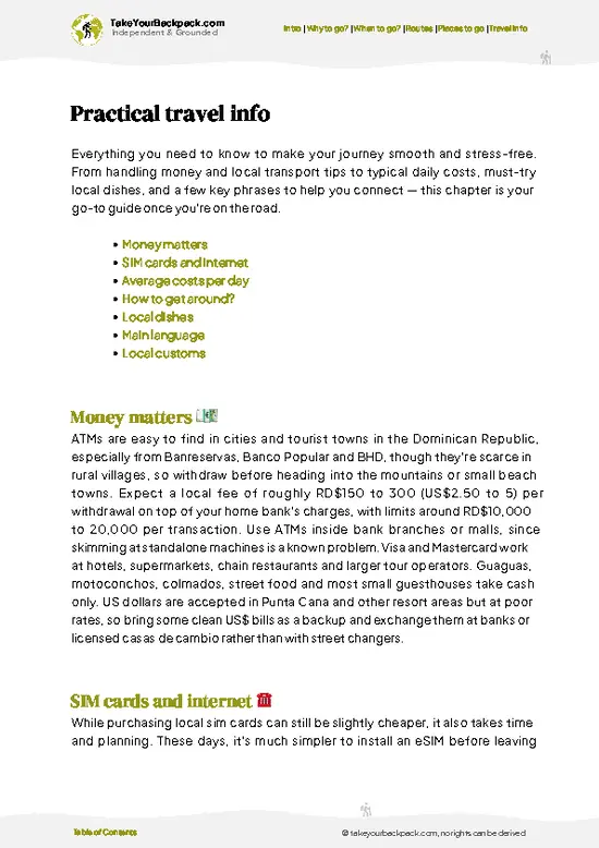
example page 2 from our offline Travel Guide for Dominican Republic
example page 3 from our offline Travel Guide for Dominican Republic
example page 4 from our offline Travel Guide for Dominican Republic
example page 5 from our offline Travel Guide for Dominican Republic
example page 6 from our offline Travel Guide for Dominican Republic
example page 7 from our offline Travel Guide for Dominican Republic
Loading the map 🌍
CLICK TO FILTER
cities
towns
landmarks
national parks
hikes
beaches
attractions
festivals
SHOW COUNTRY’S BESTSHOW ALL

✨ Why go?
Ranked #5 national park in Dominican Republic
What makes it a must-see national park

Sierra de Bahoruco National Park suits backpackers who prefer working out their own day over joining a bus tour, mostly because the tours barely exist. You get a mountain range where Hispaniolan endemic birds are the main attraction, and a few mornings with a guide can tick off species you will not see anywhere else in the Caribbean. The park also spans an unusual range of habitats, from dry thorn scrub near the lake to pine forest and damp cloud forest above 1,500 meters, so one trail can feel like three different countries. Camping and simple rural lodging in nearby villages keep daily costs low, and you meet people who actually live there. The trade-off is logistics: you need patience, some Spanish, and a flexible schedule. Self-guided travelers do best on the lower, well-known tracks, … read more 👉
Sierra de Bahoruco National Park suits backpackers who prefer working out their own day over joining a bus tour, mostly because the tours barely exist. You get a mountain range where Hispaniolan endemic birds are the main attraction, and a few mornings with a guide can tick off species you will not see anywhere else in the Caribbean. The park also spans an unusual range of habitats, from dry thorn scrub near the lake to pine forest and damp cloud forest above 1,500 meters, so one trail can feel like three different countries. Camping and simple rural lodging in nearby villages keep daily costs low, and you meet people who actually live there. The trade-off is logistics: you need patience, some Spanish, and a flexible schedule. Self-guided travelers do best on the lower, well-known tracks, then hire a local guide for anything deeper or closer to the border. Pack food and water, and enjoy the silence.

💡 HighlightsTop highlights of Sierra de Bahoruco

  1. Hispaniolan trogon and endemic birding: The park is among the best places on the island to see the national bird, the Hispaniolan trogon, plus the La Selle thrush, the white-necked crow, and several endemic warblers and tanagers.
  2. Cloud forest at higher elevations: Moss-draped trees, tree ferns, and constant mist create a cool, dripping world far from the coastal heat.
  3. Pine forest above Aguas Negras: Open stands of Hispaniolan pine with calm trails and good bird activity at dawn.
  4. Wild orchids: The range hosts many orchid species, and several are endemic to the island, with blooms most visible on shaded forest paths.
  5. Views over Lago Enriquillo: From the higher road sections, you can look down on the salt lake, the lowest point in the Caribbean, with a hazy desert-like basin around it.
  6. Dry forest
… read more 👉
  1. Hispaniolan trogon and endemic birding: The park is among the best places on the island to see the national bird, the Hispaniolan trogon, plus the La Selle thrush, the white-necked crow, and several endemic warblers and tanagers.
  2. Cloud forest at higher elevations: Moss-draped trees, tree ferns, and constant mist create a cool, dripping world far from the coastal heat.
  3. Pine forest above Aguas Negras: Open stands of Hispaniolan pine with calm trails and good bird activity at dawn.
  4. Wild orchids: The range hosts many orchid species, and several are endemic to the island, with blooms most visible on shaded forest paths.
  5. Views over Lago Enriquillo: From the higher road sections, you can look down on the salt lake, the lowest point in the Caribbean, with a hazy desert-like basin around it.
  6. Dry forest near the lake slopes: Cactus, thorny scrub, and different birds appear on the lower slopes, a sharp contrast with the damp upper forest.
  7. Hoyo de Pelempito: A dramatic escarpment drop at the edge of the park, with broad views over dry forest toward the sea on clear days.
For a first visit, Hoyo de Pelempito is the easiest win, since you can see it from the road without any serious hiking.
Spotted a mistake or missing something? Contact us.

Things to do near Sierra de Bahoruco National Park

Ratings based on Tripadvisor reviews. When you book through this link, you support our work at no extra cost to you.

🌤️ When to go?Best time to explore Sierra de Bahoruco

  • December to March: Cool, dry months and the most reliable for hiking. Lowland days run 28 to 32°C (82 to 90°F), while the pine forests above 1,200 m drop to 8 to 14°C (46 to 57°F) at night. Daylight lasts roughly 11 to 12 hours.
  • April to May: Humidity builds and afternoon storms begin, but trails stay passable and birding is excellent as species breed. Cloud often settles on the ridges by midday.
  • June to September: Hot and wet, with lowland highs of 33 to 36°C (91 to 97°F) and heavy afternoon downpours. Hurricane season peaks from August to October. Dirt tracks turn to mud, and some become impassable for ordinary vehicles.
  • October to November: Rain tapers off, forests are green and trails are quiet.
  • Crowds and prices: The park is lightly visited all year. Local guide and lodging rates barely move,
… read more 👉
  • December to March: Cool, dry months and the most reliable for hiking. Lowland days run 28 to 32°C (82 to 90°F), while the pine forests above 1,200 m drop to 8 to 14°C (46 to 57°F) at night. Daylight lasts roughly 11 to 12 hours.
  • April to May: Humidity builds and afternoon storms begin, but trails stay passable and birding is excellent as species breed. Cloud often settles on the ridges by midday.
  • June to September: Hot and wet, with lowland highs of 33 to 36°C (91 to 97°F) and heavy afternoon downpours. Hurricane season peaks from August to October. Dirt tracks turn to mud, and some become impassable for ordinary vehicles.
  • October to November: Rain tapers off, forests are green and trails are quiet.
  • Crowds and prices: The park is lightly visited all year. Local guide and lodging rates barely move, except around Christmas and Easter week, when Dominican families fill the towns.
Start hikes at first light, since cloud and rain build by early afternoon in nearly every month.


source: climatestotravel.comJANJanuary: excellent for travelingFEBFebruary: excellent for travelingMARMarch: excellent for travelingAPRApril: excellent for travelingMAYMay: good for travelingJUNJune: fair for travelingJULJuly: fair for travelingAUGAugust: fair for travelingSEPSeptember: fair for travelingOCTOctober: fair for travelingNOVNovember: highly recommended for travelingDECDecember: excellent for traveling
when-to-go

✈️ The backpacker research shortcutDominican Republic Travel Guide

An offline-friendly backpacking guide with optimized travel routes, ranked highlights, transport advice, and the best areas to stay.
example page 0 from our offline Travel Guide for Dominican Republic
example page 1 from our offline Travel Guide for Dominican Republic
example page 2 from our offline Travel Guide for Dominican Republic
example page 3 from our offline Travel Guide for Dominican Republic
example page 4 from our offline Travel Guide for Dominican Republic
example page 5 from our offline Travel Guide for Dominican Republic
example page 6 from our offline Travel Guide for Dominican Republic
example page 7 from our offline Travel Guide for Dominican Republic
The digital guide (336 pages) contains:
✅ 108 highlights, ranked by travel appeal
✅ Optimized 5, 10 & 15-day travel routes
✅ Cities, national parks, landmarks, beaches
✅ How to get around
✅ Offline-friendly for travel without Wi-Fi
👉 Click to see all 30+ guide features

📅 Plan smarter in minutes, not weeks
✅ Month by month travel advice
✅ Festivals & national holidays
✅ Budget expectations

🗺️ Go to the right places, skip the overrated ones
✅ Honest pros & cons of destinations
✅ Top hikes, parks & viewpoints
✅ Lesser-known places most travelers miss
✅ Clear “worth it vs skip it” guidance

🛏️ Travel smoothly without rookie mistakes
✅ Best areas to stay
✅ Transport systems explained simply
✅ Common scams & safety advice
✅ SIM cards, money & practical tips

🌍 Understand the country, not just visit it
✅ Culture & traditions
✅ 52 Essential phrases & customs
✅ Festivals worth planning around
✅ Traveler-friendly historical context
✅ Insights that make places more meaningful

📱 Built for real travel conditions
✅ Fully downloadable PDF
✅ Works completely offline
✅ Optimized for phone use
✅ Useful in remote areas & buses
✅ Everything in one place
Stop searching, start planning
Get instant access to your full guide. 30‑day money-back guarantee.
+ Add another guide for just

By proceeding you agree to our terms.
Sent to your inbox immediately after payment • 100% Secure Checkout
Best Backpacking Travel Advisor 2025 tourism awardBest Backpacking
Travel Advisor
2025
What others say about Take Your Backpack Guides:
⭐⭐⭐⭐⭐
Fantastic, amazing amount of information!
⭐⭐⭐⭐⭐
My goodness this is amazing, it's what I've been looking for hats off too you!
⭐⭐⭐⭐⭐
I think this is absolutely BRILLIANT
⭐⭐⭐⭐
Very complete and informative. It's still missing places, but I gotta to commend you
⭐⭐⭐⭐⭐
This is truly amazing, thank you, can't wait to explore it with my kids!
⭐⭐⭐⭐⭐
Awesome resource, thank you!
⭐⭐⭐⭐⭐
This is amazing! Can't wait to explore the ones I haven't seen
⭐⭐⭐⭐
I love this! Well done, great idea.
⭐⭐⭐⭐⭐
Thanks for taking the time to make this gem!
⭐⭐⭐⭐⭐
This might be the best website I've ever seen.
⭐⭐⭐⭐⭐
Congratulations, and thank you so much for your work; it's incredibly valuable.
⭐⭐⭐⭐
In all seriousness I think you did a great job pointing out the important spots
⭐⭐⭐⭐⭐
10/10 very good
⭐⭐⭐⭐⭐
As someone who's only just starting to visit regularly this is awesome, thank you.
⭐⭐⭐⭐
Thank you very much! I'm going to visit my dad, it's going to be very useful!
⭐⭐⭐⭐⭐
This is really cool! We'll be travelling for the first time and this definitely come in handy.
⭐⭐⭐⭐⭐
You are now our minister of culture, congratulations 👨‍💼
⭐⭐⭐⭐⭐
Just wanted to tell you that this is a pearl! Going to follow your recommendations.
⭐⭐⭐⭐⭐
This is so cool. I'll definitely be using the resource for my travels soon.
⭐⭐⭐⭐⭐
This is very impressive! Good work.
⭐⭐⭐⭐⭐
This is an amazing and informative site. Very well done!

🛏️ Where to stay?How to pick the right area

The best bases for Sierra de Bahoruco are Pedernales, Duvergé and Barahona, because there is no developed lodging inside the park. Pedernales (about 30 to 45 minutes from the Aguas Negras and Hoyo de Pelempito approaches) has simple hotels and guesthouses at roughly US$20 to 45 a night, plus restaurants and a few motos and guaguas for onward travel. It is the practical choice for the southern slopes and Hoyo de Pelempito, the huge limestone escarpment. Barahona, larger and about 2 hours from Pedernales, offers more variety, including hostel-style rooms from about US$12 to 25, and suits the coastal … read more 👉
The best bases for Sierra de Bahoruco are Pedernales, Duvergé and Barahona, because there is no developed lodging inside the park. Pedernales (about 30 to 45 minutes from the Aguas Negras and Hoyo de Pelempito approaches) has simple hotels and guesthouses at roughly US$20 to 45 a night, plus restaurants and a few motos and guaguas for onward travel. It is the practical choice for the southern slopes and Hoyo de Pelempito, the huge limestone escarpment. Barahona, larger and about 2 hours from Pedernales, offers more variety, including hostel-style rooms from about US$12 to 25, and suits the coastal side. Duvergé and Jimaní are smaller options for the northern flank near Lago Enriquillo, with basic rooms around US$15 to 30. For the cloud forest and best birding, the community of Aguas Negras and the pine-forest area above Puerto Escondido offer rustic cabins and ranger-run camping through local guides, so arrange these in advance through the park office or tour operators. Bring a tent or sleeping bag, food and water if you plan to overnight in the highlands, as there are no shops there. Book ahead around Christmas and Easter week.

👛 Costs (as of 23 October 2026)How expensive it really is

Sierra de Bahoruco National Park costs roughly US$55 to 114 a day for a backpacker using local guides and shared transport. The table below breaks down typical spending, with prices paid in Dominican pesos but shown here in US dollars.
CategoryBudget RangeLocal Reality
Entrance feeUS$2 to 4A small fee is charged at ranger posts, and it is paid in cash, so carry small bills.
Accommodation (high season)US$15 to 30Basic guesthouses in Pedernales, Duvergé or Barahona. Rustic cabins and camping inside the park cost less but need advance arrangement.
Local guideUS$20 to 40Needed for most trails and birding, with higher rates for 4x4 transport or full-day outings.
Local transportUS$8 to 20Guaguas run between towns for a few dollars. Moto-taxis or shared pickups cover the final stretch up to trailheads.
… read more 👉
Sierra de Bahoruco National Park costs roughly US$55 to 114 a day for a backpacker using local guides and shared transport. The table below breaks down typical spending, with prices paid in Dominican pesos but shown here in US dollars.
CategoryBudget RangeLocal Reality
Entrance feeUS$2 to 4A small fee is charged at ranger posts, and it is paid in cash, so carry small bills.
Accommodation (high season)US$15 to 30Basic guesthouses in Pedernales, Duvergé or Barahona. Rustic cabins and camping inside the park cost less but need advance arrangement.
Local guideUS$20 to 40Needed for most trails and birding, with higher rates for 4x4 transport or full-day outings.
Local transportUS$8 to 20Guaguas run between towns for a few dollars. Moto-taxis or shared pickups cover the final stretch up to trailheads.
Food and suppliesUS$10 to 20Comedores serve rice, beans and chicken for US$3 to 6. There are no shops in the highlands, so bring snacks and water.
Total Daily BudgetUS$55 to 114Sharing guide and vehicle costs with other travelers brings you toward the lower end.
⚠️ Prices can change and everyone travels differently, so take this as a rough guide. Hope it helps you plan your adventure!

🥾 TrailsWhere to hike in Sierra de Bahoruco: trails for every level

Sierra de Bahoruco National Park offers walking more than formal trekking, and most routes follow forest tracks, old logging roads, and paths used by local guides. Terrain ranges from dry scrub to steep pine slopes and slippery, muddy cloud forest, so footing matters more than fitness.
  • Pine forest tracks near Aguas Negras: Gentle to moderate walks of a few hours through open Hispaniolan pine, best for early birding, with mostly packed dirt underfoot.
  • Cloud forest paths: Moderate walks of half a day or more, damp and sometimes muddy, with ferns, mossy trunks, orchids, and the best chance of the trogon
… read more 👉
Sierra de Bahoruco National Park offers walking more than formal trekking, and most routes follow forest tracks, old logging roads, and paths used by local guides. Terrain ranges from dry scrub to steep pine slopes and slippery, muddy cloud forest, so footing matters more than fitness.
  • Pine forest tracks near Aguas Negras: Gentle to moderate walks of a few hours through open Hispaniolan pine, best for early birding, with mostly packed dirt underfoot.
  • Cloud forest paths: Moderate walks of half a day or more, damp and sometimes muddy, with ferns, mossy trunks, orchids, and the best chance of the trogon and thrush.
  • Escarpment viewpoint walks at Hoyo de Pelempito: Short, easy strolls along the rim, mainly for views over the valley and dry forest below.
  • Lower dry forest trails: Easy to moderate, hot, and exposed, so go early, with cacti, lizards, and different birds from the high forest.
  • Longer guided routes: Full-day outings deeper into the range, demanding but quiet, usually arranged locally with a guide who knows the border-adjacent areas.
Wildlife centers on birds, but you may also spot lizards, butterflies, and with luck the shy native hutia. Mornings are best, since mist often builds in the afternoon.
Getting to Sierra de Bahoruco National Park by public transport is slow, since buses run to towns on the edges, and you then need a motorcycle taxi, a hired driver, or a lift for the final stretch on rough roads. A rented vehicle with good clearance makes life far easier. Crowds are essentially absent, so you may walk for hours without seeing anyone. Park entry rules and fees vary by sector and are usually collected at a ranger post, so carry small cash. Bring layers, rain protection, water, and snacks, because services inside are minimal.
⚠️ Hiking info can sometimes be outdated or inaccurate. Before you hit the trail, check the latest conditions with locals. If you do spot anything that's off, I'd love to hear from you, so I can update it for fellow travelers.

🛡️ SafetyTraveler Safety Guide

Sierra de Bahoruco is a remote park with simple, low-risk hiking, and the main issues are logistics rather than danger. Trails are often unmarked and junctions are confusing, so hire a local guide (usually US$20 to 40 a day), who also helps with access to birding spots. The lowlands are hot and dry, with little shade, so start early and carry at least 3 liters of water. Highland mornings are cold and damp, and afternoon rain makes limestone and clay slick, so wear boots with grip and bring a light rain shell. Many access roads are rough, and a 4x4 or a motorbike with a driver is often needed after rain. Phone signal fades fast, so download offline maps and tell your lodging where you are going. Wildlife is not a hazard; you may meet the odd scorpion or snake, so shake out shoes and watch where … read more 👉
Sierra de Bahoruco is a remote park with simple, low-risk hiking, and the main issues are logistics rather than danger. Trails are often unmarked and junctions are confusing, so hire a local guide (usually US$20 to 40 a day), who also helps with access to birding spots. The lowlands are hot and dry, with little shade, so start early and carry at least 3 liters of water. Highland mornings are cold and damp, and afternoon rain makes limestone and clay slick, so wear boots with grip and bring a light rain shell. Many access roads are rough, and a 4x4 or a motorbike with a driver is often needed after rain. Phone signal fades fast, so download offline maps and tell your lodging where you are going. Wildlife is not a hazard; you may meet the odd scorpion or snake, so shake out shoes and watch where you place your hands. Keep your distance from nesting birds and leave no trash.

FAQFrequently asked questions about Sierra de Bahoruco

Two to three days is enough for Sierra de Bahoruco National Park if you want the main highlights. One day covers Hoyo de Pelempito and the Aguas Negras area from Pedernales, while a second day suits cloud forest birding at higher elevations. Add a third day if you plan to camp or combine it with Lago Enriquillo.
Visiting Sierra de Bahoruco National Park without a car is possible but slow. Guaguas run from Barahona and Santo Domingo to Pedernales and Duvergé for a few dollars, and from there moto-taxis or hired pickups (roughly US$15 to 40 a day) reach trailheads. Many roads are rough, so a local driver or guide is more practical than going alone.
Sierra de Bahoruco National Park charges a small entrance fee of around US$2 to 4, paid in cash at ranger posts or park offices. No separate hiking permit is usually required, though guides are recommended in remote areas. Fees may vary by sector, such as Hoyo de Pelempito or Aguas Negras, so carry small bills.
⚠️ Things can change over time, so always validate details locally before you go.

Other Dominican national parks near Sierra de Bahoruco

Explore more nearby:


💡 Not sure where to go next?
Create a personalized itinerary for Dominican Republic including Sierra de Bahoruco and the places that fit your trip.

Generate my itinerary

👉 Discover all national parks

Or checkout all Dominican Republic has to offer (think cities, towns, villages, national parks, hikes, beaches, festivals)
Country photo of Dominican Republic

We 💚 feedbackKey takeaways before you go

Sierra de Bahoruco National Park pairs naturally with a stop at Lago Enriquillo and the dry-forest drive toward Pedernales and the beaches of Bahía de las Águilas. I would do the mountains first for cool early mornings, then finish on the coast. Bring cash, a rain shell, and a driver who knows the roads.

✍️ Help improve this page!
The information on this page is based on in-depth research, insights shared by experienced travelers, and feedback from the local travel community in Dominican Republic. While every effort is made to keep the information accurate and current, conditions can change — so if you spot anything incorrect or outdated, please get in touch.


🙋‍♂️ Give feedback

👋 Meet the founderWho’s Behind Take Your Backpack?

Johan, backpacker and founder of TakeYourBackpackHi, I’m Johan (Netherlands 🇳🇱), the creator of TakeYourBackpack. Over the past 3 decades, I’ve backpacked through 90+ countries across six continents, gaining extensive experience with independent travel, long-term trips, and overland routes.

This site is built on a combination of firsthand travel experience and carefully curated insights from other backpackers. Many guides are based on places I’ve personally visited, while others bring together tips, observations, and practical advice shared by trusted travelers I’ve met along the way.

The goal is to provide realistic, experience-driven guidance — not generic itineraries — so you can explore destinations with better context, clearer expectations, and more confidence.