


×

Ecuador🇪🇨 | hikesInca Trail to IngapircaAchupallas to Ingapirca, Cobbled Inca road, Sacred Culebrillas lake, Wild camping | things to do and best time to go

Explore Laguna de CuicochaExplore Cajas National Park

Backpacking in Inca Trail to Ingapirca
👍 Recommendedhike ranked #3
By Johan Kruseman 🇳🇱 | Updated October 19, 2026

The Temple of the Sun at Ingapirca, where the trail ends, is an oval of tightly fitted stone, an Inca shape you rarely see. Inca Trail to Ingapirca runs through the southern highlands of Ecuador, north of Cuenca, from the páramo village of Achupallas to those ruins. It covers roughly 40 kilometers over three days of open grassland, with a sacred lake and stretches of original paved Inca road. The scenery is huge and empty, the camping is wild, and you can do it without a permit fuss. The downsides are real: marshy ground, patchy signs, and a tough start, since getting to Achupallas takes a bus change in Alausí and then a local ride. I stepped off that last truck onto a plaza of dogs and drying laundry, and a farmer simply pointed uphill at a wall of green. My legs were itching to go. You will love it if you like solitude and navigating by map. If you need marked huts and company, skip it.

Discover everything you want to know in the 📖 Ecuador Travel Guide.
Best time to go: June - September
Duration: 3 days
Distance: 40 kilometers
Total ascent: 1100 meters


example page 0 from our offline Travel Guide for Ecuador
example page 1 from our offline Travel Guide for Ecuador
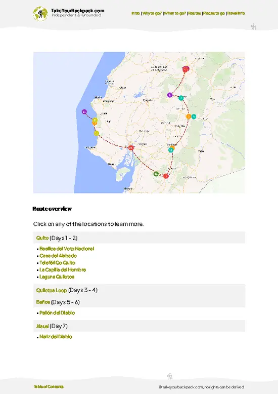
example page 2 from our offline Travel Guide for Ecuador
example page 3 from our offline Travel Guide for Ecuador
example page 4 from our offline Travel Guide for Ecuador
example page 5 from our offline Travel Guide for Ecuador
example page 6 from our offline Travel Guide for Ecuador
example page 7 from our offline Travel Guide for Ecuador
Loading the map 🌍
CLICK TO FILTER
cities
towns
landmarks
national parks
hikes
beaches
attractions
festivals
SHOW COUNTRY’S BESTSHOW ALL

✨ Why go?
Ranked #3 hike in Ecuador
The unique appeal for travelers

Inca Trail to Ingapirca gives you a real stretch of the Qhapaq Ñan, the Inca road system, for the price of a few bus rides and a tent. The stone-paved Inca road near Laguna Culebrillas is the draw. You are not looking at a museum label, you are walking on the same rock. The route also builds toward something. Three days of páramo, with almost nobody else around, finish at Ingapirca, the largest Inca site in Ecuador, so the walk has a proper ending rather than just a trailhead. Logistics suit a longer trip too. Both ends connect to the main highland bus lines, so you can fit it between Riobamba and Cuenca without backtracking. Distances are flexible. Strong hikers can compress it, and those who want to linger at the lake can stretch it. Costs stay low because there are no entry packages and … read more 👉
Inca Trail to Ingapirca gives you a real stretch of the Qhapaq Ñan, the Inca road system, for the price of a few bus rides and a tent. The stone-paved Inca road near Laguna Culebrillas is the draw. You are not looking at a museum label, you are walking on the same rock. The route also builds toward something. Three days of páramo, with almost nobody else around, finish at Ingapirca, the largest Inca site in Ecuador, so the walk has a proper ending rather than just a trailhead. Logistics suit a longer trip too. Both ends connect to the main highland bus lines, so you can fit it between Riobamba and Cuenca without backtracking. Distances are flexible. Strong hikers can compress it, and those who want to linger at the lake can stretch it. Costs stay low because there are no entry packages and no guide requirement, though a local guide from Achupallas is worth hiring if your navigation skills are shaky.

💡 HighlightsThe experiences that define the visit

  1. Ingapirca Ruins and the Temple of the Sun: This is the reason most people know the trail. The oval temple, built with mortar-free stonework, mixes Cañari and Inca design, and the finish line is walkable from the village. Entry is around US$6, and an hour or two covers the site.
  2. Laguna Culebrillas: A large, shallow lake high in the páramo, long regarded as sacred by the Cañari and Inca. Its winding shoreline gave it the name, meaning “little snake.” It makes the best campsite on the route, with reflections of the surrounding hills when the wind drops.
  3. The paved Inca road: Near the lake, long runs of original cobbled road survive, with edging stones and drainage channels still visible. Walking straight lines of fitted stone across empty grassland shows how seriously the Inca engineered this highway.
… read more 👉
  1. Ingapirca Ruins and the Temple of the Sun: This is the reason most people know the trail. The oval temple, built with mortar-free stonework, mixes Cañari and Inca design, and the finish line is walkable from the village. Entry is around US$6, and an hour or two covers the site.
  2. Laguna Culebrillas: A large, shallow lake high in the páramo, long regarded as sacred by the Cañari and Inca. Its winding shoreline gave it the name, meaning “little snake.” It makes the best campsite on the route, with reflections of the surrounding hills when the wind drops.
  3. The paved Inca road: Near the lake, long runs of original cobbled road survive, with edging stones and drainage channels still visible. Walking straight lines of fitted stone across empty grassland shows how seriously the Inca engineered this highway.
  4. Paredones ruins: A roadside Inca complex of walls and doorways near Culebrillas, used as a waystation for travelers and messengers. It is quiet, rarely visited, and lets you picture the logistics of the empire at ground level.
  5. Sangay National Park páramo: The trail crosses high grassland full of cushion plants, frailejones-like rosettes, and small ponds. Look for Andean foxes, wild horses, and condors overhead. The openness is the point, with wide horizons on all sides and no buildings.
For a first visit, start with the paved Inca road at Culebrillas, since it shows the whole story of the route in one stretch of stone.
Spotted a mistake or missing something? Contact us.

Things to do near Inca Trail to Ingapirca

Ratings based on Tripadvisor reviews. When you book through this link, you support our work at no extra cost to you.

🌤️ When to go?When to go for the best experience

Late October through February is the most dependable window for the Inca Trail to Ingapirca, when páramo mornings are often clear enough to see Culebrillas lake.
  • Late October to February: Driest stretch, with days of 10 to 15°C (50 to 59°F) and nights near 0 to 4°C (32 to 39°F) at the high camps. Fog still rolls in by afternoon. Expect only a few other hikers.
  • March to May: Wetter, with frequent drizzle and boggy tracks around the lake. Greener páramo, but slower walking and muddy tents.
  • June to August: Cold wind and low cloud on the heights, though some clear days appear. Inti Raymi around June 21 and summer holidays fill Ingapirca with visitors, and local guides and rooms book up.
  • September: Drier than July and August, with lighter foot traffic.
Daylight stays close to 12 hours all year, so start … read more 👉
Late October through February is the most dependable window for the Inca Trail to Ingapirca, when páramo mornings are often clear enough to see Culebrillas lake.
  • Late October to February: Driest stretch, with days of 10 to 15°C (50 to 59°F) and nights near 0 to 4°C (32 to 39°F) at the high camps. Fog still rolls in by afternoon. Expect only a few other hikers.
  • March to May: Wetter, with frequent drizzle and boggy tracks around the lake. Greener páramo, but slower walking and muddy tents.
  • June to August: Cold wind and low cloud on the heights, though some clear days appear. Inti Raymi around June 21 and summer holidays fill Ingapirca with visitors, and local guides and rooms book up.
  • September: Drier than July and August, with lighter foot traffic.
Daylight stays close to 12 hours all year, so start walking early to finish each stage in the light. Prices barely move with the seasons, but weekends at Ingapirca and national holidays are the times to book a guide ahead.


source: climatestotravel.comJANJanuary: fair for travelingFEBFebruary: fair for travelingMARMarch: fair for travelingAPRApril: fair for travelingMAYMay: fair for travelingJUNJune: highly recommended for travelingJULJuly: excellent for travelingAUGAugust: excellent for travelingSEPSeptember: highly recommended for travelingOCTOctober: fair for travelingNOVNovember: fair for travelingDECDecember: fair for traveling
ecuador-hike-inca-trail-to-ingapirca
© Google |

✈️ The backpacker research shortcutEcuador Travel Guide

An offline-friendly backpacking guide with optimized travel routes, ranked highlights, transport advice, and the best areas to stay.
example page 0 from our offline Travel Guide for Ecuador
example page 1 from our offline Travel Guide for Ecuador
example page 2 from our offline Travel Guide for Ecuador
example page 3 from our offline Travel Guide for Ecuador
example page 4 from our offline Travel Guide for Ecuador
example page 5 from our offline Travel Guide for Ecuador
example page 6 from our offline Travel Guide for Ecuador
example page 7 from our offline Travel Guide for Ecuador
The digital guide (274 pages) contains:
✅ 87 highlights, ranked by travel appeal
✅ Optimized 5, 10 & 15-day travel routes
✅ Cities, national parks, landmarks, beaches
✅ How to get around
✅ Offline-friendly for travel without Wi-Fi
👉 Click to see all 30+ guide features

📅 Plan smarter in minutes, not weeks
✅ Month by month travel advice
✅ Festivals & national holidays
✅ Budget expectations

🗺️ Go to the right places, skip the overrated ones
✅ Honest pros & cons of destinations
✅ Top hikes, parks & viewpoints
✅ Lesser-known places most travelers miss
✅ Clear “worth it vs skip it” guidance

🛏️ Travel smoothly without rookie mistakes
✅ Best areas to stay
✅ Transport systems explained simply
✅ Common scams & safety advice
✅ SIM cards, money & practical tips

🌍 Understand the country, not just visit it
✅ Culture & traditions
✅ 52 Essential phrases & customs
✅ Festivals worth planning around
✅ Traveler-friendly historical context
✅ Insights that make places more meaningful

📱 Built for real travel conditions
✅ Fully downloadable PDF
✅ Works completely offline
✅ Optimized for phone use
✅ Useful in remote areas & buses
✅ Everything in one place
Stop searching, start planning
Get instant access to your full guide. 30‑day money-back guarantee.
+ Add another guide for just

By proceeding you agree to our terms.
Sent to your inbox immediately after payment • 100% Secure Checkout
Best Backpacking Travel Advisor 2025 tourism awardBest Backpacking
Travel Advisor
2025
What others say about Take Your Backpack Guides:
⭐⭐⭐⭐⭐
Fantastic, amazing amount of information!
⭐⭐⭐⭐⭐
My goodness this is amazing, it's what I've been looking for hats off too you!
⭐⭐⭐⭐⭐
I think this is absolutely BRILLIANT
⭐⭐⭐⭐
Very complete and informative. It's still missing places, but I gotta to commend you
⭐⭐⭐⭐⭐
This is truly amazing, thank you, can't wait to explore it with my kids!
⭐⭐⭐⭐⭐
Awesome resource, thank you!
⭐⭐⭐⭐⭐
This is amazing! Can't wait to explore the ones I haven't seen
⭐⭐⭐⭐
I love this! Well done, great idea.
⭐⭐⭐⭐⭐
Thanks for taking the time to make this gem!
⭐⭐⭐⭐⭐
This might be the best website I've ever seen.
⭐⭐⭐⭐⭐
Congratulations, and thank you so much for your work; it's incredibly valuable.
⭐⭐⭐⭐
In all seriousness I think you did a great job pointing out the important spots
⭐⭐⭐⭐⭐
10/10 very good
⭐⭐⭐⭐⭐
As someone who's only just starting to visit regularly this is awesome, thank you.
⭐⭐⭐⭐
Thank you very much! I'm going to visit my dad, it's going to be very useful!
⭐⭐⭐⭐⭐
This is really cool! We'll be travelling for the first time and this definitely come in handy.
⭐⭐⭐⭐⭐
You are now our minister of culture, congratulations 👨‍💼
⭐⭐⭐⭐⭐
Just wanted to tell you that this is a pearl! Going to follow your recommendations.
⭐⭐⭐⭐⭐
This is so cool. I'll definitely be using the resource for my travels soon.
⭐⭐⭐⭐⭐
This is very impressive! Good work.
⭐⭐⭐⭐⭐
This is an amazing and informative site. Very well done!

🛏️ Where to stay?Best areas and accommodation options

If you enjoy meeting fellow travelers, consider choosing hostels with high ratings for atmosphere. On the other hand, if you prefer having your own space, a hotel might be a better option.

🥾 Hike detailsEverything you need to know before hiking Inca Trail to Ingapirca

Inca Trail to Ingapirca overview: The route follows the old Inca road from Achupallas to Ingapirca, passing through Sangay National Park.
Total Distance: About 40 kilometers one way.
Estimated Duration: Three days at a steady pace, with camping. Strong hikers can finish in two long days.
Difficulty: Moderate. The distance is manageable, but altitude between roughly 3,200 and 4,200 meters, boggy sections and thin signage make navigation harder than the numbers suggest. A GPS track and a map are strongly advised.
Starting Point: Achupallas, a village reached by bus to Alausí and then a local truck or
… read more 👉
Inca Trail to Ingapirca overview: The route follows the old Inca road from Achupallas to Ingapirca, passing through Sangay National Park.
Total Distance: About 40 kilometers one way.
Estimated Duration: Three days at a steady pace, with camping. Strong hikers can finish in two long days.
Difficulty: Moderate. The distance is manageable, but altitude between roughly 3,200 and 4,200 meters, boggy sections and thin signage make navigation harder than the numbers suggest. A GPS track and a map are strongly advised.
Starting Point: Achupallas, a village reached by bus to Alausí and then a local truck or shared ride. The finish at Ingapirca has buses toward Cañar and Cuenca.
Major Landmarks:
  • Achupallas valley: Farmland and the first climb into open páramo.
  • Laguna Culebrillas: The lake and main camping area.
  • Paredones: Inca ruins and old road sections nearby.
  • Ingapirca: The final site with the Temple of the Sun.
Terrain and Scenery: Rolling grassland, wet meadows, rocky ridges and cobbled old road. Views stay wide and open, with few trees to block them.
Vegetation: Tussock grass, cushion plants, low shrubs and patches of polylepis forest at lower elevations.
Wildlife: Andean foxes, wild horses, deer, many birds including Andean condors and carunculated caracaras. Llamas and cattle graze near the villages.
Practical Notes: Carry all your food, a stove and a warm sleeping bag. Water from streams needs treatment. Fog can erase the path, so leave early each day.
⚠️ Hiking info can sometimes be outdated or inaccurate. Before you hit the trail, check the latest conditions with locals. If you do spot anything that's off, I'd love to hear from you, so I can update it for fellow travelers.

🛡️ SafetyTraveler Safety Guide

The main hazard on the Inca Trail to Ingapirca is weather at altitude. The route climbs from Achupallas at about 3,200 m to roughly 4,000 m near Laguna Culebrillas, and cold rain, wind and fog can arrive within an hour, even on a bright morning. Pack a waterproof shell, warm layers, gloves and a sleeping bag rated to around -5°C (23°F). Walk slowly on day one to head off mild altitude headaches. The páramo is open and boggy with few landmarks, and fog erases the stone-paved sections, so a GPS track or a local guide is a real asset. Waterproof boots matter more than speed. Wild horses and llamas graze near the trail and are harmless if left alone. Condors and Andean foxes keep their distance. Carry all your food and water treatment, since villages are scarce after the first day, and tell your hostel your planned finish.

FAQCommon questions from travelers

The Inca Trail to Ingapirca from Achupallas to Ingapirca takes about 3 days of walking, covering roughly 40 to 45 km. Fit hikers sometimes squeeze it into 2 long days, while 4 days leaves room for Laguna Culebrillas and the Paredones ruins. Most groups camp near Culebrillas on the first or second night.
The Inca Trail to Ingapirca is moderate overall, with no technical climbing but real altitude and weather exposure. It stays between about 3,100 and 4,200 m, with long boggy páramo stretches and cold nights near freezing. Expect 6 to 8 hours of walking on the longest day, so it suits hikers with some multi-day experience.
The Inca Trail to Ingapirca has no mandatory permit for walking it, though a guide is strongly advised for navigation in fog. Local guides in Achupallas, Cañar or Cuenca usually charge about US$50 to 90 per day, and mules cost extra. Entry to the Ingapirca archaeological site at the finish is roughly US$6 for foreign adults.
⚠️ Things can change over time, so always validate details locally before you go.

Other Ecuadorian hikes near Inca Trail to Ingapirca

Explore more nearby:

  • El Altar—Emerald Laguna Amarilla, Collanes wild horses, Collapsed caldera, Muddy two-day trek| 79 km away
  • Quilotoa Loop—Village-to-village, Sigüi canyon, Hostel dinners, 3,900 m crater| 176 km away
  • Laguna de Cuicocha—14 km rim loop, Twin lake islands, Cotacachi views, Steaming fumaroles| 291 km away

💡 Not sure where to go next?
Create a personalized itinerary for Ecuador including Inca Trail to Ingapirca and the places that fit your trip.

Generate my itinerary

👉 Discover all hikes

Or checkout all Ecuador has to offer (think cities, towns, villages, national parks, hikes, beaches, festivals)
Country photo of Ecuador

We 💚 feedbackParting advice and final tips

Inca Trail to Ingapirca suits self-reliant hikers who want history underfoot and no crowds, and it frustrates anyone expecting marked paths and mountain huts. I would carry a GPS track, hire a local guide in Achupallas if the weather looks doubtful, and save the Ingapirca ruins for the final afternoon.

✈️ When did I visit Ecuador?
Ecuador I visited during my half year trip through South and Central America back in 2003

✍️ Help improve this page!
The information on this page is based on my own backpacking experience in Ecuador, supplemented with up-to-date research and feedback from other travelers. Travel details can change, so if you notice anything outdated or incomplete, feel free to let me know.


🙋‍♂️ Give feedback

👋 Meet the founderWho’s Behind Take Your Backpack?

Johan, backpacker and founder of TakeYourBackpackHi, I’m Johan (Netherlands 🇳🇱), the creator of TakeYourBackpack. Over the past 3 decades, I’ve backpacked through 90+ countries across six continents, gaining extensive experience with independent travel, long-term trips, and overland routes.

This site is built on a combination of firsthand travel experience and carefully curated insights from other backpackers. Many guides are based on places I’ve personally visited, while others bring together tips, observations, and practical advice shared by trusted travelers I’ve met along the way.

The goal is to provide realistic, experience-driven guidance — not generic itineraries — so you can explore destinations with better context, clearer expectations, and more confidence.