
×

Kiribati🇰🇮 | regionsTarawa AtollBetio bunkers, rusted guns, causeway road, maneaba halls, fish stalls | things to do and best time to go

Explore MakinExplore North Tarawa

Backpacking in Tarawa Atoll
🏆 Top pickregion ranked #1
By Johan Kruseman 🇳🇱 | Updated October 15, 2026

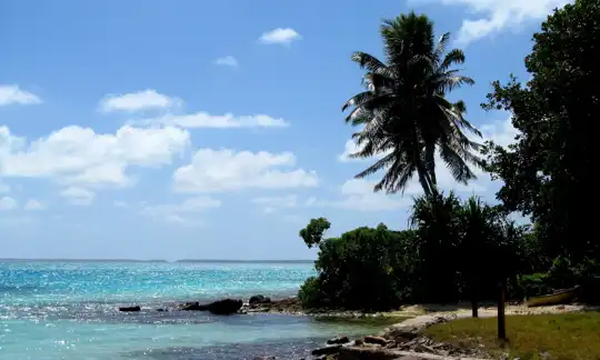
Tarawa Atoll is the one place in Kiribati where you can reach the international airport, the main shops, the ferry to the outer islands and the war relics in a single day without a flight in between. It lies in the west of the Gilbert Islands, a thin, bent ring of land in the central Pacific, and South Tarawa is the capital district. Be clear about what you are getting. This is not a resort. The lagoon is shallow and often murky near Bairiki and Betio, rubbish collects along the road, and the single causeway road is packed with minibuses and dogs. What earns your time is Betio’s Japanese bunkers, rusted guns and wrecks, the maneaba meeting houses, and the people, who greet you with a loud “Mauri.” Skip any hope of nightlife or polished sights. The light at dawn is flat gold on the lagoon, and the smell of frying fish, coconut husk smoke and low tide drifts across the road, which in places is only a few dozen meters wide between ocean and lagoon.

Discover everything you want to know in the 📖 Kiribati Travel Guide.


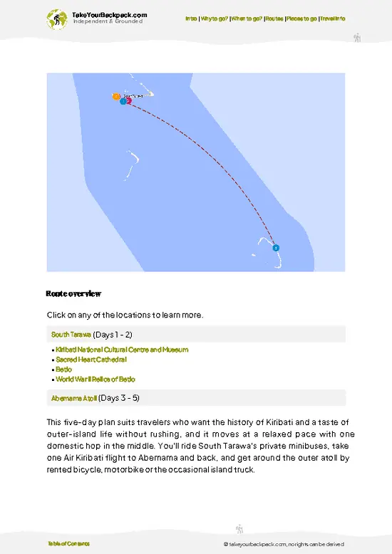
example page 0 from our offline Travel Guide for Kiribati
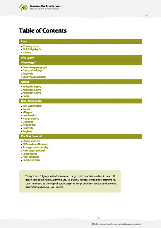
example page 1 from our offline Travel Guide for Kiribati
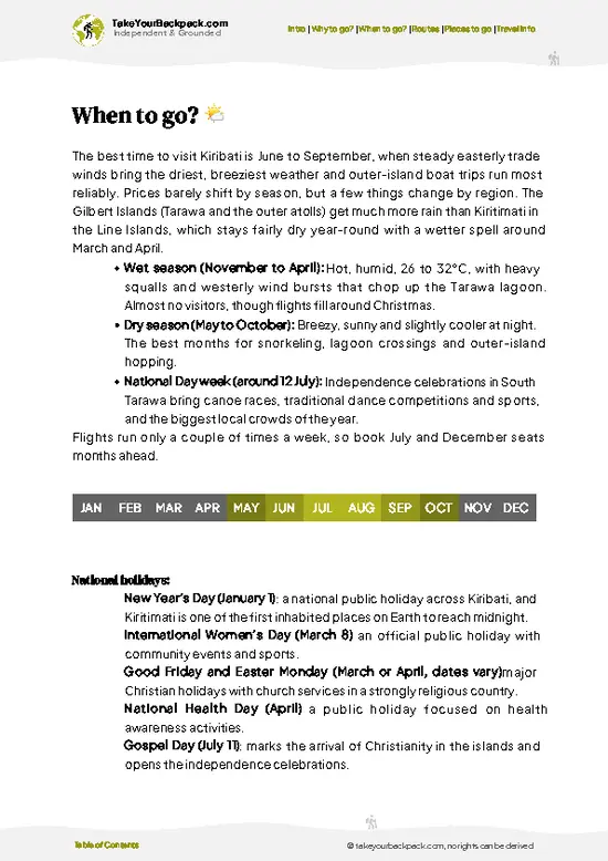
example page 2 from our offline Travel Guide for Kiribati
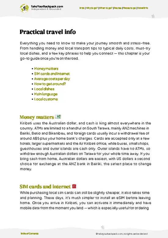
example page 3 from our offline Travel Guide for Kiribati
example page 4 from our offline Travel Guide for Kiribati
example page 5 from our offline Travel Guide for Kiribati
example page 6 from our offline Travel Guide for Kiribati
example page 7 from our offline Travel Guide for Kiribati
Loading the map 🌍
CLICK TO FILTER
towns
villages
landmarks
national parks
beaches
attractions
festivals
regions
SHOW COUNTRY’S BESTSHOW ALL

✨ Why go?
Ranked #1 region in Kiribati
The unique appeal for travelers

Come for the history that sits in plain sight. In November 1943 the Battle of Tarawa killed thousands of Japanese, Korean and American troops on tiny Betio in about 76 hours, and the island still carries the evidence. You can climb on concrete bunkers, touch corroded coastal guns and walk past rusting landing craft without a ticket booth or a rope. Few Pacific battlefields feel this unmanaged, and that rawness is the point.

Come also because Tarawa is the gateway to I-Kiribati life as it is lived, not staged. Families gather in open-sided maneabas, kids swim off the causeway at high tide, and you will be invited into conversations you did not plan. Kiribati sees very few visitors, so you get real curiosity rather than sales pitches.

It also makes sense as a base for a bigger Pacific loop. … read more 👉
Come for the history that sits in plain sight. In November 1943 the Battle of Tarawa killed thousands of Japanese, Korean and American troops on tiny Betio in about 76 hours, and the island still carries the evidence. You can climb on concrete bunkers, touch corroded coastal guns and walk past rusting landing craft without a ticket booth or a rope. Few Pacific battlefields feel this unmanaged, and that rawness is the point.

Come also because Tarawa is the gateway to I-Kiribati life as it is lived, not staged. Families gather in open-sided maneabas, kids swim off the causeway at high tide, and you will be invited into conversations you did not plan. Kiribati sees very few visitors, so you get real curiosity rather than sales pitches.

It also makes sense as a base for a bigger Pacific loop. Tarawa has the international airport and the links to outer islands such as Abaiang, where village stays are simpler and the lagoon is clearer. Treat Tarawa as the entry point and the history stop, then head out if time allows.

💡 HighlightsDon't-miss highlights and experiences

  1. Betio Battlefield Sites: The tiny western tip of the atoll is where the 1943 battle was fought, and Japanese bunkers, gun emplacements and rusted guns still line the shore. Walking the beaches here is the main reason most visitors come.
  2. Japanese Command Bunker (Admiral Shibasaki’s Bunker): A huge concrete and coconut-log structure in Betio, it is among the largest surviving fortifications. You can climb on top and look at the damage left by naval shells and assaults.
  3. Red Beach and the Betio Pier Area: This is where the Marines landed and met heavy fire across the reef. At low tide the exposed reef flat shows how far troops had to wade.
  4. Coastal Defense Guns: Large guns, reportedly Vickers guns bought from Britain by Japan, still point out to sea from Betio. Their scale makes the defenders’ strategy
… read more 👉
  1. Betio Battlefield Sites: The tiny western tip of the atoll is where the 1943 battle was fought, and Japanese bunkers, gun emplacements and rusted guns still line the shore. Walking the beaches here is the main reason most visitors come.
  2. Japanese Command Bunker (Admiral Shibasaki’s Bunker): A huge concrete and coconut-log structure in Betio, it is among the largest surviving fortifications. You can climb on top and look at the damage left by naval shells and assaults.
  3. Red Beach and the Betio Pier Area: This is where the Marines landed and met heavy fire across the reef. At low tide the exposed reef flat shows how far troops had to wade.
  4. Coastal Defense Guns: Large guns, reportedly Vickers guns bought from Britain by Japan, still point out to sea from Betio. Their scale makes the defenders’ strategy easy to grasp.
  5. Bairiki Government Area: The seat of government has ministries and small offices. It is quiet, and a good place to see the administrative heart of Kiribati.
  6. Maneaba Meeting Houses: These large open-sided halls with steep thatched roofs are community centers, where seating positions follow clan traditions. Visitors should wait to be invited and sit low.
  7. The Causeways and Lagoon Edges: Roads linking islets give cinematic views of lagoon and ocean on either side. Locals swim and fish here at high tide, and sunset light is the best for photos.
  8. Local Markets and Fish Stalls: Small stalls sell fresh tuna, coconut toddy products and baked pandanus goods. The sensory mix of smoke, salt and chatter shows daily island life.
Start at Betio in the morning, before the heat and the traffic build, because the sites are open, shadeless and best seen while the light is soft and the tide is lower.
Spotted a mistake or missing something? Contact us.

⌛️ 5 daysA smart one-week plan

Day 1: Bonriki: Start at Bonriki, where the international airport sits at the southeast end of South Tarawa, because every flight lands here and the single causeway-and-road spine of the atoll begins here. Drop your bag, then walk the airstrip edge and the nearby Japanese-era pillboxes before the heat builds. Everything on the atoll hangs off one road, so the minibus (a shared, hop-on, hop-off van) sets your pace: flag one down anywhere, ride in either direction, and accept that schedules are loose.
Day 2: Betio: Head west the full length of the atoll to Betio, the tip of the chain and the site of the 1943 battle. Going early matters, since the wartime relics are exposed to the sun: Japanese guns, bunkers and the command post, plus rusting landing debris along the beach. Spend the afternoon … read more 👉
Day 1: Bonriki: Start at Bonriki, where the international airport sits at the southeast end of South Tarawa, because every flight lands here and the single causeway-and-road spine of the atoll begins here. Drop your bag, then walk the airstrip edge and the nearby Japanese-era pillboxes before the heat builds. Everything on the atoll hangs off one road, so the minibus (a shared, hop-on, hop-off van) sets your pace: flag one down anywhere, ride in either direction, and accept that schedules are loose.
Day 2: Betio: Head west the full length of the atoll to Betio, the tip of the chain and the site of the 1943 battle. Going early matters, since the wartime relics are exposed to the sun: Japanese guns, bunkers and the command post, plus rusting landing debris along the beach. Spend the afternoon at the lagoon-side shore, where kids swim off the pier at high tide. Sleep nearby so you skip the late-day crush of vans heading back east.
Day 3: Bairiki and Nanikai: Ride back east to Bairiki, the government center, for the small national museum, the market stalls and the maneaba (the open-sided meeting house) near the parliament. Use the afternoon to continue to the causeway areas around Nanikai, where the lagoon opens up and the road runs low between water on both sides. Moving in short hops keeps you from fighting the van system.
Day 4: Detour to Abaokoro: Cross the Nippon Causeway beyond Bonriki to the northern islets (Buota and beyond), where the road thins into villages, fishing platforms and quiet shallows. You return the same way, so nothing breaks your onward plan. Carry water and food, because shops are few.
Day 5: Tabiteuea Road and Departure: Spend the last morning at Bonriki's lagoon shore, then check in early for your flight, since schedules can shift.
If one day justifies the trip, make it Day 2. Standing among the Betio bunkers, with the lagoon sparkling just beyond the wreckage, tells the story of the Pacific War and of everyday life here more clearly than anywhere else on the atoll.

🌤️ When to go?Weather, crowds, and seasonal trade-offs

  • Drier months (roughly May to October): Trade winds keep South Tarawa at 27 to 31°C (81 to 88°F), and the lagoon is calmer for boat trips and swimming. Rain still falls in short bursts. Daylight runs about 12 hours, with sunrise between about 6:10 and 6:40 am and sunset between about 6:15 and 6:45 pm, so plan activities for the morning.
  • Wetter months (roughly November to April): Heavier squalls arrive, humidity climbs, and the same 27 to 31°C range feels stickier. Winds drop, which can make the lagoon glassy but the air heavier. Flights and boats can shift with the weather.
  • Crowds and prices: Visitors are few in every month. Accommodation and flight prices stay fairly flat, though airfares rise around Christmas and when I-Kiribati families travel home. Independence Day on July 12 brings dancing,
… read more 👉
  • Drier months (roughly May to October): Trade winds keep South Tarawa at 27 to 31°C (81 to 88°F), and the lagoon is calmer for boat trips and swimming. Rain still falls in short bursts. Daylight runs about 12 hours, with sunrise between about 6:10 and 6:40 am and sunset between about 6:15 and 6:45 pm, so plan activities for the morning.
  • Wetter months (roughly November to April): Heavier squalls arrive, humidity climbs, and the same 27 to 31°C range feels stickier. Winds drop, which can make the lagoon glassy but the air heavier. Flights and boats can shift with the weather.
  • Crowds and prices: Visitors are few in every month. Accommodation and flight prices stay fairly flat, though airfares rise around Christmas and when I-Kiribati families travel home. Independence Day on July 12 brings dancing, canoe races and sports, with the busiest festive atmosphere.
  • Fishing and diving: Bonefishing and lagoon snorkeling work in most months, with clearer water in calmer, drier weather. Outer-ocean swells can be bigger from December to March.
Book flights early, since services into Bonriki are limited to a few a week and seats fill around July.


source: climatestotravel.comJANJanuary: fair for travelingFEBFebruary: fair for travelingMARMarch: fair for travelingAPRApril: fair for travelingMAYMay: highly recommended for travelingJUNJune: excellent for travelingJULJuly: excellent for travelingAUGAugust: excellent for travelingSEPSeptember: excellent for travelingOCTOctober: highly recommended for travelingNOVNovember: fair for travelingDECDecember: fair for traveling
when-to-go

✈️ The backpacker research shortcutKiribati Travel Guide

An offline-friendly backpacking guide with optimized travel routes, ranked highlights, transport advice, and the best areas to stay.
example page 0 from our offline Travel Guide for Kiribati
example page 1 from our offline Travel Guide for Kiribati
example page 2 from our offline Travel Guide for Kiribati
example page 3 from our offline Travel Guide for Kiribati
example page 4 from our offline Travel Guide for Kiribati
example page 5 from our offline Travel Guide for Kiribati
example page 6 from our offline Travel Guide for Kiribati
example page 7 from our offline Travel Guide for Kiribati
The digital guide (120 pages) contains:
✅ 25 highlights, ranked by travel appeal
✅ Optimized 2, 3 & 5-day travel routes
✅ Cities, national parks, landmarks, beaches
✅ How to get around
✅ Offline-friendly for travel without Wi-Fi
👉 Click to see all 30+ guide features

📅 Plan smarter in minutes, not weeks
✅ Month by month travel advice
✅ Festivals & national holidays
✅ Budget expectations

🗺️ Go to the right places, skip the overrated ones
✅ Honest pros & cons of destinations
✅ Top hikes, parks & viewpoints
✅ Lesser-known places most travelers miss
✅ Clear “worth it vs skip it” guidance

🛏️ Travel smoothly without rookie mistakes
✅ Best areas to stay
✅ Transport systems explained simply
✅ Common scams & safety advice
✅ SIM cards, money & practical tips

🌍 Understand the country, not just visit it
✅ Culture & traditions
✅ 52 Essential phrases & customs
✅ Festivals worth planning around
✅ Traveler-friendly historical context
✅ Insights that make places more meaningful

📱 Built for real travel conditions
✅ Fully downloadable PDF
✅ Works completely offline
✅ Optimized for phone use
✅ Useful in remote areas & buses
✅ Everything in one place
Stop searching, start planning
Get instant access to your full guide. 30‑day money-back guarantee.
+ Add another guide for just

By proceeding you agree to our terms.
Sent to your inbox immediately after payment • 100% Secure Checkout
Best Backpacking Travel Advisor 2025 tourism awardBest Backpacking
Travel Advisor
2025
What others say about Take Your Backpack Guides:
⭐⭐⭐⭐⭐
Fantastic, amazing amount of information!
⭐⭐⭐⭐⭐
My goodness this is amazing, it's what I've been looking for hats off too you!
⭐⭐⭐⭐⭐
I think this is absolutely BRILLIANT
⭐⭐⭐⭐
Very complete and informative. It's still missing places, but I gotta to commend you
⭐⭐⭐⭐⭐
This is truly amazing, thank you, can't wait to explore it with my kids!
⭐⭐⭐⭐⭐
Awesome resource, thank you!
⭐⭐⭐⭐⭐
This is amazing! Can't wait to explore the ones I haven't seen
⭐⭐⭐⭐
I love this! Well done, great idea.
⭐⭐⭐⭐⭐
Thanks for taking the time to make this gem!
⭐⭐⭐⭐⭐
This might be the best website I've ever seen.
⭐⭐⭐⭐⭐
Congratulations, and thank you so much for your work; it's incredibly valuable.
⭐⭐⭐⭐
In all seriousness I think you did a great job pointing out the important spots
⭐⭐⭐⭐⭐
10/10 very good
⭐⭐⭐⭐⭐
As someone who's only just starting to visit regularly this is awesome, thank you.
⭐⭐⭐⭐
Thank you very much! I'm going to visit my dad, it's going to be very useful!
⭐⭐⭐⭐⭐
This is really cool! We'll be travelling for the first time and this definitely come in handy.
⭐⭐⭐⭐⭐
You are now our minister of culture, congratulations 👨‍💼
⭐⭐⭐⭐⭐
Just wanted to tell you that this is a pearl! Going to follow your recommendations.
⭐⭐⭐⭐⭐
This is so cool. I'll definitely be using the resource for my travels soon.
⭐⭐⭐⭐⭐
This is very impressive! Good work.
⭐⭐⭐⭐⭐
This is an amazing and informative site. Very well done!

🛏️ Where to stay?Best areas and accommodation options

South Tarawa is the only practical base, and the best stretch for backpackers is Betio and the nearby Bairiki and Nawerewere area. Betio sits at the western tip and is the most lively, with the densest cluster of shops, small eateries, and the WWII relics (Japanese guns, bunkers, wrecked landing craft) within walking distance. Guesthouses here are simple, often with fans or basic air-conditioning, and you can meet other travelers, mostly aid workers, divers and history-minded visitors, over a shared meal. Bairiki and Nawerewere, in the middle of the atoll, put you close to government offices, … read more 👉
South Tarawa is the only practical base, and the best stretch for backpackers is Betio and the nearby Bairiki and Nawerewere area. Betio sits at the western tip and is the most lively, with the densest cluster of shops, small eateries, and the WWII relics (Japanese guns, bunkers, wrecked landing craft) within walking distance. Guesthouses here are simple, often with fans or basic air-conditioning, and you can meet other travelers, mostly aid workers, divers and history-minded visitors, over a shared meal. Bairiki and Nawerewere, in the middle of the atoll, put you close to government offices, the main supermarkets, the post office, and the bus route along the single main road. These are quieter, with more lagoon-side guesthouses, and make a sensible choice if you want calm evenings. Bikenibeu, further east, has a lived-in village feel, a big market and easier access to the airport at Bonriki, so it suits late flights and early departures. Accommodation anywhere on South Tarawa is limited, so book ahead and confirm airport pickup. Safety is generally good by day, but walk in groups after dark, take care on the road where minibuses drive fast, and avoid swimming close to the causeways and the polluted shoreline near densely populated areas. Homestays through local contacts offer the most social setup if you can arrange one.

🚌 Getting aroundHow to get from A to B

Visitors lose the most time by waiting for a bus at a stop that isn’t where the minibuses actually pull over, or by assuming a schedule exists. On South Tarawa there is none: you stand beside the single main road, raise a hand, and the next minibus or van stops. Everything from Betio to Bonriki airport runs along that one strip of sealed road, roughly 35 km end to end, and flagging works well from early morning until about dusk. North Tarawa is another matter, and it takes planning.

  • Minibuses and vans: Fares run about US$0.50 to 1 for most hops, and the full Betio-to-airport ride takes 1 to 1.5 hours in traffic. Expect loud island music, shared laps and a warm breeze through open windows. You get the whole lagoon-and-ocean sweep of the causeway views for pocket change.
  • Taxis: Short rides within
… read more 👉
Visitors lose the most time by waiting for a bus at a stop that isn’t where the minibuses actually pull over, or by assuming a schedule exists. On South Tarawa there is none: you stand beside the single main road, raise a hand, and the next minibus or van stops. Everything from Betio to Bonriki airport runs along that one strip of sealed road, roughly 35 km end to end, and flagging works well from early morning until about dusk. North Tarawa is another matter, and it takes planning.

  • Minibuses and vans: Fares run about US$0.50 to 1 for most hops, and the full Betio-to-airport ride takes 1 to 1.5 hours in traffic. Expect loud island music, shared laps and a warm breeze through open windows. You get the whole lagoon-and-ocean sweep of the causeway views for pocket change.
  • Taxis: Short rides within Betio or Bairiki cost around US$3 to 8, and you agree the price before you climb in. They are the sensible choice after dark, when minibuses thin out and the road goes pitch black. You arrive dry and unhassled for the late-night meal or the airport run.
  • Bicycle: Rentals are informal and arranged through guesthouses, and the flat road makes it easy. Roads are potholed in patches, with dogs, pigs and children sharing the shoulder. You roll past village maneabas and see the lagoon flash between the palms at your own pace.
  • Boats to North Tarawa: Water taxis and small motorboats leave from the Bairiki and Buota area, often US$5 to 15 per person depending on the destination and group size, and the trip takes 30 to 90 minutes. Tides decide the route, so you may wade the last stretch through warm, knee-deep shallows. You land in quiet villages where homestays serve fresh fish and coconut.
  • Walking: Within Betio, the World War II relics (rusting guns, bunkers and wrecks) sit close together and are easy to cover on foot. The sun is fierce and the air smells of salt, smoke and drying fish. You stand beside the old seawall guns with the reef just beyond.

Start early, carry small coins, and tell the driver where you want to stop by calling out or tapping the roof, since there are no fixed stops.

👛 Costs (as of 15 October 2026)How expensive it really is

Budget about US$65 a day on Tarawa Atoll if you stay in a basic guesthouse in high season, and the number climbs fast if you want air-conditioning or a lagoon-view room. Everything is imported, so food and fuel cost more than in most Pacific islands. Travelers pay in Australian dollars, which circulate as the local currency, and cash matters because card acceptance is patchy outside the few hotels and the main supermarkets.
CategoryBudget RangeLocal Reality
Accommodation (high season, June to October)US$35 to 60Simple guesthouse rooms with a fan sit at the low end. Rooms with air-conditioning and a private bathroom, mostly on South Tarawa, cost more. Rates ease slightly in the wetter months.
FoodUS$12 to 22Fish, rice, and breadfruit are staples in small local cafes. Imported groceries such as
… read more 👉
Budget about US$65 a day on Tarawa Atoll if you stay in a basic guesthouse in high season, and the number climbs fast if you want air-conditioning or a lagoon-view room. Everything is imported, so food and fuel cost more than in most Pacific islands. Travelers pay in Australian dollars, which circulate as the local currency, and cash matters because card acceptance is patchy outside the few hotels and the main supermarkets.
CategoryBudget RangeLocal Reality
Accommodation (high season, June to October)US$35 to 60Simple guesthouse rooms with a fan sit at the low end. Rooms with air-conditioning and a private bathroom, mostly on South Tarawa, cost more. Rates ease slightly in the wetter months.
FoodUS$12 to 22Fish, rice, and breadfruit are staples in small local cafes. Imported groceries such as fresh vegetables, cheese, and fruit are pricey and sometimes unavailable between shipments.
Local transportUS$1 to 4Minivan buses run along the causeway road between Betio and Bairiki, and fares are a flat low amount per ride. A taxi across South Tarawa costs roughly US$5 to 12.
Sights and activitiesUS$0 to 15The Betio war relics, including the sunken guns and bunkers, can be visited free or for a small guide fee. Lagoon boat trips and fishing outings cost roughly US$30 to 80 when shared.
Water and extrasUS$3 to 6Bottled or boiled water is the safe choice. Mobile data and SIM cards are available but slow and relatively costly.
Total Daily BudgetUS$51 to 107Planning on about US$65 covers a basic room, local meals, buses, and one small activity.
⚠️ Prices can change and everyone travels differently, so take this as a rough guide. Hope it helps you plan your adventure!

🍲 FoodLocal Flavors for Backpackers

Fish is the backbone of every meal on Tarawa Atoll. Look for grilled or raw tuna and reef fish, often served with rice and a sharp splash of lime. Palusami, taro leaves baked in coconut cream, is soft, rich and a little smoky from the cooking fire. Breadfruit shows up roasted or boiled, starchy and sweet. The famous drink is toddy, sap from the coconut flower, sold fresh and mildly sweet or fermented into something sour with a kick. A young green coconut costs about US$0.50 to 1 and is the best way to beat the heat.

For casual eating, small local cafés in Betio and Bairiki serve plates of fish, rice and chop suey for about US$4 to 8. You will also find fresh bread and fried doughnuts from roadside stalls and noodle-heavy canteens stocked from imported goods, so variety is limited and fresh … read more 👉
Fish is the backbone of every meal on Tarawa Atoll. Look for grilled or raw tuna and reef fish, often served with rice and a sharp splash of lime. Palusami, taro leaves baked in coconut cream, is soft, rich and a little smoky from the cooking fire. Breadfruit shows up roasted or boiled, starchy and sweet. The famous drink is toddy, sap from the coconut flower, sold fresh and mildly sweet or fermented into something sour with a kick. A young green coconut costs about US$0.50 to 1 and is the best way to beat the heat.

For casual eating, small local cafés in Betio and Bairiki serve plates of fish, rice and chop suey for about US$4 to 8. You will also find fresh bread and fried doughnuts from roadside stalls and noodle-heavy canteens stocked from imported goods, so variety is limited and fresh vegetables are scarce. Homestays on North Tarawa usually include meals, cooked over open fires and smelling of wood smoke and coconut.

When invited into a home, accept food graciously and eat what is offered, as refusing can seem rude. Meals are often shared on mats on the floor, so remove your shoes. Alcohol is limited in some villages, so ask first.

FAQFrequently asked questions about Tarawa Atoll

Tarawa Atoll is the capital atoll of Kiribati, a ring of low coral islets around a large lagoon in the central Pacific. South Tarawa, linked by causeways from Betio to Bonriki, holds roughly half the country’s population of about 120,000. Its main draws are the WWII battlefield at Betio, where the 1943 Battle of Tarawa was fought, and the lagoon.
Two to four days covers South Tarawa comfortably. One day is enough for the Betio war relics, including Japanese bunkers, guns and the landing beaches. A second day suits a lagoon trip or village visits, and a third or fourth fits fishing or a trip to North Tarawa.
Fly into Bonriki International Airport on South Tarawa, which is served by Fiji Airways from Nadi (about 3 hours, a few flights a week) and by Nauru Airlines from Brisbane via Nauru and Majuro. From the airport, taxis and minibuses reach Betio in about 30 to 60 minutes along the single main road. Most nationalities need to arrange entry details and a return ticket before travel.
⚠️ Things can change over time, so always validate details locally before you go.

Other I-Kiribati regions near Tarawa Atoll

Explore more nearby:

  • North Tarawa—Low-tide Abatao crossing, Buariki relics, village guesthouses, reef gleaning| 6 km away
  • South Tarawa—Betio bunkers, Red Beach, minibus rides, Bikenibeu museum| 14 km away
  • Abaiang—Wade-in landings, lagoon sandbars, village homestays, Sunday hymns| 42 km away

💡 Not sure where to go next?
Create a personalized itinerary for Kiribati including Tarawa Atoll and the places that fit your trip.

Generate my itinerary

👉 Discover all regions

Or checkout all Kiribati has to offer (think cities, towns, villages, national parks, hikes, beaches, festivals)
Country photo of Kiribati

We 💚 feedbackWhat to keep in mind

Two full days is enough for Tarawa, and three if you want slow time in a village or a lagoon boat trip. Give Betio a whole morning on its own, wear sandals you can wade in, and carry water because shade is rare. Do not rush the conversations, because they are the best part. Beyond three days, I would move on to an outer island.

✍️ Help improve this page!
The information on this page is based on in-depth research, insights shared by experienced travelers, and feedback from the local travel community in Kiribati. While every effort is made to keep the information accurate and current, conditions can change — so if you spot anything incorrect or outdated, please get in touch.


🙋‍♂️ Give feedback

👋 Meet the founderWho’s Behind Take Your Backpack?

Johan, backpacker and founder of TakeYourBackpackHi, I’m Johan (Netherlands 🇳🇱), the creator of TakeYourBackpack. Over the past 3 decades, I’ve backpacked through 90+ countries across six continents, gaining extensive experience with independent travel, long-term trips, and overland routes.

This site is built on a combination of firsthand travel experience and carefully curated insights from other backpackers. Many guides are based on places I’ve personally visited, while others bring together tips, observations, and practical advice shared by trusted travelers I’ve met along the way.

The goal is to provide realistic, experience-driven guidance — not generic itineraries — so you can explore destinations with better context, clearer expectations, and more confidence.