×

Kyrgyzstan🇰🇬 | hikesAk KayynValley trail, river crossings, quiet side route, flexible length | things to do and best time to go

Explore Bant SuusuExplore Ala Archa National Park

Backpacking in Ak Kayyn
👌 Worth visitinghike ranked #10
By Johan Kruseman 🇳🇱 | Updated October 15, 2026

Start early on foot or pay a local for a ride up the valley? That choice decides your day. Ak Kayyn sits in the Tien Shan on the southern side of Issyk-Kul, in the Issyk-Kul region of Kyrgyzstan, and the track is rough enough to eat a morning if you walk the lower stretch. Birch groves, a quiet trail and yak pastures come in quick succession, and the ridgelines get jagged fast. Getting there takes a marshrutka from Bishkek toward the lake, then a shared taxi for the last leg. It is quieter than Ala-Kul or Jeti-Oguz, with fewer facilities. I once ate warm bread and kaymak beside a yak herder’s yurt while birch leaves ticked in the wind.

Discover everything you want to know in the 📖 Kyrgyzstan Travel Guide.
Best time to go: June - September
Duration: 2 days
Distance: 30 kilometers
Total ascent: 1200 meters


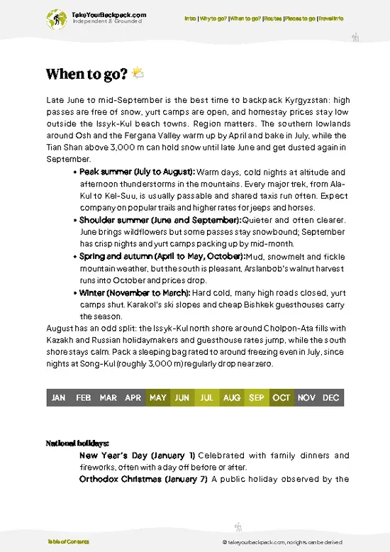
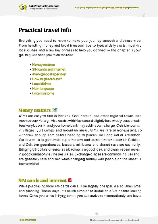
example page 0 from our offline Travel Guide for Kyrgyzstan
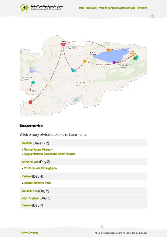
example page 1 from our offline Travel Guide for Kyrgyzstan
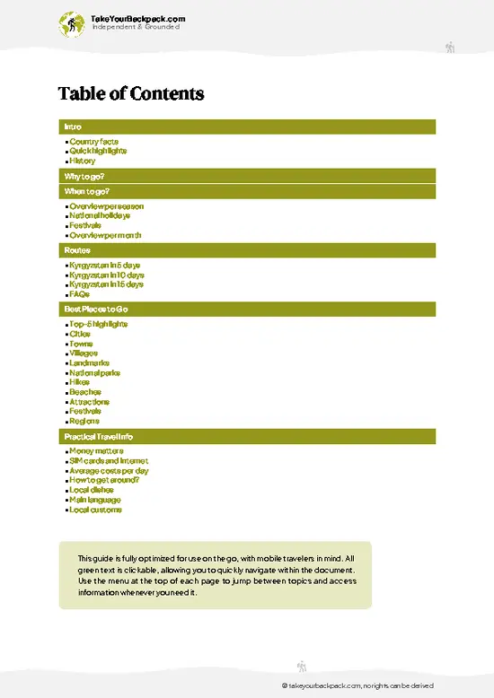
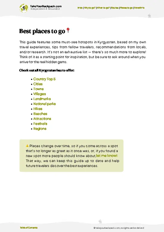
example page 2 from our offline Travel Guide for Kyrgyzstan
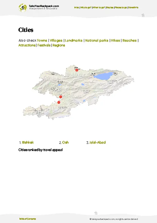
example page 3 from our offline Travel Guide for Kyrgyzstan
example page 4 from our offline Travel Guide for Kyrgyzstan
example page 5 from our offline Travel Guide for Kyrgyzstan
example page 6 from our offline Travel Guide for Kyrgyzstan
example page 7 from our offline Travel Guide for Kyrgyzstan
Loading the map 🌍
CLICK TO FILTER
cities
towns
villages
landmarks
national parks
hikes
beaches
attractions
festivals
regions
SHOW COUNTRY’S BESTSHOW ALL

✨ Why go?
Ranked #10 hike in Kyrgyzstan
Why Ak Kayyn should be on your travel list

Backpackers come for big scenery without crowds. You get birch forest, open meadows and Tien Shan ridgelines inside one valley walk, and you rarely share the trail with more than a few herders. Public transport gets you close: marshrutkas run from Bishkek toward Issyk-Kul, and shared taxis cover the last stretch for a few dollars. Costs stay low, since you can carry food from town and buy bread, dairy and tea from pasture families. Distances are flexible. Turn around after the birch groves for an easy half day, or push up toward the high meadows and camp. Ak Kayyn also fits neatly into a longer Issyk-Kul loop, as a quiet stop between busier trailheads like Karakol and Kochkor.

💡 HighlightsMust-see experiences and standout moments

  1. White birch groves: The lower valley is lined with pale-trunked birches, which are unusual in a region dominated by spruce and bare slopes. In autumn the leaves turn yellow and the light inside the groves is the best on the trail.
  2. Quiet valley trail: The path follows the valley floor with a stream alongside for much of the way. Traffic is light, so you hear water and wind more than boots, and it is good terrain for a relaxed walking pace.
  3. Alpine meadows: Higher up the trees thin out and open grassy meadows take over, dotted with summer wildflowers. They give you wide views across the valley and good flat ground if you plan to camp.
  4. Yak pastures: Yaks graze the upper slopes in summer, usually watched by local herders. Keep your distance from the animals, and if you meet a herder, a greeting often
… read more 👉
  1. White birch groves: The lower valley is lined with pale-trunked birches, which are unusual in a region dominated by spruce and bare slopes. In autumn the leaves turn yellow and the light inside the groves is the best on the trail.
  2. Quiet valley trail: The path follows the valley floor with a stream alongside for much of the way. Traffic is light, so you hear water and wind more than boots, and it is good terrain for a relaxed walking pace.
  3. Alpine meadows: Higher up the trees thin out and open grassy meadows take over, dotted with summer wildflowers. They give you wide views across the valley and good flat ground if you plan to camp.
  4. Yak pastures: Yaks graze the upper slopes in summer, usually watched by local herders. Keep your distance from the animals, and if you meet a herder, a greeting often leads to tea and fresh dairy products.
  5. Tien Shan ridgelines: Jagged rock crests frame the head of the valley and look sharper the higher you climb. On clear mornings they make the best photo backdrop for the meadows below.
I would pick the birch groves first. They come early, you reach them before you are tired, and the light there makes the rest of the walk feel earned. Do them in the morning, then decide how far up to go.
Spotted a mistake or missing something? Contact us.

🌤️ When to go?Weather, crowds, and seasonal trade-offs

The best window for Ak Kayyn is late June to early September, when the valley trail is snow-free and yak herders are up in the summer pastures.
  • Summer (Jun to Aug): Days reach 15 to 25°C (59 to 77°F), nights drop to 2 to 8°C (36 to 46°F). Daylight runs roughly 15 hours. Afternoon thunderstorms are common. Yurt stays and homestays are busiest in July and August, with prices at their highest.
  • Early Autumn (Sep): Clear, crisp days of 10 to 18°C (50 to 64°F) and birch leaves starting to turn. Crowds thin out and daylight shrinks to about 12 hours.
  • Spring (Apr to May): Muddy trails, lingering snow higher up, and cold nights below freezing. Few herders have arrived yet.
  • Winter (Nov to Mar): Deep snow, temperatures of -15 to 0°C (5 to 32°F), short days, and little local infrastructure.
Aim for the first … read more 👉
The best window for Ak Kayyn is late June to early September, when the valley trail is snow-free and yak herders are up in the summer pastures.
  • Summer (Jun to Aug): Days reach 15 to 25°C (59 to 77°F), nights drop to 2 to 8°C (36 to 46°F). Daylight runs roughly 15 hours. Afternoon thunderstorms are common. Yurt stays and homestays are busiest in July and August, with prices at their highest.
  • Early Autumn (Sep): Clear, crisp days of 10 to 18°C (50 to 64°F) and birch leaves starting to turn. Crowds thin out and daylight shrinks to about 12 hours.
  • Spring (Apr to May): Muddy trails, lingering snow higher up, and cold nights below freezing. Few herders have arrived yet.
  • Winter (Nov to Mar): Deep snow, temperatures of -15 to 0°C (5 to 32°F), short days, and little local infrastructure.
Aim for the first half of September for stable weather, quiet meadows, and softer prices.


source: climatestotravel.comJANJanuary: below average for travelingFEBFebruary: below average for travelingMARMarch: below average for travelingAPRApril: fair for travelingMAYMay: fair for travelingJUNJune: highly recommended for travelingJULJuly: highly recommended for travelingAUGAugust: highly recommended for travelingSEPSeptember: highly recommended for travelingOCTOctober: fair for travelingNOVNovember: below average for travelingDECDecember: below average for traveling
when-to-go

✈️ The backpacker research shortcutKyrgyzstan Travel Guide

An offline-friendly backpacking guide with optimized travel routes, ranked highlights, transport advice, and the best areas to stay.
example page 0 from our offline Travel Guide for Kyrgyzstan
example page 1 from our offline Travel Guide for Kyrgyzstan
example page 2 from our offline Travel Guide for Kyrgyzstan
example page 3 from our offline Travel Guide for Kyrgyzstan
example page 4 from our offline Travel Guide for Kyrgyzstan
example page 5 from our offline Travel Guide for Kyrgyzstan
example page 6 from our offline Travel Guide for Kyrgyzstan
example page 7 from our offline Travel Guide for Kyrgyzstan
The digital guide (242 pages) contains:
✅ 73 highlights, ranked by travel appeal
✅ Optimized 5, 10 & 15-day travel routes
✅ Cities, national parks, landmarks, beaches
✅ How to get around
✅ Offline-friendly for travel without Wi-Fi
👉 Click to see all 30+ guide features

📅 Plan smarter in minutes, not weeks
✅ Month by month travel advice
✅ Festivals & national holidays
✅ Budget expectations

🗺️ Go to the right places, skip the overrated ones
✅ Honest pros & cons of destinations
✅ Top hikes, parks & viewpoints
✅ Lesser-known places most travelers miss
✅ Clear “worth it vs skip it” guidance

🛏️ Travel smoothly without rookie mistakes
✅ Best areas to stay
✅ Transport systems explained simply
✅ Common scams & safety advice
✅ SIM cards, money & practical tips

🌍 Understand the country, not just visit it
✅ Culture & traditions
✅ 52 Essential phrases & customs
✅ Festivals worth planning around
✅ Traveler-friendly historical context
✅ Insights that make places more meaningful

📱 Built for real travel conditions
✅ Fully downloadable PDF
✅ Works completely offline
✅ Optimized for phone use
✅ Useful in remote areas & buses
✅ Everything in one place
Stop searching, start planning
Get instant access to your full guide. 30‑day money-back guarantee.
+ Add another guide for just

By proceeding you agree to our terms.
Sent to your inbox immediately after payment • 100% Secure Checkout
Best Backpacking Travel Advisor 2025 tourism awardBest Backpacking
Travel Advisor
2025
What others say about Take Your Backpack Guides:
⭐⭐⭐⭐⭐
Fantastic, amazing amount of information!
⭐⭐⭐⭐⭐
My goodness this is amazing, it's what I've been looking for hats off too you!
⭐⭐⭐⭐⭐
I think this is absolutely BRILLIANT
⭐⭐⭐⭐
Very complete and informative. It's still missing places, but I gotta to commend you
⭐⭐⭐⭐⭐
This is truly amazing, thank you, can't wait to explore it with my kids!
⭐⭐⭐⭐⭐
Awesome resource, thank you!
⭐⭐⭐⭐⭐
This is amazing! Can't wait to explore the ones I haven't seen
⭐⭐⭐⭐
I love this! Well done, great idea.
⭐⭐⭐⭐⭐
Thanks for taking the time to make this gem!
⭐⭐⭐⭐⭐
This might be the best website I've ever seen.
⭐⭐⭐⭐⭐
Congratulations, and thank you so much for your work; it's incredibly valuable.
⭐⭐⭐⭐
In all seriousness I think you did a great job pointing out the important spots
⭐⭐⭐⭐⭐
10/10 very good
⭐⭐⭐⭐⭐
As someone who's only just starting to visit regularly this is awesome, thank you.
⭐⭐⭐⭐
Thank you very much! I'm going to visit my dad, it's going to be very useful!
⭐⭐⭐⭐⭐
This is really cool! We'll be travelling for the first time and this definitely come in handy.
⭐⭐⭐⭐⭐
You are now our minister of culture, congratulations 👨‍💼
⭐⭐⭐⭐⭐
Just wanted to tell you that this is a pearl! Going to follow your recommendations.
⭐⭐⭐⭐⭐
This is so cool. I'll definitely be using the resource for my travels soon.
⭐⭐⭐⭐⭐
This is very impressive! Good work.
⭐⭐⭐⭐⭐
This is an amazing and informative site. Very well done!

🛏️ Where to stay?Best areas and accommodation options

If you enjoy meeting fellow travelers, consider choosing hostels with high ratings for atmosphere. On the other hand, if you prefer having your own space, a hotel might be a better option.

🥾 Hike detailsA practical overview of the hike

Total Distance: Roughly 12 to 20 km round trip from the valley road above Bokonbayevo, depending on how far up the side valley you push before turning around.
Estimated Duration: A full day of 5 to 8 hours on foot. Add a second day if you carry a tent and want to sleep high.
Difficulty: Moderate. The gradient is steady rather than steep, but you gain well over 1,000 m, and the upper sections sit above 3,000 m, where the thin air slows most people.
Starting Point: The village of Bokonbayevo on the south shore of Issyk-Kul.
  • Public Transport: Shared marshrutkas and taxis run along the south shore road
… read more 👉
Total Distance: Roughly 12 to 20 km round trip from the valley road above Bokonbayevo, depending on how far up the side valley you push before turning around.
Estimated Duration: A full day of 5 to 8 hours on foot. Add a second day if you carry a tent and want to sleep high.
Difficulty: Moderate. The gradient is steady rather than steep, but you gain well over 1,000 m, and the upper sections sit above 3,000 m, where the thin air slows most people.
Starting Point: The village of Bokonbayevo on the south shore of Issyk-Kul.
  • Public Transport: Shared marshrutkas and taxis run along the south shore road from Karakol and from Bishkek (about 5 to 6 hours from the capital). Ask in the village for a shared taxi to the trailhead, which usually costs a few hundred som per car.
Major Landmarks:
  • Lower Valley: Farm fields, a stream crossing and summer herders’ yurts.
  • Mid-Valley Meadows: Open grassland with views back across Issyk-Kul to the northern Kungey range.
  • Upper Basin: Rocky slopes and snow patches that linger into early summer.
Terrain and Scenery: Dirt tracks give way to narrow footpaths, then loose scree near the top. Expect red-tinged hillsides low down and pale granite above, with the lake glinting far below.
Vegetation: Dry steppe and grass near the village, then patches of Schrenk’s spruce in the side gullies, and alpine meadow with wildflowers in June and July.
Wildlife: Marmots whistle from the slopes, and golden eagles and lammergeiers ride the thermals. Ibex are possible on high crags if you start early and stay quiet. Herders’ dogs are the animal you will most likely have to deal with, so keep your distance from flocks.
⚠️ Hiking info can sometimes be outdated or inaccurate. Before you hit the trail, check the latest conditions with locals. If you do spot anything that's off, I'd love to hear from you, so I can update it for fellow travelers.

🛡️ SafetyStaying Safe: What Travelers Should Know

Ak Kayyn is a straightforward valley hike, and the main hazards are weather and herd dogs. Mountain weather shifts fast in the Tien Shan, so start early, keep rain layers and a warm fleece in your pack, and be off exposed meadows before afternoon storms. Nights get cold even in July. Trails are clear but can turn muddy and slippery after rain, so wear boots with grip. Stream crossings swell in the afternoon from snowmelt, so cross in the morning. Shepherd dogs guard the yak and sheep herds and can be aggressive. Stop, stay calm, avoid eye contact, and wait for the herder to call them off. Give animals space. Carry offline maps, a headlamp, and enough water or a filter, as phone signal is patchy.

FAQCommon questions from travelers

Plan on 4 to 7 hours for a day hike, covering roughly 10 to 16 km depending on how far up the valley you go. If you want to sleep in the upper meadows, make it a two-day trip. Most hikers start from the road end south of Issyk-Kul after a shared taxi from the nearest town.
Easy to moderate describes it best. The lower birch groves are gentle walking along the valley floor, while the upper slopes toward the ridgelines are steeper and higher in altitude. Stream crossings and fast weather changes are the main challenges, so bring waterproofs and warm layers even in summer.
No guide is needed for the valley trail, and a permit is generally not required for hiking in this part of the Issyk-Kul region. Border zone permits matter only if you push toward high passes near frontier areas, so check locally before going far. A local driver or horse guide costs roughly US$20 to 50 a day if you want help with the rough road.
⚠️ Things can change over time, so always validate details locally before you go.

Other Kyrgyz hikes near Ak Kayyn

Explore more nearby:

  • Ala-Kul Lake—Turquoise lake, 3,860 m pass, scree climb, Karakol start| 140 km away
  • Kol Tor—Alpine lake, grazing slopes, summer yurts, steady ascent| 144 km away
  • Song Kol Lake—Yurt camps, 3,000 m plateau, horse herds, summer-only access| 147 km away

💡 Not sure where to go next?
Create a personalized itinerary for Kyrgyzstan including Ak Kayyn and the places that fit your trip.

Generate my itinerary

👉 Discover all hikes

Or checkout all Kyrgyzstan has to offer (think cities, towns, villages, national parks, hikes, beaches, festivals)
Country photo of Kyrgyzstan

We 💚 feedbackKey takeaways before you go

Ak Kayyn is worth it for the quiet. Walking through birch groves into yak meadows with almost nobody around is rare in Kyrgyzstan. The honest downside is logistics: the last leg depends on shared taxis and rough roads, and there are few services. If you want signed trails and cafés, pick a busier valley.

✈️ When did I visit Kyrgyzstan?
I started my 1.5 year travel around the world trip in June 2015 in Kyrgyzstan.

✍️ Help improve this page!
The information on this page is based on my own backpacking experience in Kyrgyzstan, supplemented with up-to-date research and feedback from other travelers. Travel details can change, so if you notice anything outdated or incomplete, feel free to let me know.


🙋‍♂️ Give feedback

👋 Meet the founderWho’s Behind Take Your Backpack?

Johan, backpacker and founder of TakeYourBackpackHi, I’m Johan (Netherlands 🇳🇱), the creator of TakeYourBackpack. Over the past 3 decades, I’ve backpacked through 90+ countries across six continents, gaining extensive experience with independent travel, long-term trips, and overland routes.

This site is built on a combination of firsthand travel experience and carefully curated insights from other backpackers. Many guides are based on places I’ve personally visited, while others bring together tips, observations, and practical advice shared by trusted travelers I’ve met along the way.

The goal is to provide realistic, experience-driven guidance — not generic itineraries — so you can explore destinations with better context, clearer expectations, and more confidence.