×

Kyrgyzstan🇰🇬 | hikesKöl-Suu LakeBorder permit, granite walls, 3,500 m shoreline, horse approach | things to do and best time to go

Explore Altyn ArashanExplore Bant Suusu

Backpacking in Köl-Suu Lake
🌟 Highlighthike ranked #5
By Johan Kruseman 🇳🇱 | Updated October 15, 2026

The big decision is whether to arrange the border permit and a 4x4 through an agency in Naryn or Bishkek, or cobble it together yourself. It matters because without the permit, border guards turn you around at the checkpoint, and without a driver, nothing gets you up those rutted valley tracks. Köl-Suu Lake sits in the At-Bashy range of Naryn Region, close to the Chinese border. Expect river fords, scree, and thin air at around 3,500 meters. No public transport reaches the trailhead, so this is harder than Kel-Suu day hikes like Ala-Kul near Karakol. Standing on the rim, I felt cold wind hit my face while red cliffs flipped upside down in water so still it hummed with silence. Pack warm layers, you will earn that view.

Discover everything you want to know in the 📖 Kyrgyzstan Travel Guide.
Best time to go: June - September
Duration: 3 days
Distance: 65 kilometers
Total ascent: 1200 meters


example page 0 from our offline Travel Guide for Kyrgyzstan
example page 1 from our offline Travel Guide for Kyrgyzstan
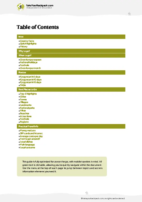
example page 2 from our offline Travel Guide for Kyrgyzstan
example page 3 from our offline Travel Guide for Kyrgyzstan
example page 4 from our offline Travel Guide for Kyrgyzstan
example page 5 from our offline Travel Guide for Kyrgyzstan
example page 6 from our offline Travel Guide for Kyrgyzstan
example page 7 from our offline Travel Guide for Kyrgyzstan
Loading the map 🌍
CLICK TO FILTER
cities
towns
villages
landmarks
national parks
hikes
beaches
attractions
festivals
regions
SHOW COUNTRY’S BESTSHOW ALL

✨ Why go?
Ranked #5 hike in Kyrgyzstan
Why Köl-Suu Lake should be on your travel list

Backpackers chase Köl-Suu for scenery per effort that few lakes in Central Asia match: turquoise water, red cliffs, and almost no other people. Public transport only gets you as far as Naryn, where marshrutkas from Bishkek run about 5 to 6 hours, so the final leg means a shared 4x4. Splitting the jeep and permit among four or five travelers keeps the cost manageable. Flexible distances help too: you can hike in from the road end, or camp near the lake and day-hike the ridges. It fits neatly into a longer Kyrgyzstan route linking Bishkek, Song-Kul, Naryn, and Tash Rabat. Bring a tent, a stove, and enough food for the whole trip, because nothing is sold out there.

💡 HighlightsThe experiences that define the visit

  1. The turquoise lake itself: Köl-Suu sits at roughly 3,500 meters, and its water shifts from pale turquoise in the shallows to deep blue near the center, glassy on windless mornings.
  2. Red cliffs around the shore: Rust-colored rock walls rise straight from the water, so the lake looks ringed by flame. Late afternoon light turns them deep orange.
  3. Border zone silence: Because a permit is required, few visitors arrive. You may spend a whole evening hearing only wind, water, and the occasional marmot whistle.
  4. At-Bashy range views: From ridges above the lake, snow-streaked summits of the range spread out along the horizon, with the Chinese frontier close by.
  5. Nomad pastures and horses on the approach: Along the valley tracks, you may pass herders with horses, sheep, and yurts in summer. It is a quick glimpse
… read more 👉
  1. The turquoise lake itself: Köl-Suu sits at roughly 3,500 meters, and its water shifts from pale turquoise in the shallows to deep blue near the center, glassy on windless mornings.
  2. Red cliffs around the shore: Rust-colored rock walls rise straight from the water, so the lake looks ringed by flame. Late afternoon light turns them deep orange.
  3. Border zone silence: Because a permit is required, few visitors arrive. You may spend a whole evening hearing only wind, water, and the occasional marmot whistle.
  4. At-Bashy range views: From ridges above the lake, snow-streaked summits of the range spread out along the horizon, with the Chinese frontier close by.
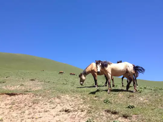
  5. Nomad pastures and horses on the approach: Along the valley tracks, you may pass herders with horses, sheep, and yurts in summer. It is a quick glimpse of high-pasture life before the wilderness takes over.
I would pick the red cliffs first. At dawn, with the lake motionless, the rock doubles in the water and the scene is unlike any other lake in the country.
Spotted a mistake or missing something? Contact us.

🌤️ When to go?Weather, crowds, and seasonal trade-offs

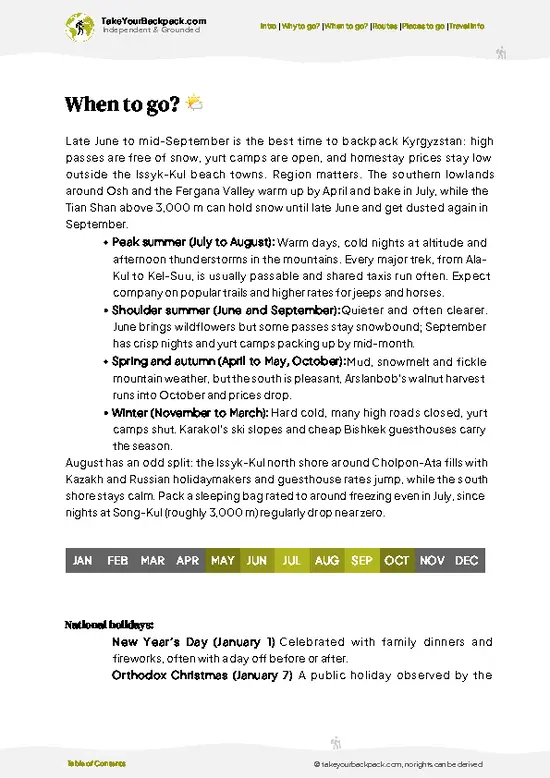
The best window for Köl-Suu Lake is mid-June to early September, when the road is open and the border-zone permit is easiest to arrange.
  • Summer (late June to August): Days reach 15 to 22°C (59 to 72°F) at the lake, around 3,500 m, and nights drop to 0 to 5°C (32 to 41°F). Daylight runs about 15 hours. This is peak season, though "peak" means a few tents and 4x4 groups. Tour prices are at their highest.
  • Early Autumn (September): Clear skies, quieter camps and cooler nights of -5 to 2°C (23 to 36°F). Snow can arrive by late month. Daylight shrinks to roughly 12 hours.
  • Late Spring (May to mid-June): Snow often blocks the pass and river crossings run high, so access is unreliable. Operators may discount or not run trips.
  • Winter (October to April): Heavy snow and temperatures well below -15°C (5°F)
… read more 👉
The best window for Köl-Suu Lake is mid-June to early September, when the road is open and the border-zone permit is easiest to arrange.
  • Summer (late June to August): Days reach 15 to 22°C (59 to 72°F) at the lake, around 3,500 m, and nights drop to 0 to 5°C (32 to 41°F). Daylight runs about 15 hours. This is peak season, though "peak" means a few tents and 4x4 groups. Tour prices are at their highest.
  • Early Autumn (September): Clear skies, quieter camps and cooler nights of -5 to 2°C (23 to 36°F). Snow can arrive by late month. Daylight shrinks to roughly 12 hours.
  • Late Spring (May to mid-June): Snow often blocks the pass and river crossings run high, so access is unreliable. Operators may discount or not run trips.
  • Winter (October to April): Heavy snow and temperatures well below -15°C (5°F) shut the area to normal travel.
Book your permit and 4x4 at least two to three weeks ahead for July and August, and pad your schedule with a spare day for weather.


source: climatestotravel.comJANJanuary: below average for travelingFEBFebruary: below average for travelingMARMarch: below average for travelingAPRApril: below average for travelingMAYMay: fair for travelingJUNJune: good for travelingJULJuly: excellent for travelingAUGAugust: excellent for travelingSEPSeptember: highly recommended for travelingOCTOctober: fair for travelingNOVNovember: below average for travelingDECDecember: below average for traveling
when-to-go

✈️ The backpacker research shortcutKyrgyzstan Travel Guide

An offline-friendly backpacking guide with optimized travel routes, ranked highlights, transport advice, and the best areas to stay.
example page 0 from our offline Travel Guide for Kyrgyzstan
example page 1 from our offline Travel Guide for Kyrgyzstan
example page 2 from our offline Travel Guide for Kyrgyzstan
example page 3 from our offline Travel Guide for Kyrgyzstan
example page 4 from our offline Travel Guide for Kyrgyzstan
example page 5 from our offline Travel Guide for Kyrgyzstan
example page 6 from our offline Travel Guide for Kyrgyzstan
example page 7 from our offline Travel Guide for Kyrgyzstan
The digital guide (242 pages) contains:
✅ 73 highlights, ranked by travel appeal
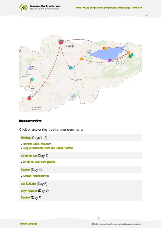
✅ Optimized 5, 10 & 15-day travel routes
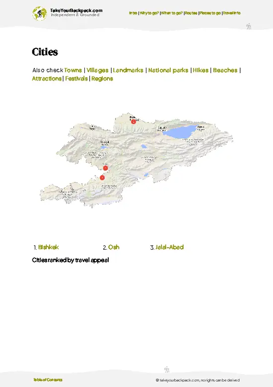
✅ Cities, national parks, landmarks, beaches
✅ How to get around
✅ Offline-friendly for travel without Wi-Fi
👉 Click to see all 30+ guide features

📅 Plan smarter in minutes, not weeks
✅ Month by month travel advice
✅ Festivals & national holidays
✅ Budget expectations

🗺️ Go to the right places, skip the overrated ones
✅ Honest pros & cons of destinations
✅ Top hikes, parks & viewpoints
✅ Lesser-known places most travelers miss
✅ Clear “worth it vs skip it” guidance

🛏️ Travel smoothly without rookie mistakes
✅ Best areas to stay
✅ Transport systems explained simply
✅ Common scams & safety advice
✅ SIM cards, money & practical tips

🌍 Understand the country, not just visit it
✅ Culture & traditions
✅ 52 Essential phrases & customs
✅ Festivals worth planning around
✅ Traveler-friendly historical context
✅ Insights that make places more meaningful

📱 Built for real travel conditions
✅ Fully downloadable PDF
✅ Works completely offline
✅ Optimized for phone use
✅ Useful in remote areas & buses
✅ Everything in one place
Stop searching, start planning
Get instant access to your full guide. 30‑day money-back guarantee.
+ Add another guide for just

By proceeding you agree to our terms.
Sent to your inbox immediately after payment • 100% Secure Checkout
Best Backpacking Travel Advisor 2025 tourism awardBest Backpacking
Travel Advisor
2025
What others say about Take Your Backpack Guides:
⭐⭐⭐⭐⭐
Fantastic, amazing amount of information!
⭐⭐⭐⭐⭐
My goodness this is amazing, it's what I've been looking for hats off too you!
⭐⭐⭐⭐⭐
I think this is absolutely BRILLIANT
⭐⭐⭐⭐
Very complete and informative. It's still missing places, but I gotta to commend you
⭐⭐⭐⭐⭐
This is truly amazing, thank you, can't wait to explore it with my kids!
⭐⭐⭐⭐⭐
Awesome resource, thank you!
⭐⭐⭐⭐⭐
This is amazing! Can't wait to explore the ones I haven't seen
⭐⭐⭐⭐
I love this! Well done, great idea.
⭐⭐⭐⭐⭐
Thanks for taking the time to make this gem!
⭐⭐⭐⭐⭐
This might be the best website I've ever seen.
⭐⭐⭐⭐⭐
Congratulations, and thank you so much for your work; it's incredibly valuable.
⭐⭐⭐⭐
In all seriousness I think you did a great job pointing out the important spots
⭐⭐⭐⭐⭐
10/10 very good
⭐⭐⭐⭐⭐
As someone who's only just starting to visit regularly this is awesome, thank you.
⭐⭐⭐⭐
Thank you very much! I'm going to visit my dad, it's going to be very useful!
⭐⭐⭐⭐⭐
This is really cool! We'll be travelling for the first time and this definitely come in handy.
⭐⭐⭐⭐⭐
You are now our minister of culture, congratulations 👨‍💼
⭐⭐⭐⭐⭐
Just wanted to tell you that this is a pearl! Going to follow your recommendations.
⭐⭐⭐⭐⭐
This is so cool. I'll definitely be using the resource for my travels soon.
⭐⭐⭐⭐⭐
This is very impressive! Good work.
⭐⭐⭐⭐⭐
This is an amazing and informative site. Very well done!

🛏️ Where to stay?Choosing the right base

If you enjoy meeting fellow travelers, consider choosing hostels with high ratings for atmosphere. On the other hand, if you prefer having your own space, a hotel might be a better option.

🥾 Hike detailsTrail overview: what to expect on the hike

Total Distance: Roughly 30 to 50 km round trip on foot, depending on where your 4x4 drops you, since track conditions vary by season.
Estimated Duration: 2 to 4 days on foot, plus about 1 day each way in a vehicle from Naryn.
Difficulty: Moderate to demanding. Altitude near 3,500 meters, river crossings, and rough tracks make it harder than the distance suggests.
Starting Point: Naryn is the practical base. Marshrutkas and shared taxis run there from Bishkek in about 5 to 6 hours. Beyond Naryn, no public transport exists, so you need a hired 4x4 and a border permit arranged in advance.
Major Landmarks:
  • Border
… read more 👉
Total Distance: Roughly 30 to 50 km round trip on foot, depending on where your 4x4 drops you, since track conditions vary by season.
Estimated Duration: 2 to 4 days on foot, plus about 1 day each way in a vehicle from Naryn.
Difficulty: Moderate to demanding. Altitude near 3,500 meters, river crossings, and rough tracks make it harder than the distance suggests.
Starting Point: Naryn is the practical base. Marshrutkas and shared taxis run there from Bishkek in about 5 to 6 hours. Beyond Naryn, no public transport exists, so you need a hired 4x4 and a border permit arranged in advance.
Major Landmarks:
  • Border checkpoint: Guards check passports and your permit before the final approach.
  • Valley tracks and fords: Cold meltwater crossings that can rise by afternoon.
  • Köl-Suu shoreline: Camping spots with views of the red cliffs.
Terrain and Scenery: Gravel tracks, grassy valleys, loose scree, and rocky ridges. The lake is ringed by red cliffs, with snow patches on higher peaks.
Vegetation: Mostly alpine meadow and grass. There are no trees at lake level, so bring a stove.
Wildlife: Marmots, golden eagles, and possibly ibex on higher slopes. Herders graze horses and sheep in summer.
⚠️ Hiking info can sometimes be outdated or inaccurate. Before you hit the trail, check the latest conditions with locals. If you do spot anything that's off, I'd love to hear from you, so I can update it for fellow travelers.

🛡️ SafetyStaying Safe: What Travelers Should Know

Köl-Suu is a remote, well-understood trip, and the main risks are cold, altitude and distance from help. The lake sits around 3,500 m, so arrive with a day or two of acclimatization and keep a slow pace to avoid headaches and poor sleep. Weather turns fast: afternoon storms, hail and sudden snow can arrive even in July, so carry a proper shell, warm layers and a three-season sleeping bag rated to about -5°C (23°F). The trail footing is loose scree and muddy track, and glacial streams swell by late afternoon, so cross early and unbuckle your pack's hip belt. Navigation is simple near the lake but phone signal is absent, so download offline maps. Carry a satellite messenger. Border-zone permits are checked, so keep your passport and permit with you and stay within the permitted area. Livestock … read more 👉
Köl-Suu is a remote, well-understood trip, and the main risks are cold, altitude and distance from help. The lake sits around 3,500 m, so arrive with a day or two of acclimatization and keep a slow pace to avoid headaches and poor sleep. Weather turns fast: afternoon storms, hail and sudden snow can arrive even in July, so carry a proper shell, warm layers and a three-season sleeping bag rated to about -5°C (23°F). The trail footing is loose scree and muddy track, and glacial streams swell by late afternoon, so cross early and unbuckle your pack's hip belt. Navigation is simple near the lake but phone signal is absent, so download offline maps. Carry a satellite messenger. Border-zone permits are checked, so keep your passport and permit with you and stay within the permitted area. Livestock dogs near shepherd camps can be protective, so walk calmly around them. Pack out all your trash.

FAQTraveler FAQ

Plan on 2 to 4 days of hiking, plus about a day of driving each way from Naryn. Naryn to the road end is a long, rough 4x4 ride, and weather can slow river crossings. Most travelers allow 4 to 5 days total from Naryn to be safe.
The hike is moderate to demanding, mainly because of altitude and rough terrain rather than distance. The lake sits near 3,500 meters, so headaches and breathlessness are common if you arrive straight from Bishkek. Cold river fords and fast weather shifts add difficulty, and a few days in Naryn first helps acclimatization.
Yes, you need a border zone permit, because the lake lies close to the Chinese frontier. Arrange it in advance through a Naryn or Bishkek agency, which can take several days, and carry your passport at all times. A 4x4 driver is practically required since no public transport serves the area, and most visitors hire one through the same agency.
⚠️ Things can change over time, so always validate details locally before you go.

Other Kyrgyz hikes near Köl-Suu Lake

Explore more nearby:

  • Song Kol Lake—Yurt camps, 3,000 m plateau, horse herds, summer-only access| 170 km away
  • Ak Kayyn—Valley trail, river crossings, quiet side route, flexible length| 175 km away
  • Kol Tor—Alpine lake, grazing slopes, summer yurts, steady ascent| 235 km away

💡 Not sure where to go next?
Create a personalized itinerary for Kyrgyzstan including Köl-Suu Lake and the places that fit your trip.

Generate my itinerary

👉 Discover all hikes

Or checkout all Kyrgyzstan has to offer (think cities, towns, villages, national parks, hikes, beaches, festivals)
Country photo of Kyrgyzstan

We 💚 feedbackWhat to keep in mind

Köl-Suu rewards you with silence and color that few places in Kyrgyzstan can match. Sitting by that water at dusk, I could hear my own breathing. The honest catch is logistics. The permit, the 4x4 cost, and the lack of any public transport make it a poor fit for a tight schedule or a thin budget.

✈️ When did I visit Kyrgyzstan?
I started my 1.5 year travel around the world trip in June 2015 in Kyrgyzstan.

✍️ Help improve this page!
The information on this page is based on my own backpacking experience in Kyrgyzstan, supplemented with up-to-date research and feedback from other travelers. Travel details can change, so if you notice anything outdated or incomplete, feel free to let me know.


🙋‍♂️ Give feedback

👋 Meet the founderWho’s Behind Take Your Backpack?

Johan, backpacker and founder of TakeYourBackpackHi, I’m Johan (Netherlands 🇳🇱), the creator of TakeYourBackpack. Over the past 3 decades, I’ve backpacked through 90+ countries across six continents, gaining extensive experience with independent travel, long-term trips, and overland routes.

This site is built on a combination of firsthand travel experience and carefully curated insights from other backpackers. Many guides are based on places I’ve personally visited, while others bring together tips, observations, and practical advice shared by trusted travelers I’ve met along the way.

The goal is to provide realistic, experience-driven guidance — not generic itineraries — so you can explore destinations with better context, clearer expectations, and more confidence.