×

Madagascar🇲🇬 | hikesAndringitra Massifgranite domes, high-altitude plateaus, endemic plant zones | things to do and best time to go

Explore Festival des RizièresExplore Ankarana Special Reserve

Backpacking in Andringitra Massif
🏆 Top pickhike ranked #1
By Johan Kruseman 🇳🇱 | Updated September 3, 2026

You land in Madagascar with a choice: do you take on the Andringitra Massif, or do you settle for the easier, more Instagrammed circuits like Isalo? This isn’t just a question of scenery—it’s about how much sweat you’re willing to trade for the kind of silence that only comes when you’re miles from the nearest road. Andringitra sits in the country’s southeast, a granite backbone rising out of rice paddies and cloud forest, far from the tourist buses. The hike itself is a test—long, steep, and often slick with mist. You’ll scramble up boulders, push through spiky grass, and curse the altitude, but then you’ll hit the summit at Pic Boby and the world drops away in every direction. Getting here by public transport is a headache—think bush taxis and hours of bouncing—but that’s part of the filter. If you want easy, stick to Isalo. If you want wild, Andringitra delivers. I still remember my legs shaking at the top, but the view—raw, endless, and utterly yours—made every blister worth it.

Discover everything you want to know in the 📖 Madagascar Travel Guide.
Best time to go: April - November
Duration: 5 to 7 days
Distance: 90 kilometers
Total ascent: 1,800 meters
Loading the map 🌍
CLICK TO FILTER
cities
towns
villages
landmarks
national parks
hikes
beaches
attractions
festivals
regions
SHOW COUNTRY’S BESTSHOW ALL

✨ Why go?
Ranked #1 hike in Madagascar
Reasons people choose to hike the here

The Andringitra Massif in Madagascar is a magnet for backpackers craving adventure. This hike delivers a killer scenery-to-effort ratio. You’ll trek through lush valleys, scale granite peaks, and navigate vibrant forests, all while feeling the burn in your legs. The views? Jaw-dropping. You’ll stand on ridges that drop into misty gorges, with the horizon stretching endlessly.

Getting there is a breeze. Public transport is reliable, with local taxis and buses whisking you from Antananarivo to the trailhead. Once you arrive, the costs are refreshingly low. You can camp or find budget lodges, keeping your wallet happy while you soak in the wild beauty.

Flexibility is key here. You can choose from various distances and routes, whether you want a quick day hike or a multi-day trek. This adaptability … read more 👉
The Andringitra Massif in Madagascar is a magnet for backpackers craving adventure. This hike delivers a killer scenery-to-effort ratio. You’ll trek through lush valleys, scale granite peaks, and navigate vibrant forests, all while feeling the burn in your legs. The views? Jaw-dropping. You’ll stand on ridges that drop into misty gorges, with the horizon stretching endlessly.

Getting there is a breeze. Public transport is reliable, with local taxis and buses whisking you from Antananarivo to the trailhead. Once you arrive, the costs are refreshingly low. You can camp or find budget lodges, keeping your wallet happy while you soak in the wild beauty.

Flexibility is key here. You can choose from various distances and routes, whether you want a quick day hike or a multi-day trek. This adaptability makes it easy to fit the Andringitra into a longer backpacking route across Madagascar.

Every step is a challenge, but the reward is palpable: the first cold beer at the end of a long day, the sunset painting the sky, and the camaraderie of fellow travelers. This is why you lace up your boots and hit the trail.
Want to include Andringitra Massif in your Madagascar route?
Create a personalized Madagascar itinerary that includes Andringitra Massif and the places that fit your trip — based on your travel style, budget, and available time. Get your route in seconds.

Generate my trip

💡 HighlightsWhat this place is best known for

  1. Summit of Pic Boby (Imarivolanitra) — The highest, most dramatic payoff: a raw, windswept summit at about 2,735 m with sweeping views over the massif and deep valleys. The climb mixes steep trails, grassy slopes and short scrambles, so it feels more “mountain” than your average Madagascar hike — alpine-like scenery and sunrise panoramas that stick with you. (Personal favorite.)
  2. Tsaranoro Valley and granite cliffs — A narrow gorge fringed by towering granite walls that attract climbers from all over. Even if you’re not roped up, the sheer faces, bouldered approach trails and campsites tucked under the cliffs give this section a dramatic, rugged vibe unlike the island’s beach or rainforest treks.
  3. High plateau viewpoints and cloud inversions — Wide, open plateaus that suddenly drop into carved
read more 👉
  1. Summit of Pic Boby (Imarivolanitra) — The highest, most dramatic payoff: a raw, windswept summit at about 2,735 m with sweeping views over the massif and deep valleys. The climb mixes steep trails, grassy slopes and short scrambles, so it feels more “mountain” than your average Madagascar hike — alpine-like scenery and sunrise panoramas that stick with you. (Personal favorite.)
  2. Tsaranoro Valley and granite cliffs — A narrow gorge fringed by towering granite walls that attract climbers from all over. Even if you’re not roped up, the sheer faces, bouldered approach trails and campsites tucked under the cliffs give this section a dramatic, rugged vibe unlike the island’s beach or rainforest treks.
  3. High plateau viewpoints and cloud inversions — Wide, open plateaus that suddenly drop into carved valleys; on the right morning you get a sea of clouds sitting in the basin below while the peaks pierce sunlight. Those cloud inversions and long sightlines make the massif feel huge and empty in a way most lowland trails don’t.
  4. Natural pools and waterfalls (Piscine naturelle) — Scattered rock pools and small falls along the routes are perfect for a cold dip after a hot day on the trail. They’re practical (cool-downs and water stops) and scenic — a sweet contrast to the granite and grassland, and a nice low-effort reward mid-hike.
  5. Endemic flora, fauna and local mountain culture — Andringitra’s mix of high-altitude endemic plants and the chance to see lemurs, chameleons and unusual succulents makes the biodiversity memorable. Add in encounters with local shepherds and simple mountain camps — the human element and seasonal grazing patterns give the trek an honest, lived-in feel that many prettier-but-touristy trails lack.
Spotted a mistake or missing something? Contact us.

Things to do near Andringitra Massif

Ratings based on Tripadvisor reviews. When you book through this link, you support our work at no extra cost to you.

🌤️ When to go?Best time to hike the Andringitra Massif


  • Weather: The dry season from April to November is your best bet. Rainfall drops sharply, turning the trails from mud traps into firm paths. Avoid the wet season (December to March) when heavy rains can flood streams and make scrambling dangerous.

  • Temperature: Days hover between 15°C and 25°C (59°F to 77°F), perfect for hiking without overheating. Nights can dip below 5°C (41°F) at higher altitudes, so pack layers. The cold bite at dawn rewards you with crisp, clear air and unbeatable views.

  • Daylight Hours: Expect roughly 11 to 12 hours of daylight during the dry season, enough time to tackle long treks without rushing. The sun rises around 6:00 AM and sets near 6:00 PM, giving you a solid window for exploration.

  • Crowds: The massif sees fewer visitors than Madagascar’s coastal spots,
read more 👉

  • Weather: The dry season from April to November is your best bet. Rainfall drops sharply, turning the trails from mud traps into firm paths. Avoid the wet season (December to March) when heavy rains can flood streams and make scrambling dangerous.

  • Temperature: Days hover between 15°C and 25°C (59°F to 77°F), perfect for hiking without overheating. Nights can dip below 5°C (41°F) at higher altitudes, so pack layers. The cold bite at dawn rewards you with crisp, clear air and unbeatable views.

  • Daylight Hours: Expect roughly 11 to 12 hours of daylight during the dry season, enough time to tackle long treks without rushing. The sun rises around 6:00 AM and sets near 6:00 PM, giving you a solid window for exploration.

  • Crowds: The massif sees fewer visitors than Madagascar’s coastal spots, but the dry season attracts a steady trickle of hikers. Arriving early in the season (April-May) or late (September-November) means quieter trails and more solitude.

  • Seasonal Activities: Dry months open up opportunities for multi-day treks, rock climbing, and camping under star-studded skies. The wet season shuts down many routes and turns rivers into barriers.

  • Price Fluctuations: Local guides and accommodation rates peak during the dry season, especially July and August. Booking ahead can lock in better deals, while the shoulder months offer more bargaining power.


Pro-tip: Time your hike for early dry season—trails are firm, crowds thin, and the air still holds that fresh, post-rain scent that makes every step feel alive.


source: climatestotravel.comJANJanuary: below average for travelingFEBFebruary: below average for travelingMARMarch: fair for travelingAPRApril: highly recommended for travelingMAYMay: excellent for travelingJUNJune: highly recommended for travelingJULJuly: highly recommended for travelingAUGAugust: highly recommended for travelingSEPSeptember: excellent for travelingOCTOctober: excellent for travelingNOVNovember: excellent for travelingDECDecember: below average for traveling
when-to-go

✈️ The backpacker research shortcutMadagascar Travel Guide

An offline-friendly backpacking guide with optimized travel routes, ranked highlights, transport advice, and the best areas to stay.
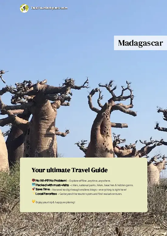
example page 0 from our offline Travel Guide for Madagascar
example page 1 from our offline Travel Guide for Madagascar
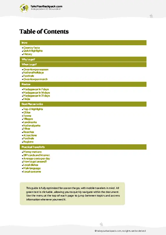
example page 2 from our offline Travel Guide for Madagascar
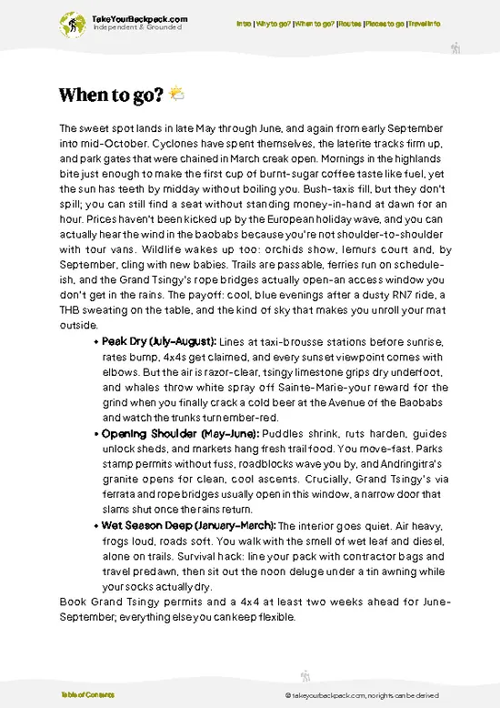
example page 3 from our offline Travel Guide for Madagascar
example page 4 from our offline Travel Guide for Madagascar
example page 5 from our offline Travel Guide for Madagascar
example page 6 from our offline Travel Guide for Madagascar
example page 7 from our offline Travel Guide for Madagascar
The digital guide (418 pages) contains:
110 highlights, ranked by travel appeal
Optimized 7, 14 & 21-day travel routes
Cities, national parks, landmarks, beaches
How to get around
Offline-friendly for travel without Wi-Fi
👉 Click to see all 30+ guide features

📅 Plan smarter in minutes, not weeks
Month by month travel advice
Festivals & national holidays
Budget expectations

🗺️ Go to the right places, skip the overrated ones
Honest pros & cons of destinations
Top hikes, parks & viewpoints
Lesser-known places most travelers miss
Clear “worth it vs skip it” guidance

🛏️ Travel smoothly without rookie mistakes
Best areas to stay
Transport systems explained simply
Common scams & safety advice
SIM cards, money & practical tips

🌍 Understand the country, not just visit it
Culture & traditions
52 Essential phrases & customs
Festivals worth planning around
Traveler-friendly historical context
Insights that make places more meaningful

📱 Built for real travel conditions
Fully downloadable PDF
Works completely offline
Optimized for phone use
Useful in remote areas & buses
Everything in one place
Save weeks of stressful planning
Get instant access to your full guide. 30‑day money-back guarantee.
+ Add another guide for just US$7.80

By proceeding you agree to our terms.
Sent to your inbox immediately after payment • 100% Secure Checkout
Best Backpacking Travel Advisor 2025 tourism awardBest Backpacking
Travel Advisor
2025
What others say about Take Your Backpack Guides:
⭐⭐⭐⭐⭐
Fantastic, amazing amount of information!
⭐⭐⭐⭐⭐
My goodness this is amazing, it's what I've been looking for hats off too you!
⭐⭐⭐⭐⭐
I think this is absolutely BRILLIANT
⭐⭐⭐⭐
Very complete and informative. It's still missing places, but I gotta to commend you
⭐⭐⭐⭐⭐
This is truly amazing, thank you, can't wait to explore it with my kids!
⭐⭐⭐⭐⭐
Awesome resource, thank you!
⭐⭐⭐⭐⭐
This is amazing! Can't wait to explore the ones I haven't seen
⭐⭐⭐⭐
I love this! Well done, great idea.
⭐⭐⭐⭐⭐
Thanks for taking the time to make this gem!
⭐⭐⭐⭐⭐
This might be the best website I've ever seen.
⭐⭐⭐⭐⭐
Congratulations, and thank you so much for your work; it's incredibly valuable.
⭐⭐⭐⭐
In all seriousness I think you did a great job pointing out the important spots
⭐⭐⭐⭐⭐
10/10 very good
⭐⭐⭐⭐⭐
As someone who's only just starting to visit regularly this is awesome, thank you.
⭐⭐⭐⭐
Thank you very much! I'm going to visit my dad, it's going to be very useful!
⭐⭐⭐⭐⭐
This is really cool! We'll be travelling for the first time and this definitely come in handy.
⭐⭐⭐⭐⭐
You are now our minister of culture, congratulations 👨‍💼
⭐⭐⭐⭐⭐
Just wanted to tell you that this is a pearl! Going to follow your recommendations.
⭐⭐⭐⭐⭐
This is so cool. I'll definitely be using the resource for my travels soon.
⭐⭐⭐⭐⭐
This is very impressive! Good work.
⭐⭐⭐⭐⭐
This is an amazing and informative site. Very well done!

🛏️ Where to stay?Best areas and accommodation options

If you enjoy meeting fellow travelers, consider choosing hostels with high ratings for atmosphere. On the other hand, if you prefer having your own space, a hotel might be a better option.

🥾 Hike detailsRoute, distance, and difficulty explained

Total Distance: The Andringitra Massif trail spans approximately 60 kilometers (about 37 miles) for a typical multi-day trek, depending on the specific route you choose.

Estimated Duration: Most hikers take around 4 to 6 days to complete the trail, allowing time to soak in the views and explore side paths.

Difficulty Level: This trail is generally considered moderate to challenging. Expect steep ascents, rocky paths, and some sections that require scrambling. It’s not for the faint-hearted, but if you’re up for a good workout, it’s totally worth it.

Starting Point: The trail begins at the … read more 👉
Total Distance: The Andringitra Massif trail spans approximately 60 kilometers (about 37 miles) for a typical multi-day trek, depending on the specific route you choose.

Estimated Duration: Most hikers take around 4 to 6 days to complete the trail, allowing time to soak in the views and explore side paths.

Difficulty Level: This trail is generally considered moderate to challenging. Expect steep ascents, rocky paths, and some sections that require scrambling. It’s not for the faint-hearted, but if you’re up for a good workout, it’s totally worth it.

Starting Point: The trail begins at the Andringitra National Park entrance, which is accessible from the town of Ambalavao.
  • Public Transport: You can catch a taxi-brousse (shared minibus) from Antananarivo to Ambalavao, which takes about 10-12 hours. From Ambalavao, you can hire a local taxi or arrange transport to the park entrance, roughly 12 kilometers away.

Major Landmarks Along the Route:
  • Bara Rock Formations: These striking rock formations are a highlight and offer fantastic photo ops.
  • Peak Boby: The second-highest peak in Madagascar, it’s a must-see for those wanting to summit.
  • Isalo Massif Views: On clear days, you can catch glimpses of the Isalo Massif in the distance.

Type of Terrain and Scenery: Expect a mix of rocky paths, grassy plateaus, and dense forest. The trail can be steep and uneven, especially as you approach the peaks. The scenery shifts dramatically, from lush valleys to stark granite cliffs, offering a visual feast.

Typical Vegetation and Wildlife: You’ll encounter unique flora like endemic orchids and various ferns. The forest is home to lemurs, chameleons, and a variety of birds. Keep your eyes peeled for the vibrant wildlife; they can be quite elusive but are a treat when spotted.

This trail is a gem for those looking for adventure and stunning landscapes, just make sure you’re prepared for the elements and have a good sense of direction!
⚠️ Hiking info can sometimes be outdated or inaccurate. Before you hit the trail, check the latest conditions with locals. If you do spot anything that's off, I'd love to hear from you, so I can update it for fellow travelers.

🛡️ SafetyStaying Safe: What Travelers Should Know

The Andringitra Massif is a playground for those who crave adventure. Expect rapid weather shifts; one moment you’re basking in sun, the next, clouds roll in, bringing rain. Dress in layers and keep your gear dry. The trails can be steep and rocky, demanding focus. Navigation isn’t always straightforward, so a good map and compass are your best friends.

Footing can be tricky, especially after rain, when mud turns paths into slip-and-slide challenges. River crossings may pop up, so be prepared to get your feet wet.

Wildlife is part of the experience. You might spot lemurs or chameleons, but keep your distance. Respect their space; this is their home.

First-timers often underestimate the altitude. Hydration is key, and pacing yourself will help you acclimatize. Embrace the grind; the views … read more 👉
The Andringitra Massif is a playground for those who crave adventure. Expect rapid weather shifts; one moment you’re basking in sun, the next, clouds roll in, bringing rain. Dress in layers and keep your gear dry. The trails can be steep and rocky, demanding focus. Navigation isn’t always straightforward, so a good map and compass are your best friends.

Footing can be tricky, especially after rain, when mud turns paths into slip-and-slide challenges. River crossings may pop up, so be prepared to get your feet wet.

Wildlife is part of the experience. You might spot lemurs or chameleons, but keep your distance. Respect their space; this is their home.

First-timers often underestimate the altitude. Hydration is key, and pacing yourself will help you acclimatize. Embrace the grind; the views from the summit are worth every step. When you finally reach that peak, take a moment to soak it all in—then celebrate with a cold drink at camp.

FAQTraveler FAQ

The Andringitra Massif hike typically takes 3 to 4 days to complete, depending on the chosen route and pace. The popular circuit covers around 40 kilometers through varied terrain. Most hikers allocate 3 nights for camping along the trail.
The hike is considered moderately difficult to challenging due to steep ascents, rocky paths, and variable weather conditions. Elevation ranges from 1,200 to over 2,600 meters, requiring good fitness and some hiking experience. Some sections involve scrambling and exposure to heights.
Yes, you need both a guide and a permit to hike in the Andringitra Massif. Permits cost around 65,000 Ariary (about $15) and must be obtained at the park entrance. Hiring a local guide is mandatory for safety and navigation, with fees typically around 50,000 to 70,000 Ariary per day.
⚠️ Things can change over time, so always validate details locally before you go.

Other Malagasy hikes near Andringitra Massif

Explore more nearby:


💡 Not sure where to go next?
Create a personalized itinerary for Madagascar including Andringitra Massif and the places that fit your trip.

Generate my itinerary

👉 Discover all hikes

Or checkout all Madagascar has to offer (think cities, towns, villages, national parks, hikes, beaches, festivals)
Country photo of Madagascar

We 💚 feedbackWhat to keep in mind

The Andringitra Massif is a raw, untamed beauty that rewards your sweat with breathtaking views and the thrill of isolation. You’ll feel the pulse of Madagascar here, with every step echoing the wild. But be ready for the reality check: the trails can be tough, and the weather unpredictable. Pack wisely and embrace the challenge. It’s all part of the adventure, and trust me, that first cold beer at the end will taste like victory.

✈️ When did I visit Madagascar?
Madagascar I went backpacking in October 2019. With a friend I rented a 4WD and drove around the southern part of Madagascar.

✍️ Help improve this page!
The information on this page is based on my own backpacking experience in Madagascar, supplemented with up-to-date research and feedback from other travelers. Travel details can change, so if you notice anything outdated or incomplete, feel free to let me know.


🙋‍♂️ Give feedback

👋 Meet the founderWho’s Behind Take Your Backpack?

Johan, backpacker and founder of TakeYourBackpackHi, I’m Johan (Netherlands 🇳🇱), the creator of TakeYourBackpack. Over the past decade, I’ve backpacked through 80+ countries across six continents, gaining extensive experience with independent travel, long-term trips, and overland routes.

This site is built on a combination of firsthand travel experience and carefully curated insights from other backpackers. Many guides are based on places I’ve personally visited, while others bring together tips, observations, and practical advice shared by trusted travelers I’ve met along the way.

The goal is to provide realistic, experience-driven guidance — not generic itineraries — so you can explore destinations with better context, clearer expectations, and more confidence.

Get full Madagascar guide •
Instant download • 110 highlights • Full Offline guide