×

Madagascar🇲🇬 | best hikesExplore the 3 Best hikes in Madagascar

Hikes in Madagascar mean red laterite underfoot, the chatter of lemurs overhead and a guide who knows which vine will hold your weight. The island splits into very different walking worlds. In the eastern rainforest, trails turn to slick clay, leeches find your socks and the air smells of wet leaf litter. The southern highlands around Ambalavao and Ranomafana offer granite domes, cool mornings and a dry, resinous breeze. The arid west and south trade shade for baobab silhouettes, limestone spikes and fierce midday glare. Most routes sit inside national parks, so a local guide is compulsory and daily fees add up. Crowds stay thin outside a few famous stops. Independent travel works, but roads are slow and shared taxis (taxi-brousse) rattle along at 30 to 50 km/h. Pick rainforest for wildlife, highlands for views and village life, and the west for open, dramatic landscapes.

By Johan Kruseman 🇳🇱 | Updated October 19, 2026
Explore the best beaches in Madagascar

Why go?Key Factors That Shape the Experience

Madagascar split from Africa roughly 160 million years ago and from India around 88 million years ago, and that long isolation is the reason walking here feels unlike anywhere else. Around 90 percent of the wildlife exists nowhere else on Earth, so even an easy forest path can put lemurs, chameleons and leaf-tailed geckos within arm’s reach. The island’s variety of climates is just as unusual: wet eastern rainforest, cool central plateau, spiny dry forest in the south and limestone tsingy in the west, all within a few days of overland travel.

The infrastructure is the hard part. Roads are potholed or washed out in the wet season, distances that look short on a map can swallow a full day, and many trailheads sit hours beyond the last paved stretch. Facilities inside parks are basic: simple … read more 👉
Madagascar split from Africa roughly 160 million years ago and from India around 88 million years ago, and that long isolation is the reason walking here feels unlike anywhere else. Around 90 percent of the wildlife exists nowhere else on Earth, so even an easy forest path can put lemurs, chameleons and leaf-tailed geckos within arm’s reach. The island’s variety of climates is just as unusual: wet eastern rainforest, cool central plateau, spiny dry forest in the south and limestone tsingy in the west, all within a few days of overland travel.

The infrastructure is the hard part. Roads are potholed or washed out in the wet season, distances that look short on a map can swallow a full day, and many trailheads sit hours beyond the last paved stretch. Facilities inside parks are basic: simple bungalows, bucket showers, candlelit dinners of rice and zebu. That rawness is part of the appeal, but it demands patience and a flexible schedule.

Before choosing Madagascar, know that guides are mandatory in nearly every protected area, and that national park fees are set in ariary and typically run around US$10 to 25 per day for foreign visitors, with guide fees on top. Trails are rarely signposted, mud is routine in the east, and the sun is brutal in the west. In return you get Malagasy culture at walking pace: terraced rice paddies, red-brick villages on the plateau, and fady (local taboos) that may close a forest or forbid pointing at a tomb. Expect slow logistics, small crowds and trails where the soundtrack is indri calls rather than other trekkers.
Why These Made the Cut
The list of best hikes in Madagascar is created based on scenery, challenge, trail quality, landmarks, and overall enjoyment. If you feel a hike is missing in this list, please let us know.

When to go?Optimal Periods for Travel

Best months and the dry season: The best months for hikes in Madagascar are April to November, with May to October the most reliable, because this is the dry season, when trails firm up, cyclone risk is gone and skies are clear. On the central highlands around Antananarivo and Ambalavao, days run about 20 to 26°C, but nights drop to 3 to 10°C and mornings smell of woodsmoke and cold earth. Pack a real fleece.

Wet season and cyclones: From December to March the heat and humidity climb, with coastal temperatures of 28 to 35°C. The east and northeast take the heaviest rain (often 300 mm or more a month at the peak), and cyclones can hit between January and March. Rainforest trails become ankle-deep red mud, rivers rise and roads such as the one to the western tsingy often close completely. Some … read more 👉
Best months and the dry season: The best months for hikes in Madagascar are April to November, with May to October the most reliable, because this is the dry season, when trails firm up, cyclone risk is gone and skies are clear. On the central highlands around Antananarivo and Ambalavao, days run about 20 to 26°C, but nights drop to 3 to 10°C and mornings smell of woodsmoke and cold earth. Pack a real fleece.

Wet season and cyclones: From December to March the heat and humidity climb, with coastal temperatures of 28 to 35°C. The east and northeast take the heaviest rain (often 300 mm or more a month at the peak), and cyclones can hit between January and March. Rainforest trails become ankle-deep red mud, rivers rise and roads such as the one to the western tsingy often close completely. Some western parks shut from roughly November to April, so check before you commit.

Shoulder seasons and crowds: April, May, October and November are shoulder months. The rainforest is still green, leeches are fewer, and the heat in the south and west is bearable. In the dry southwest, midday can pass 35°C from October onward, so start walks at dawn. September and October are good for lemur activity, as mating and birthing season brings movement in the canopy.

Peak periods and prices: July to September and the Christmas to New Year stretch bring the most visitors, and the better lodges in Ranomafana, Andasibe and Isalo fill early. Prices don’t swing wildly, but expect rooms and guide availability to tighten, and book vehicles ahead. Dry-season nights in simple rural huts can be properly cold, while January humidity can leave everything damp for days.

hike hoppingPlanning Your Route Efficiently

How long a combined trip takes: A trip linking several hikes in Madagascar needs 14 to 21 days, because road travel eats far more time than the map suggests. Two weeks covers two regions comfortably. Three weeks allows a third without constant rushing.

Which regions cluster: The most natural cluster runs south from Antananarivo along the RN7: Antsirabe, Ambositra, Ranomafana, Fianarantsoa, Ambalavao, then Isalo and onward to Toliara. The highlands sit at altitude, so the air is cool and the road winds past rice terraces and brick villages. The eastern rainforest near Andasibe can be added as a short trip from the capital, about 3 to 4 hours by road. The west, including the limestone tsingy near Bekopaka, is a separate expedition from Morondava, and the road is rough, often 8 to 12 hours or … read more 👉
How long a combined trip takes: A trip linking several hikes in Madagascar needs 14 to 21 days, because road travel eats far more time than the map suggests. Two weeks covers two regions comfortably. Three weeks allows a third without constant rushing.

Which regions cluster: The most natural cluster runs south from Antananarivo along the RN7: Antsirabe, Ambositra, Ranomafana, Fianarantsoa, Ambalavao, then Isalo and onward to Toliara. The highlands sit at altitude, so the air is cool and the road winds past rice terraces and brick villages. The eastern rainforest near Andasibe can be added as a short trip from the capital, about 3 to 4 hours by road. The west, including the limestone tsingy near Bekopaka, is a separate expedition from Morondava, and the road is rough, often 8 to 12 hours or more. The far north around Diego Suarez and Montagne d’Ambre needs a flight or a long taxi-brousse ride.

Direction and pace: Starting in the east and finishing in the south is the easiest direction, leaving the rainforest wetness behind as you head toward the dry, open country where sunsets turn rock orange. Allow 2 to 3 days per major stop, including travel. Long legs such as Fianarantsoa to Isalo take 6 to 8 hours, and Isalo to Toliara around 4 to 5 hours. Domestic flights with Madagascar Airlines save days on the longest hops but are pricey and delays are common.

Common planning mistakes: Travelers often pack too many regions into ten days and spend most of it in a cramped vehicle. Choose two regions and linger. Another error is ignoring road conditions in the wet season, when routes can close and flights are sold out. Leave one spare day before an international departure, because a breakdown or a washed-out bridge is routine. Finally, avoid arriving at a trailhead after dark, since lodges often lack electricity and guides need to be booked the day before.

The ListThe Best hikes of Madagascar

1 Andringitra Massif

Pic Boby summit, granite scramble, curry-plant heath, Riandahy camp

Climb through boulder valleys and spice-scented heath to a high camp, then scramble granite slabs to Madagascar’s second highest summit at 2,658 meters.

2 Isalo Window Trail

Sandstone arch, dusk colors, aloes, short guided walk

Walk a short sandstone track to a wind-carved arch and wait for the rock to shift from tan to orange and dusty pink.

3 Kirindy Forest Trail

Fossa, night walks, dry forest, camp lemurs

Follow flat, shaded paths with a guide to look for fossa and sifakas by day, then red-lit trails for mouse lemurs and jumping rats.

madagascar-hike-kirindy-forest-trail
© Google |
Loading the map 🌍

Expert viewInsights from Locals and Experts

How many hikes to plan: Plan three to five hikes. Road time swallows days here, and fewer, longer stops mean you actually get to hear the forest wake up at 5:30 a.m. instead of watching it through a taxi-brousse window. Go beyond five and you will mostly be sitting in vehicles on potholed asphalt.

Choosing by travel style: Wildlife seekers should prioritize rainforest walks, where night walks with a headlamp reveal mouse lemurs and tiny frogs, and the payoff is a lemur in your binoculars. Those who prefer scenery and village life suit the highlands, where paths cross terraced paddies and you may share a trail with zebu carts. Travelers who want wide horizons and heat should aim for the dry south and west, where the light turns rock canyons gold at dusk. Stay flexible, and go easy on the all-forest … read more 👉
How many hikes to plan: Plan three to five hikes. Road time swallows days here, and fewer, longer stops mean you actually get to hear the forest wake up at 5:30 a.m. instead of watching it through a taxi-brousse window. Go beyond five and you will mostly be sitting in vehicles on potholed asphalt.

Choosing by travel style: Wildlife seekers should prioritize rainforest walks, where night walks with a headlamp reveal mouse lemurs and tiny frogs, and the payoff is a lemur in your binoculars. Those who prefer scenery and village life suit the highlands, where paths cross terraced paddies and you may share a trail with zebu carts. Travelers who want wide horizons and heat should aim for the dry south and west, where the light turns rock canyons gold at dusk. Stay flexible, and go easy on the all-forest itinerary if you dislike mud.

What it costs: Budget about US$30 to 50 a day for independent travel with park walks, covering basic bungalows (US$8 to 20), meals of rice, zebu and zebu soup (US$3 to 8), and shared transport. Park entry typically runs US$10 to 25 per day, mandatory guides add roughly US$10 to 25 per half-day group trip, and night walks cost extra. A visit combining four or five hikes lands around US$350 to 700 excluding flights, depending on guides, private cars and any domestic flights. Pay in ariary, as card machines are rare and ATMs vanish outside main towns, so carry cash. The reward for spending a bit more on a private vehicle is hours saved on the road.

Safety on the trail: Always hire a licensed park guide. They track animals, read the weather and prevent wrong turns in dense forest. Trails turn slippery fast, so bring boots with grip and leech socks for the east. The sun in the south is fierce, so carry 2 to 3 liters of water, a hat and sunscreen. Malaria is present in lowland and coastal areas, so discuss prophylaxis with a doctor and use repellent, especially at dusk. Avoid walking alone at night outside parks and keep valuables out of sight in towns.

Cultural considerations: Respect fady, the local taboos that differ by village and sometimes forbid certain foods, days or actions. Ask your guide before photographing people or tombs, and never step on or sit on a grave. A greeting such as “Salama” opens doors, and a small tip of about 10 to 15 percent of the guide fee is customary. Bring small notes, since change is scarce. Buying a meal or craft in a village puts money directly where the forest is protected, and the reward is usually a warm kitchen, a plate of rice and a story.

✈️ The backpacker research shortcutMadagascar Travel Guide

An offline-friendly backpacking guide with optimized travel routes, ranked highlights, transport advice, and the best areas to stay.
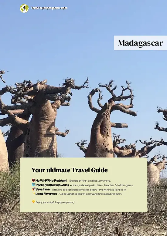
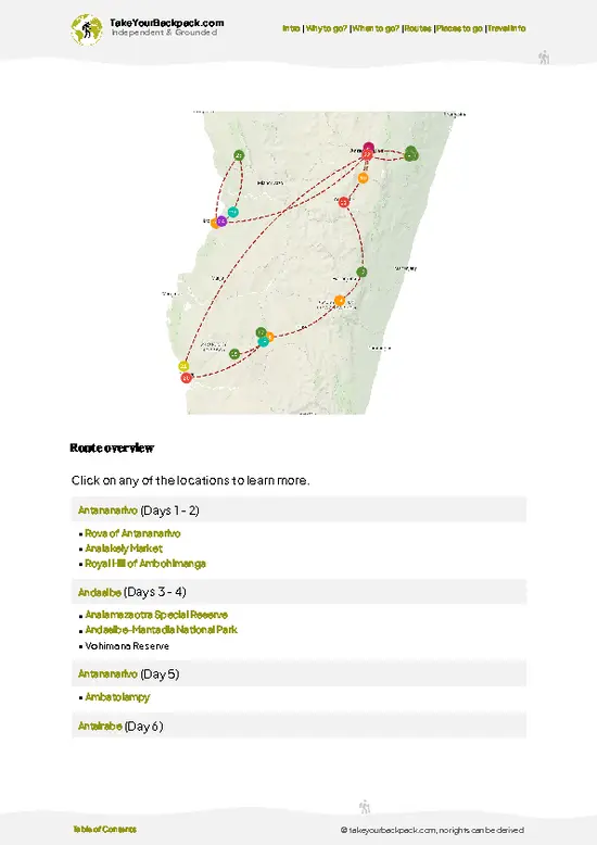
example page 0 from our offline Travel Guide for Madagascar
example page 1 from our offline Travel Guide for Madagascar
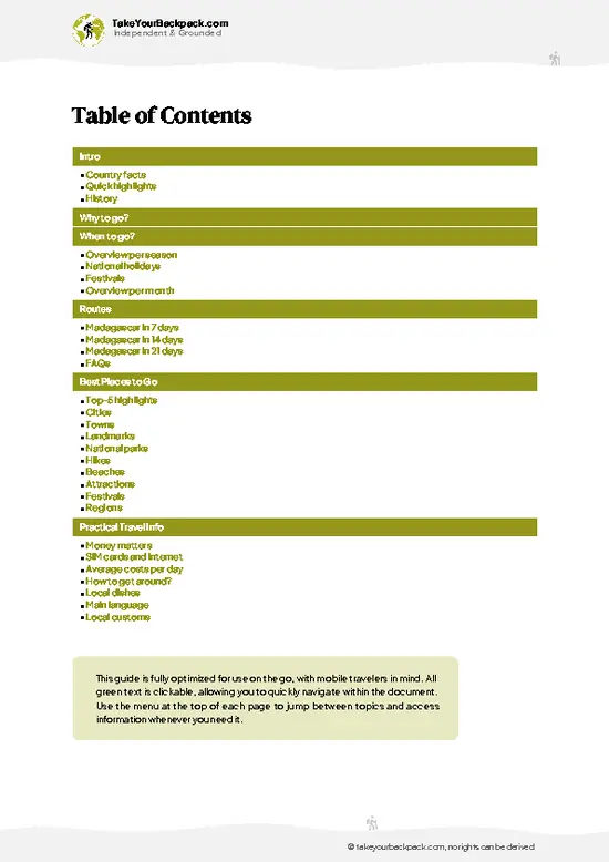
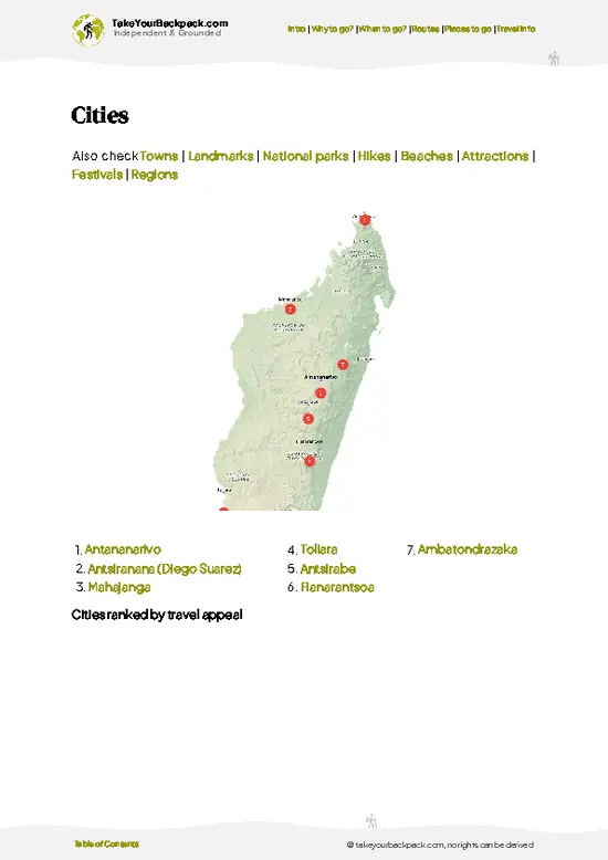
example page 2 from our offline Travel Guide for Madagascar
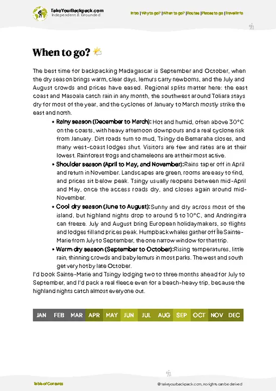
example page 3 from our offline Travel Guide for Madagascar
example page 4 from our offline Travel Guide for Madagascar
example page 5 from our offline Travel Guide for Madagascar
example page 6 from our offline Travel Guide for Madagascar
example page 7 from our offline Travel Guide for Madagascar
The digital guide (301 pages) contains:
✅ 96 highlights, ranked by travel appeal
✅ Optimized 7, 14 & 21-day travel routes
✅ Cities, national parks, landmarks, beaches
✅ How to get around
✅ Offline-friendly for travel without Wi-Fi
👉 Click to see all 30+ guide features

📅 Plan smarter in minutes, not weeks
✅ Month by month travel advice
✅ Festivals & national holidays
✅ Budget expectations

🗺️ Go to the right places, skip the overrated ones
✅ Honest pros & cons of destinations
✅ Top hikes, parks & viewpoints
✅ Lesser-known places most travelers miss
✅ Clear “worth it vs skip it” guidance

🛏️ Travel smoothly without rookie mistakes
✅ Best areas to stay
✅ Transport systems explained simply
✅ Common scams & safety advice
✅ SIM cards, money & practical tips

🌍 Understand the country, not just visit it
✅ Culture & traditions
✅ 52 Essential phrases & customs
✅ Festivals worth planning around
✅ Traveler-friendly historical context
✅ Insights that make places more meaningful

📱 Built for real travel conditions
✅ Fully downloadable PDF
✅ Works completely offline
✅ Optimized for phone use
✅ Useful in remote areas & buses
✅ Everything in one place
Stop searching, start planning
Get instant access to your full guide. 30‑day money-back guarantee.
+ Add another guide for just

By proceeding you agree to our terms.
Sent to your inbox immediately after payment • 100% Secure Checkout
Best Backpacking Travel Advisor 2025 tourism awardBest Backpacking
Travel Advisor
2025
What others say about Take Your Backpack Guides:
⭐⭐⭐⭐⭐
Fantastic, amazing amount of information!
⭐⭐⭐⭐⭐
My goodness this is amazing, it's what I've been looking for hats off too you!
⭐⭐⭐⭐⭐
I think this is absolutely BRILLIANT
⭐⭐⭐⭐
Very complete and informative. It's still missing places, but I gotta to commend you
⭐⭐⭐⭐⭐
This is truly amazing, thank you, can't wait to explore it with my kids!
⭐⭐⭐⭐⭐
Awesome resource, thank you!
⭐⭐⭐⭐⭐
This is amazing! Can't wait to explore the ones I haven't seen
⭐⭐⭐⭐
I love this! Well done, great idea.
⭐⭐⭐⭐⭐
Thanks for taking the time to make this gem!
⭐⭐⭐⭐⭐
This might be the best website I've ever seen.
⭐⭐⭐⭐⭐
Congratulations, and thank you so much for your work; it's incredibly valuable.
⭐⭐⭐⭐
In all seriousness I think you did a great job pointing out the important spots
⭐⭐⭐⭐⭐
10/10 very good
⭐⭐⭐⭐⭐
As someone who's only just starting to visit regularly this is awesome, thank you.
⭐⭐⭐⭐
Thank you very much! I'm going to visit my dad, it's going to be very useful!
⭐⭐⭐⭐⭐
This is really cool! We'll be travelling for the first time and this definitely come in handy.
⭐⭐⭐⭐⭐
You are now our minister of culture, congratulations 👨‍💼
⭐⭐⭐⭐⭐
Just wanted to tell you that this is a pearl! Going to follow your recommendations.
⭐⭐⭐⭐⭐
This is so cool. I'll definitely be using the resource for my travels soon.
⭐⭐⭐⭐⭐
This is very impressive! Good work.
⭐⭐⭐⭐⭐
This is an amazing and informative site. Very well done!

🛏️ Where to stay?Best Stay Options in Madagascar

Dorm-style hostels are rare in Madagascar, but budget guesthouses and simple hotels with private rooms from roughly 40,000 to 110,000 ariary (US$9 to 25) a night are easy to find in every town on the main tourist routes. In Antananarivo, Isoraka has the densest cluster of traveler-friendly guesthouses within walking distance of restaurants and bars, the Haute-Ville (upper town) is quieter with city views but involves steep climbs, and Analakely puts you beside the market and taxi-be hubs at the cost of noise and pickpockets, especially after dark. On the coast, Ambatoloaka on Nosy Be is the liveliest and most convenient base for nightlife, while Ivato, next to the airport, is a dull but practical … read more 👉
Dorm-style hostels are rare in Madagascar, but budget guesthouses and simple hotels with private rooms from roughly 40,000 to 110,000 ariary (US$9 to 25) a night are easy to find in every town on the main tourist routes. In Antananarivo, Isoraka has the densest cluster of traveler-friendly guesthouses within walking distance of restaurants and bars, the Haute-Ville (upper town) is quieter with city views but involves steep climbs, and Analakely puts you beside the market and taxi-be hubs at the cost of noise and pickpockets, especially after dark. On the coast, Ambatoloaka on Nosy Be is the liveliest and most convenient base for nightlife, while Ivato, next to the airport, is a dull but practical choice for one night before or after a flight.

If you enjoy meeting fellow travelers, consider choosing hostels with high ratings for atmosphere. On the other hand, if you prefer having your own space, a hotel might be a better option.

MadagascarWhere to Go Next

👋 Meet the founderWho’s Behind Take Your Backpack?

Johan, backpacker and founder of TakeYourBackpackHi, I’m Johan (Netherlands 🇳🇱), the creator of TakeYourBackpack. Over the past 3 decades, I’ve backpacked through 90+ countries across six continents, gaining extensive experience with independent travel, long-term trips, and overland routes.

This site is built on a combination of firsthand travel experience and carefully curated insights from other backpackers. Many guides are based on places I’ve personally visited, while others bring together tips, observations, and practical advice shared by trusted travelers I’ve met along the way.

The goal is to provide realistic, experience-driven guidance — not generic itineraries — so you can explore destinations with better context, clearer expectations, and more confidence.