×
Toubkal Circuit

Morocco🇲🇦 | hikesToubkal CircuitMulti-day loop, village gîtes, Tizi n’Tamatert, Lake Ifni detour | things to do and best time to go

Explore Paradise ValleyExplore M’Goun Massif

Backpacking in Toubkal Circuit
🏆 Top pickhike ranked #2
By Johan Kruseman 🇳🇱 | Updated October 22, 2026

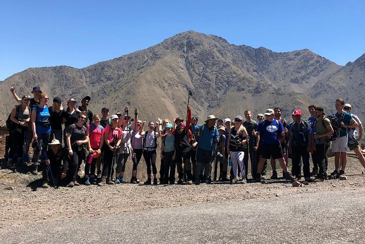
Guides and mules are cheap enough in Imlil that you can cut your own load to a daypack and still sleep in a refuge every night. Toubkal Circuit loops through the High Atlas of Morocco, south of Marrakech, starting and finishing at Imlil. Expect Berber villages, terraced walnut valleys and a final push to 4,167 meters, the highest point in North Africa. It runs about 3 to 5 days and is demanding but not technical. The grand taxi from Marrakech to Imlil is straightforward. I once paid a muleteer to carry gear I never needed, then hauled my sleeping bag uphill anyway because I hadn’t asked what the refuge supplied. Ask first, pay once. Skip the busy Imlil souvenir stalls and the rushed two-day summit-and-back, which wastes the best valleys. Day one could mean a late-morning start from Imlil, a steady climb through Aremd and a night in a village gîte.

Discover everything you want to know in the 📖 Morocco Travel Guide.
Best time to go: March - June, September - November
Duration: 4 days
Distance: 60 kilometers
Total ascent: 3000 meters


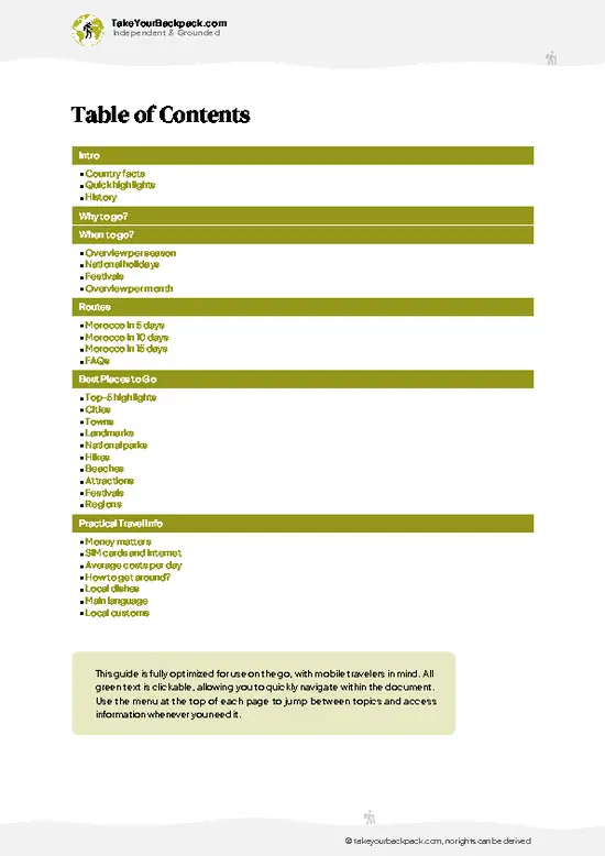
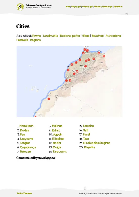
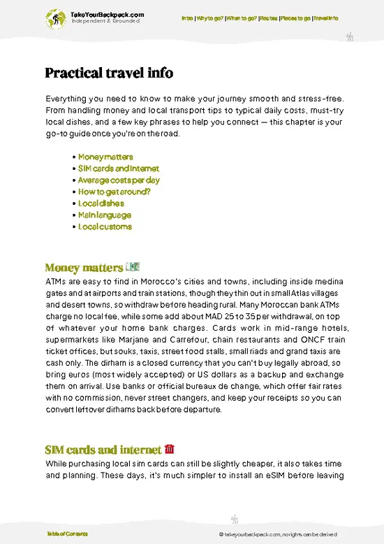
example page 0 from our offline Travel Guide for Morocco
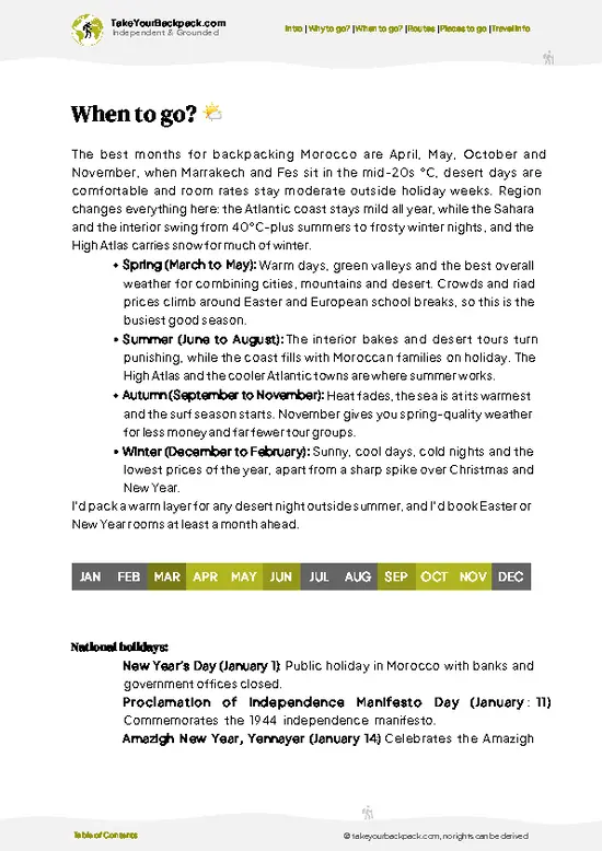
example page 1 from our offline Travel Guide for Morocco
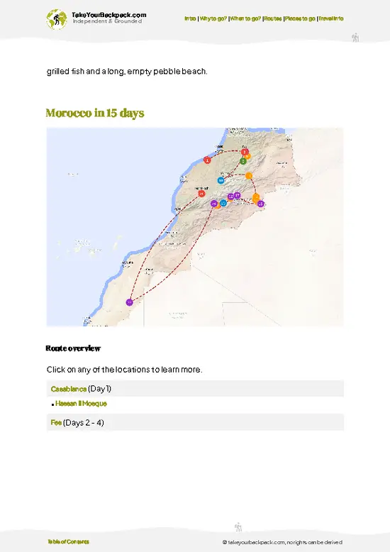
example page 2 from our offline Travel Guide for Morocco
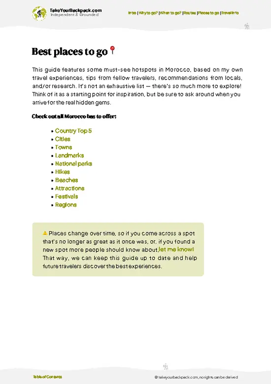
example page 3 from our offline Travel Guide for Morocco
example page 4 from our offline Travel Guide for Morocco
example page 5 from our offline Travel Guide for Morocco
example page 6 from our offline Travel Guide for Morocco
example page 7 from our offline Travel Guide for Morocco
Loading the map 🌍
CLICK TO FILTER
cities
towns
landmarks
national parks
hikes
beaches
attractions
festivals
regions
SHOW COUNTRY’S BESTSHOW ALL

✨ Why go?
Ranked #2 hike in Morocco
Why Toubkal Circuit should be on your travel list

Toubkal Circuit gives you a proper multi-day trek with almost no logistics. Imlil sits within easy reach of Marrakech, so you step off a shared taxi and onto the trail the same day. That matters when you’re stringing together a longer Morocco route and don’t want to burn a day arranging transport.

The real draw is variety. You cross Tizi n’Tamatert and Tizi Oussem passes, drop into green valleys where villagers farm tiny terraces, then finish on the bare scree of the 4,167-meter summit of Jebel Toubkal. Few hikes this accessible change landscape so often.

Costs stay low because gîtes and basic refuges handle food and beds, so you carry little. Distances are flexible too. You can shorten the loop to three days, stretch it to five with extra village nights, or add the summit as a side climb. … read more 👉
Toubkal Circuit gives you a proper multi-day trek with almost no logistics. Imlil sits within easy reach of Marrakech, so you step off a shared taxi and onto the trail the same day. That matters when you’re stringing together a longer Morocco route and don’t want to burn a day arranging transport.

The real draw is variety. You cross Tizi n’Tamatert and Tizi Oussem passes, drop into green valleys where villagers farm tiny terraces, then finish on the bare scree of the 4,167-meter summit of Jebel Toubkal. Few hikes this accessible change landscape so often.

Costs stay low because gîtes and basic refuges handle food and beds, so you carry little. Distances are flexible too. You can shorten the loop to three days, stretch it to five with extra village nights, or add the summit as a side climb. Hardy walkers can go without a guide in good weather.

💡 HighlightsMust-see experiences and standout moments

  1. Jebel Toubkal Summit: The headline sight, 4,167 meters, with views over the whole High Atlas and, on clear days, toward the Sahara. The final stretch is loose scree and steep, so start early.
  2. Toubkal Refuge (Neltner Refuge): A stone-built hut at about 3,200 meters, the standard base for the summit. It is crowded and loud, but the location and hot meals make it worth using.
  3. Tizi n’Tamatert: A high pass with sweeping views over valleys of juniper and rust-colored rock. It feels remote after the busy Imlil area.
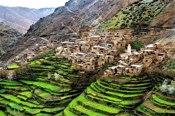
  4. Aremd and Imlil Valley Villages: Mud-brick Berber villages with walnut trees and irrigated terraces. Stopping for lunch here gives you the clearest sense of daily mountain life.
  5. Lake Ifni: A large, deep lake in a barren plateau at about 2,300 meters, reached on a detour from the loop. Its
… read more 👉
  1. Jebel Toubkal Summit: The headline sight, 4,167 meters, with views over the whole High Atlas and, on clear days, toward the Sahara. The final stretch is loose scree and steep, so start early.
  2. Toubkal Refuge (Neltner Refuge): A stone-built hut at about 3,200 meters, the standard base for the summit. It is crowded and loud, but the location and hot meals make it worth using.
  3. Tizi n’Tamatert: A high pass with sweeping views over valleys of juniper and rust-colored rock. It feels remote after the busy Imlil area.
  4. Aremd and Imlil Valley Villages: Mud-brick Berber villages with walnut trees and irrigated terraces. Stopping for lunch here gives you the clearest sense of daily mountain life.
  5. Lake Ifni: A large, deep lake in a barren plateau at about 2,300 meters, reached on a detour from the loop. Its still blue water against red rock makes a good rest day.
Allow three to five days to take in all of it comfortably.
Spotted a mistake or missing something? Contact us.
Things to do around Toubkal Circuit

Ratings based on Tripadvisor reviews. When you book through this link, you support our work at no extra cost to you.

🌤️ When to go?Seasonal considerations and timing

  • Late Spring (May to June): May to June is the best window, with snow melting off the trails and valleys turning green. Villages sit around 15 to 25°C (59 to 77°F) by day, while the Toubkal summit area drops to around 0°C (32°F) at night. Daylight runs about 14 hours.
  • Summer (July to August): Lower valleys hit 30 to 38°C (86 to 100°F), so start early. Highs at 3,000 meters and above stay near 15 to 22°C (59 to 72°F). Trails are busiest and mule and guide rates are firmest.
  • Autumn (September to October): Clear skies, daytime highs of 12 to 22°C (54 to 72°F), and thinner crowds. Afternoon storms can still roll in during September.
  • Winter (November to April): Snow and ice cover the high passes. Daytime temperatures hover around 0 to 8°C (32 to 46°F), with nights well below freezing. Crampons and
… read more 👉
  • Late Spring (May to June): May to June is the best window, with snow melting off the trails and valleys turning green. Villages sit around 15 to 25°C (59 to 77°F) by day, while the Toubkal summit area drops to around 0°C (32°F) at night. Daylight runs about 14 hours.
  • Summer (July to August): Lower valleys hit 30 to 38°C (86 to 100°F), so start early. Highs at 3,000 meters and above stay near 15 to 22°C (59 to 72°F). Trails are busiest and mule and guide rates are firmest.
  • Autumn (September to October): Clear skies, daytime highs of 12 to 22°C (54 to 72°F), and thinner crowds. Afternoon storms can still roll in during September.
  • Winter (November to April): Snow and ice cover the high passes. Daytime temperatures hover around 0 to 8°C (32 to 46°F), with nights well below freezing. Crampons and an ice axe are needed, and daylight shrinks to about 10 hours. Prices dip, but shorter days limit what you can cover.
Aim for the first half of June or late September, when weather is stable and guesthouses still have beds midweek.


source: climatestotravel.comJANJanuary: fair for travelingFEBFebruary: fair for travelingMARMarch: good for travelingAPRApril: excellent for travelingMAYMay: excellent for travelingJUNJune: excellent for travelingJULJuly: fair for travelingAUGAugust: fair for travelingSEPSeptember: excellent for travelingOCTOctober: excellent for travelingNOVNovember: highly recommended for travelingDECDecember: fair for traveling
Morocco - Toubkal Circuit

✈️ The backpacker research shortcutMorocco Travel Guide

An offline-friendly backpacking guide with optimized travel routes, ranked highlights, transport advice, and the best areas to stay.
example page 0 from our offline Travel Guide for Morocco
example page 1 from our offline Travel Guide for Morocco
example page 2 from our offline Travel Guide for Morocco
example page 3 from our offline Travel Guide for Morocco
example page 4 from our offline Travel Guide for Morocco
example page 5 from our offline Travel Guide for Morocco
example page 6 from our offline Travel Guide for Morocco
example page 7 from our offline Travel Guide for Morocco
The digital guide (424 pages) contains:
✅ 112 highlights, ranked by travel appeal
✅ Optimized 5, 10 & 15-day travel routes
✅ Cities, national parks, landmarks, beaches
✅ How to get around
✅ Offline-friendly for travel without Wi-Fi
👉 Click to see all 30+ guide features

📅 Plan smarter in minutes, not weeks
✅ Month by month travel advice
✅ Festivals & national holidays
✅ Budget expectations

🗺️ Go to the right places, skip the overrated ones
✅ Honest pros & cons of destinations
✅ Top hikes, parks & viewpoints
✅ Lesser-known places most travelers miss
✅ Clear “worth it vs skip it” guidance

🛏️ Travel smoothly without rookie mistakes
✅ Best areas to stay
✅ Transport systems explained simply
✅ Common scams & safety advice
✅ SIM cards, money & practical tips

🌍 Understand the country, not just visit it
✅ Culture & traditions
✅ 52 Essential phrases & customs
✅ Festivals worth planning around
✅ Traveler-friendly historical context
✅ Insights that make places more meaningful

📱 Built for real travel conditions
✅ Fully downloadable PDF
✅ Works completely offline
✅ Optimized for phone use
✅ Useful in remote areas & buses
✅ Everything in one place
Stop searching, start planning
Get instant access to your full guide. 30‑day money-back guarantee.
+ Add another guide for just

By proceeding you agree to our terms.
Sent to your inbox immediately after payment • 100% Secure Checkout
Best Backpacking Travel Advisor 2025 tourism awardBest Backpacking
Travel Advisor
2025
What others say about Take Your Backpack Guides:
⭐⭐⭐⭐⭐
Fantastic, amazing amount of information!
⭐⭐⭐⭐⭐
My goodness this is amazing, it's what I've been looking for hats off too you!
⭐⭐⭐⭐⭐
I think this is absolutely BRILLIANT
⭐⭐⭐⭐
Very complete and informative. It's still missing places, but I gotta to commend you
⭐⭐⭐⭐⭐
This is truly amazing, thank you, can't wait to explore it with my kids!
⭐⭐⭐⭐⭐
Awesome resource, thank you!
⭐⭐⭐⭐⭐
This is amazing! Can't wait to explore the ones I haven't seen
⭐⭐⭐⭐
I love this! Well done, great idea.
⭐⭐⭐⭐⭐
Thanks for taking the time to make this gem!
⭐⭐⭐⭐⭐
This might be the best website I've ever seen.
⭐⭐⭐⭐⭐
Congratulations, and thank you so much for your work; it's incredibly valuable.
⭐⭐⭐⭐
In all seriousness I think you did a great job pointing out the important spots
⭐⭐⭐⭐⭐
10/10 very good
⭐⭐⭐⭐⭐
As someone who's only just starting to visit regularly this is awesome, thank you.
⭐⭐⭐⭐
Thank you very much! I'm going to visit my dad, it's going to be very useful!
⭐⭐⭐⭐⭐
This is really cool! We'll be travelling for the first time and this definitely come in handy.
⭐⭐⭐⭐⭐
You are now our minister of culture, congratulations 👨‍💼
⭐⭐⭐⭐⭐
Just wanted to tell you that this is a pearl! Going to follow your recommendations.
⭐⭐⭐⭐⭐
This is so cool. I'll definitely be using the resource for my travels soon.
⭐⭐⭐⭐⭐
This is very impressive! Good work.
⭐⭐⭐⭐⭐
This is an amazing and informative site. Very well done!

🛏️ Where to stay?Best areas to stay in Morocco

If you enjoy meeting fellow travelers, consider choosing hostels with high ratings for atmosphere. On the other hand, if you prefer having your own space, a hotel might be a better option.

🥾 Hike detailsEverything you need to know before hiking Toubkal Circuit

Total Distance: Toubkal Circuit covers roughly 50 to 70 kilometers depending on the variation you choose.
Estimated Duration: 3 to 5 days, with the summit added as a long day.
Difficulty: Moderate to demanding. Altitude and long ascents are the challenge, not technical terrain.
Starting Point: Imlil, reached by shared grand taxi or minibus from Marrakech, then on foot.
Major Landmarks:
  • Aremd: Last large village before the climb.
  • Tizi n’Tamatert: Main pass on the circuit.
  • Toubkal Refuge: Overnight base for the summit.
  • Jebel Toubkal: The 4,167-meter high point.
Terrain and Scenery: Rocky mule tracks, stream
… read more 👉
Total Distance: Toubkal Circuit covers roughly 50 to 70 kilometers depending on the variation you choose.
Estimated Duration: 3 to 5 days, with the summit added as a long day.
Difficulty: Moderate to demanding. Altitude and long ascents are the challenge, not technical terrain.
Starting Point: Imlil, reached by shared grand taxi or minibus from Marrakech, then on foot.
Major Landmarks:
  • Aremd: Last large village before the climb.
  • Tizi n’Tamatert: Main pass on the circuit.
  • Toubkal Refuge: Overnight base for the summit.
  • Jebel Toubkal: The 4,167-meter high point.
Terrain and Scenery: Rocky mule tracks, stream crossings, steep switchbacks and loose scree near the top. Expect red-brown mountainsides, deep valleys and wide views.
Vegetation: Walnut and apple orchards in the valleys, juniper and thorny shrubs higher up, then bare rock above about 3,000 meters.
Wildlife: Mostly goats, sheep and mules. Birds of prey circle the ridges, and Barbary macaques live in lower forested areas of the wider range.
⚠️ Hiking info can sometimes be outdated or inaccurate. Before you hit the trail, check the latest conditions with locals. If you do spot anything that's off, I'd love to hear from you, so I can update it for fellow travelers.

🛡️ SafetyTraveler Safety Guide

The main hazards on the Toubkal Circuit are altitude, sudden weather and loose footing, not crime or wildlife. Passes and the summit area top 3,500 to 4,167 meters, so headaches and poor sleep are common if you gain height too quickly. Keep a slow, steady pace, drink plenty and spread the climb over several nights rather than rushing. Afternoon thunderstorms in summer and ice in winter can turn the scree and rocky stream crossings slick, so hiking poles, sturdy boots and an early start help. Snowmelt makes spring river fords cold and fast, so cross where mules cross or wait for a lower water level. Trails are well worn but have many forks, and mist can hide cairns, so download an offline map. Pack a warm layer, rain shell, sun protection and a basic first aid kit, since you may be a full day … read more 👉
The main hazards on the Toubkal Circuit are altitude, sudden weather and loose footing, not crime or wildlife. Passes and the summit area top 3,500 to 4,167 meters, so headaches and poor sleep are common if you gain height too quickly. Keep a slow, steady pace, drink plenty and spread the climb over several nights rather than rushing. Afternoon thunderstorms in summer and ice in winter can turn the scree and rocky stream crossings slick, so hiking poles, sturdy boots and an early start help. Snowmelt makes spring river fords cold and fast, so cross where mules cross or wait for a lower water level. Trails are well worn but have many forks, and mist can hide cairns, so download an offline map. Pack a warm layer, rain shell, sun protection and a basic first aid kit, since you may be a full day from a road. Mules have right of way, so step to the uphill side.

FAQCommon questions from travelers

Most hikers complete the Toubkal Circuit in 5 to 7 days, covering roughly 60 to 80 kilometers depending on the variation chosen. Daily stages run 5 to 8 hours between villages such as Imlil, Aroumd and Tacheddirt, with high passes around 3,000 to 3,600 meters. Adding the Toubkal summit (4,167 meters) usually means an extra day, and shorter versions of 3 to 4 days also exist.
The Toubkal Circuit is moderate to challenging, mainly because of altitude and long days rather than technical terrain. Expect 800 to 1,200 meters of ascent on the harder days, with scree slopes and rocky passes above 3,000 meters. Fit beginners can manage it with a guide and a slow pace, while winter conditions need crampons and mountaineering experience.
No permit is required for the Toubkal Circuit, and independent hiking is legal, but most trekkers hire a local guide from Imlil. A licensed mountain guide typically costs US$30 to 50 a day, and a mule to carry bags is around US$15 to 25 a day. Guides are strongly advised in winter, in poor visibility, or if you are unsure about route finding on the high passes.
⚠️ Things can change over time, so always validate details locally before you go.

Other Moroccan hikes near Toubkal Circuit

Explore more nearby:

  • Mount Toubkal—Highest in North Africa, Neltner Hut, scree bowl, two-day climb
  • Siroua Massif—Volcanic peak, saffron valleys, Anti-Atlas terraces, thin waymarking| 62 km away
  • Ait Bouguemez Valley—Walnut terraces, mud-brick villages, canal paths, Agouti granary| 152 km away

💡 Not sure where to go next?
Create a personalized itinerary for Morocco including Toubkal Circuit and the places that fit your trip.

Generate my itinerary

👉 Discover all hikes

Or checkout all Morocco has to offer (think cities, towns, villages, national parks, hikes, beaches, festivals)
Country photo of Morocco

We 💚 feedbackIs it worth it?

Toubkal Circuit pairs well with a few nights in Marrakech before or after, or a longer route continuing south toward the desert. I would add one rest day in a village gîte rather than rush the summit, and bring warm layers even in summer. The refuge hut is basic.

✈️ When did I visit Morocco?
In October 2011, I backpacked Morocco for two weeks, with climbing the Mount Toubkal in summer clothing as a highlight.

✍️ Help improve this page!
The information on this page is based on my own backpacking experience in Morocco, supplemented with up-to-date research and feedback from other travelers. Travel details can change, so if you notice anything outdated or incomplete, feel free to let me know.


🙋‍♂️ Give feedback

👋 Meet the founderWho’s Behind Take Your Backpack?

Johan, backpacker and founder of TakeYourBackpackHi, I’m Johan (Netherlands 🇳🇱), the creator of TakeYourBackpack. Over the past 3 decades, I’ve backpacked through 90+ countries across six continents, gaining extensive experience with independent travel, long-term trips, and overland routes.

This site is built on a combination of firsthand travel experience and carefully curated insights from other backpackers. Many guides are based on places I’ve personally visited, while others bring together tips, observations, and practical advice shared by trusted travelers I’ve met along the way.

The goal is to provide realistic, experience-driven guidance — not generic itineraries — so you can explore destinations with better context, clearer expectations, and more confidence.