×

Papua New Guinea🇵🇬 | national parksMount Giluwe4,367-meter summit, tussock grassland, glacial tarns, tree kangaroos | things to do and best time to go

Explore Mount Gahavisuka Provincial ParkExplore Sinasina

Backpacking in Mount Giluwe
👀 For curious travelersnational park ranked #11
By Johan Kruseman 🇳🇱 | Updated October 15, 2026

Your boots sink into spongy moss, frost crunches on the tussock, and the air thins enough to make you huff as the summit ridge appears through shifting cloud. Mount Giluwe sits in the Southern Highlands of Papua New Guinea, northeast of Mendi, and its 4,367 meter peak is the country’s second highest. Alpine grassland, mossy forest and birds of paradise reward the effort, though getting here takes time and local arrangements. Trails are faint, so an experienced traveler hires a local guide from the landowning community, because land is customary and permission matters. Crowds do not exist. Hardy, self-reliant hikers will love it; anyone wanting marked paths and facilities won’t.

Discover everything you want to know in the 📖 Papua New Guinea Travel Guide.


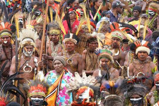
example page 0 from our offline Travel Guide for Papua New Guinea
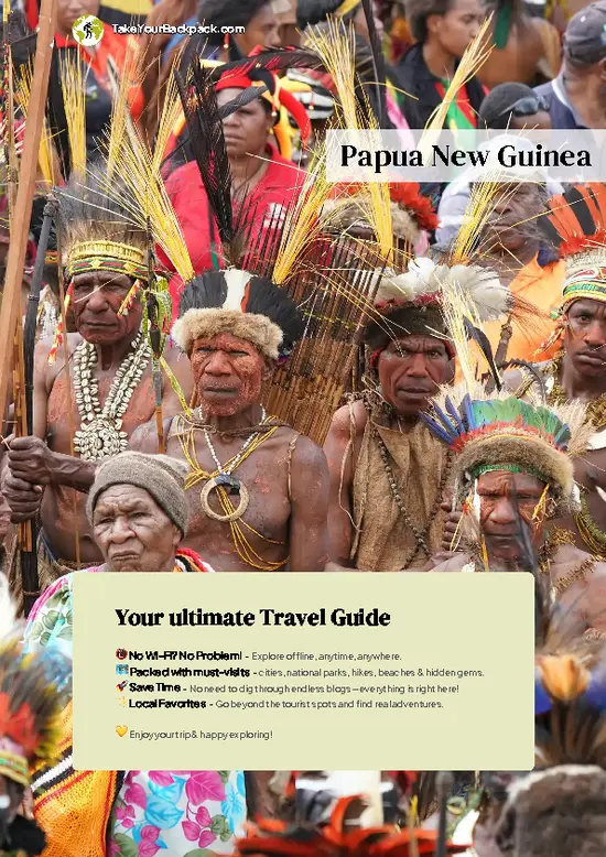
example page 1 from our offline Travel Guide for Papua New Guinea
example page 2 from our offline Travel Guide for Papua New Guinea
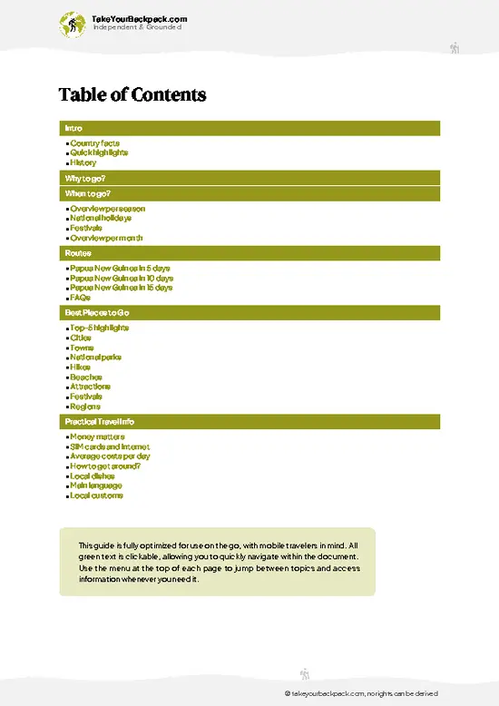
example page 3 from our offline Travel Guide for Papua New Guinea
example page 4 from our offline Travel Guide for Papua New Guinea
example page 5 from our offline Travel Guide for Papua New Guinea
example page 6 from our offline Travel Guide for Papua New Guinea
example page 7 from our offline Travel Guide for Papua New Guinea
Loading the map 🌍
CLICK TO FILTER
cities
towns
national parks
hikes
beaches
attractions
festivals
regions
SHOW COUNTRY’S BESTSHOW ALL

✨ Why go?
Ranked #11 national park in Papua New Guinea
Why visitors keep coming back

Backpackers come for the 4,367 meter summit of Giluwe, an extinct shield volcano whose upper slopes carry real alpine habitat, plus the chance to deal directly with landowning highland communities who guide, carry and host. Nobody sells you a package here. You arrange the climb yourself, and that is the appeal. The mountain rises above mossy cloud forest into open grassland dotted with tree ferns, tussock and small glacial-carved lakes, a setting you will have almost entirely to yourself. Birdwatchers hope for birds of paradise and other highland endemics, and the cold nights at altitude make the climb feel like a proper expedition. Independent, flexible travelers get far more from it than anyone on a fixed tour schedule.

💡 HighlightsDon't-miss highlights and experiences

  1. Summit of Mount Giluwe: the main prize, a broad grassy crest at 4,367 meters with sweeping views over the highlands when the cloud lifts, usually early morning.
  2. Alpine grasslands: open tussock country above the treeline, cold, windswept and crisscrossed with wallaby and bird tracks.
  3. Mossy montane forest: dripping, tangled forest on the lower slopes, thick with tree ferns, orchids and epiphytes.
  4. Glacial lakes and tarns: small high lakes carved by ice-age glaciers, a reminder that this volcano once held ice.
  5. Highland birdlife: birds of paradise, parrots and honeyeaters live in the forest belts, best seen at dawn.
  6. Tree kangaroos and alpine wallabies: elusive marsupials of the upper forest and grassland, with luck spotted at first light.
  7. Highland village life: gardens of sweet potato, pig herds and
… read more 👉
  1. Summit of Mount Giluwe: the main prize, a broad grassy crest at 4,367 meters with sweeping views over the highlands when the cloud lifts, usually early morning.
  2. Alpine grasslands: open tussock country above the treeline, cold, windswept and crisscrossed with wallaby and bird tracks.
  3. Mossy montane forest: dripping, tangled forest on the lower slopes, thick with tree ferns, orchids and epiphytes.
  4. Glacial lakes and tarns: small high lakes carved by ice-age glaciers, a reminder that this volcano once held ice.
  5. Highland birdlife: birds of paradise, parrots and honeyeaters live in the forest belts, best seen at dawn.
  6. Tree kangaroos and alpine wallabies: elusive marsupials of the upper forest and grassland, with luck spotted at first light.
  7. Highland village life: gardens of sweet potato, pig herds and welcoming landowners on the approach tracks.
For a first visit, the summit ridge at dawn is the one to aim for, since the views are clearest before clouds build.
Spotted a mistake or missing something? Contact us.
🌤️ When to go?Weather, crowds, and seasonal trade-offs

  • Drier months (May to October): Clearer mornings give the best odds of summit views from Papua New Guinea's second-highest peak (4,367 m, 14,327 ft). Days reach 15 to 20°C (59 to 68°F), and nights near the top fall to around 0°C (32°F) or below, with frost possible.
  • Wetter months (November to April): Cloud builds by late morning and afternoon rain is common. Tracks turn to mud and the alpine grassland stays soaked.
  • Daylight: Close to the equator, sunrise is near 6 am and sunset near 6 pm all year, so start climbing early.
  • Crowds and prices: Visitors are very few in any month. Guide and lodging rates in Mount Hagen stay fairly steady.
Start your climb at first light, since cloud usually closes in by midday.

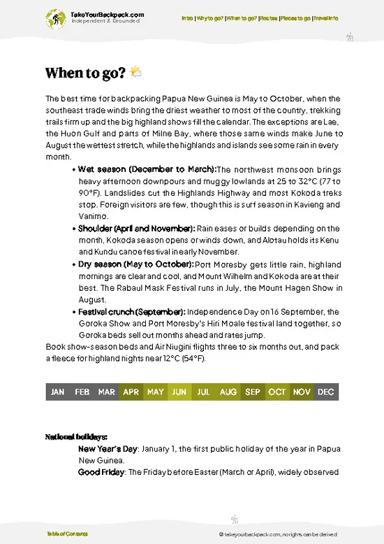
source: climatestotravel.comJANJanuary: below average for travelingFEBFebruary: below average for travelingMARMarch: below average for travelingAPRApril: fair for travelingMAYMay: highly recommended for travelingJUNJune: excellent for travelingJULJuly: excellent for travelingAUGAugust: excellent for travelingSEPSeptember: excellent for travelingOCTOctober: highly recommended for travelingNOVNovember: below average for travelingDECDecember: below average for traveling
papua-new-guinea-national-park-mount-giluwe
© Google |

✈️ The backpacker research shortcutPapua New Guinea Travel Guide

An offline-friendly backpacking guide with optimized travel routes, ranked highlights, transport advice, and the best areas to stay.
example page 0 from our offline Travel Guide for Papua New Guinea
example page 1 from our offline Travel Guide for Papua New Guinea
example page 2 from our offline Travel Guide for Papua New Guinea
example page 3 from our offline Travel Guide for Papua New Guinea
example page 4 from our offline Travel Guide for Papua New Guinea
example page 5 from our offline Travel Guide for Papua New Guinea
example page 6 from our offline Travel Guide for Papua New Guinea
example page 7 from our offline Travel Guide for Papua New Guinea
The digital guide (251 pages) contains:
✅ 81 highlights, ranked by travel appeal
✅ Optimized 5, 10 & 15-day travel routes
✅ Cities, national parks, landmarks, beaches
✅ How to get around
✅ Offline-friendly for travel without Wi-Fi
👉 Click to see all 30+ guide features

📅 Plan smarter in minutes, not weeks
✅ Month by month travel advice
✅ Festivals & national holidays
✅ Budget expectations

🗺️ Go to the right places, skip the overrated ones
✅ Honest pros & cons of destinations
✅ Top hikes, parks & viewpoints
✅ Lesser-known places most travelers miss
✅ Clear “worth it vs skip it” guidance

🛏️ Travel smoothly without rookie mistakes
✅ Best areas to stay
✅ Transport systems explained simply
✅ Common scams & safety advice
✅ SIM cards, money & practical tips

🌍 Understand the country, not just visit it
✅ Culture & traditions
✅ 52 Essential phrases & customs
✅ Festivals worth planning around
✅ Traveler-friendly historical context
✅ Insights that make places more meaningful

📱 Built for real travel conditions
✅ Fully downloadable PDF
✅ Works completely offline
✅ Optimized for phone use
✅ Useful in remote areas & buses
✅ Everything in one place
Stop searching, start planning
Get instant access to your full guide. 30‑day money-back guarantee.
+ Add another guide for just

By proceeding you agree to our terms.
Sent to your inbox immediately after payment • 100% Secure Checkout
Best Backpacking Travel Advisor 2025 tourism awardBest Backpacking
Travel Advisor
2025
What others say about Take Your Backpack Guides:
⭐⭐⭐⭐⭐
Fantastic, amazing amount of information!
⭐⭐⭐⭐⭐
My goodness this is amazing, it's what I've been looking for hats off too you!
⭐⭐⭐⭐⭐
I think this is absolutely BRILLIANT
⭐⭐⭐⭐
Very complete and informative. It's still missing places, but I gotta to commend you
⭐⭐⭐⭐⭐
This is truly amazing, thank you, can't wait to explore it with my kids!
⭐⭐⭐⭐⭐
Awesome resource, thank you!
⭐⭐⭐⭐⭐
This is amazing! Can't wait to explore the ones I haven't seen
⭐⭐⭐⭐
I love this! Well done, great idea.
⭐⭐⭐⭐⭐
Thanks for taking the time to make this gem!
⭐⭐⭐⭐⭐
This might be the best website I've ever seen.
⭐⭐⭐⭐⭐
Congratulations, and thank you so much for your work; it's incredibly valuable.
⭐⭐⭐⭐
In all seriousness I think you did a great job pointing out the important spots
⭐⭐⭐⭐⭐
10/10 very good
⭐⭐⭐⭐⭐
As someone who's only just starting to visit regularly this is awesome, thank you.
⭐⭐⭐⭐
Thank you very much! I'm going to visit my dad, it's going to be very useful!
⭐⭐⭐⭐⭐
This is really cool! We'll be travelling for the first time and this definitely come in handy.
⭐⭐⭐⭐⭐
You are now our minister of culture, congratulations 👨‍💼
⭐⭐⭐⭐⭐
Just wanted to tell you that this is a pearl! Going to follow your recommendations.
⭐⭐⭐⭐⭐
This is so cool. I'll definitely be using the resource for my travels soon.
⭐⭐⭐⭐⭐
This is very impressive! Good work.
⭐⭐⭐⭐⭐
This is an amazing and informative site. Very well done!

🛏️ Where to stay?Best areas to stay in Papua New Guinea

No lodges or developed campsites exist on Mount Giluwe, so most backpackers sleep in Mount Hagen, the main base in the Western Highlands. Hotels there run from simple guesthouses at about K150 to 300 (US$40 to 80) a night to mid-range hotels such as Highlander Hotel at roughly K500 to 800 (US$130 to 210). Mendi, in the Southern Highlands, is a second option, with a few basic guesthouses. Both towns need a hired vehicle for the road to the mountain foothills, which takes several hours on rough tracks.
For the climb itself, you arrange a village stay or camp near the trailhead with local landowners, … read more 👉
No lodges or developed campsites exist on Mount Giluwe, so most backpackers sleep in Mount Hagen, the main base in the Western Highlands. Hotels there run from simple guesthouses at about K150 to 300 (US$40 to 80) a night to mid-range hotels such as Highlander Hotel at roughly K500 to 800 (US$130 to 210). Mendi, in the Southern Highlands, is a second option, with a few basic guesthouses. Both towns need a hired vehicle for the road to the mountain foothills, which takes several hours on rough tracks.
For the climb itself, you arrange a village stay or camp near the trailhead with local landowners, who control access to the land. Bring your own tent, a sleeping bag rated to freezing, and food. Hire a local guide through your Hagen accommodation, because customary landowner permission matters here. Book Hagen rooms ahead and confirm safe transport.

👛 Costs (as of 15 October 2026)How expensive it really is

Expect to spend about US$85 to 190 a day for Mount Giluwe, mostly on transport, guides and Mount Hagen lodging.
CategoryBudget RangeLocal Reality
Entrance and guide feesUSD10 to 30No formal park fee. Landowner and guide payments are negotiated locally.
AccommodationUSD40 to 80Mount Hagen guesthouses in high season. Camping near the trailhead costs far less.
Local transportUSD20 to 50Hired vehicle with driver to the foothills. PMV minibuses cover Hagen town only.
Food and suppliesUSD15 to 30Market produce is cheap. Bring trail food and fuel from Hagen.
Total Daily BudgetUSD85 to 190Costs fall if you split vehicle hire with other travelers.
⚠️ Prices can change and everyone travels differently, so take this as a rough guide. Hope it helps you plan your adventure!

🥾 TrailsDiscover Mount Giluwe's top trails and natural wonders

Mount Giluwe has no signed, designated trails, so the walks people do are guide-led routes up the volcano’s flanks from highland villages on its lower slopes.
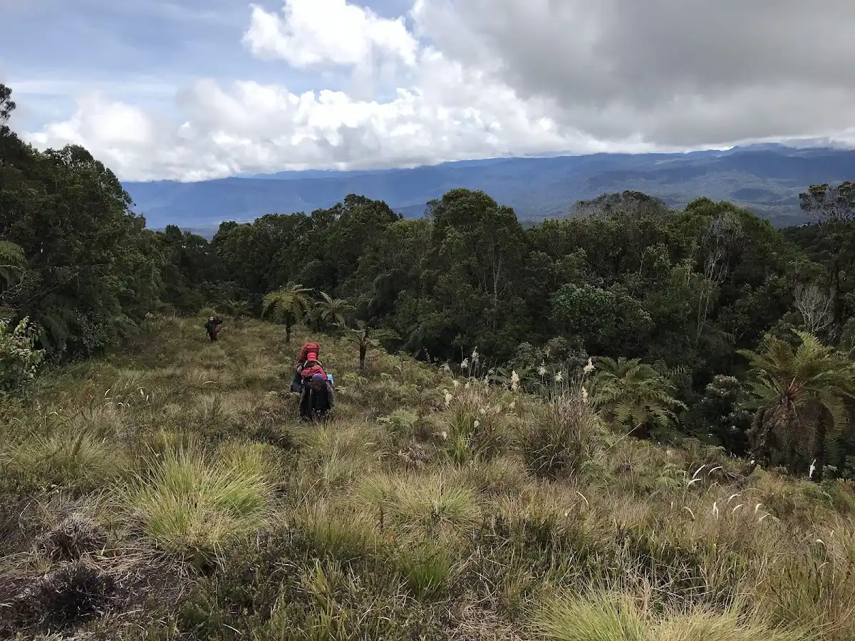
  • Approach: you start from a village near the foot, walk through gardens, then enter mossy forest with steep, muddy, root-tangled ground.
  • Upper slopes: above the forest the terrain opens into tussock grassland and boggy flats, with tree ferns and small lakes along the way.
  • Summit climb: most parties take two to three days round trip, camping high, with a pre-dawn push for the crest. Difficulty is moderate to hard, mainly from altitude, cold,
… read more 👉
Mount Giluwe has no signed, designated trails, so the walks people do are guide-led routes up the volcano’s flanks from highland villages on its lower slopes.
  • Approach: you start from a village near the foot, walk through gardens, then enter mossy forest with steep, muddy, root-tangled ground.
  • Upper slopes: above the forest the terrain opens into tussock grassland and boggy flats, with tree ferns and small lakes along the way.
  • Summit climb: most parties take two to three days round trip, camping high, with a pre-dawn push for the crest. Difficulty is moderate to hard, mainly from altitude, cold, wet ground and poor path visibility.
  • Wildlife: watch for tree kangaroos, wallabies and birds of paradise, mostly early in the morning.
  • Weather: cloud and rain arrive fast, and nights can drop near freezing, so bring warm layers and waterproofs.
Reaching the area means getting to Mendi or Mount Hagen by flight or road, then arranging local transport on rough highland roads, usually with a hired vehicle. Crowds are essentially nil. There is no formal ticket office, but you should agree on guide, porter and access payments with the landowners in advance. Carry your own food, stove and tent, and consider local security advice before setting out.
⚠️ Hiking info can sometimes be outdated or inaccurate. Before you hit the trail, check the latest conditions with locals. If you do spot anything that's off, I'd love to hear from you, so I can update it for fellow travelers.

🛡️ SafetySafety Tips and Common Scams in Mount Giluwe

Cold, wet weather and landowner relations are the main concerns on Mount Giluwe, more than wildlife. Summit nights drop to freezing, and rain with wind can cause hypothermia, so pack a waterproof shell, warm layers, a hat and gloves. At about 4,367 m (14,327 ft), altitude can bring headaches, so ascend steadily and drink plenty of water. Tracks are muddy, and cloud makes navigation hard, so go with a local guide. Wildlife is no real hazard. Security in the Highlands varies, with occasional tribal disputes and road crime, so check conditions locally, travel in daylight and use trusted drivers. Seek landowner permission before walking, and carry a first aid kit, since help is far away.

FAQCommon questions from travelers

Plan on 2 to 3 days from Mount Hagen. One day goes to the drive to the foothills, one to the summit climb and descent (often 8 to 10 hours round trip), with a spare day for weather delays.
Not realistically. Public PMV minibuses connect Mount Hagen and Mendi, but nothing runs to the trailhead, so you need a hired 4WD with driver, usually US$20 to 50 a day, plus a local guide.
No official ticket office exists, but you need permission from the customary landowners and a local guide, usually paid in cash at roughly US$10 to 30 total. Arrange this through your Mount Hagen lodging or local contacts before heading out.
⚠️ Things can change over time, so always validate details locally before you go.

Other Papua New Guinean national parks near Mount Giluwe

Explore more nearby:


💡 Not sure where to go next?
Create a personalized itinerary for Papua New Guinea including Mount Giluwe and the places that fit your trip.

Generate my itinerary

👉 Discover all national parks

Or checkout all Papua New Guinea has to offer (think cities, towns, villages, national parks, hikes, beaches, festivals)
Country photo of Papua New Guinea

We 💚 feedbackWhat to keep in mind

Travelers often turn up expecting to find the trail alone and sort things out on arrival. Don’t. Line up a local guide and village permission before you leave the road, and pack a proper cold-weather sleeping bag, because nights up high bite far harder than the equatorial location suggests.

✍️ Help improve this page!
The information on this page is based on in-depth research, insights shared by experienced travelers, and feedback from the local travel community in Papua New Guinea. While every effort is made to keep the information accurate and current, conditions can change — so if you spot anything incorrect or outdated, please get in touch.


🙋‍♂️ Give feedback

👋 Meet the founderWho’s Behind Take Your Backpack?

Johan, backpacker and founder of TakeYourBackpackHi, I’m Johan (Netherlands 🇳🇱), the creator of TakeYourBackpack. Over the past 3 decades, I’ve backpacked through 90+ countries across six continents, gaining extensive experience with independent travel, long-term trips, and overland routes.

This site is built on a combination of firsthand travel experience and carefully curated insights from other backpackers. Many guides are based on places I’ve personally visited, while others bring together tips, observations, and practical advice shared by trusted travelers I’ve met along the way.

The goal is to provide realistic, experience-driven guidance — not generic itineraries — so you can explore destinations with better context, clearer expectations, and more confidence.