×

Papua New Guinea🇵🇬 | national parksMount Wilhelm4,509-meter peak, Pindaunde Lakes, Kegsugl trailhead, pre-dawn summit push | things to do and best time to go

Explore Torricelli Mountain Range Conservation AreaExplore Mount Gahavisuka Provincial Park

Backpacking in Mount Wilhelm
🏆 Top picknational park ranked #2
By Johan Kruseman 🇳🇱 | Updated October 15, 2026

Mount Wilhelm is the highest peak in Papua New Guinea at 4,509 meters, yet Puncak Jaya in Indonesian Papua stands taller, so it is not the summit of all Oceania. You’ll find it in the Simbu highlands of Papua New Guinea, west of Goroka. Go for the climb: a steep, wet, blissfully non-technical push through cloud forest, past glacial lakes and up to a granite summit. Birds of paradise flit through the trees, and a clear dawn shows both coasts. Now the traps. Cold nights near freezing wreck hikers with thin sleeping bags, so bring a proper one. Late starts mean summit cloud, so leave the hut by 2 a.m. Unplanned guide and landowner fees cause arguments, so agree everything at Kegsugl before you walk. Crowds are tiny. Gentler Mount Gahavisuka near Goroka offers orchid gardens and an easy day out, while Wilhelm is a serious alpine effort.

Discover everything you want to know in the 📖 Papua New Guinea Travel Guide.


example page 0 from our offline Travel Guide for Papua New Guinea
example page 1 from our offline Travel Guide for Papua New Guinea
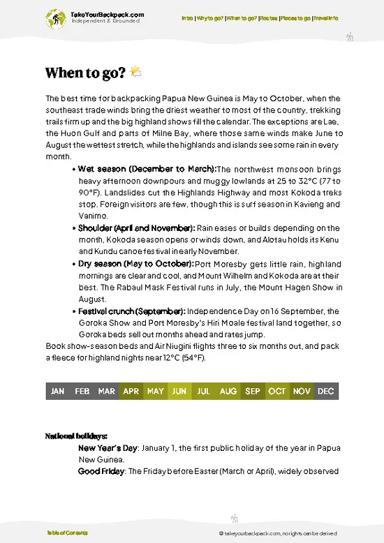
example page 2 from our offline Travel Guide for Papua New Guinea
example page 3 from our offline Travel Guide for Papua New Guinea
example page 4 from our offline Travel Guide for Papua New Guinea
example page 5 from our offline Travel Guide for Papua New Guinea
example page 6 from our offline Travel Guide for Papua New Guinea
example page 7 from our offline Travel Guide for Papua New Guinea
Loading the map 🌍
CLICK TO FILTER
cities
towns
national parks
hikes
beaches
attractions
festivals
regions
SHOW COUNTRY’S BESTSHOW ALL

✨ Why go?
Ranked #2 national park in Papua New Guinea
What makes it a must-see national park

Backpackers come for the climb to 4,509 meters, because few places let you go from village gardens to alpine grass and a cold, rocky summit in just two or three days. There is no cable car, no tour bus and no queue at the top. You walk, you sleep in basic huts beside the Pindaunde Lakes, and you decide when to start. That independence is the real draw. Local guides from the Kegsugl area know the track, the weather moods and the birds, and hiring one is simple and supports the community whose land you cross. You carry your own food and warm layers, and the logistics reward a little planning rather than a big budget. The track is clear enough that confident hikers manage without a package tour, though the altitude, rain and navigation in cloud are real. If you like earning a view, a sunrise … read more 👉
Backpackers come for the climb to 4,509 meters, because few places let you go from village gardens to alpine grass and a cold, rocky summit in just two or three days. There is no cable car, no tour bus and no queue at the top. You walk, you sleep in basic huts beside the Pindaunde Lakes, and you decide when to start. That independence is the real draw. Local guides from the Kegsugl area know the track, the weather moods and the birds, and hiring one is simple and supports the community whose land you cross. You carry your own food and warm layers, and the logistics reward a little planning rather than a big budget. The track is clear enough that confident hikers manage without a package tour, though the altitude, rain and navigation in cloud are real. If you like earning a view, a sunrise over both the Bismarck Sea and the Papuan Gulf on a clear morning is the prize.

💡 HighlightsMust-see experiences and standout moments

  1. Mount Wilhelm summit: The 4,509 meter peak is the reason for coming. The final stretch is bare rock and scree, often cold and windy. On a clear dawn you can see the north and south coasts at once.
  2. Pindaunde Lakes: Two glacial lakes sit at roughly 3,500 meters, ringed by steep walls. This is the usual overnight base, and the water is a deep, still black-blue in the early light.
  3. Lake Piunde: One of the pair near the huts, reached by a short stroll. Reflections of the cliffs and alpine grass make it a good acclimatization wander.
  4. Lake Aunde: A quiet lake below the main path, worth the extra walk if you have a spare half day. Few hikers bother, so you often get it to yourself.
  5. Kegsugl cloud forest: The lower trail climbs through mossy trees draped in lichen and ferns. Dripping, green and muffled,
… read more 👉
  1. Mount Wilhelm summit: The 4,509 meter peak is the reason for coming. The final stretch is bare rock and scree, often cold and windy. On a clear dawn you can see the north and south coasts at once.
  2. Pindaunde Lakes: Two glacial lakes sit at roughly 3,500 meters, ringed by steep walls. This is the usual overnight base, and the water is a deep, still black-blue in the early light.
  3. Lake Piunde: One of the pair near the huts, reached by a short stroll. Reflections of the cliffs and alpine grass make it a good acclimatization wander.
  4. Lake Aunde: A quiet lake below the main path, worth the extra walk if you have a spare half day. Few hikers bother, so you often get it to yourself.
  5. Kegsugl cloud forest: The lower trail climbs through mossy trees draped in lichen and ferns. Dripping, green and muffled, it is the best place to look for birds of paradise and other highland species.
  6. Alpine grassland and tussock slopes: Above the tree line, the landscape opens to wind-bent grass and low shrubs. It is a very different Papua New Guinea from the hot coast.
  7. Kegsugl village gardens: Sweet potato terraces and wooden houses mark the start of the climb. Walking through them gives context for who owns the land and who guides you.
Allow three days, with one for the approach, a pre-dawn summit push on the second morning, and the descent on the third.
Spotted a mistake or missing something? Contact us.

🌤️ When to go?Choosing the right time of year

The dry season from May to October is the best window for climbing Mount Wilhelm (4,509 m / 14,793 ft), with the clearest summit mornings between June and August.
  • Dry Season (May to October): Valley days reach 20 to 24°C (68 to 75°F) at Kegsugl, while the summit area drops to around 0°C (32°F) or below at night. Mornings are often clear before cloud builds by 10 or 11 a.m. Expect the most climbers in this period, especially around Independence Day in mid-September.
  • Wet Season (November to April): Rain is frequent, tracks turn to mud, and the summit is usually socked in. Lake Piunde and the upper rocks get slick. Few trekkers come, and guides have more availability.
  • Daylight: Sunrise is near 6 a.m. and sunset near 6 p.m. all year, so start summit pushes at 2 to 3 a.m. to see the view.
  • Prices: Guide,
… read more 👉
The dry season from May to October is the best window for climbing Mount Wilhelm (4,509 m / 14,793 ft), with the clearest summit mornings between June and August.
  • Dry Season (May to October): Valley days reach 20 to 24°C (68 to 75°F) at Kegsugl, while the summit area drops to around 0°C (32°F) or below at night. Mornings are often clear before cloud builds by 10 or 11 a.m. Expect the most climbers in this period, especially around Independence Day in mid-September.
  • Wet Season (November to April): Rain is frequent, tracks turn to mud, and the summit is usually socked in. Lake Piunde and the upper rocks get slick. Few trekkers come, and guides have more availability.
  • Daylight: Sunrise is near 6 a.m. and sunset near 6 p.m. all year, so start summit pushes at 2 to 3 a.m. to see the view.
  • Prices: Guide, porter and lodge rates are fixed locally and barely move by season.
Book your guide and a PMV ride from Kundiawa a few days ahead for dry season weekends.


source: climatestotravel.comJANJanuary: fair for travelingFEBFebruary: fair for travelingMARMarch: fair for travelingAPRApril: good for travelingMAYMay: highly recommended for travelingJUNJune: excellent for travelingJULJuly: excellent for travelingAUGAugust: excellent for travelingSEPSeptember: highly recommended for travelingOCTOctober: excellent for travelingNOVNovember: good for travelingDECDecember: fair for traveling
when-to-go

✈️ The backpacker research shortcutPapua New Guinea Travel Guide

An offline-friendly backpacking guide with optimized travel routes, ranked highlights, transport advice, and the best areas to stay.
example page 0 from our offline Travel Guide for Papua New Guinea
example page 1 from our offline Travel Guide for Papua New Guinea
example page 2 from our offline Travel Guide for Papua New Guinea
example page 3 from our offline Travel Guide for Papua New Guinea
example page 4 from our offline Travel Guide for Papua New Guinea
example page 5 from our offline Travel Guide for Papua New Guinea
example page 6 from our offline Travel Guide for Papua New Guinea
example page 7 from our offline Travel Guide for Papua New Guinea
The digital guide (251 pages) contains:
✅ 81 highlights, ranked by travel appeal
✅ Optimized 5, 10 & 15-day travel routes
✅ Cities, national parks, landmarks, beaches
✅ How to get around
✅ Offline-friendly for travel without Wi-Fi
👉 Click to see all 30+ guide features

📅 Plan smarter in minutes, not weeks
✅ Month by month travel advice
✅ Festivals & national holidays
✅ Budget expectations

🗺️ Go to the right places, skip the overrated ones
✅ Honest pros & cons of destinations
✅ Top hikes, parks & viewpoints
✅ Lesser-known places most travelers miss
✅ Clear “worth it vs skip it” guidance

🛏️ Travel smoothly without rookie mistakes
✅ Best areas to stay
✅ Transport systems explained simply
✅ Common scams & safety advice
✅ SIM cards, money & practical tips

🌍 Understand the country, not just visit it
✅ Culture & traditions
✅ 52 Essential phrases & customs
✅ Festivals worth planning around
✅ Traveler-friendly historical context
✅ Insights that make places more meaningful

📱 Built for real travel conditions
✅ Fully downloadable PDF
✅ Works completely offline
✅ Optimized for phone use
✅ Useful in remote areas & buses
✅ Everything in one place
Stop searching, start planning
Get instant access to your full guide. 30‑day money-back guarantee.
+ Add another guide for just

By proceeding you agree to our terms.
Sent to your inbox immediately after payment • 100% Secure Checkout
Best Backpacking Travel Advisor 2025 tourism awardBest Backpacking
Travel Advisor
2025
What others say about Take Your Backpack Guides:
⭐⭐⭐⭐⭐
Fantastic, amazing amount of information!
⭐⭐⭐⭐⭐
My goodness this is amazing, it's what I've been looking for hats off too you!
⭐⭐⭐⭐⭐
I think this is absolutely BRILLIANT
⭐⭐⭐⭐
Very complete and informative. It's still missing places, but I gotta to commend you
⭐⭐⭐⭐⭐
This is truly amazing, thank you, can't wait to explore it with my kids!
⭐⭐⭐⭐⭐
Awesome resource, thank you!
⭐⭐⭐⭐⭐
This is amazing! Can't wait to explore the ones I haven't seen
⭐⭐⭐⭐
I love this! Well done, great idea.
⭐⭐⭐⭐⭐
Thanks for taking the time to make this gem!
⭐⭐⭐⭐⭐
This might be the best website I've ever seen.
⭐⭐⭐⭐⭐
Congratulations, and thank you so much for your work; it's incredibly valuable.
⭐⭐⭐⭐
In all seriousness I think you did a great job pointing out the important spots
⭐⭐⭐⭐⭐
10/10 very good
⭐⭐⭐⭐⭐
As someone who's only just starting to visit regularly this is awesome, thank you.
⭐⭐⭐⭐
Thank you very much! I'm going to visit my dad, it's going to be very useful!
⭐⭐⭐⭐⭐
This is really cool! We'll be travelling for the first time and this definitely come in handy.
⭐⭐⭐⭐⭐
You are now our minister of culture, congratulations 👨‍💼
⭐⭐⭐⭐⭐
Just wanted to tell you that this is a pearl! Going to follow your recommendations.
⭐⭐⭐⭐⭐
This is so cool. I'll definitely be using the resource for my travels soon.
⭐⭐⭐⭐⭐
This is very impressive! Good work.
⭐⭐⭐⭐⭐
This is an amazing and informative site. Very well done!

🛏️ Where to stay?Where staying makes the most sense

Most climbers sleep at Pindaunde Lakes camp or in the Kegsugl village guesthouse, with Kundiawa as the town base for supplies and the night before.
Kegsugl, at around 2,800 m (9,200 ft), is the trailhead village. The Kegsugl Guesthouse (also called the Mt Wilhelm Lodge area stay) offers basic rooms with shared facilities and simple meals, and the owners arrange guides and porters. Bring a warm sleeping bag, because nights are cold.
Inside the park, the main option is the Pindaunde Lakes hut at about 3,500 m (11,500 ft), a basic shelter with bunks beside Lake Pindaunde. Most trekkers sleep here, … read more 👉
Most climbers sleep at Pindaunde Lakes camp or in the Kegsugl village guesthouse, with Kundiawa as the town base for supplies and the night before.
Kegsugl, at around 2,800 m (9,200 ft), is the trailhead village. The Kegsugl Guesthouse (also called the Mt Wilhelm Lodge area stay) offers basic rooms with shared facilities and simple meals, and the owners arrange guides and porters. Bring a warm sleeping bag, because nights are cold.
Inside the park, the main option is the Pindaunde Lakes hut at about 3,500 m (11,500 ft), a basic shelter with bunks beside Lake Pindaunde. Most trekkers sleep here, then climb to the summit in the early hours. A second hut, the old ANU research station, stands at the same lake. Both huts need you to carry food, a stove or arrange meals with your guide.
Kundiawa, the capital of Chimbu Province, is the nearest town, around 2 to 3 hours by road from Kegsugl. It has guesthouses, banks, a market and shops for stocking up. Goroka and Mount Hagen have more choice if you arrive by air, and both connect to Kundiawa by PMV along the Highlands Highway.

👛 Costs (as of 15 October 2026)Money, prices, and spending tips

Expect to spend about US$60 to 110 a day climbing Mount Wilhelm, with the guide, porter and lodging making up most of it. Prices are in kina but quoted here in US dollars for comparison.
CategoryBudget RangeLocal Reality
Entrance and community feesUS$10 to 20Landowner and trail fees are paid to the Kegsugl community, usually collected at the guesthouse.
GuideUS$15 to 25A guide is strongly recommended and is arranged locally per day.
PorterUS$10 to 20Optional but common, per day per porter. Most carry food and gear to the Pindaunde huts.
Accommodation (high season)US$10 to 25Kegsugl guesthouse beds and Pindaunde hut bunks are basic. Bring your own sleeping bag.
Food and suppliesUS$10 to 20Simple meals at the guesthouse are available. Stock up on snacks and stove fuel in Kundiawa.
Local transportUS$5
… read more 👉
Expect to spend about US$60 to 110 a day climbing Mount Wilhelm, with the guide, porter and lodging making up most of it. Prices are in kina but quoted here in US dollars for comparison.
CategoryBudget RangeLocal Reality
Entrance and community feesUS$10 to 20Landowner and trail fees are paid to the Kegsugl community, usually collected at the guesthouse.
GuideUS$15 to 25A guide is strongly recommended and is arranged locally per day.
PorterUS$10 to 20Optional but common, per day per porter. Most carry food and gear to the Pindaunde huts.
Accommodation (high season)US$10 to 25Kegsugl guesthouse beds and Pindaunde hut bunks are basic. Bring your own sleeping bag.
Food and suppliesUS$10 to 20Simple meals at the guesthouse are available. Stock up on snacks and stove fuel in Kundiawa.
Local transportUS$5 to 10PMV minibuses run between Kundiawa and Kegsugl, with fares varying by vehicle and road conditions.
Total Daily BudgetUS$60 to 110Per person, per day, in high season.
⚠️ Prices can change and everyone travels differently, so take this as a rough guide. Hope it helps you plan your adventure!

🥾 TrailsWhere to hike in Mount Wilhelm: trails for every level

The main route is a straightforward out-and-back, and nearly all hikers use it. Terrain goes from garden tracks to muddy forest, then to boulders and rock slabs near the top. The weather swings fast, so rain gear matters from the first step.
  • Kegsugl to Pindaunde Lakes: Roughly 4 to 5 hours on foot, a steady climb through gardens and cloud forest to the huts near the lakes. Moderate to hard because of the mud and altitude gain. Birdsong is constant, and tree ferns crowd the path.
  • Pindaunde to the summit: About 4 to 5 hours up from the huts in the dark, starting around 2 a.m., and 2 to 3 hours down.
… read more 👉
The main route is a straightforward out-and-back, and nearly all hikers use it. Terrain goes from garden tracks to muddy forest, then to boulders and rock slabs near the top. The weather swings fast, so rain gear matters from the first step.
  • Kegsugl to Pindaunde Lakes: Roughly 4 to 5 hours on foot, a steady climb through gardens and cloud forest to the huts near the lakes. Moderate to hard because of the mud and altitude gain. Birdsong is constant, and tree ferns crowd the path.
  • Pindaunde to the summit: About 4 to 5 hours up from the huts in the dark, starting around 2 a.m., and 2 to 3 hours down. Hard. Steep rock, loose stones, cold and thin air, with a headlamp essential. Reaching the top before sunrise gives the best chance of clear views.
  • Lake Piunde and Lake Aunde walks: Easy to moderate wanders of one to two hours each from the huts, over wet grassland and rock. Good for acclimatizing or filling a spare afternoon.
  • Wildlife: Highland birds are the highlight, including birds of paradise, along with small mammals and a flush of mosses and orchids in the forest. Alpine meadows hold different species again.
Access is the main hurdle. The usual approach is by road from Kundiawa or Goroka to Kegsugl, and public motor vehicles, often crowded minibuses, run part of the way. Those who want the full road to the trailhead may need to arrange a hire vehicle. Crowds are minimal, even in the drier months, and you may share the huts with only a few others. Fees for guides, hut use and landowners are paid locally in kina, so agree on amounts before you start, carry small notes and keep receipts.
⚠️ Hiking info can sometimes be outdated or inaccurate. Before you hit the trail, check the latest conditions with locals. If you do spot anything that's off, I'd love to hear from you, so I can update it for fellow travelers.

🛡️ SafetyTraveler Safety Guide

Mount Wilhelm is a straightforward but tiring climb, and altitude and weather cause far more trouble than anything else.
The route from Kegsugl climbs steeply through moss forest, then open alpine grass and finally loose granite scree and rock to the summit. Go slowly, spend a night at Pindaunde Lakes at around 3,500 m (11,500 ft) to acclimatize, and watch for headaches or nausea. Descend if they worsen. Cloud and rain roll in by late morning, so start before dawn and be down off the rocks by then. Wet rock is slick, so bring grippy boots, a waterproof shell, gloves and a warm hat, as summit temperatures can fall below freezing.
There are no dangerous large animals on the track. The real concern is personal security in the Highlands. Hire a local guide through the Kegsugl community, travel by … read more 👉
Mount Wilhelm is a straightforward but tiring climb, and altitude and weather cause far more trouble than anything else.
The route from Kegsugl climbs steeply through moss forest, then open alpine grass and finally loose granite scree and rock to the summit. Go slowly, spend a night at Pindaunde Lakes at around 3,500 m (11,500 ft) to acclimatize, and watch for headaches or nausea. Descend if they worsen. Cloud and rain roll in by late morning, so start before dawn and be down off the rocks by then. Wet rock is slick, so bring grippy boots, a waterproof shell, gloves and a warm hat, as summit temperatures can fall below freezing.
There are no dangerous large animals on the track. The real concern is personal security in the Highlands. Hire a local guide through the Kegsugl community, travel by day in daylight, and avoid walking alone. Water from streams should be treated. Carry a headlamp, spare food and a basic first aid kit, as help is far away.

FAQCommon questions from travelers

Plan on 3 days and 2 nights for a typical Mount Wilhelm climb, with a fourth day if you want to spend time at the lakes or allow for weather. Day one is the walk from Kegsugl (about 2,800 m) up to Pindaunde Lakes (about 3,500 m), which takes 3 to 5 hours. The summit push starts around 2 or 3 a.m. on day two, taking 3 to 4 hours up, and you descend to Kegsugl the same day or the next.
Yes, you can, because the area is reached by public transport from Kundiawa without hiring a vehicle. PMV minibuses run along the Highlands Highway and branch roads to Kegsugl, a ride of roughly 2 to 3 hours depending on road conditions. Allow extra time for waiting until the vehicle fills. After that, the entire climb is on foot from the Kegsugl trailhead.
No national park gate fee exists, but you do pay local community and landowner fees at Kegsugl, typically around US$10 to 20 in kina. No permit is usually required beyond that. A local guide is strongly recommended and costs roughly US$15 to 25 per day, and hut use is charged separately.
⚠️ Things can change over time, so always validate details locally before you go.

Other Papua New Guinean national parks near Mount Wilhelm

Explore more nearby:


💡 Not sure where to go next?
Create a personalized itinerary for Papua New Guinea including Mount Wilhelm and the places that fit your trip.

Generate my itinerary

👉 Discover all national parks

Or checkout all Papua New Guinea has to offer (think cities, towns, villages, national parks, hikes, beaches, festivals)
Country photo of Papua New Guinea

We 💚 feedbackWhat to keep in mind

Give it three full days, no fewer, so the altitude and the rain do not decide your summit morning for you. If you can spare a fourth, spend it at the lakes and let the weather window open. I would bring a proper winter sleeping bag and warm gloves, and I would book the guide at Kegsugl the day before.

✍️ Help improve this page!
The information on this page is based on in-depth research, insights shared by experienced travelers, and feedback from the local travel community in Papua New Guinea. While every effort is made to keep the information accurate and current, conditions can change — so if you spot anything incorrect or outdated, please get in touch.


🙋‍♂️ Give feedback

👋 Meet the founderWho’s Behind Take Your Backpack?

Johan, backpacker and founder of TakeYourBackpackHi, I’m Johan (Netherlands 🇳🇱), the creator of TakeYourBackpack. Over the past 3 decades, I’ve backpacked through 90+ countries across six continents, gaining extensive experience with independent travel, long-term trips, and overland routes.

This site is built on a combination of firsthand travel experience and carefully curated insights from other backpackers. Many guides are based on places I’ve personally visited, while others bring together tips, observations, and practical advice shared by trusted travelers I’ve met along the way.

The goal is to provide realistic, experience-driven guidance — not generic itineraries — so you can explore destinations with better context, clearer expectations, and more confidence.