×

South Sudan🇸🇸 | landmarksSudd WetlandsShoebill habitat, papyrus channels, floating islands, Dinka and Nuer camps | things to do and best time to go

Explore Mount KinyetiExplore John Garang Mausoleum

Backpacking in Sudd Wetlands
🏆 Top pickunique site ranked #1
By Johan Kruseman 🇳🇱 | Updated October 22, 2026

Nobody else will be sharing the water, the birds or the silence, and that is the best practical argument for Sudd Wetlands. The swamp spreads along the White Nile in the center of South Sudan, well north of Juba, where the river splits into channels, papyrus walls and floating islands. On the ground there are no roads to speak of. You move by dugout canoe or small motorboat, and the view is a flat green horizon broken by reeds and fishermen, which is the whole appeal. Shoebill sightings alone justify the effort. Birders get far more here than history buffs do, and anyone expecting lodges or marked trails will be disappointed. Access is slow and security needs sorting beforehand. Photographers get low light on glassy water and herders silhouetted against it. A first day could be a dawn paddle through a papyrus channel, a fresh fish lunch in a riverside village, and an afternoon watching hippos from the bank.

Discover everything you want to know in the 📖 South Sudan Travel Guide.
Safety warning

The current risk level for South Sudan is high. Check the advice before going.


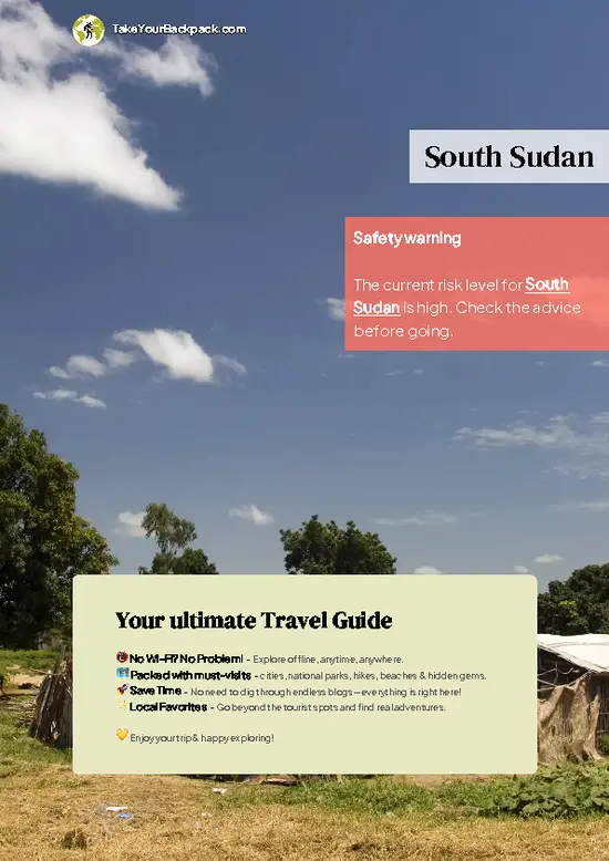
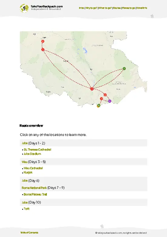
example page 0 from our offline Travel Guide for South Sudan
example page 1 from our offline Travel Guide for South Sudan
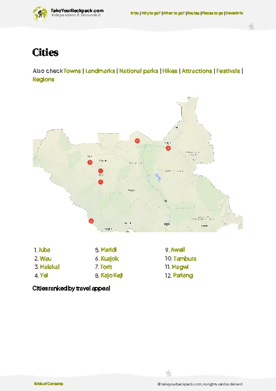
example page 2 from our offline Travel Guide for South Sudan
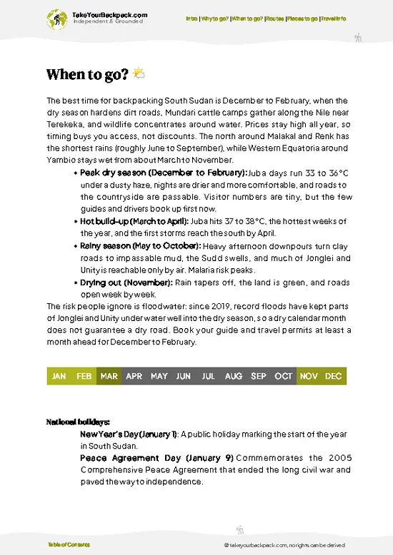
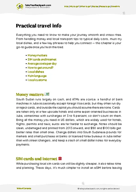
example page 3 from our offline Travel Guide for South Sudan
example page 4 from our offline Travel Guide for South Sudan
example page 5 from our offline Travel Guide for South Sudan
example page 6 from our offline Travel Guide for South Sudan
example page 7 from our offline Travel Guide for South Sudan
Loading the map 🌍
CLICK TO FILTER
cities
towns
landmarks
national parks
hikes
attractions
festivals
regions
SHOW COUNTRY’S BESTSHOW ALL

✨ Why go?
Ranked #1 unique site in South Sudan
Reasons people choose to visit here

Sudd Wetlands is one of the largest freshwater wetlands in Africa, and almost no one visits it. That alone changes what a trip feels like. You are not queuing for a viewpoint or sharing a boat with thirty strangers. You are in a place where the Nile slows down so much that roughly half its water evaporates before moving on, and you can see why from the boat.

The wildlife is the second reason. The swamp is a stronghold for the shoebill stork, a metre-tall prehistoric-looking bird that most birders travel across the continent to find, and it also holds large herds of Nile lechwe and white-eared kob. Few African destinations offer that combination without a park fee or a crowd.

The third reason is the people. Dinka and Nuer cattle camps sit on the drier ground around the edges, and the herders’ … read more 👉
Sudd Wetlands is one of the largest freshwater wetlands in Africa, and almost no one visits it. That alone changes what a trip feels like. You are not queuing for a viewpoint or sharing a boat with thirty strangers. You are in a place where the Nile slows down so much that roughly half its water evaporates before moving on, and you can see why from the boat.

The wildlife is the second reason. The swamp is a stronghold for the shoebill stork, a metre-tall prehistoric-looking bird that most birders travel across the continent to find, and it also holds large herds of Nile lechwe and white-eared kob. Few African destinations offer that combination without a park fee or a crowd.

The third reason is the people. Dinka and Nuer cattle camps sit on the drier ground around the edges, and the herders’ lives still follow the flooding and retreat of the water. For a traveler already crossing South Sudan, the swamp adds a landscape and a way of life that no other stop on the route comes close to matching.

💡 HighlightsWhat this place is best known for

  1. Shoebill stork habitat. This is what most serious visitors come for. The shoebill stands motionless in papyrus margins and shallow lagoons, hunting lungfish, and its huge clog-shaped bill makes it unmistakable. Patience in a drifting canoe is the only method that works.
  2. Papyrus channels by dugout. Narrow lanes cut through walls of papyrus several meters high, with the stems closing overhead in places. The silence is broken only by paddles, frogs and wings, and it is the clearest way to understand how the swamp once stopped explorers cold.
  3. Floating vegetation islands. Mats of papyrus, reeds and grass break loose and drift as islands, and these were what choked the river for earlier navigators. Seeing them up close shows why the name “sudd” comes from an Arabic word for barrier.
  4. Nile lechwe and
… read more 👉
  1. Shoebill stork habitat. This is what most serious visitors come for. The shoebill stands motionless in papyrus margins and shallow lagoons, hunting lungfish, and its huge clog-shaped bill makes it unmistakable. Patience in a drifting canoe is the only method that works.
  2. Papyrus channels by dugout. Narrow lanes cut through walls of papyrus several meters high, with the stems closing overhead in places. The silence is broken only by paddles, frogs and wings, and it is the clearest way to understand how the swamp once stopped explorers cold.
  3. Floating vegetation islands. Mats of papyrus, reeds and grass break loose and drift as islands, and these were what choked the river for earlier navigators. Seeing them up close shows why the name “sudd” comes from an Arabic word for barrier.
  4. Nile lechwe and kob on the floodplain edges. Lechwe wade through shallow water with a distinctive bounding gait, and white-eared kob gather in large herds on the drier grassland. Scanning the horizon at the margins gives you some of the biggest antelope numbers in the region.
  5. Hippos and crocodiles in the main channels. The river arms hold big hippo groups that grunt and surface around your boat, and crocodiles line the banks. Keeping a respectful distance is part of the thrill, and your boatman will read their moods better than you can.
  6. Dinka and Nuer cattle camps. On raised ground around the wetland, herders keep long-horned cattle, burn dung fires for smoke against insects and rub the animals with ash. Visiting with a local guide and an invitation gives you a window into pastoral life that has barely changed in generations.
  7. Fishing communities along the Bahr el Jebel. Villagers fish from canoes and dry their catch on racks, mostly Nile perch and tilapia. Eating freshly grilled fish on the bank is the best meal you will have in the swamp.
Sudd Wetlands rewards an early start, and the papyrus channels paired with a shoebill search make the best single day, since the birds are most active in the cool first hours before you move on to the herders’ camps.
Spotted a mistake or missing something? Contact us.

🌤️ When to go?Seasonal considerations and timing

  • Dry Season (December to March): Water levels drop, channels become navigable on foot and by dugout in places, and roads around Bor, Shambe and the Nile corridor are passable. Days run 32 to 40°C (90 to 104°F), nights 20 to 24°C (68 to 75°F). Daylight stays close to 12 hours. Birdlife concentrates at shrinking pools, and shoebills are easiest to find now. Prices for boats and fuel climb as demand rises.
  • Early Rains (April to June): Storms arrive, humidity builds and temperatures sit at 28 to 35°C (82 to 95°F). Dirt tracks turn to mud, and mosquito numbers surge. Migratory birds begin breeding.
  • Peak Rains (July to October): The wetland swells and floods much of the surrounding plain, with highs of 27 to 32°C (81 to 90°F). Overland access collapses, and river transport is the only option. Few travelers
… read more 👉
  • Dry Season (December to March): Water levels drop, channels become navigable on foot and by dugout in places, and roads around Bor, Shambe and the Nile corridor are passable. Days run 32 to 40°C (90 to 104°F), nights 20 to 24°C (68 to 75°F). Daylight stays close to 12 hours. Birdlife concentrates at shrinking pools, and shoebills are easiest to find now. Prices for boats and fuel climb as demand rises.
  • Early Rains (April to June): Storms arrive, humidity builds and temperatures sit at 28 to 35°C (82 to 95°F). Dirt tracks turn to mud, and mosquito numbers surge. Migratory birds begin breeding.
  • Peak Rains (July to October): The wetland swells and floods much of the surrounding plain, with highs of 27 to 32°C (81 to 90°F). Overland access collapses, and river transport is the only option. Few travelers come, so crowds are nil, but costs for hired boats stay high because of fuel.
  • Late Rains (November): Floodwater starts to recede, roads slowly reopen and the air is milder.
Book a boat and guide a few weeks ahead for January or February, since few operators exist and they fill quickly.


source: climatestotravel.comJANJanuary: highly recommended for travelingFEBFebruary: highly recommended for travelingMARMarch: highly recommended for travelingAPRApril: excellent for travelingMAYMay: good for travelingJUNJune: fair for travelingJULJuly: fair for travelingAUGAugust: fair for travelingSEPSeptember: good for travelingOCTOctober: good for travelingNOVNovember: excellent for travelingDECDecember: highly recommended for traveling
when-to-go

✈️ The backpacker research shortcutSouth Sudan Travel Guide

An offline-friendly backpacking guide with optimized travel routes, ranked highlights, transport advice, and the best areas to stay.
example page 0 from our offline Travel Guide for South Sudan
example page 1 from our offline Travel Guide for South Sudan
example page 2 from our offline Travel Guide for South Sudan
example page 3 from our offline Travel Guide for South Sudan
example page 4 from our offline Travel Guide for South Sudan
example page 5 from our offline Travel Guide for South Sudan
example page 6 from our offline Travel Guide for South Sudan
example page 7 from our offline Travel Guide for South Sudan
The digital guide (242 pages) contains:
✅ 57 highlights, ranked by travel appeal
✅ Optimized 5, 10 & 15-day travel routes
✅ Cities, national parks, landmarks, beaches
✅ How to get around
✅ Offline-friendly for travel without Wi-Fi
👉 Click to see all 30+ guide features

📅 Plan smarter in minutes, not weeks
✅ Month by month travel advice
✅ Festivals & national holidays
✅ Budget expectations

🗺️ Go to the right places, skip the overrated ones
✅ Honest pros & cons of destinations
✅ Top hikes, parks & viewpoints
✅ Lesser-known places most travelers miss
✅ Clear “worth it vs skip it” guidance

🛏️ Travel smoothly without rookie mistakes
✅ Best areas to stay
✅ Transport systems explained simply
✅ Common scams & safety advice
✅ SIM cards, money & practical tips

🌍 Understand the country, not just visit it
✅ Culture & traditions
✅ 52 Essential phrases & customs
✅ Festivals worth planning around
✅ Traveler-friendly historical context
✅ Insights that make places more meaningful

📱 Built for real travel conditions
✅ Fully downloadable PDF
✅ Works completely offline
✅ Optimized for phone use
✅ Useful in remote areas & buses
✅ Everything in one place
Stop searching, start planning
Get instant access to your full guide. 30‑day money-back guarantee.
+ Add another guide for just

By proceeding you agree to our terms.
Sent to your inbox immediately after payment • 100% Secure Checkout
Best Backpacking Travel Advisor 2025 tourism awardBest Backpacking
Travel Advisor
2025
What others say about Take Your Backpack Guides:
⭐⭐⭐⭐⭐
Fantastic, amazing amount of information!
⭐⭐⭐⭐⭐
My goodness this is amazing, it's what I've been looking for hats off too you!
⭐⭐⭐⭐⭐
I think this is absolutely BRILLIANT
⭐⭐⭐⭐
Very complete and informative. It's still missing places, but I gotta to commend you
⭐⭐⭐⭐⭐
This is truly amazing, thank you, can't wait to explore it with my kids!
⭐⭐⭐⭐⭐
Awesome resource, thank you!
⭐⭐⭐⭐⭐
This is amazing! Can't wait to explore the ones I haven't seen
⭐⭐⭐⭐
I love this! Well done, great idea.
⭐⭐⭐⭐⭐
Thanks for taking the time to make this gem!
⭐⭐⭐⭐⭐
This might be the best website I've ever seen.
⭐⭐⭐⭐⭐
Congratulations, and thank you so much for your work; it's incredibly valuable.
⭐⭐⭐⭐
In all seriousness I think you did a great job pointing out the important spots
⭐⭐⭐⭐⭐
10/10 very good
⭐⭐⭐⭐⭐
As someone who's only just starting to visit regularly this is awesome, thank you.
⭐⭐⭐⭐
Thank you very much! I'm going to visit my dad, it's going to be very useful!
⭐⭐⭐⭐⭐
This is really cool! We'll be travelling for the first time and this definitely come in handy.
⭐⭐⭐⭐⭐
You are now our minister of culture, congratulations 👨‍💼
⭐⭐⭐⭐⭐
Just wanted to tell you that this is a pearl! Going to follow your recommendations.
⭐⭐⭐⭐⭐
This is so cool. I'll definitely be using the resource for my travels soon.
⭐⭐⭐⭐⭐
This is very impressive! Good work.
⭐⭐⭐⭐⭐
This is an amazing and informative site. Very well done!

🛏️ Where to stay?Best areas to stay in South Sudan

Bor is the most practical base for the Sudd, and Juba is the place to sort out logistics before heading north. Bor sits on the Nile at the southern fringe of the wetland, with a market, river landings, and a handful of guesthouses and small compounds run by locals and aid-sector hosts. It is not a backpacker hub, so expect simple rooms, shared bathrooms, generators that run for a few hours and little nightlife. That said, the people you meet are mostly humanitarian workers, traders and boat crews, and they are the best source of current road and river information. Ask around the riverfront in … read more 👉
Bor is the most practical base for the Sudd, and Juba is the place to sort out logistics before heading north. Bor sits on the Nile at the southern fringe of the wetland, with a market, river landings, and a handful of guesthouses and small compounds run by locals and aid-sector hosts. It is not a backpacker hub, so expect simple rooms, shared bathrooms, generators that run for a few hours and little nightlife. That said, the people you meet are mostly humanitarian workers, traders and boat crews, and they are the best source of current road and river information. Ask around the riverfront in the morning to find a boatman headed upstream.

Shambe and Mingkaman are smaller settlements closer to the marsh itself. Accommodation there is basic, sometimes limited to a hut or a spot inside a compound arranged through a local contact or an NGO. Camping is possible only with permission from local authorities and a trusted guide.

Juba has the widest choice, including riverside camps with shaded gardens where overlanders and aid staff mix, and it is where you arrange permits, security updates and onward transport. Choose areas with a walled compound and a night guard, and avoid moving around after dark anywhere in the region.

👛 Costs (as of 22 October 2026)Money, prices, and spending tips

Sudd Wetlands costs roughly US$20 to 40 per day for a backpacker, and the total daily budget works out to US$150 when you hire a local boat and guide. Prices are high because supplies are flown or trucked in, and most payments are in cash, either US dollars or South Sudanese pounds.
CategoryBudget RangeLocal Reality
Accommodation (low season)US$20 to 40Basic guesthouse room in Bor, often shared bathroom.
Accommodation (high season)US$30 to 50Rooms fill with aid workers, so book ahead.
FoodUS$8 to 15Fish, beans, flatbread and rice at local eateries; limited choice.
Local transportUS$10 to 25Motorbike taxis and shared vehicles around Bor; fuel costs push fares up.
Boat hireUS$40 to 80Motorized or dugout boat for a day, with a boatman; fuel is the main cost.
Guide and local feesUS$15 to 30Local guide
… read more 👉
Sudd Wetlands costs roughly US$20 to 40 per day for a backpacker, and the total daily budget works out to US$150 when you hire a local boat and guide. Prices are high because supplies are flown or trucked in, and most payments are in cash, either US dollars or South Sudanese pounds.
CategoryBudget RangeLocal Reality
Accommodation (low season)US$20 to 40Basic guesthouse room in Bor, often shared bathroom.
Accommodation (high season)US$30 to 50Rooms fill with aid workers, so book ahead.
FoodUS$8 to 15Fish, beans, flatbread and rice at local eateries; limited choice.
Local transportUS$10 to 25Motorbike taxis and shared vehicles around Bor; fuel costs push fares up.
Boat hireUS$40 to 80Motorized or dugout boat for a day, with a boatman; fuel is the main cost.
Guide and local feesUS$15 to 30Local guide and informal permission fees; no formal park ticket system.
Water and suppliesUS$4 to 8Bottled water, insect repellent and snacks cost more than elsewhere.
Total Daily BudgetUS$150Lower if you share boat costs with others.
⚠️ Prices can change and everyone travels differently, so take this as a rough guide. Hope it helps you plan your adventure!

FAQCommon questions from travelers

Sudd Wetlands is one of the largest freshwater wetlands in the world, formed by the White Nile spreading across the flat plains of central South Sudan. It covers an area that swells to tens of thousands of square kilometers in the rains, and it is a Ramsar-listed site. Papyrus, reed beds and floating vegetation fill the channels, and the area supports shoebills, large fish populations and Nuer, Dinka and Mundari cattle herders.
Allow at least 3 to 5 days to see Sudd Wetlands properly, because travel to the edge and boat time eat up most of a day. A single boat day from Bor costs about US$40 to 80 and gives you a taste of the channels. If you want to look for shoebills or reach deeper areas, plan a week, and add buffer days for delays with permits, fuel and weather.
The usual route to Sudd Wetlands starts in Juba, from where Bor is roughly 200 kilometers north by road, around 5 to 8 hours depending on conditions. Shared vehicles and buses run the route for roughly US$20 to 40, and flights to Bor are possible on small carriers. From Bor you hire a boat or vehicle to reach the marsh edge, and in the wet season the road is often cut, so river transport becomes the main option.
⚠️ Things can change over time, so always validate details locally before you go.

Other South Sudanese landmarks near Sudd Wetlands

Explore more nearby:

  • Jonglei Canal—Unfinished Nile channel, rusting excavator, spoil banks, herder crossings| 82 km away
  • John Garang Mausoleum—Garang’s grave, Juba pilgrimage site, Martyrs’ Day, 2005 peace deal| 404 km away
  • Mount Kinyeti—3,187 m summit, Imatong cloud forest, high moorland, Gilo foothills| 549 km away

💡 Not sure where to go next?
Create a personalized itinerary for South Sudan including Sudd Wetlands and the places that fit your trip.

Generate my itinerary

👉 Discover all landmarks

Or checkout all South Sudan has to offer (think cities, towns, villages, national parks, hikes, beaches, festivals)
Country photo of South Sudan

We 💚 feedbackFinal thoughts on visiting Sudd Wetlands

Sudd Wetlands punishes travelers who treat it like a day trip from a road. The usual mistake is arriving without a local boatman and a firm plan, then spending hours lost in identical channels. I would hire a guide from the nearest river town, set out before dawn, and bring plenty of water, a hat and strong insect repellent.

✍️ Help improve this page!
The information on this page is based on in-depth research, insights shared by experienced travelers, and feedback from the local travel community in South Sudan. While every effort is made to keep the information accurate and current, conditions can change — so if you spot anything incorrect or outdated, please get in touch.


🙋‍♂️ Give feedback

👋 Meet the founderWho’s Behind Take Your Backpack?

Johan, backpacker and founder of TakeYourBackpackHi, I’m Johan (Netherlands 🇳🇱), the creator of TakeYourBackpack. Over the past 3 decades, I’ve backpacked through 90+ countries across six continents, gaining extensive experience with independent travel, long-term trips, and overland routes.

This site is built on a combination of firsthand travel experience and carefully curated insights from other backpackers. Many guides are based on places I’ve personally visited, while others bring together tips, observations, and practical advice shared by trusted travelers I’ve met along the way.

The goal is to provide realistic, experience-driven guidance — not generic itineraries — so you can explore destinations with better context, clearer expectations, and more confidence.