×

Suriname🇸🇷 | national parksBrokopondo ReservoirDrowned trees, Afobaka Dam, reservoir boats, Saramaka villages | things to do and best time to go

Explore FredbergExplore Central Suriname Nature Reserve

Backpacking in Brokopondo Reservoir
👀 For curious travelersnational park ranked #10
By Johan Kruseman 🇳🇱 | Updated October 19, 2026

The decision here is whether to base yourself at the Brokopondo reservoir shore for a day or commit to a night, and the deciding factor is transport, since services thin out fast after midday and a late start strands you. Brokopondo Reservoir lies in the north of Suriname, south of Paramaribo, around the huge Brokopondo reservoir. Expect drowned tree trunks poking from tea-colored water, humid air that smells of wet wood and diesel, and howler monkeys calling at dawn. Roads can wash out in rain, so book a driver in advance. Bring cash, since there are no ATMs nearby. Quiet trails and few crowds come with patchy signage. The shoreline at dusk is full of croaking frogs.

Discover everything you want to know in the 📖 Suriname Travel Guide.


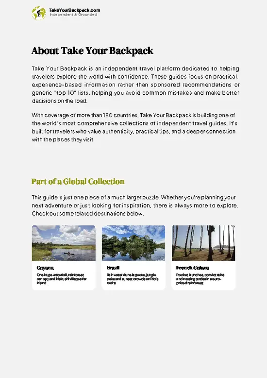
example page 0 from our offline Travel Guide for Suriname
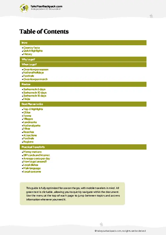
example page 1 from our offline Travel Guide for Suriname
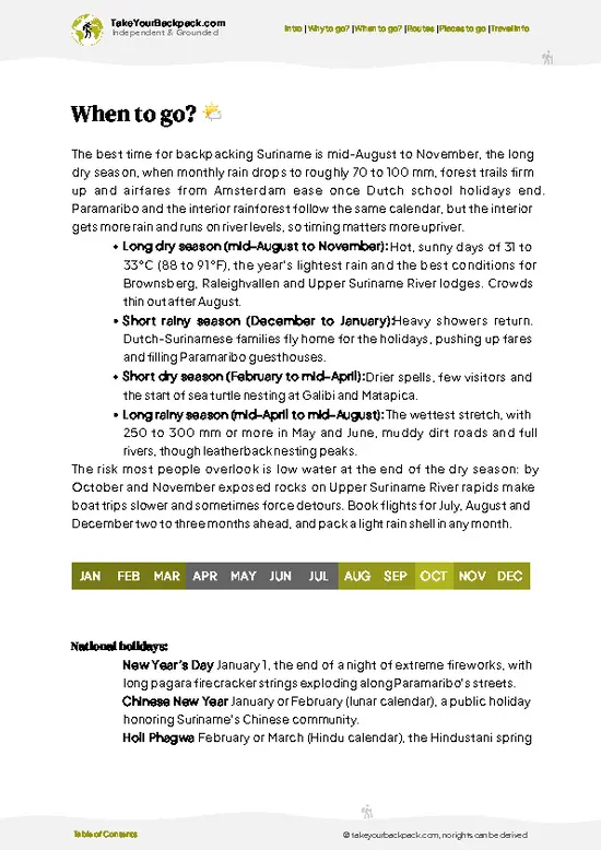
example page 2 from our offline Travel Guide for Suriname
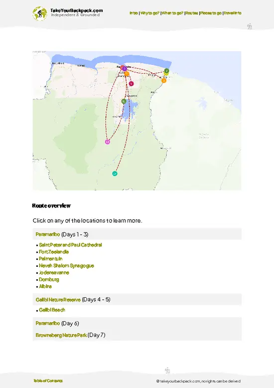
example page 3 from our offline Travel Guide for Suriname
example page 4 from our offline Travel Guide for Suriname
example page 5 from our offline Travel Guide for Suriname
example page 6 from our offline Travel Guide for Suriname
example page 7 from our offline Travel Guide for Suriname
Loading the map 🌍
CLICK TO FILTER
cities
towns
villages
landmarks
national parks
hikes
beaches
attractions
festivals
regions
SHOW COUNTRY’S BESTSHOW ALL

✨ Why go?
Ranked #10 national park in Suriname
What makes it a must-see national park

Brokopondo Reservoir suits backpackers who want to plan their own days around the water instead of following a package. The reservoir, one of the largest man-made lakes in South America, gives you a landscape that exists nowhere else in the country: skeletal trees standing in the lake where the valley was flooded in the 1960s. You can arrange boat rides with local operators, walk forest edges, and chat with villagers rather than shuffling with a tour group. The park also links well with the Afobaka dam area, so a self-guided loop is realistic with a rented car or a hired driver. Visitors are few, which means quiet shoreline mornings and sightings of birds, caimans and primates without competition. If you like improvising and don’t mind rough edges, this is a good fit. If you need marked trails and a visitor center, go elsewhere.

💡 HighlightsPlaces and moments you shouldn't skip

  1. Afobaka Dam and the Brokopondo Reservoir: The dam, finished in the 1960s, holds back the Suriname River and created one of the largest man-made lakes in the world. From the dam wall you see a flat, silver expanse with drowned tree trunks poking through the surface, a strange and quiet sight.
  2. Drowned Forest Shores: Along the reservoir edge, bleached dead trees stand in the water, and kingfishers and herons use them as perches. Early morning boat trips give the best light and the calmest water.
  3. Brokopondo Reservoir Forest Walks: Short paths lead into tall lowland rainforest where the air turns damp and green, and the ground is thick with leaf litter. Listen for the calls of howler monkeys and the rustle of agoutis in the undergrowth.
  4. Birdwatching: Parrots, toucans, and raptors cross the open water
… read more 👉
  1. Afobaka Dam and the Brokopondo Reservoir: The dam, finished in the 1960s, holds back the Suriname River and created one of the largest man-made lakes in the world. From the dam wall you see a flat, silver expanse with drowned tree trunks poking through the surface, a strange and quiet sight.
  2. Drowned Forest Shores: Along the reservoir edge, bleached dead trees stand in the water, and kingfishers and herons use them as perches. Early morning boat trips give the best light and the calmest water.
  3. Brokopondo Reservoir Forest Walks: Short paths lead into tall lowland rainforest where the air turns damp and green, and the ground is thick with leaf litter. Listen for the calls of howler monkeys and the rustle of agoutis in the undergrowth.
  4. Birdwatching: Parrots, toucans, and raptors cross the open water and forest edge. Bring binoculars, because the best sightings come at the lake margins in the first hours after dawn.
  5. Suriname River Rapids Below the Dam: Water released from the dam tumbles over rocks downstream, and the roar carries a long way through the trees. Local fishermen work the eddies from small dugout canoes.
  6. Maroon Villages Along the River: Communities of Saramaka descent live in the area, many relocated when the lake flooded their former land. Visiting with a local guide lets you see wood carving, cassava preparation, and daily river life, and you should ask before taking photos.
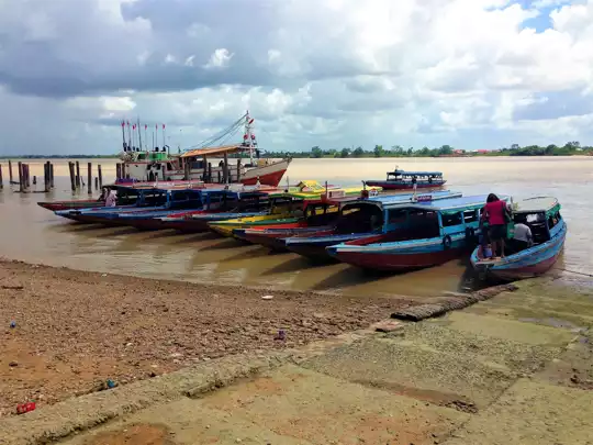
  7. Reservoir Boat Trips: Motorized boats weave among islands of former hilltops now covered in forest. Expect a hot sun, little shade, and the smell of wet wood and fuel.
The Maroon villages near the reservoir get the fewest visitors, yet they explain better than anything else why the lake looks the way it does.
Spotted a mistake or missing something? Contact us.

Things to do near Brokopondo Reservoir

Ratings based on Tripadvisor reviews. When you book through this link, you support our work at no extra cost to you.

🌤️ When to go?Seasonal considerations and timing

The long dry season from mid-August to early December is the most reliable window for Brokopondo Reservoir, with a shorter dry spell in February and March.
  • Long Dry Season (Aug to Dec): Days reach 30 to 33°C (86 to 91°F), nights drop to 22 to 24°C (72 to 75°F). Dirt roads stay firm and lake levels on the Brokopondo reservoir are easier for boat transfers. Daylight runs about 12 hours.
  • Short Dry Season (Feb to Mar): Similar temperatures with lighter showers. Quiet, and lodges rarely fill.
  • Long Rainy Season (Apr to mid-Aug): Daily downpours, humidity above 80 percent, muddy tracks and swollen creeks. Mosquitoes multiply. Some guesthouses cut rates by 10 to 20 percent.
  • Short Rainy Season (Dec to Jan): Intermittent storms, with Surinamese holiday crowds on weekends around the lake.
Book boat transfers … read more 👉
The long dry season from mid-August to early December is the most reliable window for Brokopondo Reservoir, with a shorter dry spell in February and March.
  • Long Dry Season (Aug to Dec): Days reach 30 to 33°C (86 to 91°F), nights drop to 22 to 24°C (72 to 75°F). Dirt roads stay firm and lake levels on the Brokopondo reservoir are easier for boat transfers. Daylight runs about 12 hours.
  • Short Dry Season (Feb to Mar): Similar temperatures with lighter showers. Quiet, and lodges rarely fill.
  • Long Rainy Season (Apr to mid-Aug): Daily downpours, humidity above 80 percent, muddy tracks and swollen creeks. Mosquitoes multiply. Some guesthouses cut rates by 10 to 20 percent.
  • Short Rainy Season (Dec to Jan): Intermittent storms, with Surinamese holiday crowds on weekends around the lake.
Book boat transfers a day ahead, and skip Easter and New Year weekends if you want the lake to yourself.


source: climatestotravel.comJANJanuary: fair for travelingFEBFebruary: fair for travelingMARMarch: fair for travelingAPRApril: fair for travelingMAYMay: fair for travelingJUNJune: fair for travelingJULJuly: fair for travelingAUGAugust: highly recommended for travelingSEPSeptember: excellent for travelingOCTOctober: excellent for travelingNOVNovember: highly recommended for travelingDECDecember: fair for traveling
suriname-national-park-brokopondo-reservoir
© Google | Frits Ten Katen

✈️ The backpacker research shortcutSuriname Travel Guide

An offline-friendly backpacking guide with optimized travel routes, ranked highlights, transport advice, and the best areas to stay.
example page 0 from our offline Travel Guide for Suriname
example page 1 from our offline Travel Guide for Suriname
example page 2 from our offline Travel Guide for Suriname
example page 3 from our offline Travel Guide for Suriname
example page 4 from our offline Travel Guide for Suriname
example page 5 from our offline Travel Guide for Suriname
example page 6 from our offline Travel Guide for Suriname
example page 7 from our offline Travel Guide for Suriname
The digital guide (153 pages) contains:
✅ 40 highlights, ranked by travel appeal
✅ Optimized 5, 10 & 15-day travel routes
✅ Cities, national parks, landmarks, beaches
✅ How to get around
✅ Offline-friendly for travel without Wi-Fi
👉 Click to see all 30+ guide features

📅 Plan smarter in minutes, not weeks
✅ Month by month travel advice
✅ Festivals & national holidays
✅ Budget expectations

🗺️ Go to the right places, skip the overrated ones
✅ Honest pros & cons of destinations
✅ Top hikes, parks & viewpoints
✅ Lesser-known places most travelers miss
✅ Clear “worth it vs skip it” guidance

🛏️ Travel smoothly without rookie mistakes
✅ Best areas to stay
✅ Transport systems explained simply
✅ Common scams & safety advice
✅ SIM cards, money & practical tips

🌍 Understand the country, not just visit it
✅ Culture & traditions
✅ 52 Essential phrases & customs
✅ Festivals worth planning around
✅ Traveler-friendly historical context
✅ Insights that make places more meaningful

📱 Built for real travel conditions
✅ Fully downloadable PDF
✅ Works completely offline
✅ Optimized for phone use
✅ Useful in remote areas & buses
✅ Everything in one place
Stop searching, start planning
Get instant access to your full guide. 30‑day money-back guarantee.
+ Add another guide for just

By proceeding you agree to our terms.
Sent to your inbox immediately after payment • 100% Secure Checkout
Best Backpacking Travel Advisor 2025 tourism awardBest Backpacking
Travel Advisor
2025
What others say about Take Your Backpack Guides:
⭐⭐⭐⭐⭐
Fantastic, amazing amount of information!
⭐⭐⭐⭐⭐
My goodness this is amazing, it's what I've been looking for hats off too you!
⭐⭐⭐⭐⭐
I think this is absolutely BRILLIANT
⭐⭐⭐⭐
Very complete and informative. It's still missing places, but I gotta to commend you
⭐⭐⭐⭐⭐
This is truly amazing, thank you, can't wait to explore it with my kids!
⭐⭐⭐⭐⭐
Awesome resource, thank you!
⭐⭐⭐⭐⭐
This is amazing! Can't wait to explore the ones I haven't seen
⭐⭐⭐⭐
I love this! Well done, great idea.
⭐⭐⭐⭐⭐
Thanks for taking the time to make this gem!
⭐⭐⭐⭐⭐
This might be the best website I've ever seen.
⭐⭐⭐⭐⭐
Congratulations, and thank you so much for your work; it's incredibly valuable.
⭐⭐⭐⭐
In all seriousness I think you did a great job pointing out the important spots
⭐⭐⭐⭐⭐
10/10 very good
⭐⭐⭐⭐⭐
As someone who's only just starting to visit regularly this is awesome, thank you.
⭐⭐⭐⭐
Thank you very much! I'm going to visit my dad, it's going to be very useful!
⭐⭐⭐⭐⭐
This is really cool! We'll be travelling for the first time and this definitely come in handy.
⭐⭐⭐⭐⭐
You are now our minister of culture, congratulations 👨‍💼
⭐⭐⭐⭐⭐
Just wanted to tell you that this is a pearl! Going to follow your recommendations.
⭐⭐⭐⭐⭐
This is so cool. I'll definitely be using the resource for my travels soon.
⭐⭐⭐⭐⭐
This is very impressive! Good work.
⭐⭐⭐⭐⭐
This is an amazing and informative site. Very well done!

🛏️ Where to stay?How to pick the right area

Most backpackers sleep in or near Brokopondo town, since the park itself has only a few basic lodgings. Inside the park area around the Afobaka dam and the Brokopondo reservoir, simple resorts and a few guesthouses offer fan rooms and hammock space for roughly US$20 to 60 a night, often with a restaurant attached. Hammock or tent camping is possible at some lakeside lodges for about US$5 to 12 per person if you bring your own gear and mosquito net. Brokopondo town, about 1.5 to 2 hours by road from Paramaribo, has a handful of modest guesthouses at US$25 to 45 a night and small warung-style eateries. … read more 👉
Most backpackers sleep in or near Brokopondo town, since the park itself has only a few basic lodgings. Inside the park area around the Afobaka dam and the Brokopondo reservoir, simple resorts and a few guesthouses offer fan rooms and hammock space for roughly US$20 to 60 a night, often with a restaurant attached. Hammock or tent camping is possible at some lakeside lodges for about US$5 to 12 per person if you bring your own gear and mosquito net. Brokopondo town, about 1.5 to 2 hours by road from Paramaribo, has a handful of modest guesthouses at US$25 to 45 a night and small warung-style eateries. Paramaribo remains the practical base for many travelers, with hostels from US$15 to 30 a night, and you can reach the park on a long day trip or a one-night stay. Book ahead for weekends, when local families fill lakeside lodges, and confirm that your lodge can arrange boat access to the islands and drowned forest.

👛 Costs (as of 19 October 2026)How expensive it really is

Expect to spend about US$75 a day at Brokopondo Reservoir on a budget with a guide and boat transfers.
CategoryBudget RangeLocal Reality
Entrance and GuideUS$10 to 30Fees are often bundled into lodge or tour packages. Local guides charge per group.
Accommodation (high season)US$20 to 45Simple fan rooms or guesthouses. Camping or hammocks cost less at lakeside lodges.
Local TransportUS$10 to 25Shared minibuses from Paramaribo cost a few dollars each way. Private transfers cost more.
Boat TripsUS$15 to 40Lake excursions are priced per boat, so splitting with others cuts the cost.
Food and SuppliesUS$10 to 20Rice, noodle and chicken dishes at local eateries. Bring snacks and water from Paramaribo.
Total Daily BudgetUS$65 to 160About US$75 for a frugal day with shared transport and basic lodging.
⚠️ Prices can change and everyone travels differently, so take this as a rough guide. Hope it helps you plan your adventure!

🥾 TrailsExploring Brokopondo Reservoir: trails, terrain, and views

Brokopondo Reservoir is best explored through informal walks and boat outings rather than a signed trail network. Most people start at the shore near Afobaka or at a lodge landing and head out from there.
  • Shoreline forest walk: an easy outing of one to two hours on flat, sometimes muddy ground, passing dead trees, vines and bird-filled thickets.
  • Dam area stroll: a short, flat walk of about 30 to 45 minutes along the road and viewpoints near Afobaka Dam, mostly open and sunny.
  • Boat loop among the islands: a half-day on the water with a local boatman, with chances to see caimans, kingfishers and monkeys.
… read more 👉
Brokopondo Reservoir is best explored through informal walks and boat outings rather than a signed trail network. Most people start at the shore near Afobaka or at a lodge landing and head out from there.
  • Shoreline forest walk: an easy outing of one to two hours on flat, sometimes muddy ground, passing dead trees, vines and bird-filled thickets.
  • Dam area stroll: a short, flat walk of about 30 to 45 minutes along the road and viewpoints near Afobaka Dam, mostly open and sunny.
  • Boat loop among the islands: a half-day on the water with a local boatman, with chances to see caimans, kingfishers and monkeys.
  • Longer forest hike with a guide: a moderate day trek of four to six hours through hilly rainforest, with roots, streams and humid air, best done with local knowledge.
Terrain is gently rolling lowland forest, slippery after rain. Wear quick-drying clothes, sturdy shoes and plenty of insect repellent, and carry more water than you expect.
Public transport is limited. Minibuses run from Paramaribo toward Brokopondo town, but reaching the reservoir shore usually means a hired driver or a rental car. Crowds are rare, and you may be the only visitor on a weekday. Entrance arrangements are informal and depend on the operator or lodge you use, so carry small cash in Surinamese currency or US dollars.
⚠️ Hiking info can sometimes be outdated or inaccurate. Before you hit the trail, check the latest conditions with locals. If you do spot anything that's off, I'd love to hear from you, so I can update it for fellow travelers.

🛡️ SafetyScams, Hazards, and Annoyances

Brokopondo Reservoir is straightforward for hikers who go with a local guide, which is the norm here. The main issues are heat, humidity and wet footing. Carry at least 3 liters of water per person, wear closed shoes with grip, and start walks early before afternoon storms. Forest trails are faint, so do not wander off alone, because GPS signal is patchy and everything looks alike under the canopy. Boat trips on the reservoir involve submerged tree trunks, so wear the life jacket provided and use experienced operators. Mosquitoes are constant, and a repellent with DEET and long sleeves at dusk are sensible. Snakes and caimans exist but avoid people, so watch your step and keep your distance. Bring a rain jacket, a dry bag for electronics and a basic first-aid kit, as clinics are far.

FAQCommon questions from travelers

Two days with one night is enough for Brokopondo Reservoir. That covers a boat trip across the reservoir, a guided forest walk and time at the Afobaka dam. Add a third day if you want to reach farther islands or Maroon villages along the lake.
Yes, Brokopondo Reservoir can be reached without a car, though it takes planning. Minibuses run from Paramaribo to Brokopondo town in roughly 2 hours for a few US dollars. From there, lodges arrange boat transfers or taxi rides for about US$15 to 40.
Brokopondo Reservoir has no strict permit system for most visitors, but small fees apply and are usually bundled into lodge or tour prices. Expect roughly US$5 to 15 for access or guiding. Carry your passport, since checkpoints and lodges sometimes ask for ID.
⚠️ Things can change over time, so always validate details locally before you go.

Other Surinamese national parks near Brokopondo Reservoir

Explore more nearby:


💡 Not sure where to go next?
Create a personalized itinerary for Suriname including Brokopondo Reservoir and the places that fit your trip.

Generate my itinerary

👉 Discover all national parks

Or checkout all Suriname has to offer (think cities, towns, villages, national parks, hikes, beaches, festivals)
Country photo of Suriname

We 💚 feedbackWhat to keep in mind

Pair Brokopondo Reservoir with a night in Paramaribo before and a Saramaka river stay further south, so the reservoir becomes the first step into the interior. I would hire a boatman at first light, when the dead trees stand in mist and the howlers are loudest, then be back on the road by noon.

✍️ Help improve this page!
The information on this page is based on in-depth research, insights shared by experienced travelers, and feedback from the local travel community in Suriname. While every effort is made to keep the information accurate and current, conditions can change — so if you spot anything incorrect or outdated, please get in touch.


🙋‍♂️ Give feedback

👋 Meet the founderWho’s Behind Take Your Backpack?

Johan, backpacker and founder of TakeYourBackpackHi, I’m Johan (Netherlands 🇳🇱), the creator of TakeYourBackpack. Over the past 3 decades, I’ve backpacked through 90+ countries across six continents, gaining extensive experience with independent travel, long-term trips, and overland routes.

This site is built on a combination of firsthand travel experience and carefully curated insights from other backpackers. Many guides are based on places I’ve personally visited, while others bring together tips, observations, and practical advice shared by trusted travelers I’ve met along the way.

The goal is to provide realistic, experience-driven guidance — not generic itineraries — so you can explore destinations with better context, clearer expectations, and more confidence.