×

Argentina🇦🇷 | national parksSerranía de Hornocalmulti-colored mountains, high-altitude ridges, panoramic viewpoints, limestone strata | things to do and best time to go

Explore Baritú National ParkExplore Jaaukanigas

Backpacking in Serranía de Hornocal
🌟 Highlightnational park ranked #12
By Johan Kruseman 🇳🇱 | Updated September 4, 2026

The first real fork in the road at Serranía de Hornocal is whether to pay for a 4x4 taxi up the rough track or to hike the steep, dusty road yourself. This isn’t just about saving pesos—it’s about how you want to spend your energy at 4,300 meters, where the air thins and every step counts. Serranía de Hornocal sits outside Humahuaca, in Argentina’s far northwest, a region that feels closer to Bolivia than Buenos Aires in both altitude and attitude.

Hornocal’s rainbow-striped ridges are the draw, and yes, the colors are real—but so is the wind that can sandblast your face if you linger too long at the mirador. Hiking here is short but sharp, with little shade and no water sources. Wildlife is sparse; you might spot a condor, but don’t expect lush forests. There’s no camping inside the park, and budget accommodation means staying in Humahuaca, a dusty town with charm if you squint. Entrance fees are low, but the crowds spike midday, especially compared to the quieter trails of Calilegua or the wild remoteness of Quebrada del Toro. Hornocal is a spectacle, not a wilderness escape—worth it for the view, but not for solitude.

Discover everything you want to know in the 📖 Argentina Travel Guide.
Loading the map 🌍
CLICK TO FILTER
cities
towns
villages
landmarks
national parks
hikes
beaches
attractions
festivals
regions
SHOW COUNTRY’S BESTSHOW ALL

✨ Why go?
Ranked #12 national park in Argentina
The unique appeal for travelers

Backpackers pick Serranía de Hornocal because it offers a rare chance to explore a striking mountain range on your own terms. The park’s independent exploration appeal is strong—there’s no need to book pricey guided tours to access the main viewpoints. You can hike the trails at your own pace, which means you control your schedule and energy. This is a big win for travelers who want to avoid the herd mentality common in more commercialized parks.

Budget-wise, the area supports camping and affordable hostels nearby, so you won’t be forced into expensive lodges or tourist traps. This keeps your costs down and your options flexible. The trails vary from short, manageable walks to longer treks that challenge your stamina, making it suitable for a range of fitness levels.

If you’re the type … read more 👉
Backpackers pick Serranía de Hornocal because it offers a rare chance to explore a striking mountain range on your own terms. The park’s independent exploration appeal is strong—there’s no need to book pricey guided tours to access the main viewpoints. You can hike the trails at your own pace, which means you control your schedule and energy. This is a big win for travelers who want to avoid the herd mentality common in more commercialized parks.

Budget-wise, the area supports camping and affordable hostels nearby, so you won’t be forced into expensive lodges or tourist traps. This keeps your costs down and your options flexible. The trails vary from short, manageable walks to longer treks that challenge your stamina, making it suitable for a range of fitness levels.

If you’re the type who prefers self-guided travel, Serranía de Hornocal fits perfectly. The signage is straightforward, and the terrain is well-marked enough to navigate without a guide, provided you come prepared with maps or GPS. Just remember, the weather can shift quickly, so pack accordingly. In short, this park rewards those who value freedom, affordability, and a bit of ruggedness over polished, packaged experiences.
Want to include Serranía de Hornocal in your Argentina route?
Create a personalized Argentina itinerary that includes Serranía de Hornocal and the places that fit your trip — based on your travel style, budget, and available time. Get your route in seconds.

Generate my trip

💡 HighlightsDon't-miss highlights and experiences

Cerro de los 14 Colores (The Hill of 14 Colors)
This is the main event, and it earns its reputation. The mountain’s layers of red, ochre, green, and lavender aren’t just for show—they’re the result of complex geological folding and mineral deposits over millions of years. The colors shift with the sun, so what you see at midday is different from the late afternoon. Don’t expect solitude at the main viewpoint, but the scale and palette are worth the crowd. If you only have energy for one thing, make it this. (Personal favorite: the first time I saw the colors in person, I stopped mid-sentence. That doesn’t happen often.)


Mirador de Hornocal (Hornocal Viewpoint)
The drive up is a test of nerves—steep, winding, and unpaved—but the payoff is a panoramic view that puts you eye-level with the serrated … read more 👉
Cerro de los 14 Colores (The Hill of 14 Colors)
This is the main event, and it earns its reputation. The mountain’s layers of red, ochre, green, and lavender aren’t just for show—they’re the result of complex geological folding and mineral deposits over millions of years. The colors shift with the sun, so what you see at midday is different from the late afternoon. Don’t expect solitude at the main viewpoint, but the scale and palette are worth the crowd. If you only have energy for one thing, make it this. (Personal favorite: the first time I saw the colors in person, I stopped mid-sentence. That doesn’t happen often.)


Mirador de Hornocal (Hornocal Viewpoint)
The drive up is a test of nerves—steep, winding, and unpaved—but the payoff is a panoramic view that puts you eye-level with the serrated ridgeline. The viewpoint sits at about 4,350 meters, so altitude is a real factor; move slowly and hydrate. This is the best place for photos, but also for simply sitting and letting the wind and silence remind you how far you’ve come. If you want to avoid the crowds, aim for late afternoon, but bring layers: the temperature drops fast.


Short Descent Trail from the Viewpoint
There’s a rough, unofficial trail leading down from the main viewpoint. It’s not for everyone—loose gravel, steep in places, and the altitude makes every step count. But if you’re steady on your feet, the descent gets you closer to the colored strata, and the crowds thin out quickly. The return climb is a lung-buster, so don’t overcommit. This is where you’ll feel the landscape’s scale and silence most intensely.


High-Altitude Flora and Fauna
You’re not here for wildlife safaris, but keep your eyes open. Vicuñas (wild relatives of llamas) graze on the sparse grass, and if you’re lucky, you might spot Andean condors circling overhead. The plant life is tough and low to the ground—yareta, a mossy cushion plant, is older than most cities. These details are easy to overlook, but they’re the real proof you’re in a different world.


Drive from Humahuaca to Hornocal
The journey itself is part of the experience. The 25-kilometer dirt road climbs fast, with switchbacks and drop-offs that demand respect. It’s not a drive for the faint-hearted or for rental cars with low clearance. But the changing views—cactus forests, red earth, and the sudden reveal of the mountains—are a lesson in why the approach matters as much as the destination. If you’re prone to altitude sickness or nervous driving, consider hiring a local driver. It’s money well spent and lets you focus on the scenery, not the next hairpin turn.
Spotted a mistake or missing something? Contact us.

Things to do near Serranía de Hornocal

Ratings based on Tripadvisor reviews. When you book through this link, you support our work at no extra cost to you.

🌤️ When to go?Weather, crowds, and seasonal trade-offs


  • Weather: The best window is from October to April when the dry season dominates. Rainfall drops significantly, reducing the risk of slippery trails and muddy campsites. Outside this period, especially June to August, expect cold, wet conditions that can turn your trek into a slog.

  • Temperature: Daytime highs hover around 20-25°C (68-77°F) during the warmer months, perfect for hiking without overheating. Nights can still dip to near freezing (0-5°C / 32-41°F), so pack layers. Winter months plunge further, often below freezing, making camping uncomfortable without serious gear.

  • Daylight Hours: From November to February, you get roughly 13-14 hours of daylight, maximizing your trekking time. In contrast, May to August offers only about 10 hours, forcing earlier stops and less flexibility
read more 👉

  • Weather: The best window is from October to April when the dry season dominates. Rainfall drops significantly, reducing the risk of slippery trails and muddy campsites. Outside this period, especially June to August, expect cold, wet conditions that can turn your trek into a slog.

  • Temperature: Daytime highs hover around 20-25°C (68-77°F) during the warmer months, perfect for hiking without overheating. Nights can still dip to near freezing (0-5°C / 32-41°F), so pack layers. Winter months plunge further, often below freezing, making camping uncomfortable without serious gear.

  • Daylight Hours: From November to February, you get roughly 13-14 hours of daylight, maximizing your trekking time. In contrast, May to August offers only about 10 hours, forcing earlier stops and less flexibility on the trail.

  • Crowds: The park sees a modest influx during the Southern Hemisphere summer (December to February), but it’s never overwhelming. Shoulder months like October and April offer quieter trails, letting you soak in the landscape without sharing every viewpoint.

  • Seasonal Activities: Spring and summer bring wildflowers and clearer skies, enhancing the visual appeal. Winter months limit access to higher elevations due to snow, so plan accordingly if you want full trail access.

  • Price Fluctuations: Accommodation and local transport costs spike slightly in peak summer (December-February). Booking ahead can save you from last-minute price hikes. Off-season rates drop but expect fewer services and harsher conditions.


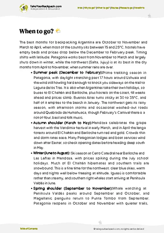
Pro-tip: Aim for late spring (October-November) or early autumn (March-April) to balance good weather, fewer crowds, and better prices—your energy and budget will thank you.


source: climatestotravel.comJANJanuary: excellent for travelingFEBFebruary: excellent for travelingMARMarch: highly recommended for travelingAPRApril: highly recommended for travelingMAYMay: fair for travelingJUNJune: below average for travelingJULJuly: below average for travelingAUGAugust: below average for travelingSEPSeptember: fair for travelingOCTOctober: highly recommended for travelingNOVNovember: highly recommended for travelingDECDecember: excellent for traveling
when-to-go

✈️ The backpacker research shortcutArgentina Travel Guide

An offline-friendly backpacking guide with optimized travel routes, ranked highlights, transport advice, and the best areas to stay.
example page 0 from our offline Travel Guide for Argentina
example page 1 from our offline Travel Guide for Argentina
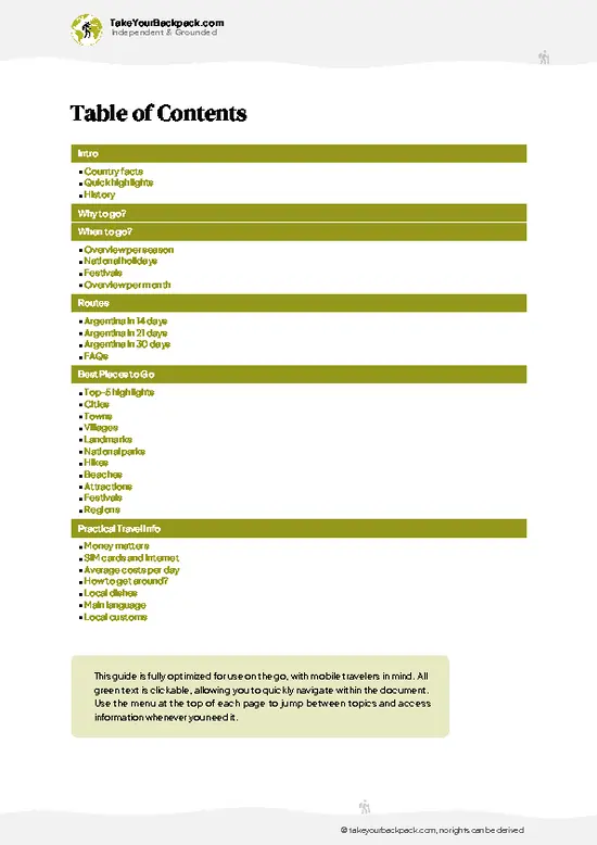
example page 2 from our offline Travel Guide for Argentina
example page 3 from our offline Travel Guide for Argentina
example page 4 from our offline Travel Guide for Argentina
example page 5 from our offline Travel Guide for Argentina
example page 6 from our offline Travel Guide for Argentina
example page 7 from our offline Travel Guide for Argentina
The digital guide (505 pages) contains:
135 highlights, ranked by travel appeal
Optimized 14, 21 & 30-day travel routes
Cities, national parks, landmarks, beaches
How to get around
Offline-friendly for travel without Wi-Fi
👉 Click to see all 30+ guide features

📅 Plan smarter in minutes, not weeks
Month by month travel advice
Festivals & national holidays
Budget expectations

🗺️ Go to the right places, skip the overrated ones
Honest pros & cons of destinations
Top hikes, parks & viewpoints
Lesser-known places most travelers miss
Clear “worth it vs skip it” guidance

🛏️ Travel smoothly without rookie mistakes
Best areas to stay
Transport systems explained simply
Common scams & safety advice
SIM cards, money & practical tips

🌍 Understand the country, not just visit it
Culture & traditions
52 Essential phrases & customs
Festivals worth planning around
Traveler-friendly historical context
Insights that make places more meaningful

📱 Built for real travel conditions
Fully downloadable PDF
Works completely offline
Optimized for phone use
Useful in remote areas & buses
Everything in one place
Save weeks of stressful planning
Get instant access to your full guide. 30‑day money-back guarantee.
+ Add another guide for just €6.50

By proceeding you agree to our terms.
Sent to your inbox immediately after payment • 100% Secure Checkout
Best Backpacking Travel Advisor 2025 tourism awardBest Backpacking
Travel Advisor
2025
What others say about Take Your Backpack Guides:
⭐⭐⭐⭐⭐
Fantastic, amazing amount of information!
⭐⭐⭐⭐⭐
My goodness this is amazing, it's what I've been looking for hats off too you!
⭐⭐⭐⭐⭐
I think this is absolutely BRILLIANT
⭐⭐⭐⭐
Very complete and informative. It's still missing places, but I gotta to commend you
⭐⭐⭐⭐⭐
This is truly amazing, thank you, can't wait to explore it with my kids!
⭐⭐⭐⭐⭐
Awesome resource, thank you!
⭐⭐⭐⭐⭐
This is amazing! Can't wait to explore the ones I haven't seen
⭐⭐⭐⭐
I love this! Well done, great idea.
⭐⭐⭐⭐⭐
Thanks for taking the time to make this gem!
⭐⭐⭐⭐⭐
This might be the best website I've ever seen.
⭐⭐⭐⭐⭐
Congratulations, and thank you so much for your work; it's incredibly valuable.
⭐⭐⭐⭐
In all seriousness I think you did a great job pointing out the important spots
⭐⭐⭐⭐⭐
10/10 very good
⭐⭐⭐⭐⭐
As someone who's only just starting to visit regularly this is awesome, thank you.
⭐⭐⭐⭐
Thank you very much! I'm going to visit my dad, it's going to be very useful!
⭐⭐⭐⭐⭐
This is really cool! We'll be travelling for the first time and this definitely come in handy.
⭐⭐⭐⭐⭐
You are now our minister of culture, congratulations 👨‍💼
⭐⭐⭐⭐⭐
Just wanted to tell you that this is a pearl! Going to follow your recommendations.
⭐⭐⭐⭐⭐
This is so cool. I'll definitely be using the resource for my travels soon.
⭐⭐⭐⭐⭐
This is very impressive! Good work.
⭐⭐⭐⭐⭐
This is an amazing and informative site. Very well done!

🛏️ Where to stay?Choosing the right base

Serranía de Hornocal is a raw, rugged slice of Argentina that doesn’t cater to the usual tourist comforts. There are no accommodations inside the national park itself. If you’re expecting lodges or campsites with amenities, you’ll be disappointed. This is a place for the prepared, not the pampered.

Your best bet is to base yourself in Humahuaca, the nearest town about 25 kilometers away. Humahuaca is small but functional, with a handful of hostels and guesthouses that cater to backpackers. It’s not fancy, but it’s reliable and gives you access to basic supplies, decent food, and a chance to acclimate … read more 👉
Serranía de Hornocal is a raw, rugged slice of Argentina that doesn’t cater to the usual tourist comforts. There are no accommodations inside the national park itself. If you’re expecting lodges or campsites with amenities, you’ll be disappointed. This is a place for the prepared, not the pampered.

Your best bet is to base yourself in Humahuaca, the nearest town about 25 kilometers away. Humahuaca is small but functional, with a handful of hostels and guesthouses that cater to backpackers. It’s not fancy, but it’s reliable and gives you access to basic supplies, decent food, and a chance to acclimate before heading into the high-altitude terrain.

Another option is Tilcara, roughly 40 kilometers from the park. It’s a bit larger and more tourist-oriented, offering a wider range of budget accommodations and a livelier atmosphere. However, staying in Tilcara means a longer commute to the park, so factor that into your daily plans.

Keep in mind that transport options to Serranía de Hornocal are limited and often irregular. Hiring a local driver or joining a tour from Humahuaca or Tilcara is usually necessary. This adds cost and requires early planning. Don’t expect to just show up and find a ride.

Bottom line: plan your stay in Humahuaca or Tilcara, arrange transport ahead, and pack for a day trip. Trying to rough it inside the park isn’t just impractical—it’s unsafe. This approach saves your energy and budget for the moments when you’re actually standing in front of those jaw-dropping, multi-colored limestone ridges.

👛 Costs (as of 4 September 2026)Money, prices, and spending tips

As of the latest available information, visiting the Serranía de Hornocal in Argentina involves an entrance fee of approximately 1,000 Argentine pesos per person, which is about €10. Transportation costs vary: organized tours from Humahuaca can range from 8,000 to 15,000 Argentine pesos per person (€80 to €150), while hiring a 4x4 vehicle for the journey may cost around 6,000 to 10,000 Argentine pesos per person (€60 to €100). Additional expenses include meals and optional purchases at the summit, such as local handicrafts and beverages. Please note that exchange rates fluctuate, so it's advisable to check the current rates before your visit.

source: turismo.jujuy.gob.ar
⚠️ Prices can change and everyone travels differently, so take this as a rough guide. Hope it helps you plan your adventure!

🥾 TrailsScenic routes and wildlife spotting in Serranía de Hornocal

Serranía de Hornocal is a striking mountain range in Argentina’s Jujuy Province, famous for its multicolored limestone formations. Hiking here is less about manicured trails and more about rugged exploration. The terrain is rocky and uneven, with steep inclines that demand solid footwear and a good level of fitness. You won’t find a network of marked paths like in more developed parks, so expect to navigate by natural landmarks and local guidance. The main hiking opportunity is a trek up to the viewpoint overlooking the “14 Colors Hill,” where the layers of sedimentary rock create a striped effect … read more 👉
Serranía de Hornocal is a striking mountain range in Argentina’s Jujuy Province, famous for its multicolored limestone formations. Hiking here is less about manicured trails and more about rugged exploration. The terrain is rocky and uneven, with steep inclines that demand solid footwear and a good level of fitness. You won’t find a network of marked paths like in more developed parks, so expect to navigate by natural landmarks and local guidance. The main hiking opportunity is a trek up to the viewpoint overlooking the “14 Colors Hill,” where the layers of sedimentary rock create a striped effect that’s best seen in the morning or late afternoon light.

Wildlife is sparse but present—look for Andean birds like the condor soaring overhead and small mammals adapted to the arid environment. The altitude, around 4,500 meters (14,760 feet), can hit hard if you’re not acclimated, so take it slow and stay hydrated. The hike itself is moderate to challenging, depending on your pace and how much you push yourself on the steeper sections. The lack of shade means sun protection is essential.

There is one main route that locals and guides recommend:

Hornocal Viewpoint Trail
  • Length: Approximately 5 kilometers (round trip)
  • Estimated Duration: 2 to 3 hours
  • Difficulty Level: Moderate to challenging due to altitude and rocky terrain
  • Key Features: Panoramic views of the multicolored limestone formations, high-altitude desert flora, occasional sightings of Andean condors
  • Terrain: Rocky paths with some steep sections, minimal shade, loose gravel in places

Getting to Serranía de Hornocal is a bit of a project. The nearest town with decent infrastructure is Humahuaca, about 25 kilometers away. From there, public transport options are limited and infrequent. Most visitors rely on private tours or taxis, which can be pricey but save time and hassle. The road to the park is unpaved and can be rough, especially after rain. Crowds are generally light, as this is not a mainstream tourist spot, but weekends and local holidays see a noticeable uptick in visitors. There is no entrance fee, but hiring a local guide is strongly recommended for safety and to enrich your understanding of the area’s geology and culture.

In short, Serranía de Hornocal is not a casual stroll. It demands respect for the altitude, the terrain, and the sparse infrastructure. But if you prepare properly, it rewards with a visual spectacle that’s rare even in the Andes. Avoid underestimating the climb or the sun exposure, and you’ll save your energy for the views that truly make this hike worth it.
⚠️ Hiking info can sometimes be outdated or inaccurate. Before you hit the trail, check the latest conditions with locals. If you do spot anything that's off, I'd love to hear from you, so I can update it for fellow travelers.

🛡️ SafetyScams, Hazards, and Annoyances

Serranía de Hornocal sits high enough to remind you that altitude is no joke—around 4,700 meters (15,400 feet). That means thinner air and a slower pace. Don’t rush; your body needs time to adjust. Weather can flip quickly, especially outside the dry season (May to September). Mornings often start crisp and clear, but afternoons may bring sudden wind or chill. Dress in layers and carry sun protection—UV is intense up here.

The trails themselves aren’t technical climbs, but expect uneven footing and loose gravel. Good hiking boots with solid grip are non-negotiable. Navigation is straightforward; the main viewpoints are well-marked, so you won’t need a compass or GPS unless you’re wandering off the beaten path. Water sources are scarce, so bring enough to stay hydrated.

Wildlife encounters … read more 👉
Serranía de Hornocal sits high enough to remind you that altitude is no joke—around 4,700 meters (15,400 feet). That means thinner air and a slower pace. Don’t rush; your body needs time to adjust. Weather can flip quickly, especially outside the dry season (May to September). Mornings often start crisp and clear, but afternoons may bring sudden wind or chill. Dress in layers and carry sun protection—UV is intense up here.

The trails themselves aren’t technical climbs, but expect uneven footing and loose gravel. Good hiking boots with solid grip are non-negotiable. Navigation is straightforward; the main viewpoints are well-marked, so you won’t need a compass or GPS unless you’re wandering off the beaten path. Water sources are scarce, so bring enough to stay hydrated.

Wildlife encounters are minimal—mostly birds and small mammals. Respect their space and avoid feeding them. The biggest hazard is underestimating the altitude and weather shifts. Prepare accordingly, pace yourself, and you’ll have the energy to enjoy the colors and contours that make this place unique.

FAQCommon questions from travelers

1 to 2 days are sufficient to explore Serranía de Hornocal. Most visitors spend a day visiting the viewpoint and nearby trails, but adding an extra day allows for acclimatization and exploring surrounding areas in Jujuy Province.
Yes, you can visit Serranía de Hornocal without a car. Local buses and guided tours from Humahuaca or Tilcara provide access, though schedules may be limited and tours offer the easiest transport option.
No entrance fee or special permit is required to visit Serranía de Hornocal. It is a natural landmark accessible to the public, but hiring a local guide is recommended for safety and to enhance the experience.
⚠️ Things can change over time, so always validate details locally before you go.

Other Argentinian national parks near Serranía de Hornocal

Explore more nearby:


💡 Not sure where to go next?
Create a personalized itinerary for Argentina including Serranía de Hornocal and the places that fit your trip.

Generate my itinerary

👉 Discover all national parks

Or checkout all Argentina has to offer (think cities, towns, villages, national parks, hikes, beaches, festivals)
Country photo of Argentina

We 💚 feedbackParting advice and final tips

Serranía de Hornocal is a rare kind of spectacle—those layered, rainbow-hued mountains that make you stop and just stare. It’s not just a photo op; it’s a reminder of how geology can shape awe. But don’t expect easy access or crowds to guide you. The roads are rough, and the altitude can sneak up on you. Plan for that, and you’ll save your energy for the views that truly deserve it.

✈️ When did I visit Argentina?
I have visited Argentina, together with Chile, in September 2012.

✍️ Help improve this page!
The information on this page is based on my own backpacking experience in Argentina, supplemented with up-to-date research and feedback from other travelers. Travel details can change, so if you notice anything outdated or incomplete, feel free to let me know.


🙋‍♂️ Give feedback

👋 Meet the founderWho’s Behind Take Your Backpack?

Johan, backpacker and founder of TakeYourBackpackHi, I’m Johan (Netherlands 🇳🇱), the creator of TakeYourBackpack. Over the past decade, I’ve backpacked through 80+ countries across six continents, gaining extensive experience with independent travel, long-term trips, and overland routes.

This site is built on a combination of firsthand travel experience and carefully curated insights from other backpackers. Many guides are based on places I’ve personally visited, while others bring together tips, observations, and practical advice shared by trusted travelers I’ve met along the way.

The goal is to provide realistic, experience-driven guidance — not generic itineraries — so you can explore destinations with better context, clearer expectations, and more confidence.

Get full Argentina guide •
Instant download • 135 highlights • Full Offline guide