
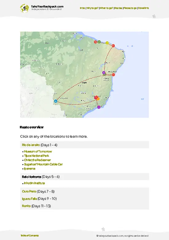
- Pico Paraná summit: The main goal at about 1,877 meters, a rocky top with a 360-degree view over ridges and forest, plus the register notebooks.
- Camapuã peak: A shorter scramble from the main camp area, with a close view of Pico Paraná's profile and often clearer air at dawn.
- Pico Paraná campsite: The base camp used by most hikers, set in open highland with water nearby and a flat spot for tents.
- Serra do Ibitiraquire ridgeline: The rolling crest between Atlantic forest and highland grass, with sudden drops and long views toward the coast.
- Sea of clouds at dawn: On clear mornings the valleys fill with cloud below the summit, a sight that justifies the cold early start.
Spotted a mistake or missing something? Contact us.

Bar-hopping and Food Tour in Curitiba

Sunset Train Ride

Scenic Train ride to historical cities of Morretes and Antonina

Full-day tour in Curitiba

Complete Tour to Ilha do Mel

Experience the Best of Curitiba: City Tour Highlights

Full Day Tour to Vila Velha and Buraco do Padre

8h full city tour in Curitiba

4 Hour City Tour in Curitiba


 Best Backpacking
 Hi, I’m Johan (Netherlands 🇳🇱), the creator of TakeYourBackpack. Over the past 3 decades, I’ve backpacked through 90+ countries across six continents, gaining extensive experience with independent travel, long-term trips, and overland routes.