

×

Madagascar🇲🇬 | hikesMarojejy Circuitrainforest slopes, bamboo thickets, lemur habitats | things to do and best time to go

Explore Ankarana Special ReserveExplore Isalo Window Trail

Backpacking in Marojejy Circuit
🌟 Highlighthike ranked #3
By Johan Kruseman 🇳🇱 | Updated September 3, 2026

Mud sucks at your boots, sweat stings your eyes, and the rainforest’s breath—thick, green, relentless—presses in from every side. You grip a root, haul yourself up another slick step, and suddenly the canopy splits. Mist curls off razorback ridges, and somewhere below, indri lemurs call out like ghosts. This is the Marojejy Circuit, deep in Madagascar’s northeast, where the pavement ends and the real work begins.

Marojejy isn’t a stroll. The circuit chews up your legs with steep, root-choked climbs and spits you out at cloud forests and knife-edge summits. The scenery is wild—ferns the size of umbrellas, waterfalls that roar after rain, and a sense of isolation you won’t find on the busier Andringitra or Ankarana trails. Getting here is half the battle: public transport crawls, and the last stretch to the park gate is a bone-rattling ride. But when you finally drop your pack at Camp 2, crack open a warm THB beer, and watch the sun bleed through the mist, you’ll know you earned every blister.

Discover everything you want to know in the 📖 Madagascar Travel Guide.
Best time to go: April - November
Duration: 6 days
Distance: 45 kilometers
Total ascent: 3,000 meters
Loading the map 🌍
CLICK TO FILTER
cities
towns
villages
landmarks
national parks
hikes
beaches
attractions
festivals
regions
SHOW COUNTRY’S BESTSHOW ALL

✨ Why go?
Ranked #3 hike in Madagascar
What makes it a must-see hike

The Marojejy Circuit in Madagascar is a magnet for backpackers craving a mix of challenge and reward. You’ll find yourself navigating through dense rainforests, where the air is thick with the scent of damp earth and wild orchids. The scenery-to-effort ratio is off the charts; every steep ascent leads to jaw-dropping views of jagged peaks and lush valleys.

Getting there is a breeze with public transport options from Antalaha, making it accessible without breaking the bank. The low cost of camping and local guides means you can stretch your budget while diving deep into this untouched paradise.

Flexibility is key here. You can tailor your distances each day, whether you want a leisurely stroll or a grueling trek. This adaptability makes it easy to weave the Marojejy Circuit into a longer … read more 👉
The Marojejy Circuit in Madagascar is a magnet for backpackers craving a mix of challenge and reward. You’ll find yourself navigating through dense rainforests, where the air is thick with the scent of damp earth and wild orchids. The scenery-to-effort ratio is off the charts; every steep ascent leads to jaw-dropping views of jagged peaks and lush valleys.

Getting there is a breeze with public transport options from Antalaha, making it accessible without breaking the bank. The low cost of camping and local guides means you can stretch your budget while diving deep into this untouched paradise.

Flexibility is key here. You can tailor your distances each day, whether you want a leisurely stroll or a grueling trek. This adaptability makes it easy to weave the Marojejy Circuit into a longer backpacking route across Madagascar.

After a day of sweating it out, the first cold beer at a local village feels like pure bliss. The effort pays off in every way, leaving you with stories and memories that linger long after the hike is over.
Want to include Marojejy Circuit in your Madagascar route?
Create a personalized Madagascar itinerary that includes Marojejy Circuit and the places that fit your trip — based on your travel style, budget, and available time. Get your route in seconds.

Generate my trip

💡 HighlightsThe experiences that define the visit

  • Silky sifaka encounters — One of the few places on Earth where you can see the ghostly white silky sifaka in the wild; watching these rare lemurs move across the canopy is an unforgettable, heart-in-your-throat wildlife moment (personal favorite).
  • Summit ridge / Peak Marojejy sunrise — A steep, breath-sapping climb that pays off with cloud-inverted panoramas and jagged ridgelines; the light on the mossy crests and distant lowlands is why people drag themselves up at 4 a.m.
  • Mossy cloud forest and epiphyte galleries — Ancient, stunted trees draped in moss, orchids and ferns create a cathedral-like, otherworldly environment that you won’t find on lower-elevation trails; great for macro photography and quiet, mossy pauses.
  • Waterfalls and mountain streams — Frequent falls, plunge pools and
read more 👉
  • Silky sifaka encounters — One of the few places on Earth where you can see the ghostly white silky sifaka in the wild; watching these rare lemurs move across the canopy is an unforgettable, heart-in-your-throat wildlife moment (personal favorite).
  • Summit ridge / Peak Marojejy sunrise — A steep, breath-sapping climb that pays off with cloud-inverted panoramas and jagged ridgelines; the light on the mossy crests and distant lowlands is why people drag themselves up at 4 a.m.
  • Mossy cloud forest and epiphyte galleries — Ancient, stunted trees draped in moss, orchids and ferns create a cathedral-like, otherworldly environment that you won’t find on lower-elevation trails; great for macro photography and quiet, mossy pauses.
  • Waterfalls and mountain streams — Frequent falls, plunge pools and clear streams slice the trail—perfect for cooling off between camps and listening to the forest come alive; they break up the hiking and make great lunch stops.
  • Sharp ecological transition and endemic biodiversity — The circuit covers lowland rainforest up into montane heath, so you’ll see dramatic changes in vegetation and lots of endemic life (lemurs, frogs, chameleons and specialist plants) in a surprisingly compact area—one of the best places in Madagascar to appreciate how quickly ecosystems shift with altitude.
Spotted a mistake or missing something? Contact us.

🌤️ When to go?Choosing the right time of year


  • Weather: The dry season from April to November is your best bet. Trails stay firm, and the relentless rain that turns paths into mudslides during the wet season (December to March) is mostly absent. Expect fewer leeches and less slippery footing.

  • Temperature: Daytime temps hover between 20-25°C (68-77°F), perfect for sweating it out without overheating. Nights can dip to 10°C (50°F), so pack layers. The cool mountain air sharpens your senses and keeps fatigue at bay.

  • Daylight Hours: Roughly 11 to 12 hours of daylight year-round, but the dry season offers clearer skies, making early starts and late finishes more reliable. You’ll want every minute to soak in the dense forest and panoramic views.

  • Crowds: The circuit sees a trickle of hikers even in peak season, but the dry months bring
read more 👉

  • Weather: The dry season from April to November is your best bet. Trails stay firm, and the relentless rain that turns paths into mudslides during the wet season (December to March) is mostly absent. Expect fewer leeches and less slippery footing.

  • Temperature: Daytime temps hover between 20-25°C (68-77°F), perfect for sweating it out without overheating. Nights can dip to 10°C (50°F), so pack layers. The cool mountain air sharpens your senses and keeps fatigue at bay.

  • Daylight Hours: Roughly 11 to 12 hours of daylight year-round, but the dry season offers clearer skies, making early starts and late finishes more reliable. You’ll want every minute to soak in the dense forest and panoramic views.

  • Crowds: The circuit sees a trickle of hikers even in peak season, but the dry months bring the most consistent traffic. You’ll share the trail with a handful of fellow adventurers, enough to feel safe but not crowded.

  • Seasonal Activities: Birdwatching peaks during the dry season when endemic species are more visible. The wet season floods rivers and waterfalls, but that’s a trade-off for slippery trails and leeches.

  • Price Fluctuations: Expect higher prices for guides and accommodation during the dry season, especially July and August. The wet season offers bargains but at the cost of comfort and trail conditions.


Pro-tip: Aim for late April or early November—dry trails, fewer crowds, and cooler temps make the grind feel less like a slog and more like a win.


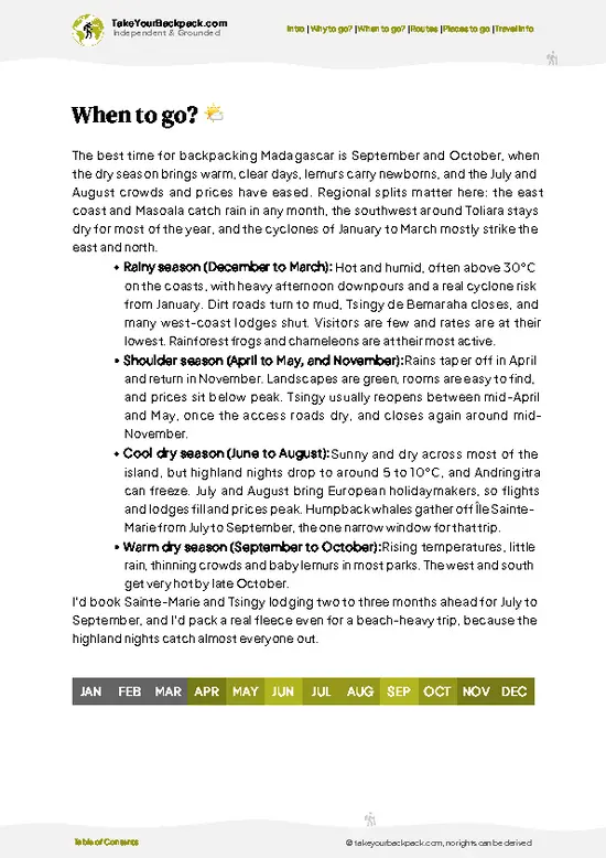
source: climatestotravel.comJANJanuary: below average for travelingFEBFebruary: below average for travelingMARMarch: fair for travelingAPRApril: highly recommended for travelingMAYMay: excellent for travelingJUNJune: excellent for travelingJULJuly: highly recommended for travelingAUGAugust: highly recommended for travelingSEPSeptember: excellent for travelingOCTOctober: excellent for travelingNOVNovember: highly recommended for travelingDECDecember: fair for traveling
when-to-go

✈️ The backpacker research shortcutMadagascar Travel Guide

An offline-friendly backpacking guide with optimized travel routes, ranked highlights, transport advice, and the best areas to stay.
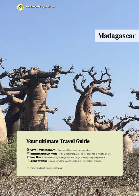
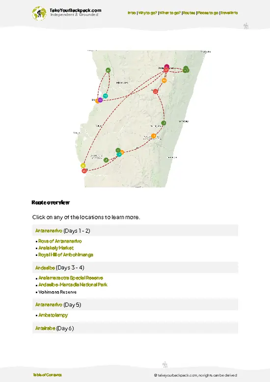
example page 0 from our offline Travel Guide for Madagascar
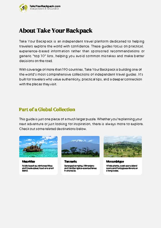
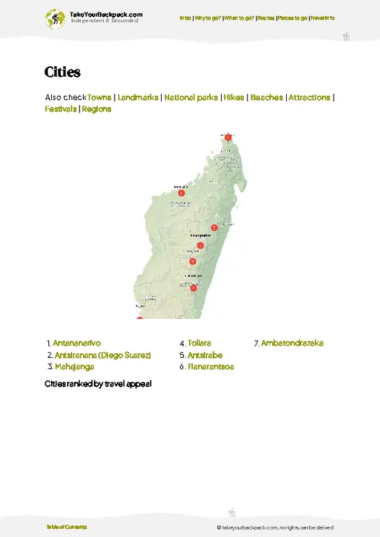
example page 1 from our offline Travel Guide for Madagascar
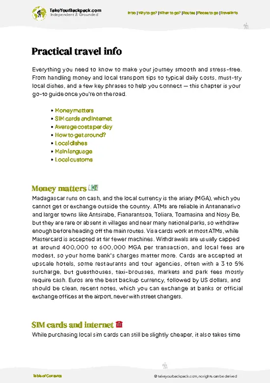
example page 2 from our offline Travel Guide for Madagascar
example page 3 from our offline Travel Guide for Madagascar
example page 4 from our offline Travel Guide for Madagascar
example page 5 from our offline Travel Guide for Madagascar
example page 6 from our offline Travel Guide for Madagascar
example page 7 from our offline Travel Guide for Madagascar
The digital guide (418 pages) contains:
110 highlights, ranked by travel appeal
Optimized 7, 14 & 21-day travel routes
Cities, national parks, landmarks, beaches
How to get around
Offline-friendly for travel without Wi-Fi
👉 Click to see all 30+ guide features

📅 Plan smarter in minutes, not weeks
Month by month travel advice
Festivals & national holidays
Budget expectations

🗺️ Go to the right places, skip the overrated ones
Honest pros & cons of destinations
Top hikes, parks & viewpoints
Lesser-known places most travelers miss
Clear “worth it vs skip it” guidance

🛏️ Travel smoothly without rookie mistakes
Best areas to stay
Transport systems explained simply
Common scams & safety advice
SIM cards, money & practical tips

🌍 Understand the country, not just visit it
Culture & traditions
52 Essential phrases & customs
Festivals worth planning around
Traveler-friendly historical context
Insights that make places more meaningful

📱 Built for real travel conditions
Fully downloadable PDF
Works completely offline
Optimized for phone use
Useful in remote areas & buses
Everything in one place
Save weeks of stressful planning
Get instant access to your full guide. 30‑day money-back guarantee.
+ Add another guide for just US$7.80

By proceeding you agree to our terms.
Sent to your inbox immediately after payment • 100% Secure Checkout
Best Backpacking Travel Advisor 2025 tourism awardBest Backpacking
Travel Advisor
2025
What others say about Take Your Backpack Guides:
⭐⭐⭐⭐⭐
Fantastic, amazing amount of information!
⭐⭐⭐⭐⭐
My goodness this is amazing, it's what I've been looking for hats off too you!
⭐⭐⭐⭐⭐
I think this is absolutely BRILLIANT
⭐⭐⭐⭐
Very complete and informative. It's still missing places, but I gotta to commend you
⭐⭐⭐⭐⭐
This is truly amazing, thank you, can't wait to explore it with my kids!
⭐⭐⭐⭐⭐
Awesome resource, thank you!
⭐⭐⭐⭐⭐
This is amazing! Can't wait to explore the ones I haven't seen
⭐⭐⭐⭐
I love this! Well done, great idea.
⭐⭐⭐⭐⭐
Thanks for taking the time to make this gem!
⭐⭐⭐⭐⭐
This might be the best website I've ever seen.
⭐⭐⭐⭐⭐
Congratulations, and thank you so much for your work; it's incredibly valuable.
⭐⭐⭐⭐
In all seriousness I think you did a great job pointing out the important spots
⭐⭐⭐⭐⭐
10/10 very good
⭐⭐⭐⭐⭐
As someone who's only just starting to visit regularly this is awesome, thank you.
⭐⭐⭐⭐
Thank you very much! I'm going to visit my dad, it's going to be very useful!
⭐⭐⭐⭐⭐
This is really cool! We'll be travelling for the first time and this definitely come in handy.
⭐⭐⭐⭐⭐
You are now our minister of culture, congratulations 👨‍💼
⭐⭐⭐⭐⭐
Just wanted to tell you that this is a pearl! Going to follow your recommendations.
⭐⭐⭐⭐⭐
This is so cool. I'll definitely be using the resource for my travels soon.
⭐⭐⭐⭐⭐
This is very impressive! Good work.
⭐⭐⭐⭐⭐
This is an amazing and informative site. Very well done!

🛏️ Where to stay?Where staying makes the most sense

If you enjoy meeting fellow travelers, consider choosing hostels with high ratings for atmosphere. On the other hand, if you prefer having your own space, a hotel might be a better option.

🥾 Hike detailsKey facts about the Marojejy Circuit hike

Total Distance: The Marojejy Circuit is about 60 kilometers (37 miles) long, taking you through some of Madagascar’s most stunning landscapes.

Estimated Duration: Expect to spend around 5 to 7 days on this trail, depending on your pace and how much you stop to soak in the views or take photos.

Difficulty Level: This trail is rated as challenging. Be prepared for steep ascents, slippery paths, and some rugged terrain. It’s definitely not a walk in the park, but the rewards are worth it.

Starting Point: The trail begins in the village of Marojejy. To get there by public transport, take a taxi-brousse … read more 👉
Total Distance: The Marojejy Circuit is about 60 kilometers (37 miles) long, taking you through some of Madagascar’s most stunning landscapes.

Estimated Duration: Expect to spend around 5 to 7 days on this trail, depending on your pace and how much you stop to soak in the views or take photos.

Difficulty Level: This trail is rated as challenging. Be prepared for steep ascents, slippery paths, and some rugged terrain. It’s definitely not a walk in the park, but the rewards are worth it.

Starting Point: The trail begins in the village of Marojejy. To get there by public transport, take a taxi-brousse (shared minibus) from Antananarivo to Sambava. From Sambava, you can catch another taxi-brousse to the village, which is about an hour away.

Major Landmarks Along the Route:
  • Marojejy National Park: This is the main attraction, showcasing diverse ecosystems and stunning vistas.
  • Camp 1 and Camp 2: These are your main stopping points, where you can set up camp and rest.
  • Peak Marojejy: The highest point on the circuit, offering breathtaking views if you’re up for the climb.

Type of Terrain and Scenery: The trail features a mix of steep, rocky paths and muddy sections, especially during the rainy season. You’ll traverse through lush rainforests, bamboo groves, and open ridges with panoramic views. The scenery is nothing short of spectacular, with waterfalls and dramatic cliffs.

Typical Vegetation and Wildlife: Expect to see a variety of unique flora, including endemic orchids and towering trees. The wildlife is just as impressive; keep an eye out for lemurs, chameleons, and a plethora of bird species. The biodiversity here is a big part of what makes this hike so special.

Make sure you pack plenty of water, snacks, and a good camera—you’ll want to capture every moment!
⚠️ Hiking info can sometimes be outdated or inaccurate. Before you hit the trail, check the latest conditions with locals. If you do spot anything that's off, I'd love to hear from you, so I can update it for fellow travelers.

🛡️ SafetySafety Tips and Common Scams in Marojejy Circuit

Marojejy Circuit is a wild ride, and it demands your attention. The weather can flip on you—sunshine one moment, rain the next. Dress in layers and pack a reliable rain jacket. The trails are steep and often muddy, so sturdy footwear is non-negotiable. Navigation can be tricky; keep your map handy and trust your instincts.

Expect river crossings that can be challenging after heavy rains. Take your time; rushing can lead to slips. Wildlife is abundant, from chameleons to lemurs. Keep your distance and don’t feed them; respect their space.

Preparation is key. Many first-timers underestimate the physical demands. Pace yourself and stay hydrated. The reward? A breathtaking view from the summit that makes every step worth it. After a long day, nothing beats that first cold beer at camp, feeling … read more 👉
Marojejy Circuit is a wild ride, and it demands your attention. The weather can flip on you—sunshine one moment, rain the next. Dress in layers and pack a reliable rain jacket. The trails are steep and often muddy, so sturdy footwear is non-negotiable. Navigation can be tricky; keep your map handy and trust your instincts.

Expect river crossings that can be challenging after heavy rains. Take your time; rushing can lead to slips. Wildlife is abundant, from chameleons to lemurs. Keep your distance and don’t feed them; respect their space.

Preparation is key. Many first-timers underestimate the physical demands. Pace yourself and stay hydrated. The reward? A breathtaking view from the summit that makes every step worth it. After a long day, nothing beats that first cold beer at camp, feeling the fatigue melt away as you soak in the beauty around you.

FAQTraveler FAQ

The Marojejy Circuit hike typically takes 4 to 6 days to complete, depending on your pace and chosen route. The main circuit covers around 70 kilometers through varied terrain. Most hikers allocate about 5 days to fully experience the park's highlights.
The Marojejy Circuit is considered challenging due to steep ascents, slippery trails, and unpredictable weather. It involves trekking through dense rainforest and high-altitude zones, requiring good fitness and hiking experience. Expect significant elevation changes, with some sections reaching over 2,000 meters above sea level.
Yes, you need both a guide and a permit to hike the Marojejy Circuit. Permits are issued by the park authorities and cost around 65,000 Ariary (about $15 USD). Hiring a local guide is mandatory for safety and navigation, and fees vary but typically start at 50,000 Ariary per day.
⚠️ Things can change over time, so always validate details locally before you go.

Other Malagasy hikes near Marojejy Circuit

Explore more nearby:


💡 Not sure where to go next?
Create a personalized itinerary for Madagascar including Marojejy Circuit and the places that fit your trip.

Generate my itinerary

👉 Discover all hikes

Or checkout all Madagascar has to offer (think cities, towns, villages, national parks, hikes, beaches, festivals)
Country photo of Madagascar

We 💚 feedbackParting advice and final tips

Marojejy Circuit is a wild symphony of biodiversity. Picture yourself trudging through lush forests, where the air is thick with the scent of damp earth and the calls of unseen creatures echo around you. But be ready for the challenge: the trails can be steep and slippery, testing your grit. The payoff? Reaching the summit, where the view stretches endlessly, and you can finally crack open that cold beer, savoring every drop.

✈️ When did I visit Madagascar?
Madagascar I went backpacking in October 2019. With a friend I rented a 4WD and drove around the southern part of Madagascar.

✍️ Help improve this page!
The information on this page is based on my own backpacking experience in Madagascar, supplemented with up-to-date research and feedback from other travelers. Travel details can change, so if you notice anything outdated or incomplete, feel free to let me know.


🙋‍♂️ Give feedback

👋 Meet the founderWho’s Behind Take Your Backpack?

Johan, backpacker and founder of TakeYourBackpackHi, I’m Johan (Netherlands 🇳🇱), the creator of TakeYourBackpack. Over the past decade, I’ve backpacked through 80+ countries across six continents, gaining extensive experience with independent travel, long-term trips, and overland routes.

This site is built on a combination of firsthand travel experience and carefully curated insights from other backpackers. Many guides are based on places I’ve personally visited, while others bring together tips, observations, and practical advice shared by trusted travelers I’ve met along the way.

The goal is to provide realistic, experience-driven guidance — not generic itineraries — so you can explore destinations with better context, clearer expectations, and more confidence.

Get full Madagascar guide •
Instant download • 110 highlights • Full Offline guide