×

Panama🇵🇦 | regionsCerro AzulCloud forest, Cerro Jefe trails, birding roads, Lake Alajuela | things to do and best time to go

Explore Chiriquí HighlandsExplore Boquete

Backpacking in Cerro Azul
👍 Recommendedregion ranked #2
By Johan Kruseman 🇳🇱 | Updated October 22, 2026

Cerro Azul was once a cool-air retreat where Panama City families kept weekend houses behind gates, and few outsiders had a reason to climb the road. Today backpackers can reach it, though it remains short on hostels and big on forest. It sits in the hills east of Panama City, in Panama, and the climb matters: the road gains height quickly, so mist collects on the ridges and the trees stay green when the lowlands brown. That explains the orchids, the birds and the quiet. The trade-off is thin infrastructure, with few shops and almost no signage on the side roads. Before leaving the last signal, I saved the Cerro Jefe trailhead pin offline, and I suggest you do the same, because it turns a confusing fork into a straight walk to the viewpoint. Unlike Cerro Campana, which draws weekend crowds to one paved path, Cerro Azul spreads out across several trails and reservoir shores with far fewer people.

Discover everything you want to know in the 📖 Panama Travel Guide.


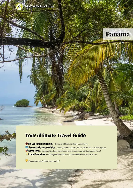
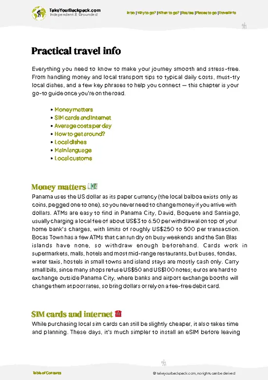
example page 0 from our offline Travel Guide for Panama
example page 1 from our offline Travel Guide for Panama
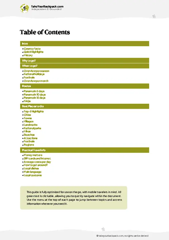
example page 2 from our offline Travel Guide for Panama
example page 3 from our offline Travel Guide for Panama
example page 4 from our offline Travel Guide for Panama
example page 5 from our offline Travel Guide for Panama
example page 6 from our offline Travel Guide for Panama
example page 7 from our offline Travel Guide for Panama
Loading the map 🌍
CLICK TO FILTER
cities
towns
villages
landmarks
national parks
hikes
beaches
attractions
festivals
regions
SHOW COUNTRY’S BESTSHOW ALL

✨ Why go?
Ranked #2 region in Panama
What makes this region worth visiting

Cerro Azul gives you cloud forest and canal-country lowland within one small area, so you change ecosystems without changing bases. In the morning you can be on the Cerro Jefe ridge among mossy trees and birdsong, then drop to the shore of Lake Alajuela by afternoon for open water, humid air and a boat. That contrast is rare so close to a capital city, and it saves you the long bus days that usually eat a trip.

The second reason is culture reachable without a big expedition. Boats from the lake side run up the Chagres River to Emberá communities, where you can spend a few hours on a visit arranged directly with the village rather than through a packaged circuit. Pair that with a forest walk and you have a slow, varied itinerary based on a handful of short moves.

It also suits travelers who … read more 👉
Cerro Azul gives you cloud forest and canal-country lowland within one small area, so you change ecosystems without changing bases. In the morning you can be on the Cerro Jefe ridge among mossy trees and birdsong, then drop to the shore of Lake Alajuela by afternoon for open water, humid air and a boat. That contrast is rare so close to a capital city, and it saves you the long bus days that usually eat a trip.

The second reason is culture reachable without a big expedition. Boats from the lake side run up the Chagres River to Emberá communities, where you can spend a few hours on a visit arranged directly with the village rather than through a packaged circuit. Pair that with a forest walk and you have a slow, varied itinerary based on a handful of short moves.

It also suits travelers who like a quiet evening. Nights are calm, the air cools with elevation, and the landscape rewards early starts when birds are most active. Come here to walk, look and listen, not to tick off a checklist.

💡 HighlightsThe experiences that define the visit

  1. Cerro Jefe: the high point of the area, wrapped in cloud forest that holds ferns, orchids, hummingbirds and trogons. The summit road is lined with moss-heavy trees, and the antenna-topped peak gives long views on clear mornings.
  2. Lake Alajuela: the reservoir that feeds the canal, ringed by forested hills. Boat trips cross the open water and give a different view of the ridges you walked earlier.
  3. Chagres National Park: protected rainforest that supplies much of the water for the canal and the capital. Its trails and river access let you see lowland forest in a wild, working watershed.
  4. Chagres River boat route: a dugout ride upriver where the banks close in with trees and herons wade near the shore. It is the usual route to the Emberá communities.
  5. Emberá Parará Puru: a riverside Emberá village that
… read more 👉
  1. Cerro Jefe: the high point of the area, wrapped in cloud forest that holds ferns, orchids, hummingbirds and trogons. The summit road is lined with moss-heavy trees, and the antenna-topped peak gives long views on clear mornings.
  2. Lake Alajuela: the reservoir that feeds the canal, ringed by forested hills. Boat trips cross the open water and give a different view of the ridges you walked earlier.
  3. Chagres National Park: protected rainforest that supplies much of the water for the canal and the capital. Its trails and river access let you see lowland forest in a wild, working watershed.
  4. Chagres River boat route: a dugout ride upriver where the banks close in with trees and herons wade near the shore. It is the usual route to the Emberá communities.
  5. Emberá Parará Puru: a riverside Emberá village that receives visitors for music, dance, crafts and a simple meal of fried fish with plantain. Go with respect, ask before taking photos, and buy crafts directly.
  6. Cerro Azul ridge roads: lesser known, and popular with locals who drive up for cooler air. The winding lanes pass shaded gardens and viewpoints over the lowlands, and you can walk them quietly at dawn.
  7. Cerro Jefe summit road birding: a lesser-known habit among Panamanian birders, who walk the road itself at first light. Fruiting trees along the verge pull in tanagers and toucans without any hard trekking.
  8. Lake Alajuela shoreline: quiet fishing spots on the water edge where locals grill the catch on weekends. It is a calm place to watch the light change over the water.
Cerro Azul trips to the Emberá village and boat rides on the Chagres need to be booked ahead through the community or a boat operator, while the Cerro Jefe trails are open-access walks.
Spotted a mistake or missing something? Contact us.

Things to do near Cerro Azul

Ratings based on Tripadvisor reviews. When you book through this link, you support our work at no extra cost to you.

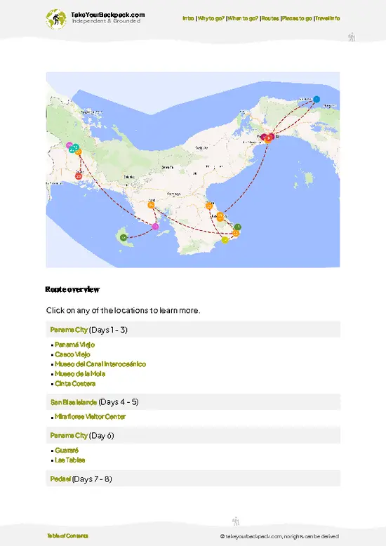
⌛️ 5 daysA smart one-week plan

Day 1: Cerro Jefe: Start here, and do not skip it. The ridge is the reason Cerro Azul exists on a backpacker map, and the cloud forest is clearest in the early hours, before mist closes the views. Walk the summit road first, since the bird activity drops once the morning warms. Stay in the hills overnight so you avoid the commute back down.

Day 2: Cerro Azul ridge roads: Spend a slow day on foot along the quiet lanes. Public transport up here is limited, so a shared taxi or an arranged ride sets your pace. Walking the roads lets you spot birds, gardens and lookouts that a car would pass, and you finish with a long evening of cool air.

Day 3: Lake Alajuela: Head downhill to the reservoir. The change in elevation is the logic: you move from cool forest to warm water in one short transfer. … read more 👉
Day 1: Cerro Jefe: Start here, and do not skip it. The ridge is the reason Cerro Azul exists on a backpacker map, and the cloud forest is clearest in the early hours, before mist closes the views. Walk the summit road first, since the bird activity drops once the morning warms. Stay in the hills overnight so you avoid the commute back down.

Day 2: Cerro Azul ridge roads: Spend a slow day on foot along the quiet lanes. Public transport up here is limited, so a shared taxi or an arranged ride sets your pace. Walking the roads lets you spot birds, gardens and lookouts that a car would pass, and you finish with a long evening of cool air.

Day 3: Lake Alajuela: Head downhill to the reservoir. The change in elevation is the logic: you move from cool forest to warm water in one short transfer. Take a boat across the lake, then eat grilled fish at a shoreline stand.

Day 4: Chagres River: Use the lake as your launch point for a dugout trip upriver and an Emberá village visit, arranged in advance because boats depend on the community. Plan one outing only, since river schedules are slow and you will want time to listen and ask questions.

Day 5: Chagres National Park: Add a guided forest walk in the park, which fits the same return route to the capital and adds lowland jungle to your ridge walks. Then head out in the afternoon.

If I had one day to justify the trip, I would choose Day 1, with the mist lifting off Cerro Jefe while the first birds start calling.

🌤️ When to go?Seasonal considerations and timing

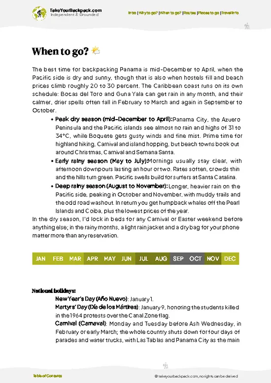
Cerro Azul is coolest and driest from January to April, when its ridge trails are firm and the views toward Panama City and the Chagres hills stay open. Prices don’t swing much here.
  • Dry Season (mid-December to April): Days run 24 to 29°C (75 to 84°F), with nights near 17 to 20°C (63 to 68°F). Mornings are clear and breezy, which suits hiking and birding. Weekends fill with Panama City residents escaping the heat.
  • Green Season (May to November): Expect 22 to 27°C (72 to 81°F), with mist in the early morning and rain most afternoons. Forest is lush, waterfalls run full, and trails turn slick. Weekdays are nearly empty and stays cost less.
  • Wettest Stretch (October and November): Downpours can last for hours and cloud often covers the summit road. Skip this if you want views.
  • Daylight: Days stay
… read more 👉
Cerro Azul is coolest and driest from January to April, when its ridge trails are firm and the views toward Panama City and the Chagres hills stay open. Prices don’t swing much here.
  • Dry Season (mid-December to April): Days run 24 to 29°C (75 to 84°F), with nights near 17 to 20°C (63 to 68°F). Mornings are clear and breezy, which suits hiking and birding. Weekends fill with Panama City residents escaping the heat.
  • Green Season (May to November): Expect 22 to 27°C (72 to 81°F), with mist in the early morning and rain most afternoons. Forest is lush, waterfalls run full, and trails turn slick. Weekdays are nearly empty and stays cost less.
  • Wettest Stretch (October and November): Downpours can last for hours and cloud often covers the summit road. Skip this if you want views.
  • Daylight: Days stay close to twelve hours all year, so start hikes early.
Go on a weekday in January or February and you get the clearest air without the weekend traffic.


source: climatestotravel.comJANJanuary: excellent for travelingFEBFebruary: excellent for travelingMARMarch: excellent for travelingAPRApril: highly recommended for travelingMAYMay: fair for travelingJUNJune: fair for travelingJULJuly: fair for travelingAUGAugust: fair for travelingSEPSeptember: fair for travelingOCTOctober: fair for travelingNOVNovember: good for travelingDECDecember: highly recommended for traveling
panama-region-cerro-azul v1
© Google |

✈️ The backpacker research shortcutPanama Travel Guide

An offline-friendly backpacking guide with optimized travel routes, ranked highlights, transport advice, and the best areas to stay.
example page 0 from our offline Travel Guide for Panama
example page 1 from our offline Travel Guide for Panama
example page 2 from our offline Travel Guide for Panama
example page 3 from our offline Travel Guide for Panama
example page 4 from our offline Travel Guide for Panama
example page 5 from our offline Travel Guide for Panama
example page 6 from our offline Travel Guide for Panama
example page 7 from our offline Travel Guide for Panama
The digital guide (272 pages) contains:
✅ 89 highlights, ranked by travel appeal
✅ Optimized 5, 10 & 15-day travel routes
✅ Cities, national parks, landmarks, beaches
✅ How to get around
✅ Offline-friendly for travel without Wi-Fi
👉 Click to see all 30+ guide features

📅 Plan smarter in minutes, not weeks
✅ Month by month travel advice
✅ Festivals & national holidays
✅ Budget expectations

🗺️ Go to the right places, skip the overrated ones
✅ Honest pros & cons of destinations
✅ Top hikes, parks & viewpoints
✅ Lesser-known places most travelers miss
✅ Clear “worth it vs skip it” guidance

🛏️ Travel smoothly without rookie mistakes
✅ Best areas to stay
✅ Transport systems explained simply
✅ Common scams & safety advice
✅ SIM cards, money & practical tips

🌍 Understand the country, not just visit it
✅ Culture & traditions
✅ 52 Essential phrases & customs
✅ Festivals worth planning around
✅ Traveler-friendly historical context
✅ Insights that make places more meaningful

📱 Built for real travel conditions
✅ Fully downloadable PDF
✅ Works completely offline
✅ Optimized for phone use
✅ Useful in remote areas & buses
✅ Everything in one place
Stop searching, start planning
Get instant access to your full guide. 30‑day money-back guarantee.
+ Add another guide for just

By proceeding you agree to our terms.
Sent to your inbox immediately after payment • 100% Secure Checkout
Best Backpacking Travel Advisor 2025 tourism awardBest Backpacking
Travel Advisor
2025
What others say about Take Your Backpack Guides:
⭐⭐⭐⭐⭐
Fantastic, amazing amount of information!
⭐⭐⭐⭐⭐
My goodness this is amazing, it's what I've been looking for hats off too you!
⭐⭐⭐⭐⭐
I think this is absolutely BRILLIANT
⭐⭐⭐⭐
Very complete and informative. It's still missing places, but I gotta to commend you
⭐⭐⭐⭐⭐
This is truly amazing, thank you, can't wait to explore it with my kids!
⭐⭐⭐⭐⭐
Awesome resource, thank you!
⭐⭐⭐⭐⭐
This is amazing! Can't wait to explore the ones I haven't seen
⭐⭐⭐⭐
I love this! Well done, great idea.
⭐⭐⭐⭐⭐
Thanks for taking the time to make this gem!
⭐⭐⭐⭐⭐
This might be the best website I've ever seen.
⭐⭐⭐⭐⭐
Congratulations, and thank you so much for your work; it's incredibly valuable.
⭐⭐⭐⭐
In all seriousness I think you did a great job pointing out the important spots
⭐⭐⭐⭐⭐
10/10 very good
⭐⭐⭐⭐⭐
As someone who's only just starting to visit regularly this is awesome, thank you.
⭐⭐⭐⭐
Thank you very much! I'm going to visit my dad, it's going to be very useful!
⭐⭐⭐⭐⭐
This is really cool! We'll be travelling for the first time and this definitely come in handy.
⭐⭐⭐⭐⭐
You are now our minister of culture, congratulations 👨‍💼
⭐⭐⭐⭐⭐
Just wanted to tell you that this is a pearl! Going to follow your recommendations.
⭐⭐⭐⭐⭐
This is so cool. I'll definitely be using the resource for my travels soon.
⭐⭐⭐⭐⭐
This is very impressive! Good work.
⭐⭐⭐⭐⭐
This is an amazing and informative site. Very well done!

🛏️ Where to stay?Best areas and accommodation options

Stay in Panama City’s Casco Viejo or Bella Vista and ride up to Cerro Azul for the day, unless you want silence and cool nights, in which case sleep in the hills themselves. Casco Viejo has the densest backpacker scene in the country, with shared dorms, rooftop bars and plenty of other solo travelers to split a taxi fare with. Walkable streets and late-night food make it safe and easy for a first night. Bella Vista and El Cangrejo are calmer, with cheaper meals, supermarkets and good bus links, and suit travelers who want a base outside the tourist core.
Cerro Azul itself is quiet and residential. … read more 👉
Stay in Panama City’s Casco Viejo or Bella Vista and ride up to Cerro Azul for the day, unless you want silence and cool nights, in which case sleep in the hills themselves. Casco Viejo has the densest backpacker scene in the country, with shared dorms, rooftop bars and plenty of other solo travelers to split a taxi fare with. Walkable streets and late-night food make it safe and easy for a first night. Bella Vista and El Cangrejo are calmer, with cheaper meals, supermarkets and good bus links, and suit travelers who want a base outside the tourist core.
Cerro Azul itself is quiet and residential. Lodging is limited to guesthouses and private rentals, mostly in the US$40 to 90 range, and the social scene is thin. It suits birders, hikers and anyone who wants dawn forest sounds and temperatures a few degrees below the city. Arrive with groceries, because shops are few.
If you want company in the hills, base yourself in the city on weeknights and book one night up top. Dorm beds in the city typically cost US$12 to 22, which keeps your budget healthy.

🚌 Getting aroundHow to get from A to B

Cerro Azul is easiest to reach by ride-hailing app or taxi from Panama City, because the road climbs steeply and public transport thins out fast above the lower suburbs. That works because the community is a spread of hillside homes and forest lanes rather than a town with a center, so no single bus stop serves it. Expect a drive of 45 to 75 minutes depending on traffic, which is heavy at weekday rush hours.
  • Taxi or Uber from Panama City: About US$25 to 40 one way, door to door. Drivers know the main road up, and the payoff is cool air and a ridge view that opens as the humidity drops with every bend.
  • Public bus to the lower highway: Buses from the Albrook terminal toward the eastern suburbs cost roughly US$1 to 2 and run frequently. They stop well below the hills, so you finish by taxi. The
… read more 👉
Cerro Azul is easiest to reach by ride-hailing app or taxi from Panama City, because the road climbs steeply and public transport thins out fast above the lower suburbs. That works because the community is a spread of hillside homes and forest lanes rather than a town with a center, so no single bus stop serves it. Expect a drive of 45 to 75 minutes depending on traffic, which is heavy at weekday rush hours.
  • Taxi or Uber from Panama City: About US$25 to 40 one way, door to door. Drivers know the main road up, and the payoff is cool air and a ridge view that opens as the humidity drops with every bend.
  • Public bus to the lower highway: Buses from the Albrook terminal toward the eastern suburbs cost roughly US$1 to 2 and run frequently. They stop well below the hills, so you finish by taxi. The saving is real, and you get a look at everyday Panamanian commuting on the way.
  • Shared rides and local taxis: Once you’re up top, short hops between lanes cost about US$3 to 8. They are not metered, so agree on the fare first. You skip a long, hot uphill walk and arrive at the trailhead fresh.
  • Walking: Lanes are narrow, steep and shaded, with little sidewalk and few streetlights. Allow extra time for the climbs. Birdsong and the occasional clearing with a view over the canopy make it worth the effort.
  • Rental car: About US$30 to 50 a day with insurance. Only worth it if you plan to link Cerro Azul with nearby cloud forest on the same day, since parking is easy but gravel stretches punish small cars.
Arrange a return ride before you hike, since signal fades in the forest and drivers are scarce after dark. Start your trip before 8 a.m. to beat the traffic out of the city and the afternoon cloud on the way up.

🍲 FoodEating & Drinking in Cerro Azul

Eat Panamanian comfort food in the city, then carry a picnic up to Cerro Azul, where cooler air makes sancocho, a clear chicken broth with yucca and culantro, taste even better. Look for arroz con pollo, patacones (twice-fried green plantain disks) and carimañolas, crisp yucca fritters stuffed with seasoned beef. They cost US$1 to 3 at roadside stalls and bakeries on the way up.
For a sit-down meal, find a fonda or a simple comedor serving the daily set plate, usually rice, beans, stewed meat and fried plantain, for about US$4 to 7. Mornings start with hojaldras, puffy fried dough, and a cup of strong coffee. Highland-grown beans are common in the hills, with a nutty, chocolate edge.
To drink, order chicha de piña or chicha de tamarindo, tart and cold, from a roadside cooler. Locals also drink … read more 👉
Eat Panamanian comfort food in the city, then carry a picnic up to Cerro Azul, where cooler air makes sancocho, a clear chicken broth with yucca and culantro, taste even better. Look for arroz con pollo, patacones (twice-fried green plantain disks) and carimañolas, crisp yucca fritters stuffed with seasoned beef. They cost US$1 to 3 at roadside stalls and bakeries on the way up.
For a sit-down meal, find a fonda or a simple comedor serving the daily set plate, usually rice, beans, stewed meat and fried plantain, for about US$4 to 7. Mornings start with hojaldras, puffy fried dough, and a cup of strong coffee. Highland-grown beans are common in the hills, with a nutty, chocolate edge.
To drink, order chicha de piña or chicha de tamarindo, tart and cold, from a roadside cooler. Locals also drink Seco Herrerano with milk and ice on weekends. Tipping is modest, 10 percent at sit-down places and nothing at stalls. Lunch is the main meal, and kitchens in the hills often close by early evening, so eat before dusk.

FAQFrequently asked questions about Cerro Azul

One full day is enough for Cerro Azul if you only want a ridge hike and a view, and two days lets you add early-morning birdwatching. Most backpackers go up from Panama City, a ride of 45 to 75 minutes. Plan on starting by 7 a.m. because cloud tends to roll in during the afternoon.
Cerro Azul has no good public transport at the top, so you rely on taxis or Uber from Panama City, about US$25 to 40 each way. A city bus from Albrook for US$1 to 2 gets you to the lower suburbs, and you finish the climb by taxi. Local hops once you are up there cost roughly US$3 to 8, and walking the shaded lanes is realistic for short distances.
Cerro Azul is known for its cooler climate, forested ridges and views back toward Panama City, making it a popular escape from the heat. Temperatures sit several degrees below the lowlands, often 22 to 27°C (72 to 81°F). Birdwatchers come for the surrounding cloud forest, and city residents come for weekend homes and quiet trails.
⚠️ Things can change over time, so always validate details locally before you go.

Other Panamanian regions near Cerro Azul

Explore more nearby:

  • Taboga Island—Car-free village, ferry pier, pelican colony, hillside lookouts| 47 km away
  • Isla Contadora—Golf carts, small beaches, snorkeling, whale season| 74 km away
  • San Blas Islands—Guna Yala, sandbar cabins, wreck snorkeling, mola villages| 81 km away

💡 Not sure where to go next?
Create a personalized itinerary for Panama including Cerro Azul and the places that fit your trip.

Generate my itinerary

👉 Discover all regions

Or checkout all Panama has to offer (think cities, towns, villages, national parks, hikes, beaches, festivals)
Country photo of Panama

We 💚 feedbackIs it worth it?

Cerro Azul looks like a day on a map, but first-timers often overlook how thin the services are once the road climbs: shops, cash machines and rides all thin out fast. I would arrive with food, water and cash already in hand, and book a driver for the return before heading up. Do that, and the quiet ridge becomes the easiest part of your trip.

✈️ When did I visit Panama?
Panama I visited during my half year trip through South and Central America back in 2003

✍️ Help improve this page!
The information on this page is based on my own backpacking experience in Panama, supplemented with up-to-date research and feedback from other travelers. Travel details can change, so if you notice anything outdated or incomplete, feel free to let me know.


🙋‍♂️ Give feedback

👋 Meet the founderWho’s Behind Take Your Backpack?

Johan, backpacker and founder of TakeYourBackpackHi, I’m Johan (Netherlands 🇳🇱), the creator of TakeYourBackpack. Over the past 3 decades, I’ve backpacked through 90+ countries across six continents, gaining extensive experience with independent travel, long-term trips, and overland routes.

This site is built on a combination of firsthand travel experience and carefully curated insights from other backpackers. Many guides are based on places I’ve personally visited, while others bring together tips, observations, and practical advice shared by trusted travelers I’ve met along the way.

The goal is to provide realistic, experience-driven guidance — not generic itineraries — so you can explore destinations with better context, clearer expectations, and more confidence.