×

Guyana🇬🇾 | villagesKamarangMazaruni landing, dirt airstrip, Akawaio hub, upriver gateway | things to do and best time to go

Explore KurupukariExplore Karanambu Ranch

Backpacking in Kamarang
👀 For curious travelersvillage ranked #9
By Johan Kruseman 🇳🇱 | Updated October 19, 2026

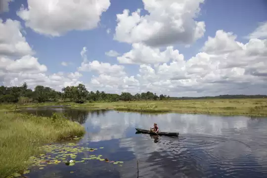
Kamarang is a river-and-airstrip settlement, not a Pakaraima mountain village, and the highlands start a long way beyond it. It sits in the Upper Mazaruni region in the west of Guyana, where the Kamarang River meets the Mazaruni. Red dirt tracks run between wooden houses, and small planes drone in over the airstrip. You get a working Amerindian hub, with Akawaio families, miners and boat crews loading fuel and food. Evenings are quiet, lit by generators and cookfires, and other travelers are few, so you talk to locals. Nearby riverbanks give you cool swims and a view of forested hills. Roads are rough, and comforts are basic. Kamarang suits self-reliant, curious travelers heading to Kaieteur or Mount Roraima country. It will frustrate anyone wanting tours, menus or fast connections.

Discover everything you want to know in the 📖 Guyana Travel Guide.


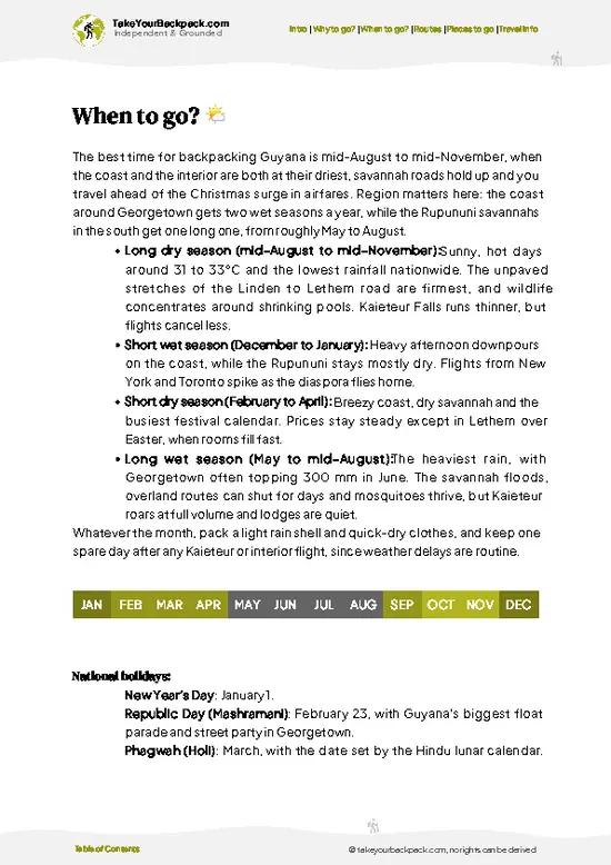
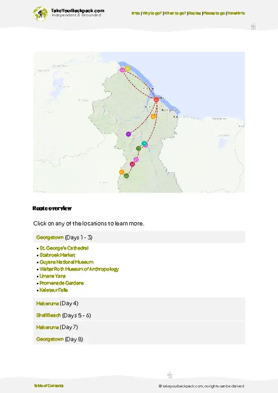
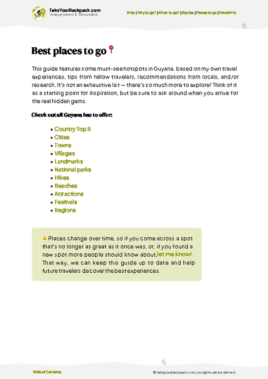
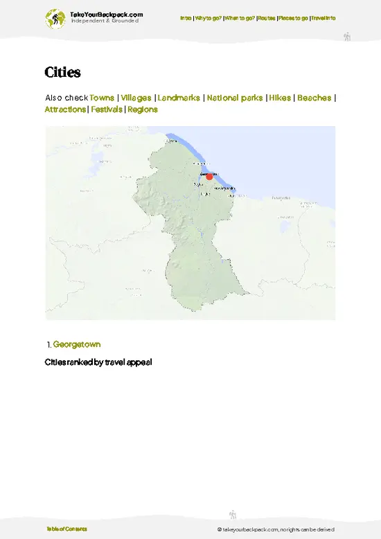
example page 0 from our offline Travel Guide for Guyana
example page 1 from our offline Travel Guide for Guyana
example page 2 from our offline Travel Guide for Guyana
example page 3 from our offline Travel Guide for Guyana
example page 4 from our offline Travel Guide for Guyana
example page 5 from our offline Travel Guide for Guyana
example page 6 from our offline Travel Guide for Guyana
example page 7 from our offline Travel Guide for Guyana
Loading the map 🌍
CLICK TO FILTER
cities
towns
villages
landmarks
national parks
hikes
beaches
attractions
festivals
regions
SHOW COUNTRY’S BESTSHOW ALL

✨ Why go?
Ranked #9 village in Guyana
What sets this place apart

Kamarang sits on the Kamarang River where it meets the Mazaruni, in Guyana’s Cuyuni-Mazaruni region, and it works as a working gateway rather than a resort. Travelers stop here because it is the jump-off for the Mazaruni and Kamarang river country, where Amerindian communities of the Akawaio people live along the banks and small-plane or boat links lead on toward the Pakaraima highlands. The pace is set by the airstrip, the river landings and the mining and trading trade, so you spend time watching boats load and planes come in. Most people stay one night, two at most, while they sort out onward transport. Guesthouses are few and basic, and evenings are quiet with generator hum and river sounds. It suits self-sufficient, patient travelers heading toward Orinduik or the interior who like seeing … read more 👉
Kamarang sits on the Kamarang River where it meets the Mazaruni, in Guyana’s Cuyuni-Mazaruni region, and it works as a working gateway rather than a resort. Travelers stop here because it is the jump-off for the Mazaruni and Kamarang river country, where Amerindian communities of the Akawaio people live along the banks and small-plane or boat links lead on toward the Pakaraima highlands. The pace is set by the airstrip, the river landings and the mining and trading trade, so you spend time watching boats load and planes come in. Most people stay one night, two at most, while they sort out onward transport. Guesthouses are few and basic, and evenings are quiet with generator hum and river sounds. It suits self-sufficient, patient travelers heading toward Orinduik or the interior who like seeing how daily life runs far from the coast. If you need nightlife, sights or polished services, treat it as a pause and keep moving.

💡 HighlightsWhat this place is best known for

  1. Kamarang Airstrip: The settlement’s lifeline, where light aircraft bring in people, food and mail. Watching a landing, with villagers gathering at the edge of the dirt runway, is the clearest view of local life. Go in the morning when flights are likelier. Free, 30 minutes to an hour.
  2. Mazaruni River Landing: The riverbank where boats load fuel, cargo and passengers heading upriver. The water is tea-colored and good for a cool swim in the shallows when locals say it is safe. Late afternoon is calmest and cooler. Free, about an hour.
  3. Kamarang Village Walk: A stroll along the red dirt tracks past wooden homes, small shops and school grounds gives you a feel for Akawaio daily life. Greetings and a few questions go a long way. Early morning is best, before the heat builds. Free, 1 to 2 hours.
Beyond … read more 👉
  1. Kamarang Airstrip: The settlement’s lifeline, where light aircraft bring in people, food and mail. Watching a landing, with villagers gathering at the edge of the dirt runway, is the clearest view of local life. Go in the morning when flights are likelier. Free, 30 minutes to an hour.
  2. Mazaruni River Landing: The riverbank where boats load fuel, cargo and passengers heading upriver. The water is tea-colored and good for a cool swim in the shallows when locals say it is safe. Late afternoon is calmest and cooler. Free, about an hour.
  3. Kamarang Village Walk: A stroll along the red dirt tracks past wooden homes, small shops and school grounds gives you a feel for Akawaio daily life. Greetings and a few questions go a long way. Early morning is best, before the heat builds. Free, 1 to 2 hours.
Beyond the village, the Mazaruni River stretches toward Imbaimadai and the Pakaraima foothills, and Kaieteur Falls is reachable by air from the wider region. For a first visit, start with the Kamarang Airstrip, because it shows you exactly how this place functions.
Spotted a mistake or missing something? Contact us.

🌤️ When to go?Best time to visit Kamarang

February to April is the driest stretch around Kamarang, and it is the easiest window for flights and river travel in the Upper Mazaruni.
  • Dry Season (Feb to Apr, Sep to Oct): Days run 29 to 33°C (84 to 91°F), nights 21 to 23°C (70 to 73°F). Rivers drop, sandbanks appear, and trails stay firm. Daylight is about 12 hours all year.
  • Main Rains (May to Aug): Heavy downpours can push the Kamarang and Mazaruni rivers high, and boat runs get slower. Expect mud, biting insects and 26 to 30°C (79 to 86°F). Flights sometimes cancel in low cloud.
  • Short Wet Spell (Nov to Jan): Showers are lighter and shorter. Mornings are clear and hiking is workable.
  • Crowds and Prices: Visitors are few in every month. Charter and boat prices stay fairly flat, though fuel costs can rise when river levels are low.
Book your … read more 👉
February to April is the driest stretch around Kamarang, and it is the easiest window for flights and river travel in the Upper Mazaruni.
  • Dry Season (Feb to Apr, Sep to Oct): Days run 29 to 33°C (84 to 91°F), nights 21 to 23°C (70 to 73°F). Rivers drop, sandbanks appear, and trails stay firm. Daylight is about 12 hours all year.
  • Main Rains (May to Aug): Heavy downpours can push the Kamarang and Mazaruni rivers high, and boat runs get slower. Expect mud, biting insects and 26 to 30°C (79 to 86°F). Flights sometimes cancel in low cloud.
  • Short Wet Spell (Nov to Jan): Showers are lighter and shorter. Mornings are clear and hiking is workable.
  • Crowds and Prices: Visitors are few in every month. Charter and boat prices stay fairly flat, though fuel costs can rise when river levels are low.
Book your return flight with a buffer day, because weather delays here are routine.


source: climatestotravel.comJANJanuary: good for travelingFEBFebruary: excellent for travelingMARMarch: excellent for travelingAPRApril: excellent for travelingMAYMay: good for travelingJUNJune: fair for travelingJULJuly: fair for travelingAUGAugust: fair for travelingSEPSeptember: fair for travelingOCTOctober: fair for travelingNOVNovember: good for travelingDECDecember: good for traveling
when-to-go

✈️ The backpacker research shortcutGuyana Travel Guide

An offline-friendly backpacking guide with optimized travel routes, ranked highlights, transport advice, and the best areas to stay.
example page 0 from our offline Travel Guide for Guyana
example page 1 from our offline Travel Guide for Guyana
example page 2 from our offline Travel Guide for Guyana
example page 3 from our offline Travel Guide for Guyana
example page 4 from our offline Travel Guide for Guyana
example page 5 from our offline Travel Guide for Guyana
example page 6 from our offline Travel Guide for Guyana
example page 7 from our offline Travel Guide for Guyana
The digital guide (161 pages) contains:
✅ 43 highlights, ranked by travel appeal
✅ Optimized 5, 10 & 15-day travel routes
✅ Cities, national parks, landmarks, beaches
✅ How to get around
✅ Offline-friendly for travel without Wi-Fi
👉 Click to see all 30+ guide features

📅 Plan smarter in minutes, not weeks
✅ Month by month travel advice
✅ Festivals & national holidays
✅ Budget expectations

🗺️ Go to the right places, skip the overrated ones
✅ Honest pros & cons of destinations
✅ Top hikes, parks & viewpoints
✅ Lesser-known places most travelers miss
✅ Clear “worth it vs skip it” guidance

🛏️ Travel smoothly without rookie mistakes
✅ Best areas to stay
✅ Transport systems explained simply
✅ Common scams & safety advice
✅ SIM cards, money & practical tips

🌍 Understand the country, not just visit it
✅ Culture & traditions
✅ Local customs
✅ Festivals worth planning around
✅ Traveler-friendly historical context
✅ Insights that make places more meaningful

📱 Built for real travel conditions
✅ Fully downloadable PDF
✅ Works completely offline
✅ Optimized for phone use
✅ Useful in remote areas & buses
✅ Everything in one place
Stop searching, start planning
Get instant access to your full guide. 30‑day money-back guarantee.
+ Add another guide for just

By proceeding you agree to our terms.
Sent to your inbox immediately after payment • 100% Secure Checkout
Best Backpacking Travel Advisor 2025 tourism awardBest Backpacking
Travel Advisor
2025
What others say about Take Your Backpack Guides:
⭐⭐⭐⭐⭐
Fantastic, amazing amount of information!
⭐⭐⭐⭐⭐
My goodness this is amazing, it's what I've been looking for hats off too you!
⭐⭐⭐⭐⭐
I think this is absolutely BRILLIANT
⭐⭐⭐⭐
Very complete and informative. It's still missing places, but I gotta to commend you
⭐⭐⭐⭐⭐
This is truly amazing, thank you, can't wait to explore it with my kids!
⭐⭐⭐⭐⭐
Awesome resource, thank you!
⭐⭐⭐⭐⭐
This is amazing! Can't wait to explore the ones I haven't seen
⭐⭐⭐⭐
I love this! Well done, great idea.
⭐⭐⭐⭐⭐
Thanks for taking the time to make this gem!
⭐⭐⭐⭐⭐
This might be the best website I've ever seen.
⭐⭐⭐⭐⭐
Congratulations, and thank you so much for your work; it's incredibly valuable.
⭐⭐⭐⭐
In all seriousness I think you did a great job pointing out the important spots
⭐⭐⭐⭐⭐
10/10 very good
⭐⭐⭐⭐⭐
As someone who's only just starting to visit regularly this is awesome, thank you.
⭐⭐⭐⭐
Thank you very much! I'm going to visit my dad, it's going to be very useful!
⭐⭐⭐⭐⭐
This is really cool! We'll be travelling for the first time and this definitely come in handy.
⭐⭐⭐⭐⭐
You are now our minister of culture, congratulations 👨‍💼
⭐⭐⭐⭐⭐
Just wanted to tell you that this is a pearl! Going to follow your recommendations.
⭐⭐⭐⭐⭐
This is so cool. I'll definitely be using the resource for my travels soon.
⭐⭐⭐⭐⭐
This is very impressive! Good work.
⭐⭐⭐⭐⭐
This is an amazing and informative site. Very well done!

🛏️ Where to stay?Best areas and accommodation options

Kamarang has only a handful of simple guesthouses, so expect basic rooms for roughly US$15 to 40 a night. Most are family-run places near the airstrip and the river landing, with fans, shared or small private bathrooms, and patchy power from generators. Cold water showers are normal in this heat. Rooms are not listed on major booking sites, so arrange them through a local contact in Georgetown or on arrival, and carry cash because there are no ATMs. Meals are often cooked on request for about US$4 to 8, so tell your host in advance. Many travelers also sling hammocks at a village benab or a community … read more 👉
Kamarang has only a handful of simple guesthouses, so expect basic rooms for roughly US$15 to 40 a night. Most are family-run places near the airstrip and the river landing, with fans, shared or small private bathrooms, and patchy power from generators. Cold water showers are normal in this heat. Rooms are not listed on major booking sites, so arrange them through a local contact in Georgetown or on arrival, and carry cash because there are no ATMs. Meals are often cooked on request for about US$4 to 8, so tell your host in advance. Many travelers also sling hammocks at a village benab or a community lodge with permission from the village council, which can cost little or nothing for a small donation. Bring a mosquito net, a headlamp and a water filter. Staying near the airstrip makes early flights easy, while riverside spots are quieter at night.

🚌 Day tripsEasy escapes and nearby places

Kamarang works as a base for short trips only if you accept that everything here runs on rivers, airstrips and your own timing, because there are no road links to bigger towns and public transport barely exists.
Imbaimadai:
This Amerindian village sits on a neighboring river and is the usual jump-off for the Upper Mazaruni diamond and gold country. The trip works best by a chartered boat or by catching a ride with a miner or community vehicle, so plan on 1 to 2 hours each way and about US$30 to 80 if you share costs. You come for the market stalls, the jungle landscape and a look at how mining communities work. First-timers often turn up without cash in small bills, and nobody here takes cards.

Paruima Village:
Paruima is an Akawaio community at the edge of the Kamarang River, reached by boat … read more 👉
Kamarang works as a base for short trips only if you accept that everything here runs on rivers, airstrips and your own timing, because there are no road links to bigger towns and public transport barely exists.
Imbaimadai:
This Amerindian village sits on a neighboring river and is the usual jump-off for the Upper Mazaruni diamond and gold country. The trip works best by a chartered boat or by catching a ride with a miner or community vehicle, so plan on 1 to 2 hours each way and about US$30 to 80 if you share costs. You come for the market stalls, the jungle landscape and a look at how mining communities work. First-timers often turn up without cash in small bills, and nobody here takes cards.

Paruima Village:
Paruima is an Akawaio community at the edge of the Kamarang River, reached by boat in about 2 to 3 hours, though water levels change that a lot. Budget US$50 to 100 for the boat. Visit from September to March for the steadiest river conditions. Walk the village, see how cassava bread is prepared, and ask permission before taking photos. The common error is leaving too late; you need to be back before dark, as river travel after sunset is risky.

Mount Roraima Foothill Viewpoints:
Short hikes in the savanna around the area give long views toward the Pakaraima plateau edges. A local guide for a half day costs around US$20 to 40. Go early, in the dry window from February to April, before afternoon cloud builds. Bring more water than you think necessary, because shade is thin on the open ground.

FAQFrequently asked questions about Kamarang

Most travelers fly into Kamarang from Georgetown on a small charter or scheduled plane, about 1 hour to 1 hour 30 minutes. Seats typically cost around US$150 to 250 one way, and flights run from Ogle (Eugene F. Correia International Airport). Overland, the route involves long, rough roads and river travel over several days, so most skip it.
Kamarang is worth it if you want Amerindian communities, river travel and the Upper Mazaruni highlands without tour crowds. Facilities are basic, and costs for boats and flights are high compared with the coast. Plan at least three to four days to justify the airfare and allow for weather delays.
Kamarang cannot realistically be done as a day trip from Georgetown, because flights are infrequent and schedules can change with weather. A same-day return is possible only on a charter, costing US$1,000 or more. Staying two or three nights lets you take boat trips to nearby villages and falls at a far lower cost per outing.
⚠️ Things can change over time, so always validate details locally before you go.

Other Guyanese villages near Kamarang

Explore more nearby:

  • Paramakatoi—Mountain ridge, misty valleys, Patamona lanes, waterfall paths| 164 km away
  • Port Kaituma—Jonestown site, Kaituma landing, frontier market, gold-country hub| 222 km away
  • Rockstone—Essequibo crossing, Fish Festival, Gluck Island boats, Golden Beach| 232 km away

💡 Not sure where to go next?
Create a personalized itinerary for Guyana including Kamarang and the places that fit your trip.

Generate my itinerary

👉 Discover all villages

Or checkout all Guyana has to offer (think cities, towns, villages, national parks, hikes, beaches, festivals)
Country photo of Guyana

We 💚 feedbackFinal thoughts on visiting Kamarang

Plan one night in Kamarang, two if you need flights or boats arranged, since schedules shift with weather and fuel. Longer stays only suit people who like watching a place work at its own pace. I would bring cash in small bills, spare snacks and a flexible mindset, because plans here bend around the river.

✍️ Help improve this page!
The information on this page is based on in-depth research, insights shared by experienced travelers, and feedback from the local travel community in Guyana. While every effort is made to keep the information accurate and current, conditions can change — so if you spot anything incorrect or outdated, please get in touch.


🙋‍♂️ Give feedback

👋 Meet the founderWho’s Behind Take Your Backpack?

Johan, backpacker and founder of TakeYourBackpackHi, I’m Johan (Netherlands 🇳🇱), the creator of TakeYourBackpack. Over the past 3 decades, I’ve backpacked through 90+ countries across six continents, gaining extensive experience with independent travel, long-term trips, and overland routes.

This site is built on a combination of firsthand travel experience and carefully curated insights from other backpackers. Many guides are based on places I’ve personally visited, while others bring together tips, observations, and practical advice shared by trusted travelers I’ve met along the way.

The goal is to provide realistic, experience-driven guidance — not generic itineraries — so you can explore destinations with better context, clearer expectations, and more confidence.