×

Benin🇧🇯 | best hikesEssential 3 hikes to Explore in Benin

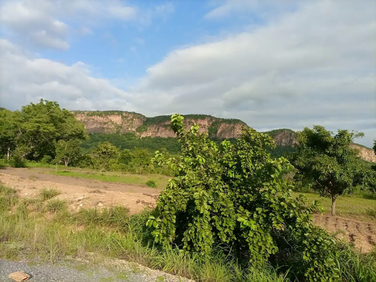
Hikes in Benin are short, hot, and low-altitude: red laterite paths, baobab shade, and hills that rise from flat savanna rather than alpine ridges. The northwest Atacora brings sandstone cliffs, waterfalls, and mud-walled villages, with few other visitors and the highest costs in transport. The central Collines offer granite domes above Dassa-Zoumè, easier to reach from the coast. Near the south, walks are flat, humid, and tied to lagoons and villages. Independent backpackers can do all of it by bush taxi and moto-taxi, but expect dust, woodsmoke, and little signage.

By Johan Kruseman 🇳🇱 | Updated October 23, 2026
Explore the best beaches in Benin

Why go?Why These hike Stand Out

Benin is not a mountain country, and that shapes everything. The highest ground, the Atacora range in the northwest, tops out around 640 meters, so hiking here means heat, laterite dust, and walks of a few hours rather than multi-day treks. What the country offers instead is culture underfoot. Trails pass working villages, cassava drying on rooftops, and the fortress-like clay homes of the Betammaribé people, so a walk often ends in a market or a shared bowl of pounded yam rather than a summit sign. Drumming drifts across valleys, and the air smells of smoke and shea butter.

Infrastructure is thin. Few trails have maps or waymarks, so a local guide is the norm and usually necessary. Paved roads run north from Cotonou, but the last stretch to any trailhead is often dirt, handled by moto-taxi. … read more 👉
Benin is not a mountain country, and that shapes everything. The highest ground, the Atacora range in the northwest, tops out around 640 meters, so hiking here means heat, laterite dust, and walks of a few hours rather than multi-day treks. What the country offers instead is culture underfoot. Trails pass working villages, cassava drying on rooftops, and the fortress-like clay homes of the Betammaribé people, so a walk often ends in a market or a shared bowl of pounded yam rather than a summit sign. Drumming drifts across valleys, and the air smells of smoke and shea butter.

Infrastructure is thin. Few trails have maps or waymarks, so a local guide is the norm and usually necessary. Paved roads run north from Cotonou, but the last stretch to any trailhead is often dirt, handled by moto-taxi. The prices are low, though the CFA franc (XOF, roughly 600 to the US dollar) buys less when you hire a private car in the north.

Know before choosing Benin: the heat is the main hazard, start walks at dawn, and carry more water than seems sensible. The far north near the Burkina Faso and Niger borders has security advisories, so check current guidance before heading beyond Natitingou. Yellow fever vaccination and an e-visa are required.
Behind the Scenes of Selection
The list of best hikes in Benin is created based on scenery, challenge, trail quality, landmarks, and overall enjoyment. If you feel a hike is missing in this list, please let us know.

When to go?Best Time to Visit Benin for hikes

Best months: November to February: The best months for hiking in Benin are November to February, when the rains have stopped, the trails are firm, and daytime highs sit around 30 to 34°C instead of the 38 to 42°C of late spring. Mornings in the north can drop to 18 to 22°C, and the air is clear and pale gold before 9 a.m.

Harmattan and shoulder months: From December to February the Harmattan wind carries Saharan dust south. It turns the sky a flat milky gray, dries the lips, and cuts long views, yet it also cools nights. March and April are the hottest stretch, especially in the Atacora and the north, where midday walking becomes punishing, so start before 7 a.m. November and early December are the sweet spot, with green vegetation still holding on and waterfalls still running.

Rainy season … read more 👉
Best months: November to February: The best months for hiking in Benin are November to February, when the rains have stopped, the trails are firm, and daytime highs sit around 30 to 34°C instead of the 38 to 42°C of late spring. Mornings in the north can drop to 18 to 22°C, and the air is clear and pale gold before 9 a.m.

Harmattan and shoulder months: From December to February the Harmattan wind carries Saharan dust south. It turns the sky a flat milky gray, dries the lips, and cuts long views, yet it also cools nights. March and April are the hottest stretch, especially in the Atacora and the north, where midday walking becomes punishing, so start before 7 a.m. November and early December are the sweet spot, with green vegetation still holding on and waterfalls still running.

Rainy season by region: The south has two rainy seasons, roughly April to July and September to November, with heavy June downpours that flood roads and turn paths to red mud. The north has a single wet season from about May to October, peaking in August with 200 mm or more a month. Laterite becomes slick, rivers rise, and some dirt approaches are barely passable. Dry season is also high season, but crowds remain thin, and accommodation prices rarely change by more than 10 to 20 percent.

hike hoppingHow to Combine hikes Into One Trip

Plan 7 to 10 days: A trip combining several hikes in Benin needs 7 to 10 days, because the distances between regions eat more time than the walks themselves. Most of the country’s hiking sits along one north-south axis, so the sensible direction is south to north: arrive in Cotonou, move through the central Collines around Dassa-Zoumè and Savalou, then continue to Natitingou, the hub of the northwest.

Time per stop and between regions: Allow one to two nights per hiking area. Cotonou to Dassa-Zoumè takes roughly 3 to 4 hours by bus or shared taxi, and Dassa to Natitingou another 5 to 7 hours. Cotonou to Natitingou direct runs 8 to 10 hours, often more once the vehicle stops at every market town. Bush taxis leave when full, so early departures, ideally before 7 a.m., save an afternoon of waiting … read more 👉
Plan 7 to 10 days: A trip combining several hikes in Benin needs 7 to 10 days, because the distances between regions eat more time than the walks themselves. Most of the country’s hiking sits along one north-south axis, so the sensible direction is south to north: arrive in Cotonou, move through the central Collines around Dassa-Zoumè and Savalou, then continue to Natitingou, the hub of the northwest.

Time per stop and between regions: Allow one to two nights per hiking area. Cotonou to Dassa-Zoumè takes roughly 3 to 4 hours by bus or shared taxi, and Dassa to Natitingou another 5 to 7 hours. Cotonou to Natitingou direct runs 8 to 10 hours, often more once the vehicle stops at every market town. Bush taxis leave when full, so early departures, ideally before 7 a.m., save an afternoon of waiting in diesel fumes and heat.

Common planning mistakes: The biggest error is cramming the north into a day. Travelers try to reach Natitingou, walk, and return in 24 hours, then spend most of it on a vibrating seat. Better: take the long ride in one go, rest, and hike the next morning. Another is scheduling hikes right after overnight travel, when midday heat arrives with no energy left. Lastly, relying on cash alone: ATMs are scarce outside towns such as Natitingou, so withdraw in Cotonou or Parakou. Build in one buffer day for breakdowns and washed-out roads.

The ListMust-Visit hikes in Benin

1 Somba Country Trek

Clay tower-houses, dawn starts, Natitingou base, village-to-village ridges

Cross boulder ridges, baobabs and millet fields with a hired guide, passing Betammaribé compounds before heat builds and finishing at a cool waterfall pool.

2 Tanougou Falls

Two-tier cascade, rust-colored pool, sandstone cliffs, short scramble

Walk a short dry-forest trail to layered red rock, then scramble up beside the water or swim in the cool, tea-tinted basin below.

3 Boukoumbé Hiking Trail

Tata somba houses, Atakora ridges, Togo border views, guide-led footpaths

Follow red-earth paths between round-towered Batammariba homes, climbing steep crests for wide views across terraced fields and compounds toward the Togo side.

benin-hike-boukoumbe-hiking-trail
© Google |
Loading the map 🌍

Expert viewExpert Commentary on hikes

How many hikes to plan: Three hikes is the number I would advise for one trip to Benin. Trails here are short and the heat is heavy, so the limit is energy, not distance. Most walks start at 6:30 or 7:00 a.m. while the air still smells of damp red earth and woodsmoke, and by 11:00 the sun flattens everything and your shirt is soaked. One walk per day, with the afternoon given to shade, a cold Beninoise beer and a plate of grilled fish, leaves you able to enjoy the next one. Past three, the trips blur and the transport days start to dominate.Which kind to prioritize: Choose by what you want your boots to touch. If you are drawn to rocky hills, escarpments and villages with clay-walled homes, put the northwest first, where the walking has the most elevation and the views open across dry savanna … read more 👉
How many hikes to plan: Three hikes is the number I would advise for one trip to Benin. Trails here are short and the heat is heavy, so the limit is energy, not distance. Most walks start at 6:30 or 7:00 a.m. while the air still smells of damp red earth and woodsmoke, and by 11:00 the sun flattens everything and your shirt is soaked. One walk per day, with the afternoon given to shade, a cold Beninoise beer and a plate of grilled fish, leaves you able to enjoy the next one. Past three, the trips blur and the transport days start to dominate.Which kind to prioritize: Choose by what you want your boots to touch. If you are drawn to rocky hills, escarpments and villages with clay-walled homes, put the northwest first, where the walking has the most elevation and the views open across dry savanna gold in the late afternoon. If you want wildlife, the northern park country gives you walks with a ranger through tall grass that rustles and cracks, and a hippo grunt carrying across water. If culture and water appeal more, the south offers flat walks and boat-linked paths past stilt houses, palm groves and the hum of village life. A first-timer should begin with the south or the hills, which have easier logistics. A seasoned backpacker will find the north rougher but emptier.What it costs: Budget US$25 to 45 a day for independent travel including simple lodging, food and shared transport, with walking days at the lower end. Entry fees for parks and protected sites run roughly US$5 to 15 (3,000 to 9,000 CFA francs). A required local guide or ranger costs about US$8 to 25 for a half day, and park walks with armed rangers sit at the top of that range. Motorbike taxis (zemidjans) cost US$1 to 4 for short hops and about US$10 to 20 for a long day hire. Bush taxis and minibuses between towns are cheapest but leave only when full. Carry small CFA notes, since change is scarce and cards are almost useless outside Cotonou. Over a three-hike trip, expect US$60 to 120 on guides, fees and trailhead transport alone.Safety and culture: Hire a local guide for every trail. Paths are rarely signed, junctions look identical, and the guide is also your introduction to the village, which matters more than any map. Greet everyone you pass, since a quick “bonjour” and a handshake open doors, and ask before photographing people, shrines or ceremonies. Many hills and forests are sacred to Vodun practitioners, so follow your guide on where not to step or point a camera. Dress with covered shoulders and knees near villages.Health and ground conditions: Carry at least 2 to 3 liters of water per person, plus electrolytes, because the humid heat drains you fast. Wear long, light trousers against thorn scrub and ticks, and use a malaria prophylaxis plan from your doctor. Check current government advisories before heading to the far north near the borders, where security conditions can limit access to some parks. Rocks turn slick in the rain, so a grippy sole matters. Reward yourself at the end with a cold drink under a mango tree.

✈️ The backpacker research shortcutBenin Travel Guide

An offline-friendly backpacking guide with optimized travel routes, ranked highlights, transport advice, and the best areas to stay.
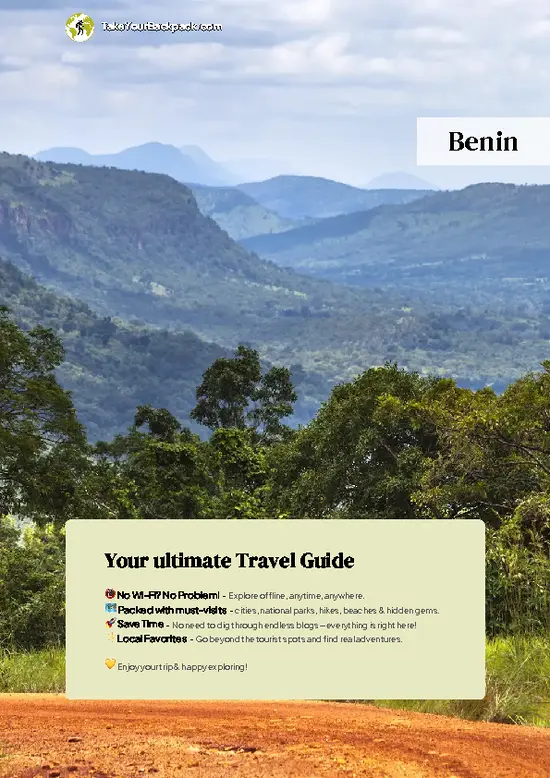
example page 0 from our offline Travel Guide for Benin
example page 1 from our offline Travel Guide for Benin
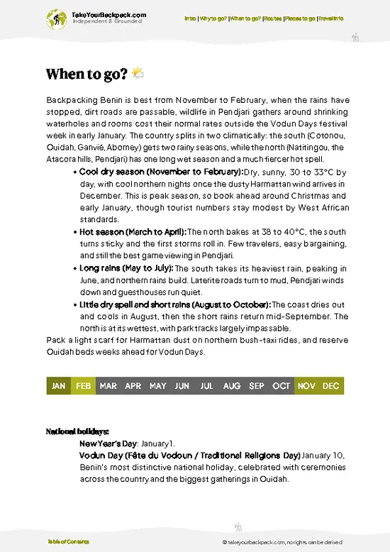
example page 2 from our offline Travel Guide for Benin
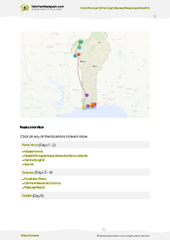
example page 3 from our offline Travel Guide for Benin
example page 4 from our offline Travel Guide for Benin
example page 5 from our offline Travel Guide for Benin
example page 6 from our offline Travel Guide for Benin
example page 7 from our offline Travel Guide for Benin
The digital guide (213 pages) contains:
✅ 48 highlights, ranked by travel appeal
✅ Optimized 5, 10 & 15-day travel routes
✅ Cities, national parks, landmarks, beaches
✅ How to get around
✅ Offline-friendly for travel without Wi-Fi
👉 Click to see all 30+ guide features

📅 Plan smarter in minutes, not weeks
✅ Month by month travel advice
✅ Festivals & national holidays
✅ Budget expectations

🗺️ Go to the right places, skip the overrated ones
✅ Honest pros & cons of destinations
✅ Top hikes, parks & viewpoints
✅ Lesser-known places most travelers miss
✅ Clear “worth it vs skip it” guidance

🛏️ Travel smoothly without rookie mistakes
✅ Best areas to stay
✅ Transport systems explained simply
✅ Common scams & safety advice
✅ SIM cards, money & practical tips

🌍 Understand the country, not just visit it
✅ Culture & traditions
✅ 52 Essential phrases & customs
✅ Festivals worth planning around
✅ Traveler-friendly historical context
✅ Insights that make places more meaningful

📱 Built for real travel conditions
✅ Fully downloadable PDF
✅ Works completely offline
✅ Optimized for phone use
✅ Useful in remote areas & buses
✅ Everything in one place
Stop searching, start planning
Get instant access to your full guide. 30‑day money-back guarantee.
+ Add another guide for just

By proceeding you agree to our terms.
Sent to your inbox immediately after payment • 100% Secure Checkout
Best Backpacking Travel Advisor 2025 tourism awardBest Backpacking
Travel Advisor
2025
What others say about Take Your Backpack Guides:
⭐⭐⭐⭐⭐
Fantastic, amazing amount of information!
⭐⭐⭐⭐⭐
My goodness this is amazing, it's what I've been looking for hats off too you!
⭐⭐⭐⭐⭐
I think this is absolutely BRILLIANT
⭐⭐⭐⭐
Very complete and informative. It's still missing places, but I gotta to commend you
⭐⭐⭐⭐⭐
This is truly amazing, thank you, can't wait to explore it with my kids!
⭐⭐⭐⭐⭐
Awesome resource, thank you!
⭐⭐⭐⭐⭐
This is amazing! Can't wait to explore the ones I haven't seen
⭐⭐⭐⭐
I love this! Well done, great idea.
⭐⭐⭐⭐⭐
Thanks for taking the time to make this gem!
⭐⭐⭐⭐⭐
This might be the best website I've ever seen.
⭐⭐⭐⭐⭐
Congratulations, and thank you so much for your work; it's incredibly valuable.
⭐⭐⭐⭐
In all seriousness I think you did a great job pointing out the important spots
⭐⭐⭐⭐⭐
10/10 very good
⭐⭐⭐⭐⭐
As someone who's only just starting to visit regularly this is awesome, thank you.
⭐⭐⭐⭐
Thank you very much! I'm going to visit my dad, it's going to be very useful!
⭐⭐⭐⭐⭐
This is really cool! We'll be travelling for the first time and this definitely come in handy.
⭐⭐⭐⭐⭐
You are now our minister of culture, congratulations 👨‍💼
⭐⭐⭐⭐⭐
Just wanted to tell you that this is a pearl! Going to follow your recommendations.
⭐⭐⭐⭐⭐
This is so cool. I'll definitely be using the resource for my travels soon.
⭐⭐⭐⭐⭐
This is very impressive! Good work.
⭐⭐⭐⭐⭐
This is an amazing and informative site. Very well done!

🛏️ Where to stay?Top Places to Consider Staying

Benin has only a handful of true backpacker hostels, but simple guesthouses (auberges) and basic hotels are easy to find, with fan rooms at roughly 8,000 to 15,000 CFA (US$13 to 25) and air-conditioned doubles at 15,000 to 25,000 CFA (US$25 to 42). In Cotonou, Haie Vive has the most choice plus the best restaurants and bars, though prices run higher, while Ganhi puts you close to banks and the Dantokpa market but goes quiet after dark. Fidjrossè is a calmer beach-side option that gets lively on weekends. Beyond the capital, Ouidah and Grand-Popo offer relaxed, cheap beach lodges with little nightlife, and Abomey has basic rooms within walking distance of the royal palaces.

If you enjoy meeting … read more 👉
Benin has only a handful of true backpacker hostels, but simple guesthouses (auberges) and basic hotels are easy to find, with fan rooms at roughly 8,000 to 15,000 CFA (US$13 to 25) and air-conditioned doubles at 15,000 to 25,000 CFA (US$25 to 42). In Cotonou, Haie Vive has the most choice plus the best restaurants and bars, though prices run higher, while Ganhi puts you close to banks and the Dantokpa market but goes quiet after dark. Fidjrossè is a calmer beach-side option that gets lively on weekends. Beyond the capital, Ouidah and Grand-Popo offer relaxed, cheap beach lodges with little nightlife, and Abomey has basic rooms within walking distance of the royal palaces.

If you enjoy meeting fellow travelers, consider choosing hostels with high ratings for atmosphere. On the other hand, if you prefer having your own space, a hotel might be a better option.

BeninMore Places Across Benin

👋 Meet the founderWho’s Behind Take Your Backpack?

Johan, backpacker and founder of TakeYourBackpackHi, I’m Johan (Netherlands 🇳🇱), the creator of TakeYourBackpack. Over the past 3 decades, I’ve backpacked through 90+ countries across six continents, gaining extensive experience with independent travel, long-term trips, and overland routes.

This site is built on a combination of firsthand travel experience and carefully curated insights from other backpackers. Many guides are based on places I’ve personally visited, while others bring together tips, observations, and practical advice shared by trusted travelers I’ve met along the way.

The goal is to provide realistic, experience-driven guidance — not generic itineraries — so you can explore destinations with better context, clearer expectations, and more confidence.